Mount Baldy (Arizona) facts for kids
Quick facts for kids Mount Baldy |
|
|---|---|

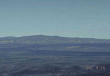
Mount Baldy from a US Forest Service webcam
|
|
| Highest point | |
| Elevation | 11,409 ft (3,477 m) NAVD 88 |
| Prominence | 4,723 ft (1,440 m) |
| Listing |
|
| Geography | |
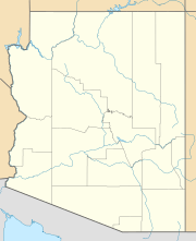
| Location | Apache County, Arizona, U.S. |
| Parent range | White Mountains |
| Topo map | USGS Mount Baldy (AZ) |
Mount Baldy is a tall mountain in eastern Arizona, United States. Its name in the Apache language is Dził Łigai, which means White Mountain.
The top of Mount Baldy is very high, reaching 11,409 feet (3,477 m) above sea level. Because it's so high, the peak is above the tree line. This means it's too cold and windy for trees to grow there, leaving the top mostly bare. This is how the mountain got its name, "Baldy."
The eastern side of the mountain is part of the Mount Baldy Wilderness. This special area is protected and managed by the Apache-Sitgreaves National Forest.
Contents
Mount Baldy's Location and Height
The very top of Mount Baldy is located inside the Fort Apache Indian Reservation. It is the highest point in the White Mountains and also the highest point in Apache County.
Mount Baldy is the fifth-highest point in all of Arizona. It is the tallest mountain in the state outside of the San Francisco Peaks area near Flagstaff.
There are other peaks nearby. About half a mile north of the main summit, there's a smaller peak that is 10,890 feet (3,319 m) tall. This peak is not on the reservation and can be reached by public trails. Another peak, Ord Peak, is about three miles northwest of Mount Baldy.
History and Sacred Meaning
Mount Baldy is a very important and sacred mountain for the Apache people of Arizona. The Western Apache have lived in areas around four main sacred mountain ranges. These include the White Mountains (where Mount Baldy is), the Pinaleno Mountains, the Four Peaks, and the San Francisco Peaks.
In 1873, a man named Captain George M. Wheeler visited the top of Mount Baldy. He said the view was "The most magnificent and effective" he had ever seen. Wheeler first named the mountain Mount Thomas, after General Lorenzo Thomas. However, the name was later changed to Mount Baldy. The U.S. Geological Survey has since given the name Mount Thomas to a different peak nearby.
Rivers and Wildlife
Mount Baldy is very important for water in Arizona. It is where the Little Colorado River and Salt River begin. These rivers flow from the mountain and are known for having many trout fishing streams. No other mountain in Arizona creates as many rivers and streams.
There are also several lakes made by people along the slopes of Mount Baldy. The area around the mountain gets a lot of rain and snow, more than most other places in Arizona.
Many different animals live on Mount Baldy. This includes the Mexican Grey Wolf, which has recently been brought back to the area.
From Historic Fort Apache, which is 5,290 ft (1,610 m) high, Mount Baldy looks very tall. It rises about 6,130 ft (1,870 m) above the fort.
Climate at Mount Baldy
The weather on Mount Baldy can change a lot, especially because it is so high up. Here's a look at the typical climate at an elevation of 9,370 feet on the mountain:
| Climate data for Mount Baldy, Arizona (station elevation 9,370 ft) | |||||||||||||
|---|---|---|---|---|---|---|---|---|---|---|---|---|---|
| Month | Jan | Feb | Mar | Apr | May | Jun | Jul | Aug | Sep | Oct | Nov | Dec | Year |
| Record high °F (°C) | 58 (14) |
58 (14) |
59 (15) |
68 (20) |
75 (24) |
83 (28) |
80 (27) |
79 (26) |
75 (24) |
75 (24) |
65 (18) |
60 (16) |
83 (28) |
| Mean daily maximum °F (°C) | 37.9 (3.3) |
39.3 (4.1) |
41.9 (5.5) |
49.6 (9.8) |
60.4 (15.8) |
68.8 (20.4) |
69.6 (20.9) |
67.7 (19.8) |
64.7 (18.2) |
57.1 (13.9) |
45.9 (7.7) |
40.3 (4.6) |
53.6 (12.0) |
| Mean daily minimum °F (°C) | 9.2 (−12.7) |
10.0 (−12.2) |
16.1 (−8.8) |
21.4 (−5.9) |
27.7 (−2.4) |
35.6 (2.0) |
40.8 (4.9) |
37.5 (3.1) |
34.0 (1.1) |
26.9 (−2.8) |
17.3 (−8.2) |
11.9 (−11.2) |
24.0 (−4.4) |
| Record low °F (°C) | −26 (−32) |
−19 (−28) |
−9 (−23) |
−9 (−23) |
9 (−13) |
16 (−9) |
28 (−2) |
27 (−3) |
19 (−7) |
−5 (−21) |
−16 (−27) |
−20 (−29) |
−26 (−32) |
| Average precipitation inches (mm) | 3.10 (79) |
2.76 (70) |
4.09 (104) |
1.45 (37) |
0.82 (21) |
0.90 (23) |
4.85 (123) |
4.20 (107) |
2.84 (72) |
2.08 (53) |
1.68 (43) |
2.68 (68) |
31.47 (799) |
| Average snowfall inches (cm) | 40.4 (103) |
37.5 (95) |
42.9 (109) |
16.0 (41) |
2.8 (7.1) |
trace | 0 (0) |
0 (0) |
0.1 (0.25) |
3.1 (7.9) |
15.7 (40) |
29.4 (75) |
188 (480) |
| Source: The Western Regional Climate Center | |||||||||||||
 | Aurelia Browder |
 | Nannie Helen Burroughs |
 | Michelle Alexander |


