San Francisco Peaks facts for kids
Quick facts for kids San Francisco Peaks |
|
|---|---|
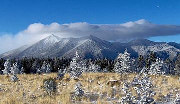
The San Francisco Peaks viewed from atop nearby 9,000 ft Mount Elden
|
|
| Highest point | |
| Peak | Humphreys Peak |
| Elevation | 12,637 ft (3,852 m) NAVD 88 |
| Naming | |
| Native name | Error {{native name}}: an IETF language tag as parameter {{{1}}} is required (help) |
| Geography | |
| Country | United States |
| State | Arizona |
| Range coordinates | 35°20′N 111°40′W / 35.333°N 111.667°W |
| Geology | |
| Age of rock | Between 1 Million and 93,000 Years Ago |
| Type of rock | Igneous |
| Volcanic arc | San Francisco Volcanic Field |
| Last eruption | ~400,000 |
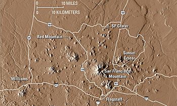
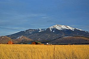
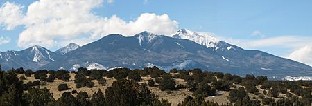
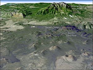
The San Francisco Peaks are a group of volcanic mountains in north central Arizona. They are located just north of the city of Flagstaff. These peaks are what is left of a very old volcano called San Francisco Mountain.
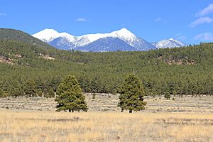
The highest point in this mountain range is Humphreys Peak. It is also the highest point in the entire state of Arizona. Humphreys Peak stands tall at 12,633 feet (3,851 m) above sea level. The San Francisco Peaks are the remains of a stratovolcano that has been worn down over time.
An underground water source, called an aquifer, is found inside the volcano's caldera (the large bowl-shaped hollow). This aquifer provides a lot of water for Flagstaff. The mountains are part of the Coconino National Forest, which is a popular place for outdoor activities.
The Arizona Snowbowl ski area is on the western side of Humphreys Peak. This ski area has been part of a big discussion involving several Native American tribes and environmental groups. They have different ideas about how the land should be used.
Contents
Exploring the San Francisco Peaks
The San Francisco Peaks are home to Arizona's six highest individual mountain tops. These tall peaks include:
- Humphreys Peak, 12,633 feet (3,851 m)
- Agassiz Peak, 12,356 feet (3,766 m)
- Fremont Peak, 11,969 feet (3,648 m)
- Aubineau Peak, 11,838 feet (3,608 m)
- Rees Peak, 11,474 feet (3,497 m)
- Doyle Peak, 11,460 feet (3,493 m)
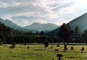
These mountains offer many fun things to do. In winter, people enjoy skiing on the snow. During the rest of the year, hiking is a popular activity. Hart Prairie is a great place for hiking. It is also a Nature Conservancy preserve located near the Arizona Snowbowl ski resort.
Humphreys Peak and Agassiz Peak are special. They are the two southernmost mountain peaks in the United States that are taller than 12,000 feet (3,700 m).
Scientists believe that the San Francisco Peaks were once much taller. Before parts of the mountain collapsed about 200,000 years ago, it might have been around 16,000 feet (4,900 m) high. This collapse happened because of a lateral eruption (an eruption from the side of the volcano) and later, glaciers wore it down.
History of the Peaks
In 1629, Spanish friars named the peaks "San Francisco" to honor Francis of Assisi. This was 147 years before the city of San Francisco, California, got its name. The friars were at a Hopi Indian village about 65 miles from the peaks.
In the mid-1850s, a mountain man named Antoine Leroux visited the San Francisco Peaks. He helped guide American explorers and surveyors in northern Arizona. Leroux showed them the only reliable spring in the area, on the western side of the peaks. This spring was later named Leroux Springs after him.
Around 1877, John Willard Young, the son of Mormon leader Brigham Young, claimed the land near Leroux Springs. He built a log stockade called Fort Moroni. This fort housed workers who cut trees to make railroad ties for the Atlantic & Pacific Railroad. This railroad was being built across northern Arizona at the time.
In 1898, U.S. President William McKinley created the San Francisco Mountain Forest Reserve. He did this because Gifford Pinchot, who led the U.S. Division of Forestry, asked him to. Some local people in Williams, Arizona, were not happy about this. The Williams News newspaper even wrote that the reserve "virtually destroys Coconino County." In 1908, the San Francisco Mountain Forest Reserve became part of the new Coconino National Forest.
In 2002, the Arizona Snowbowl ski resort wanted to expand. They also planned to make snow using reclaimed water. This water is treated sewage water. A group of Native American tribes and environmental groups disagreed with this plan. They felt it would harm their traditional culture, public health, and the environment. They tried to stop the expansion.
In 2011, construction began on a pipeline to bring the water to the peaks. People protested this, with some even chaining themselves to equipment. One notable protester is Navajo musician Klee Benally. In 2012, a court decided that Arizona Snowbowl could go ahead with their plan. Snowmaking with reclaimed water began in the 2012–2013 ski season.
Life Zones and Ecology
In 1889, a biologist named Clinton Hart Merriam studied these mountains. He described six different "life zones" based on how high up they were, their location, and how much rain they got. He explained the types of plants found in each zone.
The San Francisco Peaks themselves have four of these life zones. Each zone has different plants and animals because of changes in elevation, temperature, and rainfall.
- Ponderosa Pine Forests
- This zone is found from about 6,000 to 8,500 feet (1,800 to 2,600 m).
- The main tree here is the southwestern ponderosa pine.
- Other trees like Gambel oak and New Mexico locust grow at lower parts of this zone.
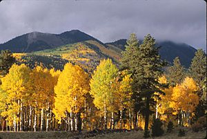
- Higher up, you might see Rocky Mountain Douglas-fir and quaking aspen.
- This zone gets about 18 to 26 inches (460 to 660 mm) of rain each year.
- Mixed Conifer Forest
- This zone is higher, from about 8,000 to 9,500 feet (2,400 to 2,900 m).
- It has a mix of trees like Douglas-fir, white fir, and limber pine.
- Blue spruce and Ponderosa pine also grow here.
- The average yearly rainfall is about 25 to 30 inches (640 to 760 mm).
- Subalpine Conifer Forest
- This zone is even higher, from about 9,500 to 11,500 feet (2,900 to 3,500 m).
- The main trees are Engelmann spruce, corkbark fir, and quaking aspen.
- You can also find the Rocky Mountain bristlecone pine here.
- This zone gets about 30 to 40 inches (760 to 1,020 mm) of rain each year.
- Alpine Tundra
- The San Francisco Peaks have the only alpine tundra in Arizona.
- This special area is about 1,200 acres (4.9 km2) and is above 10,600 feet (3,200 m).
- Only a few small plants can grow in this cold, windy environment.
- One special plant, the San Francisco Peaks groundsel, is found only here. It is a threatened species.
- The tundra receives about 35 to 40 inches (890 to 1,020 mm) of rain and snow each year.
Cultural Significance for Native Peoples
The San Francisco Peaks are very important to thirteen local American Indian tribes. These tribes include the Havasupai, Navajo, Hopi, and Zuni.
For the Navajo people, the peaks are a sacred mountain of the west. They call it Dookʼoʼoosłííd. This name means "the summit which never melts" or "the mountain whose peak never thaws." The peaks are linked to the color yellow and are said to contain abalone. They are seen as female and covered with yellow clouds and evening twilight.
For the Hopi people, the peaks are connected to the southwest direction. They are considered very sacred places. The Hopi use the peaks to help them figure out the winter solstice. This event marks the start of a new year, with new planting and new life. The peaks are also seen as the home of the katsinam or kachina spirits. These spirits are ancestors who become clouds after they pass away. The Hopi invite katsinam to their villages to guide them.
Humphrey's Peak, called Aaloosaktukwi by the Hopi, is especially important. It is linked to the deity Aaloosaka. This deity is a symbol of the Two-Horn Society, a religious group among the Hopi. Pictures of the peaks used for calendar-keeping have been found in old Hopi villages. Other Native American groups also believe that kachina spirits bring heavy snow to the peaks.
The San Francisco Peaks have many names in different local languages:
- Dookʼoʼoosłííd–(Navajo) (meaning “the summit which never melts”)
- Nuvaʼtukyaʼovi – (Hopi) (meaning “place-of-snow-on-the-very-top”)
- Dził Tso – Dilzhe’e – (Apache)
- Tsii Bina – Aaʼku – (Acoma)
- Nuvaxatuh – Nuwuvi – (Southern Paiute)
- Hvehasahpatch or Huassapatch – Havasu ʼBaaja – (Havasupai)
- Wikʼhanbaja – Hwalʼbay – (Hualapai)
- Wi꞉mun Kwa – Yavapai
- Sunha Kʼhbchu Yalanne – A:shiwi (Zuni)
- ʼAmat ʼIikwe Nyava – Hamakhav – (Mojave)
- Sierra sin Agua – (Spanish)
- The Peaks – (Anglo Arizonans)
See also
 In Spanish: Sierra de San Francisco para niños
 | Sharif Bey |
 | Hale Woodruff |
 | Richmond Barthé |
 | Purvis Young |


