Humphreys Peak facts for kids
Quick facts for kids Humphreys Peak |
|
|---|---|
| Hopi: Aaloosaktukwi Navajo: Doko'o'osliid | |

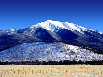
Humphreys Peak in winter 2004
|
|
| Highest point | |
| Elevation | 12,637 ft (3,852 m) NAVD 88 |
| Prominence | 6,039 ft (1,841 m) |
| Isolation | 245.85 miles (395.66 km) |
| Listing |
|
| Geography | |
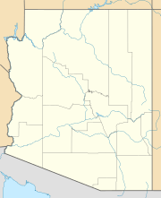
| Location | Coconino County, Arizona, U.S. |
| Parent range | San Francisco Peaks |
| Topo map | USGS Humphreys Peak |
| Geology | |
| Mountain type | igneous, volcanic |
| Volcanic field | San Francisco volcanic field |
| Climbing | |
| Easiest route | Humphreys Trail, class 1 |
Humphreys Peak is the highest natural point in the U.S. state of Arizona. It stands tall at 12,637 feet (3,852 meters) above sea level. This impressive peak is located within the Kachina Peaks Wilderness area. It's also part of the Coconino National Forest, about 11 miles (18 km) north of Flagstaff, Arizona.
Humphreys Peak is the tallest of a group of mountains called the San Francisco Peaks. These peaks are actually volcanic mountains that are currently "sleeping" (dormant). This means they are not active right now.
Reaching the Summit
The easiest way to get to the very top of Humphreys Peak is by hiking. There's a path called the Humphreys Summit Trail. This trail is about 4.8 miles (7.7 km) long. It starts at the Arizona Snowbowl ski resort. The hike offers amazing views of the surrounding area.
How Humphreys Peak Got Its Name
Humphreys Peak was named around 1870. It was named after General Andrew A. Humphreys. He was an officer in the United States Army. General Humphreys was also a general during the American Civil War. Later, he became the Chief of Engineers for the United States Army Corps of Engineers.
For a while, some maps showed the peak with a different name: "San Francisco Peak." This name came from the larger San Francisco Mountain range that the peak is part of. However, in 1933, the official name was changed back to Humphreys Peak.
See also
 In Spanish: Pico Humphreys para niños
 | John T. Biggers |
 | Thomas Blackshear |
 | Mark Bradford |
 | Beverly Buchanan |


