Agassiz Peak facts for kids
Quick facts for kids Agassiz Peak |
|
|---|---|

Agassiz Peak
|
|
| Highest point | |
| Elevation | 12,360 ft (3,767 m) NAVD 88 |
| Prominence | 556 ft (169 m) |
| Geography | |
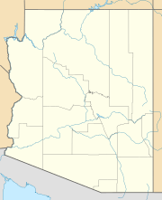
| Location | Coconino County, Arizona, U.S. |
| Parent range | San Francisco Peaks |
| Topo map | USGS Humphreys Peak |
| Climbing | |
| Easiest route | Hike (see below for closed season) |
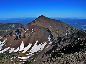
Agassiz Peak is a tall mountain in Arizona. It is the second-highest peak in the state. This mountain stands at 12,360 feet (3,767 meters) high. You can find it north of Flagstaff, Arizona. It is part of the San Francisco Peaks mountain range. The peak is also inside the Kachina Peaks Wilderness area. This area is managed by the Coconino National Forest. The mountain got its name from a famous scientist, Louis Agassiz.
About Agassiz Peak
Many people visiting Flagstaff often think Agassiz Peak is Humphreys Peak. Humphreys Peak is actually the tallest mountain in Arizona. Agassiz Peak stands between Flagstaff and Humphreys Peak. This means Agassiz Peak blocks the view of the true highest peak from the town.
Climbing the Peak
You can only climb Agassiz Peak during the winter. This is when the mountain is covered in snow. Hiking above the tree line at other times is not allowed. This rule helps protect a special plant. The plant is called the San Francisco Peaks groundsel. It is an endangered species. Its home on the mountain is very important.
Southernmost High Peak
Agassiz Peak is special for another reason. It is the southernmost mountain peak in the United States. This means it is the furthest south of any peak in the main part of the U.S. that is taller than 12,000 feet (3,658 meters). Its exact location is 35°19'33"N latitude.
 | Janet Taylor Pickett |
 | Synthia Saint James |
 | Howardena Pindell |
 | Faith Ringgold |


