
Wupatki National Monument facts for kids
Quick facts for kids Wupatki National Monument |
|
|---|---|
|
IUCN Category V (Protected Landscape/Seascape)
|
|
Wukoki in 2008
|
|
| Location | Coconino County, Arizona, US |
| Nearest city | Flagstaff, Arizona |
| Area | 35,422 acres (143.35 km2) |
| Created | December 9, 1924 |
| Visitors | 205,122 (in 2018) |
| Governing body | National Park Service |
| Website | Wupatki National Monument |
Imagine stepping back in time to a place where ancient people built amazing homes from red stone! That's what you'll find at Wupatki National Monument in Arizona, USA. It's a special protected area filled with old Native American sites. The National Park Service looks after Wupatki, making sure these important historical places are safe. It became a national monument in 1924.
Contents
Discovering Ancient Homes
The many old villages you see at Wupatki were built by groups of Ancient Pueblo People. These included the Cohonina, Kayenta, and Sinagua tribes. The name "Wupatki" means "Long Cut House" in the Hopi language. It describes the biggest building here, which had over 100 rooms!
Life After the Volcano
Around 1,000 years ago, a volcano called Sunset Crater erupted nearby. It covered the land with ash. This ash actually made the soil better for farming! More people moved to the area after the eruption. They grew maize (corn) and squash without needing irrigation. They collected rainwater because springs were rare.
By the year 1182, about 85 to 100 people lived in the main Wupatki Pueblo. But by 1225, everyone had left the site for good. For many years, the ash and lava made it hard to live there.

Building with Red Stone
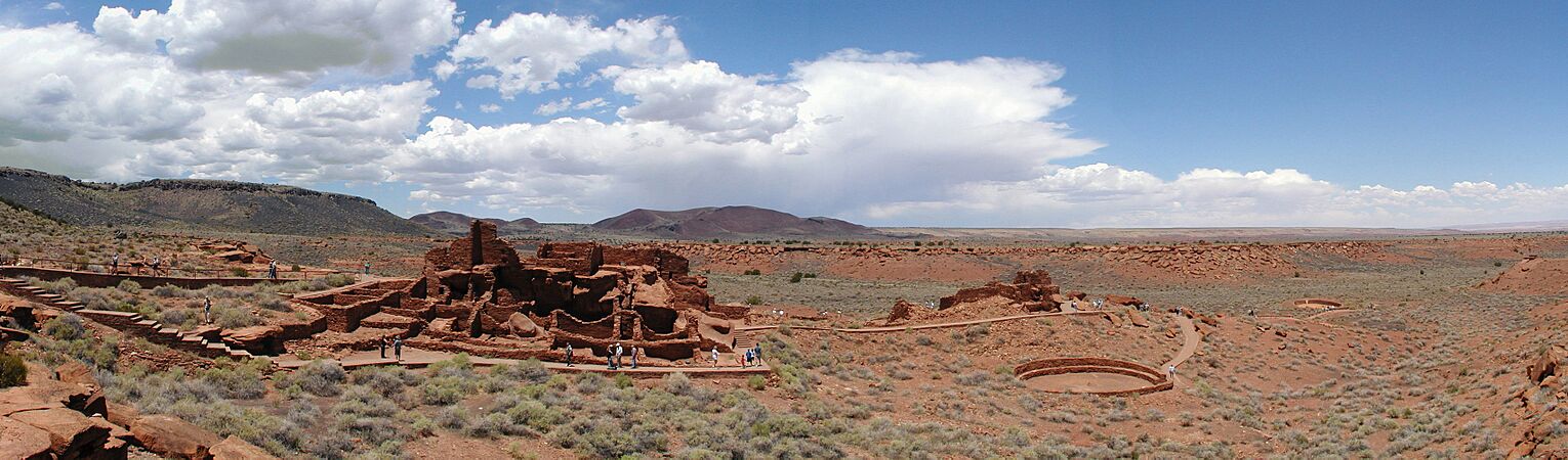
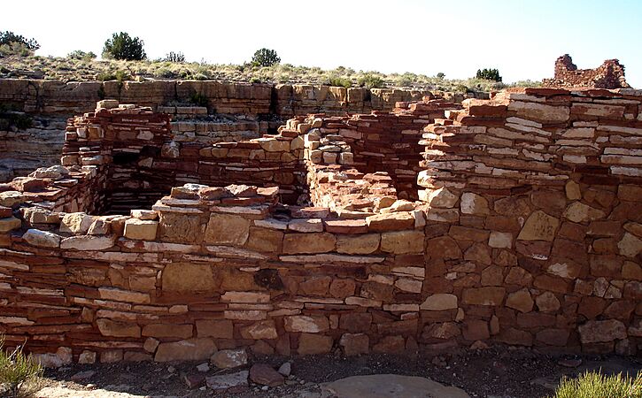
The walls of these ancient homes were made from thin, flat pieces of local red sandstone. This gave the pueblos their unique color. The builders used mortar to hold the stones together. Many of these walls are still standing today! Each village was built as one large structure, sometimes with many rooms.
The Wupatki Pueblo is the largest and tallest building from that time in the region. It was built around a natural rock outcrop.

Special Features of Wupatki
Wupatki has some really cool features:
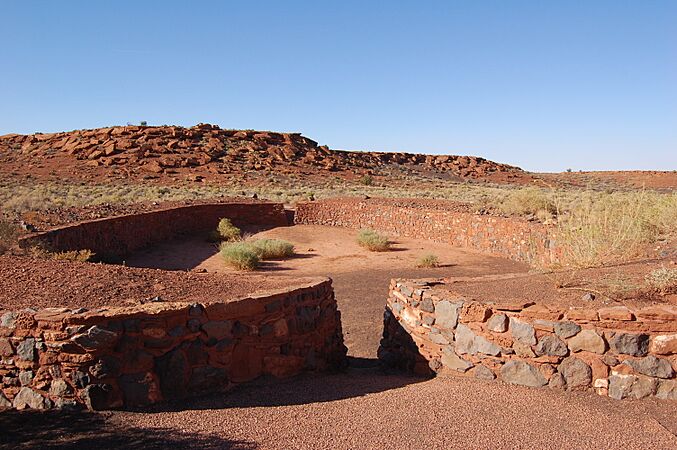
- Ball Court: There's a special court, like those found in ancient Mesoamerica. People played a game there, similar to a modern sport. This is the northernmost ball court ever found in North America!
- Geological Blowhole: This is a natural opening in the ground where wind blows out from an underground cave system. It's like the Earth is breathing!
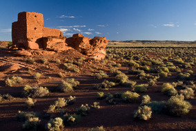
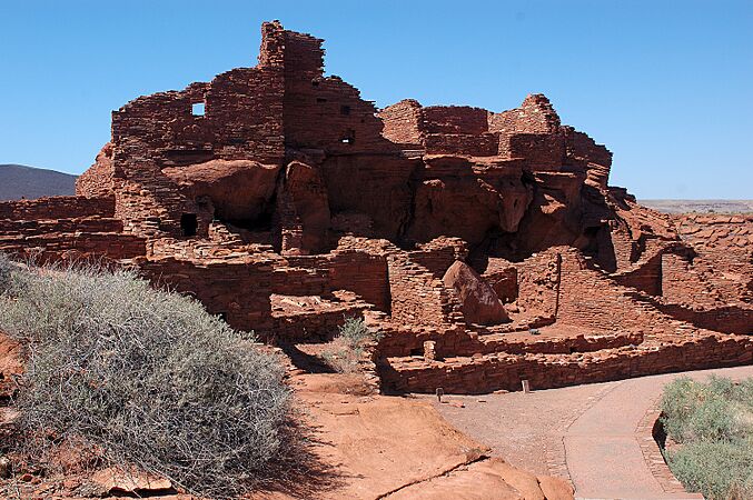
Other important sites in the monument include Wukoki and The Citadel.

Spiritual Connections and Trade
Even though Wupatki looks empty now, it's not forgotten. The Hopi people believe that the spirits of those who lived and died here are still present as guardians. Stories about Wupatki are shared among the Hopi, Navajo, Zuni, and other Native American tribes. Members of different Hopi clans still visit to learn more about their family history.
People at Wupatki also traded with others far away. Even though the area didn't have many food or water sources, archaeologists have found items from distant places. Things like different types of pottery and seashells from the Pacific and Gulf Coasts show that these ancient people were connected to a wide network of trade.

Images for kids
- Wupatki Sites
-
Wupatki Panorama
-
Wupatki Ball Court
-
Box Canyon
-
Wupatki Pueblo


Wupatki's Climate
Wupatki has a dry climate, meaning it doesn't get much rain. It has cold winters and hot summers. Scientists have studied the climate of Wupatki from hundreds of years ago and compared it to today. They found that the weather hasn't changed much in the last 2,000 years!
| Climate data for Wupatki National Monument, Arizona, 1991–2020 normals, extremes 1940–present | |||||||||||||
|---|---|---|---|---|---|---|---|---|---|---|---|---|---|
| Month | Jan | Feb | Mar | Apr | May | Jun | Jul | Aug | Sep | Oct | Nov | Dec | Year |
| Record high °F (°C) | 76 (24) |
77 (25) |
85 (29) |
92 (33) |
101 (38) |
107 (42) |
109 (43) |
106 (41) |
102 (39) |
93 (34) |
82 (28) |
72 (22) |
109 (43) |
| Mean maximum °F (°C) | 61.7 (16.5) |
67.7 (19.8) |
76.7 (24.8) |
84.7 (29.3) |
91.5 (33.1) |
101.3 (38.5) |
103.4 (39.7) |
99.7 (37.6) |
94.6 (34.8) |
85.9 (29.9) |
72.7 (22.6) |
62.1 (16.7) |
104.0 (40.0) |
| Mean daily maximum °F (°C) | 47.6 (8.7) |
54.5 (12.5) |
63.1 (17.3) |
70.5 (21.4) |
79.7 (26.5) |
91.5 (33.1) |
94.4 (34.7) |
91.2 (32.9) |
84.6 (29.2) |
72.5 (22.5) |
57.9 (14.4) |
45.9 (7.7) |
71.1 (21.7) |
| Daily mean °F (°C) | 36.8 (2.7) |
42.3 (5.7) |
49.8 (9.9) |
56.7 (13.7) |
65.7 (18.7) |
76.7 (24.8) |
80.8 (27.1) |
78.2 (25.7) |
71.2 (21.8) |
59.0 (15.0) |
45.8 (7.7) |
35.5 (1.9) |
58.2 (14.6) |
| Mean daily minimum °F (°C) | 26.0 (−3.3) |
30.1 (−1.1) |
36.4 (2.4) |
42.9 (6.1) |
51.6 (10.9) |
61.9 (16.6) |
67.1 (19.5) |
65.2 (18.4) |
57.7 (14.3) |
45.6 (7.6) |
33.7 (0.9) |
25.2 (−3.8) |
45.3 (7.4) |
| Mean minimum °F (°C) | 14.8 (−9.6) |
18.4 (−7.6) |
24.5 (−4.2) |
30.7 (−0.7) |
38.1 (3.4) |
49.8 (9.9) |
59.2 (15.1) |
57.8 (14.3) |
46.5 (8.1) |
32.3 (0.2) |
20.7 (−6.3) |
13.3 (−10.4) |
11.5 (−11.4) |
| Record low °F (°C) | −4 (−20) |
−2 (−19) |
10 (−12) |
14 (−10) |
20 (−7) |
30 (−1) |
41 (5) |
35 (2) |
33 (1) |
17 (−8) |
7 (−14) |
−5 (−21) |
−5 (−21) |
| Average precipitation inches (mm) | 0.68 (17) |
0.51 (13) |
0.60 (15) |
0.41 (10) |
0.40 (10) |
0.12 (3.0) |
1.59 (40) |
1.47 (37) |
0.99 (25) |
0.68 (17) |
0.48 (12) |
0.58 (15) |
8.51 (216) |
| Average snowfall inches (cm) | 0.5 (1.3) |
0.9 (2.3) |
0.4 (1.0) |
0.3 (0.76) |
0.0 (0.0) |
0.0 (0.0) |
0.0 (0.0) |
0.0 (0.0) |
0.0 (0.0) |
0.0 (0.0) |
0.4 (1.0) |
0.9 (2.3) |
3.4 (8.6) |
| Average precipitation days (≥ 0.01 inch) | 3.5 | 3.6 | 3.6 | 2.7 | 3.0 | 1.2 | 7.1 | 9.0 | 5.4 | 3.8 | 2.8 | 3.7 | 49.4 |
| Average snowy days (≥ 0.1 inch) | 0.7 | 0.6 | 0.2 | 0.2 | 0.0 | 0.0 | 0.0 | 0.0 | 0.0 | 0.0 | 0.2 | 0.7 | 2.6 |
| Source: NOAA | |||||||||||||
See also
 In Spanish: Monumento nacional Wupatki para niños
