
List of national monuments of the United States facts for kids

The United States has 133 special protected places called national monuments. These amazing spots can be created by the President or by Congress. The President gets this power from a law called the Antiquities Act of 1906. This law lets the President protect "historic landmarks, old buildings, and other interesting things" that are important for history or science.
This law was made to protect ancient Native American ruins and artifacts, especially in the western U.S. It helped save public lands quickly without waiting for Congress to pass new laws. Thanks to this act, many different kinds of places are now protected, including natural wonders, cultural sites, and historical spots.
President Theodore Roosevelt created the very first national monument, Devils Tower in Wyoming, on September 24, 1906. He created 18 national monuments in total. Since then, 18 different presidents have used the Antiquities Act to create national monuments. Only Presidents Richard Nixon, Ronald Reagan, and George H. W. Bush did not create any. President Bill Clinton created 19 new ones and made three others bigger.
President Jimmy Carter protected huge parts of Alaska, creating 15 national monuments. Seven of these later became national parks. President Barack Obama created or expanded 34 national monuments. This is the most by any president, protecting over half a billion acres of land and water!
National monuments are found in 32 states, Washington, D.C., the Virgin Islands, American Samoa, the Minor Outlying Islands, and the Northern Mariana Islands. Arizona has the most, with 19, followed by California with 18, and New Mexico with 13. Many monuments protect natural places, like geological features, marine areas, and volcanoes. Others protect historical sites, including those related to Native Americans, African American history, and old forts. Four of these monuments are even recognized as World Heritage Sites. National monuments come in all sizes, with the average size being about 3,500 acres. The five largest are all marine sites, protecting ocean waters where commercial fishing is not allowed.
Many places that were once national monuments have been changed into national parks or other types of protected areas by Congress. Some have even been given to states or closed down.
Who Manages National Monuments?
Nine different federal agencies from five U.S. government departments manage the 133 national monuments. Most monuments (117) are managed by just one agency. However, 16 monuments are managed by two agencies working together. For example, Grand Canyon–Parashant and Avi Kwa Ame are managed by the National Park Service (NPS) but are not official units because they overlap with Lake Mead National Recreation Area. How each monument is managed depends on the agency's goals, the size of the area, and what kind of place it is. Usually, activities like hunting, fishing, and taking out resources are not allowed.
Monuments or memorials not created by the U.S. government, like the USS Maine National Monument, are not included in this list.
| Agency | Department | Co-managed | Total managed |
|---|---|---|---|
| National Park Service (NPS) | Interior | 3 with BLM, 1 with FWS | 86 |
| Bureau of Land Management (BLM) | Interior | 3 with NPS, 6 with USFS | 30 |
| United States Forest Service (USFS) | Agriculture | 6 with BLM | 15 |
| Fish and Wildlife Service (FWS) | Interior | 5 with NOAA, 1 with NPS, 1 with DOE | 9 |
| National Oceanic and Atmospheric Administration (NOAA) | Commerce | 5 with FWS | 5 |
| Department of Energy (DOE) | Energy | 1 with FWS | 1 |
| Armed Forces Retirement Home (AFRH) | Defense | 1 | |
| United States Army | Defense | 1 | |
| United States Air Force (USAF) | Defense | 1 | |
| (duplications) | (16) | ||
| Total | 133 | ||
List of National Monuments
| Name | Location | Agency | Date established | Area |
Visitors (2018) | Description |
|---|---|---|---|---|---|---|
| Admiralty Island
|
Alaska | USFS | December 1, 1978 | 1,019,861 acres | This monument covers most of Admiralty Island, the 7th largest island in the U.S. It's part of Tongass National Forest. It protects the largest known population of brown bears on Earth, plus habitat for Sitka black-tailed deer. Most of the monument is a wilderness area, which means future building is limited. | |
| African Burial Ground
|
New York | NPS | February 27, 2006 | 0.35 acres | 45,035 | This site was found in 1991 during digging for a new building. It's an old burial ground with the remains of over 400 free and enslaved Africans from the 1600s and 1700s. It became a National Historic Landmark in 1993. |
| Agate Fossil Beds
|
Nebraska | NPS | June 14, 1997 | 3,057.87 acres | 16,238 | The Niobrara River valley here is famous for its many well-preserved Miocene mammal fossils. These fossils are about 20 million years old. |
| Agua Fria
|
Arizona | BLM | January 11, 2000 | 70,980 acres | This monument is around the canyon of the Agua Fria River. It has over 450 different Native American structures, including large pueblos with more than 100 rooms. | |
| Aleutian Islands World War II
|
Alaska | FWS | December 5, 2008 | 4,950 acres | During World War II, Japan briefly took over Attu Island and Kiska Island in the Aleutian chain. This monument, inside the Alaska Maritime National Wildlife Refuge, includes the site of the 19-day battle to take back Attu. It also has items from the Japanese occupation of Kiska and a crashed U.S. B-24D Liberator plane on Atka Island. | |
| Alibates Flint Quarries
|
Texas | NPS | August 21, 1965 | 1,370.97 acres | 7,415 | Alibates was a quarry where people found high-quality, colorful flint. This flint was traded across the Great Plains before Christopher Columbus arrived. The monument is managed with the Lake Meredith National Recreation Area and includes old Plains Village Indian homes. |
| Aniakchak
|
Alaska | NPS | December 1, 1978 | 137,176 acres | 100 | Mount Aniakchak erupted 3,500 years ago. This area is one of the least visited NPS sites. Surprise Lake, inside the volcano's 6-mile-wide, 2,500-foot-deep caldera, is where the Aniakchak River begins. |
| Avi Kwa Ame
|
Nevada | BLM, NPS | March 21, 2023 | 506,814 acres | Spirit Mountain (Avi Kwa Ame) is a sacred place for the Yuman tribes. They believe it's where creation happened. This area in the Mojave Desert has huge Joshua tree forests. It's also an important home for animals like the desert bighorn sheep, desert tortoise, and Gila monster. | |
| Aztec Ruins
|
New Mexico | NPS | January 24, 1923 | 318.4 acres | 54,933 | These ruins have Pueblo buildings from the 11th to 13th centuries. They have over 400 stone rooms. Early American settlers mistakenly thought they were built by the Aztecs. This site is part of the Chaco Culture World Heritage Site. |
| Baaj Nwaavjo I'tah Kukveni – Ancestral Footprints of the Grand Canyon
|
Arizona | BLM, USFS | August 8, 2023 | 917,618 acres | This monument protects land on both sides of Grand Canyon National Park. It is very important to several Native American tribes. It also includes part of Kaibab National Forest. | |
| Bandelier
|
New Mexico | NPS | February 11, 1916 | 33,676.67 acres | 198,441 | Frijoles Canyon has Ancestral Pueblo homes, kivas (ceremonial rooms), rock paintings, and petroglyphs (rock carvings). The Pueblo buildings, made of volcanic rock, are from 1150 CE. Other items found here are over 11,000 years old. |
| Basin and Range
|
Nevada | BLM | July 10, 2015 | 703,585 acres | This remote area includes the Mount Irish, Seaman, and Golden Gate Ranges. These mountains surround the Garden and Coal Valleys and White River Narrows. It is home to many desert animals and 4,000-year-old rock art. | |
| Bears Ears
|
Utah | BLM, USFS | December 28, 2016 | 1,360,000 acres | The Bears Ears are two tall rock formations above sandstone canyons and mesas. Other cool rock features include dome-shaped peaks, striped rock towers, and natural arches. The area has tens of thousands of old archaeological sites. These include rock art, ancient cliff homes, and ceremonial kivas. Part of it is in Manti–La Sal National Forest. | |
| Belmont-Paul Women's Equality
|
District of Columbia | NPS | April 12, 2016 | 0.34 acres | 9,081 | This house has been the home of the National Woman's Party since 1929. It's a historic house near the U.S. Capitol. Party leader Alice Paul and others lived and worked here, fighting for women's rights. |
| Berryessa Snow Mountain
|
California | USFS, BLM | July 10, 2015 | 330,780 acres | This monument is less than 100 miles from the San Francisco Bay Area. It protects part of the California Coast Range, which has many different kinds of plants and animals. It's home to elk, osprey, river otters, and half of California's dragonfly species. It also has the state's second-largest group of bald eagles in winter. Part of it is in Mendocino National Forest. | |
| Birmingham Civil Rights
|
Alabama | NPS | January 12, 2017 | 0.88 acres | This site protects the A. G. Gaston Motel. The KKK bombed it after Martin Luther King Jr. and other civil rights leaders stayed there. This event led to the Birmingham riot of 1963. | |
| Booker T. Washington
|
Virginia | NPS | April 2, 1956 | 239.01 acres | 22,732 | This monument protects parts of the 207-acre tobacco farm where educator and civil rights leader Booker T. Washington was born into slavery on April 5, 1856. The site has copies of the house Washington was born in, a smokehouse, a blacksmith shed, a tobacco barn, and a horse barn. |
| Browns Canyon
|
Colorado | BLM, USFS | February 19, 2015 | 21,604 acres | Tall granite cliffs and colorful rocks overlook the Arkansas River. Visitors can go whitewater rafting here. There are also ancient campsites and shelters from 11,000 years ago. Gold mining sites from the late 1800s are also present. About half of the monument is in San Isabel National Forest. | |
| Buck Island Reef
|
U.S. Virgin Islands | NPS | December 28, 1961 | 19,015.47 acres | 31,411 | Most of this monument is underwater. It has a large elkhorn coral barrier reef that provides shelter for many reef fish, sea turtles, and least terns. It is centered around Buck Island, an uninhabited 176-acre island. |
| Cabrillo
|
California | NPS | October 14, 1913 | 159.94 acres | 842,104 | This monument remembers when Juan Rodríguez Cabrillo landed at San Diego Bay on September 28, 1542. This was the first European trip to what became the U.S. West Coast. The monument has a statue of Cabrillo, a rocky tide pool area, and 20th-century coastal artillery batteries built to protect San Diego's harbor. |
| California Coastal
|
California | BLM | January 11, 2000 | 2,628 acres | This monument protects over 20,000 small islands, reefs, and rock formations along the entire 840-mile California coastline. These areas extend 12 nautical miles from the shore. | |
| Camp Hale — Continental Divide
|
Colorado | USFS | October 12, 2022 | 53,804 acres | Soldiers in the U.S. Army's 10th Mountain Division trained at Camp Hale. They learned skiing, climbing, and snowshoeing to fight in the Italian Alps during World War II. It's part of White River National Forest. | |
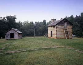
| Camp Nelson
|
Kentucky | NPS | October 26, 2018 | 373 acres | Camp Nelson was set up in 1863 as a supply base for the Union Army during the Civil War. It became a big center for recruiting African American Union soldiers. It was a key place for these soldiers to gain freedom and a safe place for their families. | |
| Canyon de Chelly
|
Arizona | NPS | April 1, 1931 | 83,840 acres | 439,306 | This monument is located within the Navajo Nation. It protects the valleys and edges of Canyon de Chelly, Canyon del Muerto, and Monument Canyon. Several ancient Puebloan cliff homes are built into the canyon walls. |
| Canyons of the Ancients
|
Colorado | BLM | June 9, 2000 | 176,370 acres | This monument surrounds Hovenweep National Monument. It protects over 6,000 archaeological sites, the most in the U.S. These include Lowry Pueblo, from 1103 CE, and Painted Hand Pueblo, built by the Ancestral Puebloans. | |
| Cape Krusenstern
|
Alaska | NPS | December 1, 1978 | 649,096.15 acres | 15,087 | This coastal plain has large lagoons and rolling limestone hills. The cliffs show thousands of years of changes in the Chukchi Sea shorelines. They also show signs of human life for about 9,000 years. |
| Capulin Volcano
|
New Mexico | NPS | August 9, 1916 | 792.84 acres | 67,411 | Capulin is an extinct cinder cone volcano about 59,000 years old. It's part of the Raton-Clayton Volcanic Field. The crater is 400 feet deep, and its rim is over 1,500 feet across. |
| Carrizo Plain
|
California | BLM | January 12, 2001 | 211,045 acres | Carrizo Plain is the largest single native grassland left in California. It has part of the San Andreas Fault and is surrounded by the Temblor Range and the Caliente Range. In the middle of the plain is Soda Lake, which is near Painted Rock. | |
| Casa Grande Ruins
|
Arizona | NPS | August 3, 1918 | 472.5 acres | 62,995 | This monument protects a group of buildings surrounded by a wall in the Gila Valley. They were built in the early 1200s and lived in by the Hohokam people until the mid-1400s. |
| Cascade–Siskiyou
|
Oregon, California | BLM | June 9, 2000 | 114,000 acres | This area has one of the most diverse ecosystems in the Cascade Range. It has over 100 homes and plant-gathering sites belonging to the Modoc, Klamath, and Shasta tribes. | |
| Castillo de San Marcos
|
Florida | NPS | October 15, 1924 | 19.38 acres | 748,058 | This Spanish fort near St. Augustine was first called Fort Marion. It served for 205 years under four different flags. Built in 1672, it was part of battles with the British, the American Revolution, the Civil War, and other conflicts. |
| Castle Clinton
|
New York | NPS | August 12, 1946 | 1 acre | 4,533,564 | This circular sandstone fort was built in 1811 at the southern tip of Manhattan. It was meant to protect New York City from the British. Now in Battery Park, it has been a beer garden, a theater, the first immigration station (before Ellis Island), a public aquarium, and a ticket office for the Statue of Liberty National Monument. |
| Castle Mountains
|
California | NPS | February 12, 2016 | 21,025.5 acres | The Castle Mountains are in the Mojave Desert, between Nevada and Mojave National Preserve. They protect desert grasslands with Joshua tree forests. Wildlife like golden eagles and bighorn sheep live here. It also has historic Native American sites. | |
| Castner Range
|
Texas | Army | March 21, 2023 | 6,672 acres | This part of the Franklin Mountains in west Texas's Chihuahuan Desert has 41 archaeological sites. These sites show human presence dating back to 6,000 BC. The area was used for weapons testing for Fort Bliss for 40 years. It is still being cleaned up from old ammunition. Castner Range is the only land conservation national monument within the Department of Defense. | |
| Cedar Breaks
|
Utah | NPS | August 22, 1933 | 6,154.6 acres | 644,515 | This is a natural amphitheater canyon, like the formations at Bryce Canyon National Park. It stretches over 3 miles and is more than 2,000 feet deep. |
| César E. Chávez
|
California | NPS | October 8, 2012 | 116.56 acres | 12,769 | This monument honors the life and work of labor leader and civil rights activist Cesar Chavez. The site, called La Paz, was Chavez's home for about 20 years. His burial site is also here. It's also where the United Farm Workers union, founded by Chavez, has its main office. |
| Charles Young Buffalo Soldiers
|
Ohio | NPS | March 25, 2013 | 59.66 acres | 31,448 | Charles Young was the first African American to become a colonel in the U.S. Army. He was also the first national park superintendent for Sequoia and General Grant National Parks. He was a professor at Wilberforce University. His home there is now a museum about his life. |
| Chimney Rock
|
Colorado | USFS | September 21, 2012 | 4,724 acres | This site, a jewel of San Juan National Forest, was once home to the ancestors of today's Pueblos. About 1,000 years ago, the Ancestral Pueblo People built over 200 homes and ceremonial buildings high above the valley floor. | |
| Chiricahua
|
Arizona | NPS | April 18, 1924 | 12,024.73 acres | 60,577 | These tall pillars of rhyolite tuff are what's left after a huge volcanic eruption 27 million years ago. The Apache people called it the "Land of the Standing-Up Rocks." |
| Colorado
|
Colorado | NPS | May 24, 1911 | 20,536.39 acres | 375,467 | Monument Canyon runs through the park and has rock formations shaped by erosion. The monument covers semi-desert land high on the Colorado Plateau. It has many animals and plants, like pinyon pines, juniper trees, ravens, jays, desert bighorn sheep, and coyotes. It's also great for outdoor activities. |
| Craters of the Moon
|
Idaho | NPS, BLM | May 2, 1924 | 343,000 acres | 263,506 | This is one of the best-preserved flood basalt areas in the U.S. It has three lava fields along Idaho's Great Rift. Among the volcanic cinder cones, lava tubes, and cracks created 15,000 to 2,000 years ago, you can find the world's deepest open rift crack. The nearby National Preserve protects another 410,000 acres. |
| Devils Postpile
|
California | NPS | July 6, 1911 | 800.19 acres | 139,724 | This monument was once part of Yosemite National Park. It features a dark cliff of columnar basalt formed by a lava flow over 100,000 years ago. It also has the 101-foot-high Rainbow Falls. |
| Devils Tower
|
Wyoming | NPS | September 24, 1906 | 1,347.21 acres | 468,216 | The tower is a huge igneous rock formation that rises dramatically 1,267 feet above the land around it. President Theodore Roosevelt declared this the very first national monument. |
| Dinosaur
|
Colorado, Utah | NPS | October 4, 1915 | 210,281.92 acres | 304,468 | This sandstone and rock bed, where the Green and Yampa Rivers meet, formed during the Jurassic Period. It has dinosaur fossils, including Allosaurus and various long-neck dinosaurs. |
| Effigy Mounds
|
Iowa | NPS | October 25, 1949 | 2,526.39 acres | 55,576 | This monument protects three prehistoric sites with 206 ancient mounds. Thirty-one of these mounds are special because they are shaped like mammals, birds, or reptiles. |
| El Malpais
|
New Mexico | NPS | December 31, 1987 | 114,347.11 acres | 154,368 | A very rough, rocky lava flow covers much of this park. It fills a large basin surrounded by taller sandstone cliffs. It has lava tube caves that stretch over 17 miles. The Cebolla Wilderness here has ancient rock art and the Zuni-Acoma Trail, an old Pueblo trade route. |
| El Morro
|
New Mexico | NPS | December 8, 1906 | 1,278.72 acres | 65,453 | This site is on an ancient east–west trail. It has a large sandstone cliff with a pool of water at its base. There are carvings from the 1600s and older petroglyphs made by the Ancestral Puebloans. |
| Emmett Till and Mamie Till-Mobley
|
Illinois Mississippi |
NPS | July 25, 2023 | 5.7 acres | Three sites honor Emmett Till, an African American boy who was kidnapped and killed in Mississippi in 1955 when he was 14. This happened after he was accused of offending a white woman. The sites are: the Roberts Temple Church of God in Christ in Chicago, Illinois; Graball Landing on the Tallahatchie River in Mississippi; and the Tallahatchie County Second District Courthouse in Sumner. | |
| Florissant Fossil Beds
|
Colorado | NPS | August 20, 1969 | 6,300 acres | 79,568 | Huge petrified redwoods and incredibly detailed fossils of ancient insects and plants are found here. They show that Colorado looked very different almost 35 million years ago during the Eocene age. |
| Fort Frederica
|
Georgia | NPS | May 26, 1936 | 305 acres | 183,591 | These remains of a fort and town were built by James Oglethorpe between 1736 and 1748. They protected the southern border of the British colony of Georgia from Spanish attacks. It was a few miles from the site of the Battle of Bloody Marsh. |
| Fort Matanzas
|
Florida | NPS | October 15, 1924 | 300.11 acres | 608,103 | This Spanish fort from 1740 guarded Matanzas Inlet, the southern entrance to the Matanzas River. This river allowed access to St. Augustine. The monument is managed with Castillo de San Marcos National Monument. It also protects 100 acres of salt marsh and barrier islands. |
| Fort McHenry
|
Maryland | NPS | March 3, 1925 | 43.26 acres | 486,113 | This is the only place called both a national monument and a historic shrine. Fort McHenry is a star-shaped fort famous for its role in the War of 1812. It successfully defended Baltimore Harbor from a British attack. These events inspired Francis Scott Key to write "The Star-Spangled Banner". |
| Fort Monroe
|
Virginia | NPS | November 1, 2011 | 367.12 acres | This six-sided star fort tells the American story from the 1600s to the 2000s. It was a stop for Captain John Smith's journeys. It also offered freedom to enslaved people during the Civil War. It was a strong defense for the Chesapeake Bay. | |
| Fort Ord
|
California | BLM | April 20, 2012 | 14,658 acres | Fort Ord was an Army base from 1917 to 1994. Now, it has trails for recreation and various wildlife in its grasslands, chaparral, and woodlands. | |
| Fort Pulaski
|
Georgia | NPS | October 15, 1924 | 5,623.1 acres | 419,930 | In 1862, during the American Civil War, the Union Army successfully used a rifled cannon against the Confederates defending this fort. This showed that brick forts were no longer useful. Fort Pulaski was also used as a prisoner-of-war camp during the war. The monument includes most of Cockspur Island (where the fort is) and all of nearby McQueens Island. |
| Fort Stanwix
|
New York | NPS | August 21, 1935 | 15.52 acres | 90,507 | Fort Stanwix protected an important 18th-century portage (a place where boats are carried over land) called the Oneida Carrying Place. It was built during the French and Indian War (1754–1763). The fort successfully held off a British attack in 1777 during the American Revolutionary War. The original fort was covered by the growth of Rome, New York, but it was rebuilt as a national monument in the late 1970s. |
| Fort Union
|
New Mexico | NPS | April 5, 1956 | 720.6 acres | 10,860 | This was a military post and supply center in the late 1800s. It was located where the Mountain and Cimarron Branches of the old Santa Fe Trail met. |
| Fossil Butte
|
Wyoming | NPS | October 23, 1972 | 8,198 acres | 21,349 | Fossil Butte preserves 50-million-year-old Green River lake beds. These beds have the best paleontological record of ancient water communities in North America. Fossils of fish, alligators, bats, turtles, dog-sized horses, insects, and many other plants and animals suggest the area was a warm, wet freshwater basin when the sediments built up over about 2 million years. |
| Freedom Riders
|
Alabama | NPS | January 12, 2017 | 5.96 acres | This monument protects two sites in and near Anniston, Alabama from the civil rights movement. One is an old Greyhound bus station where Freedom Riders were attacked by a racist mob. The other is where their bus was burned outside of town. | |
| George Washington Birthplace
|
Virginia | NPS | January 23, 1930 | 653.18 acres | 111,058 | This site shows what 18th-century Virginia tobacco farms were like. It's the birthplace and childhood home of George Washington. The entrance has a small version of the Washington Monument. The monument also includes the historic birthplace home, a kitchen house, and the Washington family burial ground. |
| George Washington Carver
|
Missouri | NPS | July 14, 1943 | 210 acres | 44,411 | This site protects Moses Carver's farm, where George Washington Carver grew up. Carver was a scientist and educator who found many uses for peanuts. This was the first national monument dedicated to an African American and the first to a non-president. |
| Giant Sequoia
|
California | USFS | April 15, 2000 | 352,626 acres | This monument includes 38 of the 39 giant sequoia groves in the Sequoia National Forest. This is about half of all sequoia groves in the world. It includes one of the ten largest giant sequoias, the Boole Tree. Its two parts are around Kings Canyon and Sequoia National Parks. | |
| Gila Cliff Dwellings
|
New Mexico | NPS | November 16, 1907 | 533.13 acres | 79,108 | Located in the Gila Wilderness, these cliff dwellings were home to the Mogollon culture from the 1280s to the early 1300s. They lived in five caves with 46 rooms, 180 feet above the canyon floor. |
| Gold Butte
|
Nevada | BLM | December 28, 2016 | 296,937 acres | This Mojave Desert landscape has dramatic red sandstone and canyons. It also has forested mountains, ancient rock art, rock shelters, and an old mining ghost town. It's an important home for the Mojave Desert tortoise. | |
| Governors Island
|
New York | NPS | January 19, 2001 | 22.91 acres | 589,798 | From 1783 to 1966, Governors Island in New York Harbor was an Army base. From 1966 to 1996, it was a Coast Guard base. Castle Williams and Fort Jay on the island protected New York City from sea attacks. |
| Grand Canyon–Parashant
|
Arizona | BLM, NPS | January 11, 2000 | 1,021,030 acres | This monument is on the northern edge of the Grand Canyon on the Shivwits Plateau. It has diverse landscapes, including canyons, cliffs, and buttes formed over millions of years. It also has many fossils of ancient sea creatures and desert volcanoes. Old ranches and mills from early pioneers are also here. A fifth of the monument is also in Lake Mead National Recreation Area. There are no paved roads or visitor services, but off-road vehicles can reach scenic viewpoints. | |
| Grand Portage
|
Minnesota | NPS | January 27, 1960 | 709.97 acres | 94,137 | The Grand Portage is an 8.5-mile footpath that goes around waterfalls on the Pigeon River near Lake Superior. This area was a very important trade route and center for the fur trade. It's also an Anishinaabeg Ojibwe heritage site. |
| Grand Staircase–Escalante
|
Utah | BLM | September 18, 1996 | 1,870,000 acres | This monument has three main areas: the Grand Staircase, the Kaiparowits Plateau, and the Canyons of the Escalante. It's home to unique dinosaur fossils, sandstone arches, and rock layers that show 400 million years of Earth's history. It's known for its paleontological finds and geology. It was the first monument managed by the Bureau of Land Management. | |
| Hagerman Fossil Beds
|
Idaho | NPS | November 18, 1988 | 4,351.15 acres | 26,477 | This monument has the largest group of Hagerman horse fossils in North America. It protects the world's richest known fossil deposits from the late Pliocene epoch, 3.5 million years ago. These plants and animals show what life was like just before the Ice Age, and the first signs of modern plants and animals. |
| Hanford Reach
|
Washington | FWS, DOE | June 8, 2000 | 194,450.93 acres | This area was once a security zone around the Hanford Nuclear Reservation. It has been untouched by building or farming since 1943. The area is part of the Columbia River Plateau, formed by basalt lava flows and water erosion. It's named after the Hanford Reach, the last free-flowing part of the Columbia River. | |
| Harriet Tubman Underground Railroad
|
Maryland | FWS | March 25, 2013 | 480 acres | Harriet Tubman was a famous leader on the Underground Railroad, helping many enslaved people find freedom. This monument includes places related to Tubman's life, like the slave-built Stewart's Canal and Jacob Jackson's home. The parts of the monument managed by the NPS are now a National Historical Park (NHP). The FWS lands are in Blackwater National Wildlife Refuge. | |
| Hohokam Pima
|
Arizona | NPS | October 21, 1972 | 1,690 acres | Hohokam Pima is part of the Gila River Indian Community and is not open to the public. The monument includes the site of the Snaketown settlement, which has archaeological remains of the Hohokam culture. This culture lived in the area until 1200. Digs of old homes, fields, and canals were refilled in the 1960s, so nothing is visible above ground now. | |
| Hovenweep
|
Colorado, Utah | NPS | March 2, 1923 | 784.93 acres | 40,574 | Hovenweep has six groups of Native American ruins. Holly Canyon, Hackberry Canyon, Cutthroat Castle, and Goodman Point are in Colorado. Square Tower and Cajon are in Utah. Ancestral Puebloans lived in the Hovenweep area from 1150 to 1350. |
| Ironwood Forest
|
Arizona | BLM | June 9, 2000 | 129,055 acres | This monument is in the Sonoran Desert. It has many ironwood (Olneya tesota) trees and two endangered animal and plant species. Over 200 Hohokam and Paleoindian archaeological sites have been found here, dating from 600 to 1450 AD. | |
| Jewel Cave
|
South Dakota | NPS | February 7, 1908 | 1,273.51 acres | 142,356 | Jewel Cave is the third longest cave in the world. It has over 215 miles of mapped tunnels under the Black Hills of South Dakota. Miners found the entrance in 1900 and named it for its calcite crystals. |
| John Day Fossil Beds
|
Oregon | NPS | October 26, 1974 | 14,062.02 acres | 204,621 | Located in the John Day River Basin, these Fossil Beds have a very well-preserved record of fossil plants and animals. They cover more than 40 of the 65 million years of the Cenozoic Era. The monument has three parts: Painted Hills, named for its colorful rock layers; Sheep Rock; and Clarno. Blue Basin near Sheep Rock is a volcanic ash bowl that turned into claystone over time, colored blue by minerals. |
| Jurassic
|
Utah | BLM | March 12, 2019 | 850 acres | Over 12,000 bones from at least 74 dinosaurs have been found at the Cleveland-Lloyd Dinosaur Quarry. This makes it the site with the most dinosaur bones from the Jurassic period. The bones are from many different kinds of dinosaurs, mostly meat-eaters (more than half are Allosaurus). It's a mystery why they are all mixed together. | |
| Kasha-Katuwe Tent Rocks
|
New Mexico | BLM | January 17, 2001 | 4,647 acres | Kasha-Katuwe is known for its unique geology. It has layers of volcanic rock and ash from a volcanic explosion. Over time, weathering and erosion have created canyons and tent rocks. The tent rocks are cones of soft rock under harder caprocks. | |
| Katahdin Woods and Waters
|
Maine | NPS | August 24, 2016 | 87,564.27 acres | Katahdin Woods and Waters National Monument protects mountains and wilderness in the North Maine Woods. This includes a part of the East Branch Penobscot River. It is next to the eastern side of Baxter State Park. | |
| Lava Beds
|
California | NPS | November 21, 1925 | 46,692.42 acres | 127,771 | This site has the largest group of lava tube caves in North America. It also has Petroglyph Point, one of the biggest Native American rock art panels. The monument is on the northeast side of the Medicine Lake Volcano, the largest volcano in the Cascade Range. |
| Little Bighorn Battlefield
|
Montana | NPS | July 1, 1940 | 765.34 acres | 272,591 | The 1876 Battle of the Little Bighorn happened here. It was fought between George Armstrong Custer's 7th Cavalry and a combined force of Lakota Sioux, Northern Cheyenne, and Arapaho led by Sitting Bull and Crazy Horse. |
| Marianas Trench Marine
|
Northern Mariana Islands, Guam | FWS, NOAA | January 6, 2009 | 61,077,668 acres | This marine monument includes the waters and submerged lands of the three northernmost islands of the Mariana Archipelago. It also has the submerged lands of 21 volcanic features and the Mariana Trench, the deepest place on Earth. | |
| Medgar and Myrlie Evers Home
|
Mississippi | NPS | December 10, 2020 | 0.74 acres | Medgar Evers was a civil rights activist who worked for the NAACP. He fought to end segregation and help people vote in Mississippi. He was killed outside his home in Jackson by a white supremacist in 1963. His wife Myrlie later became chairwoman of the NAACP. | |
| Military Working Dog Teams | Texas | DOD | October 28, 2013 | 0.069 acres | This memorial is at Lackland Air Force Base, where the U.S. Department of Defense Military Working Dog Program is located. It honors the hard work and sacrifices of military working dogs who serve the United States. | |
| Mill Springs Battlefield
|
Kentucky | NPS | September 22, 2020 | 1,459 acres | The Battle of Mill Springs was fought here in January 1862. It was the first major victory for the Union Army. Union forces, led by George Henry Thomas, defeated Confederate groups led by Felix Zollicoffer, who died in the battle. The site is now mostly an open field with a visitor center next to Mill Springs National Cemetery. | |
| Misty Fjords
|
Alaska | USFS | December 1, 1978 | 2,294,072 acres | This monument is called the Yosemite of the North because of its similar geology. It has widespread light-colored granite that is 50 to 70 million years old. This rock was shaped by glaciers that carved deep U-shaped valleys. Mountain goats live in the higher areas, and brown and black bears are also common. It's part of Tongass National Forest. | |
| Mojave Trails
|
California | BLM | February 12, 2016 | 1,600,000 acres | The Mojave Trails National Monument includes several rugged mountain ranges, ancient lava flows at the Amboy Crater, and the Cadiz Dunes. Human history here includes Native American trading routes, World War II training camps, and an undeveloped part of Route 66. | |
| Montezuma Castle
|
Arizona | NPS | December 8, 1906 | 1,015.52 acres | 390,151 | Montezuma Castle features cliff dwellings built by the Pre-Columbian Sinagua people between 1100 and 1400 AD. The name is wrong because it has no connection to Montezuma. However, some modern Native American tribes like the Yavapai, Hopi, and Zuni do have ties to the site. The monument also includes Montezuma Well, which has been used for irrigation since the 700s. |
| Mount St. Helens Volcanic
|
Washington | USFS | August 27, 1982 | 113,205 acres | 183,000 (2016) | After the 1980 eruption of Mount St. Helens, the environment was allowed to recover naturally. The volcanic crater is surrounded by a plain of volcanic rock. It has deposits from the landslide, preserved wind-blown trees, and the Ape Cave lava tube. It's part of Gifford Pinchot National Forest. |
| Muir Woods
|
California | NPS | January 9, 1908 | 553.55 acres | 957,932 | This monument is part of the Golden Gate National Recreation Area. It protects one of the last old growth Coast redwood (Sequoia sempervirens) groves in the San Francisco Bay Area. It's also one of the easiest to visit. |
| Natural Bridges
|
Utah | NPS | April 16, 1908 | 7,636.49 acres | 103,118 | Located where White Canyon and Armstrong Canyon meet, this monument is part of the Colorado River area. It has the second- and third-largest natural bridges in the western hemisphere. These bridges were carved from white sandstone, which gives White Canyon its name. |
| Navajo
|
Arizona | NPS | March 20, 1909 | 360 acres | 61,195 | This monument protects three of the most complete cliff dwellings of the Ancestral Puebloan people. The monument is high on the Shonto plateau, looking over the Tsegi Canyon system on the Navajo Nation in Northern Arizona. |
| Newberry Volcanic
|
Oregon | USFS | November 5, 1990 | 57,323 acres | 225,000 (2018) | This monument protects the area around the Newberry Volcano and its geological features. These include Lava Butte and the Lava River Cave. This volcanic site in the Cascades is still active with hot springs and has lakes and ancient lava flow fields. It's part of Deschutes National Forest. |
| Northeast Canyons and Seamounts Marine
|
Atlantic Ocean | FWS, NOAA | September 15, 2016 | 3,144,320 acres | The monument protects four underwater mountains and three very deep canyons on the continental shelf. These are about 100 miles off the coast of Massachusetts. They are home to deep-water corals, endangered whales, and fish and birds that travel long distances. | |
| Oregon Caves
|
Oregon | NPS | July 12, 1909 | 4,554.03 acres | 67,417 | The monument is known for its marble caves. It's also known for the Pleistocene jaguar and grizzly bear fossils found in the deeper caves. There are four main buildings: The Oregon Caves Chateau, The Ranger Residence, The Chalet, and the old Dormitory. |
| Organ Mountains–Desert Peaks
|
New Mexico | BLM | May 21, 2014 | 419,532 acres | This protected area includes five mountain ranges that rise above the Chihuahua Desert: Robledo Mountains, Sierra de las Uvas, Doña Ana Mountains, Organ Mountains, and Potrillo Mountains. There are about 870 types of plants here. The area is popular for hiking and climbing. | |
| Organ Pipe Cactus
|
Arizona | NPS | April 13, 1937 | 330,688.86 acres | 260,375 | This monument is the only place in the United States where the organ pipe cactus grows naturally. There are many other types of cacti and desert plants native to the Sonoran Desert. The Bates Well Ranch and Dos Lomitas Ranch are also within the monument. |
| Pacific Remote Islands Marine
|
U.S. Minor Outlying Islands south-southwest of Hawaii | FWS, NOAA | January 6, 2009 | 313,941,851 acres | This marine monument includes Baker Island, Howland Island, Jarvis Island, Johnston Atoll, Kingman Reef, Palmyra Atoll, and Wake Island. These are spread across the Pacific Ocean southwest of Hawaii. It was made bigger in 2014 to include oceans 200 nautical miles offshore. This made it about 16 times larger, to protect huge numbers of unique corals, fish, marine mammals, birds, and plants. | |
| Papahānaumokuākea Marine
|
Hawaii, U.S. Minor Outlying Islands | FWS, NOAA | June 15, 2006 | 372,848,597 acres | This marine monument includes ocean waters and 10 islands and atolls of the Northwestern Hawaiian Islands, including Midway Atoll. It was created in 2006. Its boundaries were expanded on August 26, 2016, making it more than four times bigger. It is now the largest protected area on Earth, almost as big as the Gulf of Mexico. The Northwestern Hawaiian Islands "is the planet's largest seabird gathering site, with over 14 million birds from 22 species. It is also home to almost all Laysan albatrosses and the remaining endangered Hawaiian monk seals." It was named a World Heritage Site in 2010. | |
| Petroglyph
|
New Mexico | NPS | June 27, 1990 | 7,209.3 acres | 268,613 | This monument protects many cultural and natural features. These include five volcanic cones, hundreds of archaeological sites, and about 25,000 images carved by native peoples and early Spanish settlers. It is on West Mesa, a volcanic rock cliff. |
| Pipe Spring
|
Arizona | NPS | May 31, 1923 | 40 acres | 25,179 | This site is rich with Native American, early explorer, and Mormon pioneer history. It shows what life was like for Ancestral Puebloans, Kaibab Paiute Indians, and pioneers in the Old West. It includes the cabin where explorer John Wesley Powell's survey crew stayed in 1871. The water from Pipe Spring, found in 1858, allowed plants, animals, and people to live in this dry desert area. |
| Pipestone
|
Minnesota | NPS | August 25, 1937 | 281.78 acres | 73,267 | This monument protects traditional catlinite quarries. This stone was used to make ceremonial pipes, which were very important to traditional Plains Indian culture. The quarries are sacred to the Sioux and Lakota people. They are historically neutral territory where enrolled citizens of all tribes can quarry the stone. |
| Pompeys Pillar
|
Montana | BLM | January 17, 2001 | 51 acres | Pompeys Pillar is a 150-foot sandstone pillar from the late Cretaceous period, next to the Yellowstone River. It has many Native American petroglyphs. It also has the signature of William Clark, who named the formation after Sacagawea's baby son. | |
| Poverty Point
|
Louisiana | NPS | October 31, 1988 | 910.85 acres | Poverty Point is an ancient archaeological site from between 1650 and 700 BC. It has six earthen rings and seven mounds. The outer ring is 0.75 miles across, and the largest mound is 51 feet tall. It was named a World Heritage Site in 2014. | |
| Prehistoric Trackways
|
New Mexico | BLM | March 30, 2009 | 5,280 acres | Prehistoric Trackways has fossilized footprints of many ancient amphibians, reptiles, and insects. It also has fossilized plants and petrified wood from about 280 million years ago. | |
| President Lincoln and Soldiers’ Home
|
District of Columbia | AFRH | July 7, 2000 | 2.3 acres | President Abraham Lincoln and his family lived here part-time. It's on the grounds of the Armed Forces Retirement Home, which was started in 1851 for homeless and disabled war veterans. The national monument and visitor center are managed by President Lincoln's Cottage at the Soldiers’ Home. | |
| Rainbow Bridge
|
Utah | NPS | May 30, 1910 | 160 acres | 110,904 | Rainbow Bridge is one of the world's largest natural bridges. It stands 290 feet tall and spans 275 feet wide. The top of the bridge is 42 feet thick and 33 feet wide. It was made from sandstone formed during the Triassic and Jurassic periods. |
| Río Grande del Norte
|
New Mexico | BLM | March 25, 2013 | 242,710 acres | This site includes part of the Rio Grande Gorge and extinct volcanoes from the Taos Plateau volcanic field. It has many archaeological and historical items, including petroglyphs and old Hispanic settlement sites. It's home to various wildlife and offers many outdoor activities. | |
| Rose Atoll Marine
|
American Samoa | FWS, NOAA | January 6, 2009 | 8,609,045 acres | This marine monument includes the two small islands of Rose Atoll, its lagoon, and the waters around it. The atoll's coral reef is pink from special algae. It provides a home for nesting hawksbill and green turtles, large predators like whitetip reef sharks, and endangered fish like the humphead wrasse. Seventeen types of protected seabirds nest on the island. It is east of American Samoa and the southernmost point in the U.S.. | |
| Russell Cave
|
Alabama | NPS | May 11, 1961 | 310.45 acres | 21,620 | Donated by the National Geographic Society, the cave's very large main entrance was used as a shelter by prehistoric Indians. It shows the earliest known human settlement in the southeastern United States. The rock forming Russell Cave came from sediments deposited over 300 million years ago at the bottom of an inland sea. |
| Saint Francis Dam Disaster
|
California | USFS | March 12, 2019 | 353 acres | The St. Francis Dam was a 700-foot-wide dam that held water for Los Angeles. It broke in 1928, and the flood killed at least 431 people. The site now has the ruins of the dam's concrete base in a forested valley. It's part of Angeles National Forest. | |
| Salinas Pueblo Missions
|
New Mexico | NPS | November 1, 1909 | 1,071.42 acres | 34,629 | Formerly known as Gran Quivira National Monument, this is where Native American trade communities lived when Spanish missionaries arrived in the 1600s. What's left are the ruins of four mission churches at Quarai, Abó, and Gran Quivira, and the partly dug-up pueblo of Las Humanas. |
| San Gabriel Mountains
|
California | USFS | October 10, 2014 | 345,222 acres | The San Gabriel mountains in northern Los Angeles County and western San Bernardino County, California have peaks as high as 10,068 feet. They provide a home for the endangered California condor and Nelson's bighorn sheep. It's an important water source and recreation spot for the Los Angeles area. It also has over 600 archaeological sites. Part of Angeles and San Bernardino National Forests. | |
| San Juan Islands
|
Washington | BLM | March 25, 2013 | 970 acres | The rugged landscapes of the San Juan Islands, a group of islands in the Pacific Northwest, are home to orcas, eagles, and seals. They offer opportunities for kayaking, birdwatching, and other activities. The monument protects many small rocks, islands, and points, including the Cattle Point Light. | |
| Sand to Snow
|
California | BLM, USFS | February 12, 2016 | 154,000 acres | This monument stretches from the Mojave and Sonoran Desert floors up to over 10,000 feet in the San Bernardino Mountains. It includes the San Gorgonio Wilderness. The site protects 1,700 Native American petroglyphs and other archaeological sites. Part of it is in San Bernardino National Forest. | |
| Santa Rosa and San Jacinto Mountains
|
California | BLM, USFS | October 24, 2000 | 280,009 acres | This monument protects large parts of the Santa Rosa and San Jacinto ranges. These are the northernmost of the Peninsular Ranges. Parts of it are within San Bernardino National Forest and the California Desert Conservation Area. | |
| Scotts Bluff
|
Nebraska | NPS | December 12, 1919 | 3,004.73 acres | 142,028 | Scotts Bluff is an important rock formation and landmark from the 1800s on the Oregon Trail and Mormon Trail. It has several bluffs on the south side of the North Platte River. It's named after a tall bluff called Scotts Bluff, which rises over 830 feet above the plains. The monument has five rock formations: Crown Rock, Dome Rock, Eagle Rock, Saddle Rock, and Sentinel Rock. |
| Sonoran Desert
|
Arizona | BLM | January 17, 2001 | 486,400 acres | This monument protects a small part of the Sonoran Desert. It is home to several endangered species. It also has three wilderness areas, many important archaeological and historic sites, and parts of several historic trails. | |
| Statue of Liberty
|
New York, New Jersey | NPS | October 15, 1924 | 58.38 acres | 4,335,431 | This famous statue, built in 1886 on Liberty Island, is 151 feet tall. It celebrates 100 years since the signing of the United States Declaration of Independence. It's a gift of friendship from France to the U.S. Liberty Enlightening the World welcomes immigrants to the U.S. and is a World Heritage Site. Ellis Island, where 12 million immigrants entered the U.S., is also part of the monument. |
| Stonewall
|
New York | NPS | June 24, 2016 | 7.7 acres | 511,220 | The Stonewall Inn is a gay bar in New York City. It was the site of the Stonewall riots in 1969. These riots are seen as the most important event that led to the gay liberation movement and the modern fight for LGBT rights in the United States. Christopher Park across the street is also included. |
| Sunset Crater Volcano
|
Arizona | NPS | May 30, 1930 | 3,040 acres | 104,583 | Sunset Crater is the youngest volcano in the San Francisco volcanic field, near the San Francisco Peaks. Its last eruption in the 1200s covered the top of the cone with bright red and orange rocks, giving it its name. Hikers can walk through a black lava flow and on a second cinder crater. |
| Timpanogos Cave
|
Utah | NPS | October 14, 1922 | 250 acres | 121,311 | The Timpanogos cave system is in the Wasatch Range in the American Fork Canyon. Three main rooms are open: Hansen Cave, Middle Cave, and Timpanogos Cave. You can see many colorful cave features, like helictites, cave bacon, cave columns, flowstone, cave popcorn, and cave drapery. |
| Tonto
|
Arizona | NPS | October 21, 1907 | 1,120 acres | 39,822 | This monument is on the northeastern edge of the Sonoran Desert along the Salt River. Tonto preserves two cliff dwellings that were lived in by the Salado culture from the 1200s to the 1400s. The monument is surrounded by Tonto National Forest. |
| Tule Lake
|
California | NPS, FWS | December 5, 2008 | 1,391 acres | Tule Lake Segregation Center was the largest of ten camps where Japanese Americans were held during World War II. 29,800 U.S. citizens and immigrants were held here, including those separated from other camps for political reasons. The site includes the main camp, Camp Tulelake (which was a work site and later a prisoner-of-war camp), and the Peninsula/Castle Rock bluff in Tule Lake National Wildlife Refuge. | |
| Tule Springs Fossil Beds
|
Nevada | NPS | December 19, 2014 | 22,650 acres | This is a major archaeological site north of Las Vegas. Thousands of prehistoric fossils have been found here, including mammoth, lion, and camel. This area was once a wetland. | |
| Tuzigoot
|
Arizona | NPS | July 25, 1939 | 811.89 acres | 98,090 | Tuzigoot protects a two- to three-story pueblo ruin on top of a limestone and sandstone ridge in the Verde Valley. It was built by the Sinagua people between 1125 and 1400. |
| Upper Missouri River Breaks
|
Montana | BLM | January 17, 2001 | 377,346 acres | This area has badlands with rock formations, steep cliffs, and grassy plains along the 149-mile Upper Missouri National Wild and Scenic River in central Montana. The Breaks are home to at least 60 mammal species and hundreds of bird species. Charles Marion Russell often painted here, and Lewis and Clark traveled along this pathway. | |
| Vermilion Cliffs
|
Arizona | BLM | November 9, 2000 | 279,566 acres | Steep, eroded cliffs made mostly of sandstone, siltstone, limestone, and shale rise as much as 3,000 feet from their base. These sedimentary rocks have been deeply eroded for millions of years, showing hundreds of layers of colorful rock along Paria Canyon. The Coyote Buttes, across the Paria Plateau from the Canyon and Vermilion Cliffs, have wavy slopes like The Wave. | |
| Virgin Islands Coral Reef
|
U.S. Virgin Islands | NPS | January 17, 2001 | 12,708.07 acres | These coral reefs, sandy sea bottoms, seagrass beds, and mangrove forests are in a 3-mile wide marine area. They surround St John and Virgin Islands National Park. | |
| Waco Mammoth
|
Texas | NPS | July 10, 2015 | 107.23 acres | 106,932 | The Waco Mammoth National Monument is a fossil site and museum in Waco, Texas. Fossils of twenty-four Columbian mammoths (Mammuthus columbi) and other mammals from the Ice Age have been found here. It's the largest known group of mammoths from one herd that died from the same event, likely a flash flood. |
| Walnut Canyon
|
Arizona | NPS | November 30, 1915 | 3,529.26 acres | 167,736 | Walnut Canyon protects dozens of cliff dwelling rooms built around the 1100s by the Sinagua people. They bravely climbed the challenging cliffs to find water. It's on the Colorado Plateau and cuts through old rock layers, showing the Toroweap Formation and Coconino Sandstone. |
| Wupatki
|
Arizona | NPS | December 9, 1924 | 35,422.13 acres | 205,122 | Several ancient settlement sites built by the Sinagua, Cohonina, and Ancestral Puebloans are found throughout the monument. They show signs of trade and farming from the 500s to the 1200s. About 2,000 Ancient Pueblo People moved here to farm after a volcano eruption in the 1000s spread ash, making the soil fertile. |
| Yucca House
|
Colorado | NPS | December 19, 1919 | 33.87 acres | This is a research national monument. It's a large, un-dug Ancestral Puebloan archeological site. It's one of many Ancestral Puebloan village sites in the Montezuma Valley that were lived in between 900 and 1300 CE. |


.jpg)


.jpg)


.jpg)


.jpg)


.jpg)


.jpg)


.jpg)


.jpg)


.jpg)

.jpg)


.jpg)


.jpg)


.jpg)


See also
 In Spanish: Anexo:Monumentos nacionales de Estados Unidos para niños
