
Lake Superior facts for kids
Quick facts for kids Lake Superior |
|
|---|---|

Lake Superior taken from the International Space Station on June 6, 2019
|
|

Lake Superior
Location in North America
|
|

Lake Superior bathymetric map. The deepest point, roughly off its southeastern shore, is marked with "×". The deep trenches in its eastern part may have originated from tunnel valleys.
|
|
| Location | North America |
| Group | Great Lakes |
| Coordinates | 47°42′N 87°30′W / 47.7°N 87.5°W |
| Lake type | Glacial |
| Native name | Gichi-gami or Anishinaabewi-gichi-gami (Ojibwe) |
| Primary inflows | Nipigon, St. Louis, Pigeon, Pic, White, Michipicoten, Kaministiquia, Ontonagon, Tahquamenon Rivers |
| Primary outflows | St. Marys River |
| Catchment area | 49,300 sq mi (128,000 km2) |
| Basin countries | Canada and the United States |
| Max. length | 350 mi (560 km) |
| Max. width | 160 mi (260 km) |
| Surface area | 82,100 km2 (31,700 sq mi) |
| Average depth | 483 ft (147 m) |
| Max. depth | 1,333 ft (406 m) |
| Water volume | 12,070 km3 (2,900 cu mi) |
| Residence time | 191 years |
| Shore length1 | 1,729 mi (2,783 km) plus 997 mi (1,605 km) for islands |
| Surface elevation | 601.71 ft (183 m) (2013 average) |
| Islands | Isle Royale, Apostle Islands, Michipicoten Island, Grand Island, Slate Islands |
| Settlements | |
| 1 Shore length is not a well-defined measure. | |
Lake Superior is the biggest freshwater lake in the world by its surface area. It's also the third largest freshwater lake by how much water it holds. In fact, it contains 10% of all the fresh surface water on Earth! This huge lake is located in the middle of North America. It's the most northern and western of the Great Lakes of North America. Lake Superior sits right on the border between Canada and the United States. To its north and east is the Canadian province of Ontario. To its west are the U.S. states of Minnesota, and to its south are Michigan and Wisconsin. Water from Lake Superior flows into Lake Huron through the St. Marys River. From there, it travels through the other Great Lakes to the St. Lawrence River and finally reaches the Atlantic Ocean.
Contents
What's in a Name?


The Ojibwe people, who have lived around the lake for a long time, call it gichi-gami. This name means "great sea." You might have heard this name before! The poet Henry Wadsworth Longfellow wrote it as "Gitche Gumee" in his poem The Song of Hiawatha. The singer Gordon Lightfoot also used it in his famous song "The Wreck of the Edmund Fitzgerald".
Some other Ojibwe names for the lake are Ojibwe Gichigami, meaning "Ojibwe's Great Sea," or Anishinaabe Gichigami, meaning "Anishinaabe's Great Sea."
In the 1600s, the first French explorers reached this huge lake. They called it le lac supérieur, which means "the upper lake." This was because it was located above Lake Huron. Later, in the 1760s, the British took control of the area. They changed the name to "Superior" because it was much bigger than any other lake on the continent.
How Big is Lake Superior?
Lake Superior is the largest freshwater lake in the world by area. It's also the third largest by volume. Only Lake Baikal in Siberia and Lake Tanganyika in East Africa hold more freshwater. The Caspian Sea is larger, but its water is salty, not fresh.

Lake Superior covers an area of about 31,700 square miles (82,100 km²). That's roughly the size of a U.S. state like South Carolina! The lake is about 350 miles (563 km) long and 160 miles (257 km) wide. Its average depth is 483 feet (147 meters), but its deepest point is a whopping 1,333 feet (406 meters) down.
Lake Superior holds an incredible 2,900 cubic miles (12,100 km³) of water. There's enough water in this lake to cover all of North and South America with about a foot (30 cm) of water! The shoreline of the lake, including its islands, stretches for 2,726 miles (4,387 km).
The temperature of the lake's surface changes with the seasons. But below about 660 feet (200 meters), the water stays at a constant 39°F (4°C). Because it's so big, it takes a very long time for all the water in Lake Superior to be replaced. This is called its "retention time," and for Lake Superior, it's about 191 years!
Big storms on Lake Superior can create huge waves. Waves over 20 feet (6 meters) are common, and some have even been recorded at over 30 feet (9 meters) tall!
Rivers and Outlets

More than 200 rivers flow into Lake Superior. Some of the main ones include the Nipigon River, the St. Louis River, and the Michipicoten River. The only way water leaves Lake Superior is through the St. Marys River. This river has some fast-moving sections called rapids. To help ships get past these rapids and handle the 25-foot (7.6-meter) drop in height to Lake Huron, there are special structures called the Soo Locks.
Water Levels
.jpg)
The average surface level of Lake Superior is about 600 feet (183 meters) above sea level. For a long time, the natural rapids in the St. Marys River controlled how much water flowed out. But by 1921, people built gates, locks, and canals to control the water flow completely. The water levels are now managed by a group called the International Lake Superior Board of Control.
Lake Superior's water level changes throughout the year. It's usually highest in October and November. In the summer of 1985, the lake reached its highest recorded level. Recently, in 2019 and 2020, new high-water records were set almost every month. The lowest levels usually happen in March and April. The lowest recorded level was in the winter of 1926.
Climate Change and the Lake
Scientists have noticed that Lake Superior might be warming faster than the land around it. Between 1979 and 2007, the lake's summer surface temperature increased by about 4.5°F (2.5°C). This is more than the increase in the surrounding air temperature. This warming might be linked to less ice covering the lake in winter. When there's less ice, more sunlight can reach the water and warm it up.
Warmer temperatures could also mean more "lake-effect snow" along the lake's shores, especially in Michigan's Upper Peninsula. However, recent winters have seen a lot of ice cover on the Great Lakes. In March 2014, 92.5% of the Great Lakes were covered in ice, which was the second-highest amount ever recorded. Lake Superior itself had 95% ice coverage in 2019, even more than in 2014.
Where is Lake Superior?

The biggest island in Lake Superior is Isle Royale in Michigan. Isle Royale is so large it even has its own lakes, and some of those lakes have islands too! Other well-known islands include Madeline Island in Wisconsin and Michipicoten Island in Ontario.
Many important cities are located on the shores of Lake Superior. These include Thunder Bay, Ontario; Duluth, Minnesota; and Marquette, Michigan. The cities of Duluth and Superior, Wisconsin, are at the western end of the lake. This spot is the furthest inland port in the world that ships can reach from the Atlantic Ocean through the Saint Lawrence Seaway.
The lake is also surrounded by many beautiful natural places. These include Apostle Islands National Lakeshore, Isle Royale National Park, and Pictured Rocks National Lakeshore. You can even drive around the entire lake on the Great Lakes Circle Tour, a special scenic road system.
Lake Superior's Weather
Lake Superior's huge size actually helps to make the weather around it less extreme. The water changes temperature very slowly. In the summer, the lake keeps the nearby air cooler, often creating a nice sea breeze. In winter, it helps to keep the air a bit warmer. This also causes "lake-effect snow," where cold air picks up moisture from the warmer lake, leading to lots of snow on the shores. The hills and mountains near the lake often have moisture and fog, especially in the fall.
How Lake Superior Was Formed

The rocks along Lake Superior's northern shore are incredibly old, dating back billions of years. During a time called the Precambrian era, hot liquid rock (magma) pushed its way up from deep inside the Earth. This created the hard granite rocks you can see today. This area is also rich in valuable metals like copper, iron, silver, and gold.
Later, the Earth's crust in this area began to crack and pull apart, forming one of the deepest rifts (cracks) in the world. Lake Superior now sits in this ancient rift valley, known as the Midcontinent Rift. Hot lava flowed out of this rift, forming black basalt rock. Even beautiful amethyst crystals formed in some of the spaces created by this rift. You can find amethyst mines in the Thunder Bay area.

More recently, about 10,000 years ago, a huge sheet of ice, over a mile (1.6 km) thick, covered the region. As this ice sheet moved and then melted, it carved out the land and created the shape of the lake basin we see today. The melting ice filled the basin, forming an even larger ancient lake called Lake Minong, which was a precursor to Lake Superior. As the heavy ice melted, the land slowly rose up, and the St. Marys River formed as an outlet.
A Look Back in Time

The first people arrived in the Lake Superior region about 10,000 years ago, after the glaciers melted. They hunted animals like caribou using stone-tipped spears. Later groups, around 5000 BC, used bows and arrows, paddled canoes, fished, and even mined copper to make tools and weapons. They also set up trading networks. These early people are thought to be the ancestors of the Ojibwe and Cree peoples.
The Anishinaabe people, which include the Ojibwe, have lived around Lake Superior for over 500 years. When Europeans arrived, the Anishinaabe became important middlemen in the fur trade between the French and other Native peoples. They became the most powerful Native American group in the region. By the mid-1700s, the Ojibwe lived all along Lake Superior's shores.


In the 1700s, the fur trade was booming because people in Europe wanted beaver hats. The Hudson's Bay Company had a lot of control over this trade. But then, a rival company, the North West Company, was formed. They built forts around Lake Superior. Eventually, the two companies merged. Many towns around the lake today were once important for mining, processing, or shipping goods. Now, tourism is also a big industry, as people come to enjoy the rugged shorelines and wilderness.
Shipping on the Lake

Lake Superior has always been a key part of the Great Lakes Waterway. It's used to transport important goods like iron ore, grain, and other materials. Large cargo ships called lake freighters carry these items across the lake. Shipping on Lake Superior usually stops from mid-January to late March because of the ice. The exact dates change each year depending on the weather.
Famous Shipwrecks
The southern shore of Lake Superior, especially near Whitefish Point, is known as the "Graveyard of the Great Lakes." More ships have been lost here than anywhere else on the lake. These shipwrecks are now protected. Big storms like the Mataafa Storm in 1905 and the Great Lakes Storm of 1913 caused many ships to sink.
One famous shipwreck is the SS Cyprus, an ore carrier that sank in 1907 during a storm. Only one person out of 23 survived. In 1918, two French minesweepers, the Inkerman and Cerisoles, disappeared in a storm on Lake Superior. All 78 crew members were lost, making it the biggest loss of life on the lake.
The last ship to sink in Lake Superior was the SS Edmund Fitzgerald. It went down in a storm on November 10, 1975, about 15 miles (24 km) from Whitefish Point. The singer Gordon Lightfoot made the wreck famous in his song ""The Wreck of the Edmund Fitzgerald"." All 29 crew members died, and their bodies were never found. The Edmund Fitzgerald was so badly damaged that the 729-foot (222-meter) ship broke in half. Its two pieces lie about 170 feet (52 meters) apart at a depth of 530 feet (162 meters).
In 2024, the wreckage of the Arlington, which sank in 1940, was discovered.
Animals and Plants in Lake Superior


More than 80 different kinds of fish live in Lake Superior. Some fish that are naturally found here include brook trout, lake sturgeon, lake trout, and walleye. Many other fish species have been introduced to the lake, either on purpose or by accident. These include Atlantic salmon, brown trout, and rainbow trout.
Lake Superior has fewer nutrients dissolved in its water compared to the other Great Lakes. This means it doesn't support as many fish as the other lakes. This is partly because the soil in the surrounding area isn't very developed, and there aren't as many people or farms around the lake. However, the amount of nitrate in the lake has been slowly increasing for over a century. While it's still safe for humans, scientists are trying to understand why this is happening.
Like other Great Lakes fish, populations in Lake Superior have been affected by new species that have been introduced, such as the sea lamprey and the Eurasian ruffe. These new species sometimes compete with or prey on native fish. Overfishing has also caused some fish populations to decline.
Lake Superior Fun Facts
- It covers a massive 31,700 square miles (82,000 square kilometers)! That's about the same size as the entire state of South Carolina or the country of Austria!
- Lake Superior holds an astonishing 2,900 cubic miles (12,100 cubic kilometers) of water. To give you an idea, there's enough water in Lake Superior to cover all of North and South America with 12 inches (30 centimeters) of water!
- If you walked along its entire edge, including all the islands, you'd travel 2,726 miles (4,387 km) – that's like walking from New York to California and back!
- The original people who lived around the lake, the Ojibwe, called it Gichi-gami (pronounced Gitchi-gami), which means "great sea."
- Because it's so huge, it takes about 191 years for all the water in Lake Superior to completely refresh itself!
- More than 200 rivers flow into Lake Superior, bringing fresh water from the surrounding land.
- The southern shore of Lake Superior, especially near Whitefish Point, is known by the name the "Graveyard of the Great Lakes" because so many ships have been lost there in powerful storms.
- You might hear that "Superior never gives up her dead." This is because the water is so incredibly cold all year round (under 36°F or 2°C). This cold temperature slows down the tiny bacteria that would normally cause a sunken body to bloat with gas and float to the surface.
- Because Lake Superior is so deep, cold, and its surrounding land doesn't provide many nutrients, it's considered an "oligotrophic" lake. This sounds fancy, but it just means it's not as productive for fish populations as some other lakes.
Images for kids
-
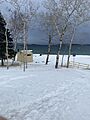
Shores of Lake Superior in early April, 2023
-
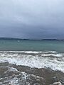
Waves on Lake Superior in early April, 2023
-
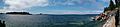
Panorama of Lake Superior, taken from Agawa Rock, looking at Rock Island. Aug 2015.
-
Lake Superior Provincial Park - Ontario
-
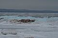
Ice on Lake Superior
-
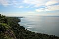
Bare Bluff offers panoramic views of Lake Superior and the Keweenaw Peninsula
-
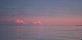
Pink sunset over Lake Superior
-
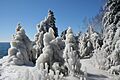
Ice-covered trees on the shore of Lake Superior after a storm.
-
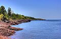
Shoreline of Lake Superior


.jpg)

.jpg)


See also
 In Spanish: Lago Superior para niños
