Apostle Islands facts for kids
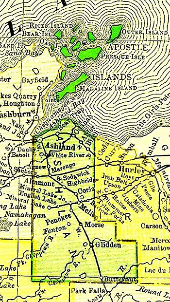
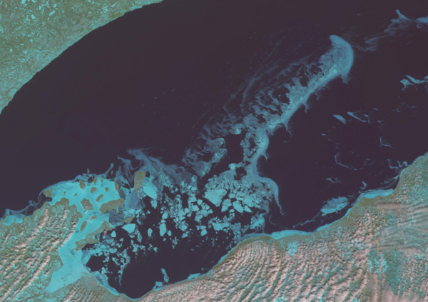
The Apostle Islands are a group of 22 islands. They are located in Lake Superior, off the Bayfield Peninsula in northern Wisconsin. Most of the islands are in Ashland County. Only Sand, York, Eagle, and Raspberry Islands are in Bayfield County.
All the islands, except for Madeline Island, are part of the Apostle Islands National Lakeshore. This is a special area protected for its natural beauty. About 250,000 people visit these islands each year.
Nature and Wildlife
The Apostle Islands National Lakeshore has many different kinds of plants. Over 800 plant species grow here. This includes some rare and protected plants in Wisconsin.
The islands are mostly covered by a type of forest called a boreal forest. This forest has lots of white spruce and balsam fir trees. You can also find white birch, white cedar, white pine, balsam poplar, and quaking aspen. On some islands like Madeline Island and Stockton Island, you can find a unique bog dune ecosystem. This is a special wetland area near deep bays and lagoons.
Black bears are common on Stockton Island. You might also see them on Sand and Oak islands. Because bears can swim, they might visit almost any of the Apostle Islands.
The lakeshore is an important place for many birds to build their nests. These include herring and ring-billed gulls. You can also find double-crested cormorants, great blue herons, and cliff swallows. Gull and Eagle Island are especially important. They are home to most of the herring gulls that breed along Wisconsin's Lake Superior shore. Eagle Island also has the only great blue heron nesting colony in the park.
Amazing Sea Caves
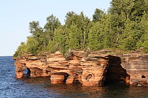
The Apostle Islands have amazing sea caves. You can find good examples at Swallow Point on Sand Island. There are also sea caves on the North Shore of Devils Island. Another spot is near Mawikwe Bay on the mainland.
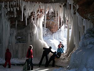
These caves have natural arches and delicate chambers. In the winter, if the lake freezes solid, you can walk on the ice to see them. You might see frozen waterfalls and chambers filled with beautiful icicles!
Island History
People have lived on or visited the Apostle Islands for a very long time. Archeologists have found signs of human activity from as far back as 100 BC.
The first known full-time settlers were the Anishinaabe people. They started moving from the east coast around 950 AD. They followed old trade routes that had been used for thousands of years. The Anishinaabe kept stories of their travels on birch bark scrolls. Some of these scrolls are now in the Smithsonian Museum.
As they moved west, they created several important settlements. When they found wild rice growing in the shallow Chequamegon Bay, they made Mooningwanekaaning their main city. Today, this place is called Madeline Island. They also had settlements on Stockton Island and Manitou Island.
The Ojibwa people, part of the Anishinaabe, made many discoveries and improvements on these islands. They learned to dig for copper and made special tools for farming, hunting, and fishing. They also used canoes to harvest wild rice. They developed a farming method called the "Three Sisters Crop Complex." This helped them grow a lot of food. These advances helped the Ojibwa people grow in number and power. The islands became their main center.
When early French traders arrived around 1640, the main city on Madeline Island was named La Pointe. By 1693, it became an official trading post for New France. Later, as more Europeans moved west, there were conflicts.
In 1811, Chief Buffalo from La Pointe worked to protect his people. He met Michel Caddotte, who convinced him that talking, not fighting, would help the Ojibwa people get better treaties. Even though the American flag was raised over the islands in 1816, Chief Buffalo worked for many years. He successfully secured permanent land for the Red Cliff band and other Ojibwa groups.
The islands were later renamed the Apostle Islands by a French historian named Pierre François Xavier de Charlevoix. He named them after the 12 apostles because there were 12 larger islands.
In 2018, the Apostle Islands were chosen to represent Wisconsin on the America the Beautiful quarters series.
The Islands
All islands are in the Town of La Pointe, Ashland County, unless noted.
| Name | Size (Acres) | Notes |
|---|---|---|
| Madeline Island | 15359.45 Acres | Also known as "Mooniingwanekaaning". It is the largest island and people live there. It is not part of the Apostle Islands National Lakeshore. |
| Stockton Island | 9892.46 Acres | Also known as "Gigawekamingo". |
| Gull Island | 3.51 Acres | Also known as "Gayaashko". This is the smallest island. |
| Eagle Island | 27.7 Acres | Also known as "Naabikwaani". This is the westernmost island. It is in the Town of Bayfield, Bayfield County. |
| Outer Island | 7860.88 Acres | Also known as "Gichi-ishkwaayaan". This is the easternmost and northernmost island. It has the Outer Island Lighthouse. |
| Oak Island | 5024.09 Acres | Also known as "Mitigominikaani". |
| Sand Island | 2859.33 Acres | Also known as "Waabaabikaa". It is in the Town of Bayfield, Bayfield County. It has the Sand Island Lighthouse. |
| Basswood Island | 1914.28 Acres | Also known as "Wiigobiish". |
| Bear Island | 1814.03 Acres | Also known as "Makwa". |
| Michigan Island | 1538.74 Acres | Also known as "Bagidaabii". It has the Michigan Island Lighthouse. |
| Hermit Island | 787.60 Acres | Also known as "Eshkwegwindeg". |
| Cat Island | 1339.07 Acres | Also known as "Gaagaagiwanzhiikaag". |
| Otter Island | 1322.68 Acres | Also known as "Anweshin-nigig". |
| Manitou Island | 1325.20 Acres | Also known as "Manidoo". |
| Rocky Island | 1049.32 Acres | Also known as "Ziinzibaakwado". |
| Long Island | 308.7 Acres | Also known as "Zaagawaamikong". This is the southernmost island. It is not geologically part of the Apostle Islands. It is in the Town of Sanborn, Ashland County. |
| Ironwood Island | 666.05 Acres | Also known as "Gaa-maananoonsi". |
| York Island | 273.83 Acres | Also known as "Miskwaabiimizhikaag". It is in the Town of Russell, Bayfield County. |
| Raspberry Island | 287.6 Acres | Also known as "Miskominikaani". It is in the Town of Russell, Bayfield County. It has the Raspberry Island Lighthouse. |
| Devils Island | 310.28 Acres | Also known as "Maji-manidoo". It has the Devils Island Lighthouse. |
| South Twin Island | 336.37 Acres | Also known as "Waaboozo". |
| North Twin Island | 165.7 Acres | Also known as "Miskwasinikaag". |
Climate
|
|||||||||||||||||||||||||||||||||||||||||||||||||||||||||||||||||||||||||||||||||||||||||||||||||
See Also
 | Jewel Prestage |
 | Ella Baker |
 | Fannie Lou Hamer |


