Bayfield County, Wisconsin facts for kids
Quick facts for kids
Bayfield County
|
|
|---|---|

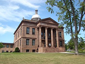
Bayfield County Courthouse
|
|

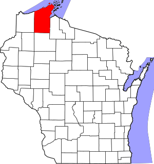
Location within the U.S. state of Wisconsin
|
|
 Wisconsin's location within the U.S. |
|
| Country | |
| State | |
| Founded | 1845 |
| Named for | Henry Bayfield |
| Seat | Washburn |
| Largest city | Washburn |
| Area | |
| • Total | 2,042 sq mi (5,290 km2) |
| • Land | 1,478 sq mi (3,830 km2) |
| • Water | 564 sq mi (1,460 km2) 28% |
| Population
(2020)
|
|
| • Total | 16,220 |
| • Estimate
(2023)
|
16,769 |
| • Density | 7.943/sq mi (3.0669/km2) |
| Time zone | UTC−6 (Central) |
| • Summer (DST) | UTC−5 (CDT) |
| Congressional district | 7th |
Bayfield County is a county in the state of Wisconsin, USA. It is located in the northern part of Wisconsin. In 2020, about 16,220 people lived here. The main town and county seat is Washburn. Bayfield County was officially created in 1845. The Red Cliff Band of Lake Superior Chippewa has a special area called a reservation in Bayfield County. This group is also the county's biggest employer.
Contents
History of Bayfield County
Bayfield County has an interesting past. When it was first formed in 1848, it was called La Pointe County, Wisconsin. Later, two other counties, Douglas County (in 1854) and Ashland County (in 1860), were created from parts of the original La Pointe County. On April 12, 1866, the remaining part of La Pointe County was renamed Bayfield County.
Geography of Bayfield County
Bayfield County is a large area. It covers a total of 2,042 square miles (5,290 km2). Most of this area, 1,478 square miles (3,830 km2), is land. The rest, 564 square miles (1,460 km2) (which is about 28%), is water. This makes Bayfield County the third-largest county in Wisconsin by its total size. It is the second-largest by land area.
Neighboring Counties
Bayfield County shares its borders with several other counties:
- Ashland County – to the east
- Sawyer County – to the south
- Washburn County – to the southwest
- Douglas County – to the west
- Lake County, Minnesota – to the north (across Lake Superior)
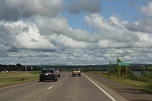
Main Roads
Many important roads run through Bayfield County, helping people travel around.
|
Bus Services
You can find bus services in the county, like:
- Bay Area Rural Transit
- Indian Trails
Airport
The Cable Union Airport (airport codes: 3CU) serves Bayfield County. It helps people fly in and out of the area.
Protected Natural Areas
Bayfield County is home to parts of several important natural areas. These places are protected to keep their beauty and wildlife safe.
- Apostle Islands National Lakeshore (part of it is in Bayfield County)
- Chequamegon National Forest (part of this large forest is here)
- Whittlesey Creek National Wildlife Refuge
People of Bayfield County
| Historical population | |||
|---|---|---|---|
| Census | Pop. | %± | |
| 1850 | 489 | — | |
| 1860 | 353 | −27.8% | |
| 1870 | 344 | −2.5% | |
| 1880 | 564 | 64.0% | |
| 1890 | 7,390 | 1,210.3% | |
| 1900 | 14,392 | 94.7% | |
| 1910 | 15,987 | 11.1% | |
| 1920 | 17,201 | 7.6% | |
| 1930 | 15,006 | −12.8% | |
| 1940 | 15,827 | 5.5% | |
| 1950 | 13,760 | −13.1% | |
| 1960 | 11,910 | −13.4% | |
| 1970 | 11,683 | −1.9% | |
| 1980 | 13,822 | 18.3% | |
| 1990 | 14,008 | 1.3% | |
| 2000 | 15,013 | 7.2% | |
| 2010 | 15,014 | 0.0% | |
| 2020 | 16,220 | 8.0% | |
| U.S. Decennial Census 1790–1960 1900–1990 1990–2000 2010 2020 |
|||
Population in 2020
In 2020, the population of Bayfield County was 16,220 people. This means there were about 11 people living in every square mile of land. Most people in the county are White (83.2%). A significant number are Native American (10.5%). Other groups also live here, making the county a diverse place. About 1.7% of the population was Hispanic or Latino.
Population in 2010
Back in 2010, there were 15,014 people living in Bayfield County. At that time, about 86.7% of the people were White. About 9.6% were Native American. A small number of people were from other backgrounds, including Asian, Black, or African American. About 1.1% of the people were Hispanic or Latino.
Communities in Bayfield County
Bayfield County has several towns, villages, and cities where people live.
Cities
- Ashland (most of this city is in Ashland County)
- Bayfield
- Washburn (This is the county seat, where the main county government offices are.)
Village
Towns
Census-Designated Places
These are areas that are like towns but are not officially incorporated as cities or villages.
- Cable
- Cornucopia
- Drummond
- Grand View
- Herbster
- Iron River
- Port Wing
Unincorporated Communities
These are smaller communities that are not officially part of a city, village, or census-designated place.
See also
 In Spanish: Condado de Bayfield para niños
 | Delilah Pierce |
 | Gordon Parks |
 | Augusta Savage |
 | Charles Ethan Porter |


