Barksdale, Wisconsin facts for kids
Quick facts for kids
Barksdale, Wisconsin
|
|
|---|---|

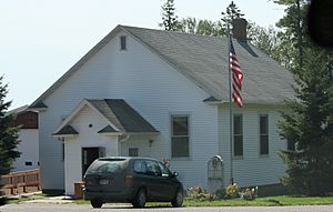
Town hall
|
|

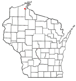
Location of Barksdale, Wisconsin
|
|
| Country | |
| State | |
| County | Bayfield |
| Area | |
| • Total | 66.3 sq mi (171.7 km2) |
| • Land | 55.2 sq mi (142.9 km2) |
| • Water | 11.1 sq mi (28.8 km2) |
| Elevation | 1,145 ft (349 m) |
| Population
(2020)
|
|
| • Total | 745 |
| • Density | 11.238/sq mi (4.339/km2) |
| Time zone | UTC-6 (Central (CST)) |
| • Summer (DST) | UTC-5 (CDT) |
| ZIP code |
54891
|
| Area codes | 715 and 534 |
| FIPS code | 55-04725 |
| GNIS feature ID | 1582751 |
Barksdale is a small town in Bayfield County, Wisconsin, in the United States. In 2020, about 745 people lived there. This was a small increase from 723 people in 2010. The town is also home to a smaller community, also called Barksdale.
The town got its name from Hamilton M. Barksdale. He was a vice president at the DuPont Chemical Company. William G. Ramsay, who was the chief engineer for DuPont, chose the name.
Barksdale was once important for its DuPont factory. This factory made explosives. Over the years, there were some serious incidents at the facility.
Getting Around Barksdale
Wisconsin Highway 13 is the main road that runs through Barksdale. It goes along the eastern side of the town. This highway helps people travel in and out of the area.
Barksdale's Location and Land
Barksdale covers a total area of about 171.7 square kilometers (about 66.3 square miles). Most of this area is land, around 142.9 square kilometers (55.2 square miles). The rest, about 28.8 square kilometers (11.1 square miles), is water.
The eastern part of Barksdale reaches into Chequamegon Bay. This bay is an arm of Lake Superior, one of the largest freshwater lakes in the world. Barksdale is located about 6 miles (10 km) northwest of the city of Ashland.
Who Lives in Barksdale?
In 2000, there were 801 people living in Barksdale. These people lived in 303 households, and 232 of these were families. The town had about 14.5 people for every square mile.
Many households in Barksdale were made up of married couples living together. Some households had children under 18. The average household had about 2.64 people.
The people in Barksdale are of different ages:
- About 25.6% were under 18 years old.
- About 6.4% were between 18 and 24 years old.
- About 25.7% were between 25 and 44 years old.
- About 31.2% were between 45 and 64 years old.
- About 11.1% were 65 years old or older.
The average age in Barksdale was 40 years.
See also
 In Spanish: Barksdale (Wisconsin) para niños
 | Kyle Baker |
 | Joseph Yoakum |
 | Laura Wheeler Waring |
 | Henry Ossawa Tanner |

