Great Lakes Waterway facts for kids
The Great Lakes Waterway (GLW) is like a giant water highway. It's a system of natural rivers and man-made canals that lets ships travel between the Great Lakes in North America. Even though the lakes are connected, big obstacles like Niagara Falls and fast-moving rivers like the St. Marys River used to stop boats from going through.
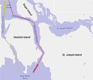
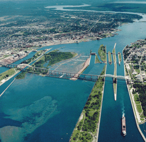
Engineers built important structures to make this waterway possible. These include the Welland Canal between Lake Ontario and Lake Erie. There are also the huge Soo Locks between Lake Huron and Lake Superior. Workers also dug deeper channels in places like the St. Marys River, the Detroit River, Lake St. Clair, and the St. Clair River. These channels help ships move easily between Lake Huron and Lake Erie.
Sometimes, U.S. Coast Guard icebreakers help keep the water open for ships in late fall and early winter. However, shipping usually stops for a few months after that. The St. Lawrence Seaway connects the GLW to the Atlantic Ocean. The Illinois Waterway links it to the Mississippi River and the Gulf of Mexico. The governments of Canada and the United States work together to manage the Great Lakes Waterway.
What is the Great Lakes Waterway?

This amazing waterway allows ships to travel from the Atlantic Ocean all the way to Duluth, Minnesota. Duluth is a port city on Lake Superior. This journey is about 2,340 miles (3,770 km) long! Ships can also reach Chicago, on Lake Michigan, which is about 2,250 miles (3,620 km) away.
The Great Lakes Waterway works with the Saint Lawrence Seaway. Together, they let large ocean ships and big lake freighters travel far inland. These freighters carry things like iron ore, grain, and coal. They can go from the Atlantic Ocean to the deepest parts of the Great Lakes.
The locks on the Great Lakes Waterway are bigger and deeper than those on the lower St. Lawrence Seaway. This means the largest freighters can only travel on the four lakes upstream of the Welland Canal and Lake Ontario. Also, bigger ocean ships cannot go past Saint Lambert, Quebec. Many people simply call both waterways the "St. Lawrence Seaway." This is because the Great Lakes and the St. Lawrence River form one big pathway of freshwater. This pathway connects the Atlantic Ocean to the middle of the continent.
Some of the main ports on the Great Lakes Waterway include Duluth-Superior, Chicago, Detroit, Cleveland, Twin Harbors, Hamilton, and Thunder Bay.
How Ships Use the Waterway
The shipping channels are set up to keep ships moving safely. There are separate paths for ships going in different directions. "Upbound" means moving away from the St. Lawrence River. This is usually west or north, except in Lake Michigan where it's south.
Special buoys mark the channels in narrow areas. Pilots are needed on foreign ships to help guide them. Smaller recreational boats can use or cross the ship channels. However, the large ships are harder to steer and always have the right of way.
Map of the Waterway
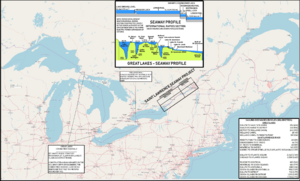
This map from 1959 shows the Great Lakes and the St. Lawrence Seaway. It displays the entire route. You can see it starts at the Gulf of Saint Lawrence in the east. It goes all the way to Lake Superior in the west.
See also
 In Spanish: Vía navegable de los Grandes Lagos para niños
 | Lonnie Johnson |
 | Granville Woods |
 | Lewis Howard Latimer |
 | James West |


