Lake Erie facts for kids
Quick facts for kids Lake Erie |
|
|---|---|
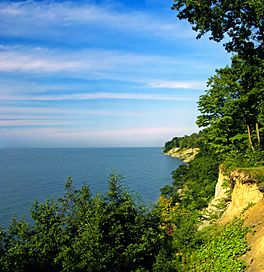
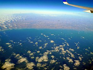
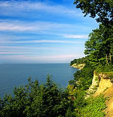
Lake Erie from the David M. Roderick Wildlife Reserve
|
|
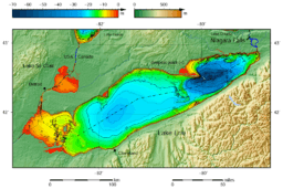
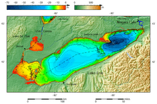
Lake Erie and Lake Saint Clair bathymetric map. The deepest point is marked with "×".
|
|
| Location | North America |
| Group | Great Lakes |
| Coordinates | 42°12′N 81°12′W / 42.2°N 81.2°W |
| Lake type | Glacial |
| Native name | Lac Érié (French) |
| Primary inflows | Detroit River |
| Primary outflows | Niagara River Welland Canal |
| Basin countries | |
| Max. length | 241 mi (388 km) |
| Max. width | 57 mi (92 km) |
| Surface area | 9,910 sq mi (25,667 km2) |
| Average depth | 62 ft (19 m) |
| Max. depth | 210 ft (64 m) |
| Water volume | 116 cu mi (480 km3) |
| Residence time | 2.6 years |
| Shore length1 | 799 mi (1,286 km) plus 72 mi (116 km) for islands |
| Surface elevation | 569 ft (173 m) |
| Islands | 24+ (see list) |
| Settlements | Cleveland, Ohio Buffalo, New York Erie, Pennsylvania Toledo, Ohio Monroe, Michigan Leamington, Ontario Port Colborne, Ontario |
| 1 Shore length is not a well-defined measure. | |
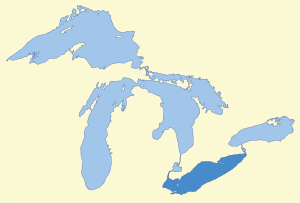
Lake Erie is one of the five Great Lakes in North America. It's the fourth largest of these lakes by surface area and the eleventh largest in the world. Lake Erie is the most southern, shallowest, and smallest of the Great Lakes in terms of water volume. This means its water stays in the lake for the shortest time compared to the other Great Lakes. At its deepest point, Lake Erie is about 210 feet (64 m) deep.
The lake sits on the border between Canada and the United States. Its northern shore is in the Canadian province of Ontario. Its western, southern, and eastern shores are in the U.S. states of Michigan, Ohio, Pennsylvania, and New York. These areas share the lake's surface with water boundaries. The biggest city on the lake is Cleveland, Ohio. Other major cities along the shore include Buffalo, New York; Erie, Pennsylvania; and Toledo, Ohio.
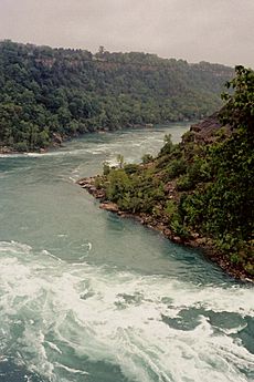
Lake Erie gets most of its water from the Detroit River, which flows from Lake Huron. The main natural way water leaves Lake Erie is through the Niagara River. This river helps create hydroelectric power for Canada and the U.S. as it flows over Niagara Falls. Some water also leaves through the Welland Canal, which is part of the Saint Lawrence Seaway. This canal helps ships travel from Lake Erie to Lake Ontario. Over the years, people have been worried about Lake Erie's health due to issues like too much fishing, pollution, and algae blooms.
Contents
- Exploring Lake Erie's Geography
- How Lake Erie Was Formed
- Lake Erie's Past
- Lake Erie's Environment
- Lake Erie's Economy
- Images for kids
- See also
Exploring Lake Erie's Geography
Lake Erie is about 571 feet (174 m) above sea level. Its surface area is about 9,990 square miles (25,874 km2). The lake is 241 statute miles (388 km; 209 nmi) long and 57 statute miles (92 km; 50 nmi) wide at its widest points.
It is the shallowest of the Great Lakes, with an average depth of 62 feet (19 m). The deepest part is 210 feet (64 m). For comparison, Lake Superior is much deeper, with an average depth of 483 feet (147 m). Because Lake Erie is shallow, it warms up faster in the summer. This can sometimes be a problem for power plants that need cool lake water. It also means Lake Erie is the first of the Great Lakes to freeze in winter. The western part of Lake Erie is very shallow, averaging only 25 to 30 feet (7.6 to 9.1 m) deep. Even a small breeze can create big waves there. Sometimes, these sudden strong waves have led to dramatic rescues.
Besides the Detroit River, other rivers that flow into Lake Erie include the Grand River, the Huron River, the Maumee River, the Sandusky River, the Buffalo River, and the Cuyahoga River. The land area that drains into Lake Erie covers about 30,140 square miles (78,100 km2).
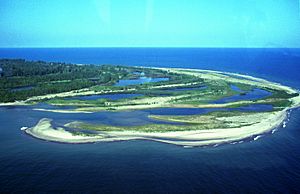
Point Pelee National Park, the southernmost point of mainland Canada, is on a peninsula stretching into the lake. Many islands are in the western part of the lake. Most of these islands belong to Ohio, except for Pelee Island and eight nearby islands, which are part of Ontario.
Major cities along Lake Erie include Buffalo; Erie, Pennsylvania; Toledo, Ohio; and Cleveland, Ohio.
Lake Erie's Islands
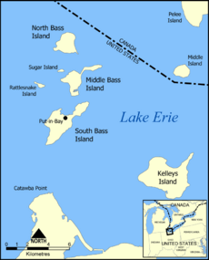
There are 31 islands in Lake Erie, mostly in the western part. Thirteen are in Canada and 18 are in the U.S.
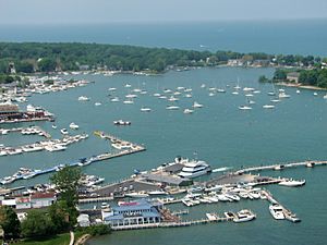
- Put-in-Bay, Ohio is a village on South Bass Island. It's known for attracting young people who enjoy the lively atmosphere.
- Kelleys Island, Ohio offers a quieter experience. Visitors can relax on beaches, hike, bike, and see amazing deep grooves left in the limestone by glaciers.
- Pelee Island is the largest of Lake Erie's islands. You can reach it by ferry from Leamington, Ontario or Sandusky, Ohio. This island has a special and delicate ecosystem. It's home to rare plants like wild hyacinth and prickly pear cactus. Two endangered snakes, the blue racer and the Lake Erie water snake, also live here. Songbirds visit Pelee in spring, and monarch butterflies stop there in the fall during their migration.
Lake Erie's Water Levels
Lake Erie's water changes with the seasons, just like the other Great Lakes. Water levels are usually lowest in January and February and highest in June or July. The average yearly level depends on how much rain and snow falls. Strong winds can also cause quick changes in water levels. When strong southwesterly winds blow across the lake, water can pile up at the eastern end. These storm-driven water shifts, called seiches, can cause damage on shore. For example, in November 2003, the water level at Buffalo rose by 7 feet (2.1 m) with waves up to 15 feet (4.6 m). At the same time, Toledo at the western end saw a similar drop in water level. Lake Erie's water is used for drinking.
- Highest Water Levels: The highest water levels usually happen in June and July. In the summer of 1986, Lake Erie reached its highest recorded level, about 5.08 feet (1.55 m) above its normal measurement point.
- Lowest Water Levels: Lake Erie's lowest levels are typically in winter. In the winter of 1934, the lake reached its lowest recorded level, about 1.5 feet (0.46 m) below its normal measurement point.
How Lake Erie Was Formed
Lake Erie was shaped by huge sheets of ice. In its current form, it's less than 4,000 years old, which is quite young in terms of Earth's history. Millions of years ago, before the ice ages, there was a large lowland basin with a river flowing east. This old river system was destroyed by the first major glacier in the area. The glaciers deepened and widened the lowland areas, allowing water to collect and form a lake.
The glaciers carved more land on the eastern side of the lowland because the rock there is softer shale. On the western side, the rock is harder dolomite and limestone. This is why the eastern and central parts of the lake are much deeper than the western part, which averages only 25 feet (7.6 m) deep. Lake Erie is the shallowest of the Great Lakes because the ice was thinner and didn't have as much power to erode the land when it reached this far south.
Several glaciers moved across the land, creating temporary lakes in between each ice age. These lakes had different amounts of water, so their shorelines were at different heights. The last of these lakes, Lake Warren, existed about 13,000 to 12,000 years ago. It was deeper than today's Lake Erie. The old shorelines left behind high sand ridges. These ridges were used as trails by Native Americans and later by pioneers. Some of these old sand dunes can still be seen in the Oak Openings Region in Northwest Ohio.
Lake Erie's Past
Native American History
When Europeans first arrived, several Native American groups lived around the eastern end of Lake Erie. The Erie tribe, who gave the lake its name, lived along the southern shore. The Neutrals lived along the northern shore. Near Port Stanley, Ontario, there's an ancient village from the 16th century called the Southwold Earthworks, where up to 800 Neutral people once lived. Europeans called them "Neutral" because they refused to fight with other tribes. Both the Erie and Neutral tribes were later conquered by the Iroquois Confederacy between 1651 and 1657 during what are known as the Beaver Wars.
For many years after these wars, the Iroquois used the land around eastern Lake Erie for hunting. As the Iroquois' power weakened in the late 1600s, other Native American tribes, mainly the Anishinaabe, moved into the areas they had claimed.
European Exploration and Settlement
In 1669, the Frenchman Louis Jolliet was the first European known to have seen Lake Erie. However, some think Étienne Brûlé might have seen it earlier in 1615. Lake Erie was the last of the Great Lakes to be explored by Europeans. This was because the Iroquois, who lived near the Niagara River, were often in conflict with the French. They didn't allow explorers or traders to pass through. Instead, explorers would follow rivers from Lake Ontario and carry their boats directly to Lake Huron.
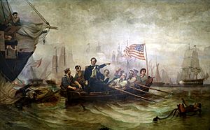
During the War of 1812, Oliver Hazard Perry led American forces to capture a British fleet near Put-in-Bay, Ohio, in 1813. This was a significant victory for the Americans. Despite conflicts like the American Revolutionary War and the War of 1812, relations between the U.S. and Canada have generally been friendly. They have an "unfortified boundary" and an agreement that keeps warships off the Great Lakes.
In 1837, there were rebellions in Canada between settlers and the British government, mainly over political changes and land. Some rebels crossed the frozen Sandusky Bay to Pelee Island, but the islanders had already left. Later, a battle took place on the ice.
By the 1850s, settlers started commercial fishing on the lake's north coast. Fishing became an important business. Around 1852, railways were built all around the lake. Ship traffic increased, but the lake was usually closed due to ice from December to early April. Since slavery was abolished in Canada in 1833 but still legal in the southern U.S. states, crossing Lake Erie was sometimes a way for enslaved people to find freedom.
Ships in the past didn't have modern radar or weather forecasts. This meant vessels were often caught in strong storms. In 1868, a ship captain reported seeing a sunken vessel with three men clinging to the mast, but he couldn't help them due to the storm.
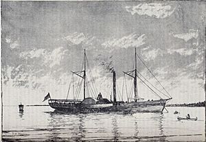
In 1857, a balloonist named John Steiner made an amazing trip across the lake. He rose about three miles high and saw the entire lake. He counted 38 sailing vessels below him. He landed in the water about 25 miles below Long Point and was rescued by a steamship.
In 1885, strong lake winds caused water levels to drop significantly, sometimes by as much as two feet. This meant boats couldn't load coal or leave ports like Toledo.
By 1895, there were concerns that Lake Erie was being overfished. Critics worried that wasteful fishing methods were harming the fish populations. They said that small fish were being caught and used for fertilizer instead of being allowed to grow.
In 1913, a memorial to Commodore Perry was built on Put-in-Bay island. Throughout the 20th century, commercial fishing was common, but so was the growth of factories around the lake. Rivers and streams were often used to dump untreated waste into the lake. In 1969, Time magazine called the lake a "gigantic cesspool" because of pollution. Many beaches were unsafe for swimming.
By 1975, the popular commercial fish called blue pike was thought to be extinct. By the 1980s, commercial fishing was declining quickly, especially on the American side.
Great Lakes Compact
In 2005, the Great Lakes states (Ohio, Michigan, New York, Pennsylvania, Illinois, Indiana, Wisconsin, Minnesota) and the Canadian provinces (Ontario and Quebec) agreed to the Great Lakes-St. Lawrence River Basin Sustainable Water Resources Compact. This agreement was signed into law in 2008. It's an international policy that aims to stop water from being taken from the Great Lakes and sent to distant states. It also sets rules for how water should be used and conserved.
Lake Erie's Environment
Weather Patterns
Lake Erie in Winter
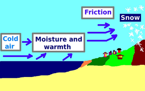
Like the other Great Lakes, Lake Erie creates "lake effect snow" when cold winter winds blow over its warmer waters. When the temperature difference between the warm lake surface and the cold air is big enough (about 18 to 23 degrees Fahrenheit or 10 to 13 degrees Celsius), lake-effect snow can happen. As cold air moves over the warm water, the lake warms and adds moisture to the air. This warm, moist air rises, cools, and forms clouds and snowflakes. When the wind pushes these clouds over land, the snow production increases.
Heavy lake-effect snowfalls can occur when cold air travels 60 miles (97 km) or more over a large, unfrozen lake. This makes Buffalo and Erie some of the snowiest places in the United States. Buffalo usually gets 95 inches (240 cm) of snow each winter. Sometimes, it can even get 10 feet (3.0 m) of snow.
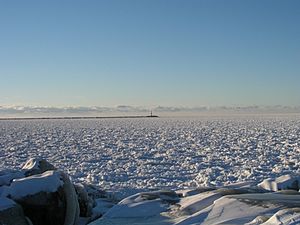
The lake effect snow stops or slows down when the lake freezes over. Since Lake Erie is the shallowest of the Great Lakes, it's the most likely to freeze completely, which it often does. When the lake freezes, it usually stops the lake effect snowfall. In the past, the ice was so thick that people could drive cars or go sailing on iceboats. However, in recent years, the ice hasn't been thick enough for these activities. Many people who live near the lake enjoy traveling on the ice. Some even drive to Canada and back.
Windy Conditions
Strong winds can shift sediment on the lake bottom, creating "shifting sandbars" that have caused shipwrecks. However, winds can also be used for good. There have been ideas to place wind turbines in windy and shallow parts of the lake and along the coast to produce electricity. In 2010, there were plans to build wind turbines near Cleveland to generate power. A former steel mill site in Buffalo was turned into an urban wind farm in 2007. This project, called Steel Winds, has 14 turbines that can generate up to 35 megawatts of electricity.
Microclimates and Agriculture
The lake also creates special local climates, called microclimates, which are important for agriculture. Along its north shore in Canada, there's a very rich area for growing fruit and vegetables. This area, especially around Leamington, is known as Canada's "tomato capital." The "tempering effect of the lake" allows special trees and tropical plants to grow here that are rarely found so far north. Along the southeastern shore in Ohio, Pennsylvania, and New York, there's an important grape growing region. Apple orchards are also common in northeast Ohio and western New York.
Long-Term Weather Patterns
About 34 to 36 inches of water evaporate from Lake Erie each year. This evaporation contributes to rainfall and other precipitation in the surrounding areas. There are different ideas about how global warming might affect the Great Lakes region in the long term.
Lake Erie's Ecosystems
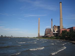
Lake Erie has a complex ecosystem with many different species living together. Human activities, like pollution and ship traffic, can affect this environment. Sometimes, new species entering the lake can have good effects, and other times, they can have harmful effects. For example, the introduction of Pacific salmon has been seen as helpful. Occasionally, large numbers of certain fish species die off, sometimes for unknown reasons.
Invasive Species
The lake has faced problems with many invasive species. These include zebra and quagga mussels, the goby, and the grass carp. It's estimated that there are 180 invasive species in the Great Lakes. Some of these arrived in the ballast water of international ships. Zebra mussels and gobies have been linked to an increase in the population and size of smallmouth bass in Lake Erie. In 2008, there were worries that the "bloody-red shrimp," a new invader, might harm fish populations and cause algae blooms.
Scientists and environmentalists study the lake's conditions at places like the Franz Theodore Stone Laboratory on Gibraltar Island. This lab, founded in 1895, is the oldest biological field station in the United States. The Great Lakes Institute at the University of Windsor also has experts who study issues like lake sediment pollution and the flow of chemicals like phosphorus.
Common invasive species in Lake Erie include: Zebra Mussels, Quagga Mussels, Round Gobies, Spiny European Water Fleas, Fishhook Water Fleas, the Sea Lamprey, and White Perch. Invasive plants like Eurasian Milfoil and Purple Loosestrife also grow in Lake Erie.
Eutrophication and the Dead Zone
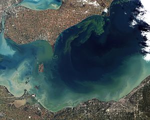
A continuing concern is "eutrophication," which means too many nutrients like nitrogen and phosphorus enter the lake from fertilizers, human waste, and animal waste. This causes plant life, especially algae, to grow very quickly. Since there are fewer wetlands, which naturally filter nutrients, and more "channelization of waterways," nutrients can easily flow into the lake. This leads to large algal blooms and "low-oxygen dead zones." In the 2010s, much of the phosphorus in the lake came from fertilizer used on soybean and corn fields that washed into streams during heavy rains. The algae blooms are caused by the growth of Microcystis, a toxic blue-green algae that the zebra mussels in the lake don't eat.
There is often a dead zone in the lake, which is an area with very low oxygen. Its exact location changes. Scientists study the lake's blue-green algae blooms to predict when they will spread. This problem was very bad in the 1960s and 1970s. Studies showed that pollution from factories, cities, and farms was causing the eutrophication. These sources added nutrients, mainly phosphorus, to the lake. This caused too much growth of organisms, which used up the oxygen. Recommendations were made to reduce pollution from factories and cities and to change farming practices to reduce phosphorus. Many industrial and city pollution sources have been greatly reduced. Improved farming practices were followed for a while, and the lake recovered remarkably in the 1970s.
However, these farming practices are not always continued. Some reports suggest that seasonal algae blooms in Lake Erie are caused by "runoff from cities, fertilizers, zebra mussels, and livestock near water." Another report says that zebra mussels cause "big oxygen-poor dead zones" because they filter so much sediment, which helps algae grow. The oxygen-poor zone in the lake's central basin started around 1993 and gets worse in summer. Some scientists think it might be a natural event. Another report pointed to Ohio's Maumee River as the main source of phosphorus pollution. In 2008, satellite images showed an algae bloom moving towards Pelee Island. This "growing zone" is a thick layer of cold water at the bottom of the lake that kills fish and tiny creatures in the food chain. It also makes the water dirty and could cause more problems for fishing in the future. Algae blooms continued in 2013, and new farming techniques, climate change, and changes in Lake Erie’s ecosystem make phosphorus pollution harder to control.
Snakes of Lake Erie
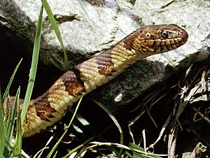
The Lake Erie water snake is a type of northern water snake. It lives near Ohio's Put-in-Bay Harbor. This snake was once on the threatened species list, meaning it might soon become endangered. By 2010, the water snake population was over 12,000. Even though their bite is not venomous, they are important predators in the lake's ecosystem. They eat mudpuppies, walleye, and smallmouth bass. The snake has also helped control the population of goby fish. They mate from late May to early June and can be found in large groups with one female surrounded by several males.
Asian Carp and Snakehead Fish
There is concern that Asian carp might enter the Great Lakes. These fish are described as "greedy giants that suck plankton from the water." Scientists worry they could harm the "aquatic food web" by taking over the food supply from other species.
In 2007, there was also worry about snakehead fish getting into the Great Lakes. Officials warned that if these fish invade, they could "decimate the aquatic food chain." These fish can grow up to 5 feet 11 inches (1.80 m) long. They can also "survive out of water for four days" and have teeth that can "shear fish in half." They can even eat ducks and small mammals. However, snakehead fish cannot live in a lake that completely freezes over, as they need to come to the surface to breathe.
Wildlife and Agriculture Around the Lake
In 1999, weather radar detected millions of mayflies heading for Presque Isle. These insects were a sign that Lake Erie was becoming healthier, because mayflies need clean water to live. A biologist called them a "nice nuisance" because their return showed the lake's health improving after 40 years. These insects mate over a 72-hour period from June to September. They fly in large groups to the shore, mate in the air, and then females lay up to 8,000 eggs over the water. The eggs sink, and the cycle repeats. Sometimes, the clouds of mayflies have caused power outages and made roads slippery. Since zebra mussels filter extra nutrients from the lake, it helps the mayfly larvae grow.
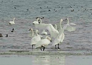
There have been cases of birds dying from botulism in 2000 and 2002. Birds affected included grebes, mergansers, loons, and gulls. Some reports suggest that bird populations are in trouble, especially the woodland warbler, which saw a 60 percent decline in 2008. Possible reasons for these declines include farming practices, loss of habitats, soil problems, and toxic chemicals.
Water Quality and Restoration
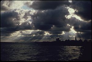
Lake Erie became very polluted in the 1960s and 1970s. This was due to many factories and cities on its shores. Reports described beaches full of bacteria and fish contaminated by industrial waste. In the 1970s, parts of the lake were called "dead" because of industrial waste and sewage. In 1969, Cleveland's Cuyahoga River, which flows into Lake Erie, even caught fire. Time magazine described the lake as a "gigantic cesspool." They reported that cities were dumping billions of gallons of untreated waste into the lake. This waste, especially nitrates and phosphates, acted like fertilizer for algae. The algae would then use up oxygen from the deeper parts of the lake and rise to the surface as smelly green scum. Commercial and game fish almost disappeared, replaced by "trash fish" that needed less oxygen. Weeds grew everywhere, turning shorelines into swamps.
These events embarrassed officials and led to major cleanup efforts. Cleveland spent $100 million to upgrade its sewage system. The United States Congress passed the Clean Water Act of 1972. In the same year, the United States and Canada agreed on limits for water pollution in an International Water Quality Agreement. These controls worked, but it took several decades to see the effects. By 1999, large numbers of mayflies were seen on the lake again after 40 years, which was a sign of returning health.
The water also became clearer partly because of zebra mussels from Europe. These mussels spread quickly and covered the lake bottom. Each mussel filters about a liter of fresh water a day, helping to clean the lake. The 1972 Great Lakes Water Quality Agreement also greatly reduced the dumping of phosphorus into the lake. The lake is now clean enough for sunlight to reach the bottom and grow algae and seaweed. However, a dead zone still appears in the central Lake Erie Basin during late summer.
Since the 1970s, environmental regulations have greatly improved water quality. Important fish species like walleye and other aquatic life have returned. By 1979, there was strong evidence that new controls had significantly reduced levels of DDT in the water. Cleanup efforts were seen as a big environmental success story. The combined effect of laws, studies, and bans had reversed the pollution.
Joint U.S.-Canadian agreements pushed many industrial polluters to meet requirements for keeping the water clean. It's estimated that $5 billion was spent to upgrade sewage treatment plants. The water quality has been improving since the 1970s.
Lake Erie's Economy
Fishing in Lake Erie
Fish Species
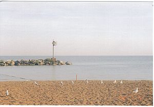
Lake Erie has one of the world's largest freshwater commercial fisheries. Its fish populations are the most plentiful of the Great Lakes. This is partly because the lake has mild temperatures and lots of plankton, which is the base of the food chain. The lake's fish population makes up about 50% of all fish in the Great Lakes. The lake has steelhead, walleye, largemouth bass, smallmouth bass, perch, lake trout, king salmon, whitefish, smelt, and many others. Many introduced species also live in the lake. Common non-native fish include the rainbow smelt, alewife, white perch, and common carp. Non-native sport fish like rainbow trout and brown trout are added to the lake specifically for anglers to catch.
Until the late 1950s, the most common commercial fish was a type of walleye called the blue walleye. In the 1970s and 1980s, as pollution in the lake decreased, the number of walleyes caught grew from 112,000 in 1975 to 4.1 million in 1985. It was estimated that there were about 33 million walleyes in the lake. However, the blue walleye population collapsed due to too much fishing and pollution. In the mid-1980s, the blue walleye was declared extinct.
There have been concerns about increasing levels of mercury in walleye fish. A study found an "increasing concentration trend" but said the levels were within safe limits. Because of chemicals like PCBs, it was recommended that people eat no more than one walleye meal per month. In 1990, the National Wildlife Federation considered advising people not to eat walleye and smallmouth bass. These fish were the main catch of an $800 million commercial fishing industry.
The longest fish in Lake Erie is the sturgeon, which can grow up to 10 feet (3.0 m) long and weigh 300 pounds (140 kg). However, it is an endangered species and mostly lives on the bottom of the lake. In 2009, a sturgeon was caught and safely returned to the lake. There are hopes that the sturgeon population is growing again.
Commercial Fishing
Estimates for the fishing market in the Great Lakes vary. In 2007, one estimate for commercial and recreational fishing was $4 billion annually. Another estimate was over $7 billion. However, since high pollution levels were found in the 1960s and 1970s, there has been ongoing debate about how much commercial fishing should be allowed. Commercial fishing in Lake Erie has been hurt by pollution and government rules that limit how much fish they can catch. One report said that the number of fishing boats and workers had dropped by two-thirds in recent decades.
U.S. fishermen along Lake Erie have lost their jobs over the past few decades. They no longer catch fish like whitefish for markets in New York. Commercial fishing is now mostly done by Canadian communities. There is a much smaller fishery in Ohio, mainly for yellow perch. The Ontario fishery is managed very carefully. However, some Canadian commercial fishermen are unhappy with fishing quotas and have sued the government. They feel that sport fishing interests are favored over commercial fishing.
The Lake Erie fishery was one of the first in the world to be managed with individual transferable quotas. This means fishermen have specific limits on what they can catch. They also have to report their catches daily. Still, commercial fishing faces criticism from those who want the lake to be managed only for sport fishing. The Canadian town of Port Dover is home to the lake's largest fishing fleet.
Sport Fishing
The lake supports a strong sport fishery. While commercial fishing has declined, sport fishing has continued to grow. The deep, cool waters that are best for fishing are on the Canadian side of the lake. If a fishing boat crosses the international border, fishermen need to carry their passports and report to a border protection office when they return to the American shore.
In 2008, the Pennsylvania Fish and Boat Commission tried stocking the lake with brown trout. This was an effort to create a "put-grow-and-take" fishery, where fish are stocked, allowed to grow, and then caught. Charter boat fishing increased significantly on the American side, from 46 to 638 boats in Ohio alone, between 1975 and 1985. This happened as pollution levels dropped and walleye populations grew. In 1984, Ohio sold 27,000 fishing permits to non-residents, showing that sport fishing was a big business. In 1992, fishermen were regularly catching walleye weighing up to 12 pounds (5.4 kg). It's also possible to fish off piers in winter for burbot, which are known to make a midwinter spawning run.
Ice Fishing
In winter, when the lake freezes, many fishermen go out on the ice, cut holes, and fish. It's even possible to build bonfires on the ice. However, venturing onto Lake Erie's ice can be dangerous. In 2009, warming temperatures, strong winds, and currents caused a large ice floe to break away from the shore. This trapped over 130 fishermen offshore. One person died, while the rest were rescued by helicopters or boats.
The day began with fishermen setting down wooden pallets to create a bridge over a crack in the ice so they could roam farther out on the lake. But the planks fell into the water when the ice shifted, stranding the fishermen about 1,000 yards offshore ... When fishermen realized late Saturday morning that the ice had broken away, they began to debate the best way off. Some chose to sit and wait for authorities, while others headed east in search of an ice bridge ... Others managed to get to land on their own by riding their all-terrain vehicles about five miles east to where ice hadn't broken away. ... When the rescued fishermen made it to shore, authorities had them line up single-file to take down their names.
Agriculture Around Lake Erie
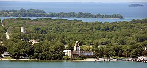
The lake's former lakebed creates good soil for agriculture in the nearby areas of Ontario, Ohio, Michigan, Pennsylvania, and New York. The Lake Erie parts of western New York have a good climate for growing grapes. There are many vineyards and wineries in Chautauqua County and Erie County. The Canadian region of Lake Erie's north shore is also becoming a well-known wine region. It's called the Lake Erie North Shore, or LENS region, and includes Pelee Island. Because it's farther north than other wine-growing areas, the summer days are longer. The lake's moderate temperatures also create a longer growing season, reducing the risk of early frosts.
The land that drains into the lake has very fertile soil. The north coast of Ohio is widely known for its plant nurseries.
Tourism and Recreation
Diving for Shipwrecks
Lake Erie is a popular spot for divers because it has many shipwrecks. Estimates range from 1,400 to 8,000 wrecks, with about 270 confirmed locations. Research into shipwrecks is done by the Peachman Lake Erie Shipwreck Research Center. Most wrecks haven't been found yet, but they are believed to be well preserved. They are at most 200 feet (61 m) below the water surface. Some say there are more wrecks per square mile here than any other freshwater location. The wrecks include ancient Native American boats. Efforts are being made to find and map these underwater sites for study. While Lake Erie is warmer than other Great Lakes, it has a thermocline, meaning the water temperature drops about 30 degrees Fahrenheit change (17 °C) as a diver goes deeper, so a wetsuit is needed. Divers have a rule not to remove or touch anything at the wreck sites. The cold conditions make diving challenging, requiring skilled and experienced divers. One company in western New York takes about 1,500 divers to Lake Erie shipwrecks each season from April to October.
Among the diving community, they are considered world class, offering opportunities to visit an underwater museum that most people will never see.
In 1991, the 19th-century paddle steamer Atlantic was found. It sank in 1852 after hitting another ship. About 20 to 130 people drowned. There was talk that the ship might have been a gambling ship with money on board, but most historians doubted this.
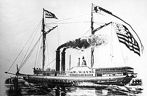
In 1998, the wreckage of the Adventure became the first shipwreck registered as an "underwater archaeological site." Its propeller had been removed and taken to a junkyard, but it was recovered and returned to the dive site. In 2003, divers found the steamer Canobie near Presque Isle, which sank in 1921. Other wrecks include the Neal H. Dow (1910), the Elderado (1880), and the Anthony Wayne (1850), which sank after its boilers exploded, killing 38 people. The Anthony Wayne wreck belongs to Ohio, and it's illegal to remove anything from it, but divers can visit.
Public Parks
There are many public parks around the lake. In western Pennsylvania, a wildlife reserve was created in 1991 for hiking, fishing, cross-country skiing, and walking on the beach. In Ontario, Long Point is a peninsula that stretches 20 miles (32 km) into Lake Erie. It's a stopover for migrating birds and turtles. Long Point Provincial Park is there and is a UNESCO Biosphere reserve. In Ontario's Sand Hill Park, there's a 450-foot (140 m) high sand dune that people climb for great views of the lake. In southern Michigan, Sterling State Park has campgrounds and 1,300 acres (530 ha) for hiking, biking, fishing, and boating. It also has a sand beach for sunbathing, swimming, and picnicking.
Biking Around the Lake
In 1997, a reporter for The New York Times took a bike tour around Lake Erie. She rode about 40 miles (64 km) per day and stayed at bed and breakfasts. She biked through cities like Cleveland, Erie, Windsor, Detroit, and Toledo, as well as resort towns, vineyards, and cornfields. The best parts of the trip were the "small port towns and rural farmlands of southern Ontario."
Lake Erie's Islands for Visitors
Lake Erie's islands are mostly in the western part of the lake and each has its own unique feel.
- Kelleys Island, Ohio offers activities like relaxing on the beach, hiking, biking, and seeing the deep glacial grooves left in the bedrock limestone.
- Pelee Island is the largest of the Lake Erie islands. You can get there by ferry from Leamington, Ontario, or by plane or ferry from Sandusky, Ohio. The island has a special ecosystem with plants rarely found in Canada, such as wild hyacinth and prickly pear cactus. It's also home to two endangered snakes, the blue racer and the Lake Erie water snake. Songbirds migrate there in spring, and monarch butterflies stop over in the fall.
- South Bass Island is home to the island-village of Put-in-Bay, Ohio. It's known as a lively "party island" with scenic rocky cliffs. Its year-round population is small, but it grows a lot in the summer.
Water Sports
Kayaking has become more popular on the lake, especially in places like Put-in-Bay, Ohio. There are beautiful views with steep cliffs, interesting wildlife, and a long shoreline. Long-distance swimmers have crossed the lake to set records. For example, a 15-year-old amputee swam the 12-mile (19 km) stretch across the lake in 2001. In 2008, 14-year-old Jade Scognamillo swam from New York's Sturgeon Point to Ontario's Crystal Beach. She completed the 11.9 miles (19.2 km) swim in five hours, 40 minutes, and 35 seconds, becoming the youngest swimmer to make the crossing. It is illegal for swimmers younger than 14 to try such a crossing. In Port Dover, Ontario, swimmers do high-dives at the annual "Polar Bear Swim" on the beach. Strong currents can be a problem, and there have been occasional drownings.
Lighthouses
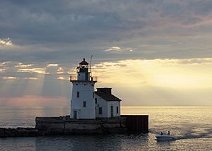
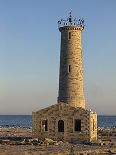
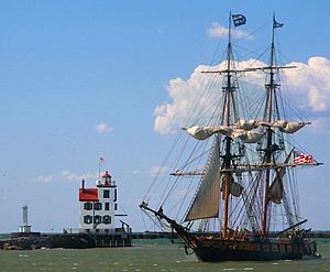
The lake has many unique lighthouses. A lighthouse off the coast of Cleveland, covered in cold winter lake spray, can take on an unusual icy shape. Sometimes, the ice can even block the light from being seen by ships.
Lake Erie Folklore
There have been reports of people seeing a creature similar to the Loch Ness Monster in Lake Erie. However, there are no confirmed sightings. In 1990, people reported seeing a "large creature moving in the water" about 1,000 feet (300 m) from their boat. They described it as black, about 35 feet (11 m) long, with a snake-like head, and moving as fast as a boat. Five other people reported seeing something similar on three different occasions. However, there is no scientific evidence of such a creature. There's a beer named after the Lake Erie Monster and a hockey team called the Cleveland Monsters. In the 19th century, people reported seeing a sea creature sometimes called "Bessie" or "South Bay Bessie."
There have also been occasional reports of people in Cleveland being able to see the Canadian shoreline as if it were right offshore, even though Canada is 50 miles (80 km) away. People think this is a weather-related event, similar to a mirage.
Shipping and Transportation
Lake Erie has been an important shipping route for boats for centuries. Ships heading east can use the Welland Canal and a series of eight locks. These locks lower ships 326 feet (99 m) to Lake Ontario, a journey that takes about 12 hours. Thousands of ships make this trip each year. In the 19th century, ships could enter the Buffalo River and travel the Erie Canal east to Albany, then south to New York City along the Hudson River. Generally, there is heavy ship traffic on the lake, except during the winter months from January to March when ice prevents safe travel.
In 2007, there was a protest against Ontario's energy policy that allows the shipping of coal on the lake. Greenpeace activists climbed onto a freighter and chained themselves to the conveyor belt that unloads the ship's cargo. Three activists were arrested, and the ship was delayed for over four hours. Anti-coal messages were painted on the ship.
Ferryboats
Ferryboats operate in many places, such as the Jet Express Ferry from Sandusky and Port Clinton. However, plans to run a ferry between the U.S. port of Erie and the Ontario port of Port Dover faced many political problems. These included security rules and extra fees for border inspectors. The project was eventually canceled.
The Great Lakes Circle Tour is a scenic road system that connects all of the Great Lakes and the Saint Lawrence River. Drivers can cross from the United States to the Canadian town of Fort Erie by driving over the Peace Bridge.
Border Crossings
Since the border between the two nations is mostly unpatrolled, it is possible for people to cross undetected from one country to the other by boat. In 2010, Canadian police arrested people crossing the border illegally from the United States to Canada near the Ontario town of Amherstburg.
Images for kids
See also
 In Spanish: Lago Erie para niños
 | Shirley Ann Jackson |
 | Garett Morgan |
 | J. Ernest Wilkins Jr. |
 | Elijah McCoy |


