List of Lake Erie Islands facts for kids
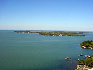
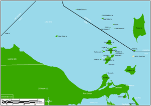
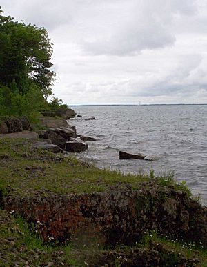
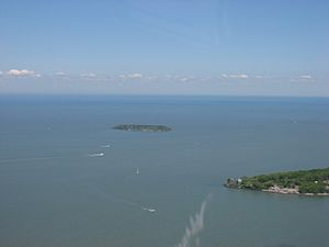
The Lake Erie Islands are a group of islands found in Lake Erie. Imagine a string of pearls across the lake – that's what these islands are like! They include well-known spots like Kelleys Island, Pelee Island, and the Bass Islands, plus many smaller ones. Most of these islands belong to the State of Ohio in the United States. However, Pelee Island is a big island that's part of Ontario, Canada. Also, the tiny Middle Island is the southernmost point of land in all of Canada!
Many of the larger islands are super popular places to visit. You can reach them by ferry (boats that carry cars and people) from the mainland or by traveling between islands. Some islands even have small airports or private boat docks for visitors. These islands, along with nearby towns like Sandusky and Port Clinton, Ohio, are part of a fun area called "Vacationland". It's a great spot for summer adventures!
Contents
How the Islands Were Formed
The Lake Erie Islands have a really cool history that goes back millions of years! They are made of a type of hard rock called limestone. A very long time ago, huge sheets of ice, called glaciers, moved across the land. These glaciers were like giant bulldozers, carving out the basin (the big bowl shape) where Lake Erie is today.
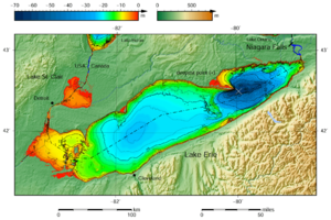
The hard limestone rocks of the islands were tougher than the softer rocks around them. So, while the glaciers dug out the rest of the lake, these hard spots stayed above the water. That's why the western part of Lake Erie, where the islands are, is much shallower than the eastern part.
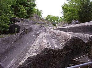
On Kelleys Island, you can even see amazing marks left by these ancient glaciers! These marks are called glacial grooves. They are deep scratches in the bedrock, showing exactly where the ice scraped by. These grooves are so important that they are now protected as part of Kelleys Island State Park. They are some of the best clues we have about how the ice age shaped our world!
Island Life and Economy
Most of the Lake Erie Islands rely on tourism to support their communities. This means that during the summer, the islands become bustling hubs of activity with lots of visitors!
Long ago, growing grapes and making wine was a huge part of the islands' economy. While some islands, like Kelleys Island, have seen their vineyards replaced by forests, others still have active wineries. Pelee Island is a great example, where vineyards are still very common.
You can also find some limestone quarrying on Kelleys Island, which is where they dig out rock for building materials. Some islands also have small hobby farms. Many of the islands, including South Bass Island, Middle Bass Island, North Bass Island, and Kelleys Island, have parts that are protected as state parks. North Bass Island State Park is the largest, covering most of that island!
Who Lives on the Islands?
The islands have a small number of people who live there all year round. But when summer arrives, the population explodes with thousands of excited vacationers! This is especially true on South Bass Island, which is the most popular island for tourists, even though it's quite small.
The year-round populations vary: about 500 people live on South Bass Island, 100 on Kelleys Island, 40 on Middle Bass Island, and just 12 on North Bass Island.
Some islands, like Kelleys Island, Middle Bass, North Bass, and South Bass (also known as Put-in-Bay), even have their own school districts! North Bass Local School District is special because it's the last operating one-room schoolhouse in Ohio.
Most islands with year-round residents have ferry service, making it easy to get there. However, North Bass Island does not have a ferry. For those who prefer to fly, Middle, North, and South Bass Islands have public airports. Kelleys Island and Pelee Island also have paved runways, and Rattlesnake Island has a private grass landing strip.
List of Lake Erie Islands
| Name | State/Province | Area sq. mi.(km²) |
Inhabited? |
|---|---|---|---|
| Pelee Island | Ontario | 16.140 sq. mi. (41.79 km2) | Yes |
| Kelleys Island | Ohio | 4.41 sq. mi. (11.42 km2) | Yes |
| South Bass Island | Ohio | 2.482 sq. mi. (6.428 km2) | Yes |
| Middle Bass Island | Ohio | 1.258 sq. mi. (3.258 km2) | Yes |
| North Bass Island | Ohio | 1.076 sq. mi. (2.786 km2) | Yes |
| Johnson's Island | Ohio | 0.469 sq. mi. (1.215 km2) | Yes |
| Rattlesnake Island | Ohio | 0.133 sq. mi. (0.344 km2) | Yes |
| West Sister Island | Ohio | 0.120 sq. mi. (0.311 km2) | No Longer |
| Middle Island | Ontario | 0.072 sq. mi. (0.186 km2) | No Longer |
| East Sister Island | Ontario | 0.058 sq. mi. (0.150 km2) | No |
| Sugar Island | Ohio | 0.047 sq. mi. (0.123 km2) | Yes |
| Green Island | Ohio | 0.027 sq. mi. (0.069 km2) | No Longer |
| Ballast Island | Ohio | 0.019 sq. mi. (0.049 km2) | Yes |
| Mouse Island | Ohio | No Longer | |
| Gibraltar Island | Ohio | 0.010 sq. mi. (0.026 km2) | Yes |
| Indian Island | Michigan | No | |
| Hen Island and her "Chickens": Big Chicken, Chick, and Little Chicken islands |
Ontario | Hen Yes, the "chickens" No | |
| Middle Sister Island | Ontario | 0.015 sq. mi. (0.039 km2) | No Longer |
| North Harbour Island | Ontario | Yes | |
| Turtle Island | Michigan/Ohio | 0.002 sq. mi. (0.005 km2) | No Longer |
| Ryerson's Island | Ontario | Yes | |
| Second Island | Ontario | No | |
| Starve Island | Ohio | 0.003 sq. mi. (0.008 km2) | No |
| Buckeye Island | Ohio | No | |
| Lost Ballast Island | Ohio | No | |
| Snow Island | Ontario | No | |
| Mohawk Island (formerly Gull Island) | Ontario | 0.015 sq. mi. (0.039 km2) | No Longer |
| Gull Island, Ohio | Ohio | No | |
| Catawba Island (former island) |
Ohio | 5.700 sq. mi. (14.8 km2) | Yes |
| Gard Island | Michigan | No Longer | |
| Presque Island (former island) |
Pennsylvania | 4.863 sq. mi. (12.594 km2) | Yes |
| Kafralu Island | Ohio | No Longer | |
| Bird Island | New York | No |
See also
 | Sharif Bey |
 | Hale Woodruff |
 | Richmond Barthé |
 | Purvis Young |


