Lorain, Ohio facts for kids
Quick facts for kids
Lorain, Ohio
|
|||
|---|---|---|---|
|
|
|||
|
|||
| Nickname(s):
International City, Steel City
|
|||
| Country | United States | ||
| State | Ohio | ||
| County | Lorain | ||
| Founded | 1807 | ||
| Incorporated | February, 1817 | ||
| Incorporated | July 16, 1834 (township) | ||
| Government | |||
| • Type | Mayor–council | ||
| Area | |||
| • City | 24.08 sq mi (62.37 km2) | ||
| • Land | 23.61 sq mi (61.14 km2) | ||
| • Water | 0.47 sq mi (1.23 km2) | ||
| Elevation | 617 ft (188 m) | ||
| Population
(2020)
|
|||
| • City | 65,211 | ||
| • Density | 2,762.36/sq mi (1,066.57/km2) | ||
| • Urban
(Lorain–Elyria, OH)
|
199,067 (US: 196th) | ||
| • Urban density | 2,196.9/sq mi (848.2/km2) | ||
| Time zone | UTC−5 (EST) | ||
| • Summer (DST) | UTC−4 (EDT) | ||
| Zip code(s) |
44052–44055
|
||
| Area code(s) | 440 | ||
| FIPS code | 39-44856 | ||
| GNIS feature ID | 1086514 | ||
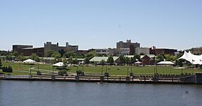
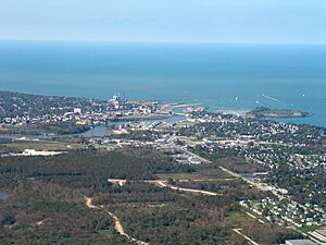
Lorain is a city in Lorain County, Ohio, United States. It is located in Northeast Ohio on the shore of Lake Erie. The city sits where the Black River meets the lake. Lorain is about 25 miles (40 km) west of Cleveland.
In 2020, Lorain had a population of 65,211 people. This makes it the ninth-largest city in Ohio. It is also the largest city in Lorain County.
Contents
History of Lorain
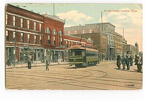
Lorain started as a small village called "Black River Village" before 1834. In 1837, its name was changed to "Charleston." However, people living there still preferred to call it Black River Village.
The village officially became a town named Lorain in 1874. It grew into a city in 1896. The first mayor of Lorain was Conrad Reid. He started his job on April 6, 1874. The city's borders grew to include parts of nearby townships.
The 1924 Tornado Disaster
On Saturday, June 28, 1924, a very strong tornado hit Lorain. This tornado first formed over Sandusky Bay. It then moved east over Lake Erie before striking Lorain.
The tornado caused a lot of damage and sadness. In Lorain, 72 people lost their lives. Fifteen of these people were inside a movie theater that collapsed. This was the deadliest tornado event from one building in Ohio's history. Eight more people died at the Bath House near the lake.
Geography of Lorain
Lorain covers a total area of about 24.14 square miles (62.5 km²). Most of this area, about 23.67 square miles (61.3 km²), is land. The remaining 0.47 square miles (1.2 km²) is water, mainly from the Black River and Lake Erie.
People and Population
| Historical population | |||
|---|---|---|---|
| Census | Pop. | %± | |
| 1880 | 1,595 | — | |
| 1890 | 4,863 | 204.9% | |
| 1900 | 16,028 | 229.6% | |
| 1910 | 28,883 | 80.2% | |
| 1920 | 37,205 | 28.8% | |
| 1930 | 44,512 | 19.6% | |
| 1940 | 44,125 | −0.9% | |
| 1950 | 51,202 | 16.0% | |
| 1960 | 68,932 | 34.6% | |
| 1970 | 78,185 | 13.4% | |
| 1980 | 75,416 | −3.5% | |
| 1990 | 71,245 | −5.5% | |
| 2000 | 68,652 | −3.6% | |
| 2010 | 64,097 | −6.6% | |
| 2020 | 65,211 | 1.7% | |
| U.S. Decennial Census | |||
In 2020, Lorain had a population of 65,211 people. The city is home to a diverse group of residents. About 49.4% of the people were non-Hispanic White. About 29.2% were Hispanic or Latino. Another 15.2% were non-Hispanic Black. Smaller groups included Asian, Native American, and people of mixed backgrounds.
Economy and Jobs
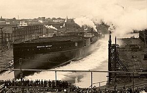
Lorain's economy has changed a lot over the years. It used to be a major industrial city. Large companies like American Ship Building Company and Ford Motor Company had big factories here. There was also a large steel mill run by United States Steel Corporation.
Today, Lorain's economy is less focused on heavy industry. This change is sometimes called "deindustrialization." Like many cities in the "Rust Belt" (a region in the US where old industries have declined), Lorain has faced challenges. These include a decrease in population and some areas needing repair. However, the city is working to rebuild and create new opportunities.
Major Employers in Lorain
Here are some of the biggest employers in Lorain, based on a 2013 report:
| # | Employer | # of employees |
|---|---|---|
| 1 | Mercy Health | 1,657 |
| 2 | Lorain City School District | 870 |
| 3 | Lorain Tubular | 796 |
| 4 | Republic Steel | 633 |
| 5 | CAMACO, Inc. | 500 |
| 6 | The City Of Lorain | 468 |
| 7 | Grace Management Services | 314 |
| 8 | Cleveland Clinic | 300 |
| 9 | The Nord Center | 228 |
| 10 | Walmart | 211 |
Arts and Culture in Lorain
Lorain has several fun events and places to visit.
- The Lorain International Festival is held every summer. It celebrates the many different cultures in the city. It often includes a pageant.
- The Fire Fish Festival happens every September 21st in downtown Lorain. This event supports local artists. It also celebrates Lorain's history and looks forward to its future.
- The Lorain Palace Theatre first opened in 1928. This historic theater still hosts shows and events today.
Parks and Recreation
Lorain has many parks for everyone to enjoy. The city's parks and recreation department manages 51 parks. These parks cover a total of 583 acres.
Lakeview Park: A Community Gem
Lakeview Park is a popular spot in Lorain. It is split into two parts by West Erie Avenue. The northern part is managed by the Lorain County Metro Parks. The southern part is managed by the city. The park was created in 1917 to give people more access to the lakefront.
Lakeview Park offers many features:
- A sandy beach for swimming and relaxing.
- A beautiful rose garden.
- Places for sports and games.
- A bathhouse and a place to buy snacks.
- Several picnic shelters and gazebos.
- A lawn bowling area.
One special feature is a sculpture shaped like an Easter basket. It was built in 1935 from local sandstone. It was officially named the "floral basket" in 1941. Many Lorain families take their annual Easter photo at this basket.
The rose garden was opened in 1932. It has 2,500 roses in 48 flower beds. The garden is shaped like a wheel with eight spokes. This design is the symbol of Rotary International. It honors the 17 community groups that helped fund the garden at the start. Today, new roses are planted to remember people connected to the community or the garden's history.
Education in Lorain
The Lorain City School District serves the students of Lorain. It operates ten elementary schools and three middle schools. Older students attend Lorain High School.
The city also has the Lorain Public Library System. This system provides books and resources for everyone in the community.
Media in Lorain
Lorain is home to CW station WUAB, which is channel 43. Its main offices and studios are located in Cleveland.
City Infrastructure
Lorain has a network of local streets. Four state highways and one U.S. route also pass through the city. There are no major interstate highways directly in Lorain.
Getting Around: Transportation
Public transportation in Lorain is provided by Lorain County Transit. They operate two bus routes that help people get around. A freight railroad, run by Norfolk Southern Railway, also runs along the Lake Erie shoreline.
Public Bus Routes
Lorain County Transit has two main bus lines: Route 1 and Route 2.
- Route 1 has 34 stops. It connects Meridian Plaza in downtown Lorain to the LifeSkills Center in Elyria. A bus runs in each direction every two hours.
- Route 2 also runs every two hours and has 36 stops. It connects the same two points as Route 1.
Main Roads and Highways
- U.S. Route 6 goes east-west along Erie Avenue. It crosses the northern part of the city near Lake Erie.
- Ohio State Route 2 briefly passes through the city limits at the Broadway Avenue/Middle Ridge Road exit.
- Ohio State Route 57 generally runs north-south. It starts at Erie Avenue and Broadway Avenue. It goes south along Broadway, then turns east along 28th Street. It then turns south on Grove Avenue towards Elyria.
- Ohio State Route 58 runs north-south. It starts at Erie Avenue and North Leavitt Road and continues south towards Amherst.
- Ohio State Route 611 runs east-west. It starts at Erie Avenue and West 21st Street and continues east towards Sheffield Village.
Important Bridges
Three bridges cross the Black River in Lorain Harbor. Two are for cars and people, and one is for trains.
- The Charles Berry Bridge and the Lofton Henderson Memorial Bridge are the two bridges for vehicles and pedestrians. They opened on October 12, 1940. They were once called the "Twin Bridges."
- The Charles Berry Bridge is a special type of bridge called a bascule bridge. It can open in the middle to let tall ships pass through. It is 1,052 feet (321 meters) long. When it was built, it was the largest bascule bridge in the world. It opens about 700 times each year.
- The rail bridge, also known as the 11th Street Bridge, is a vertical-lift bridge. It was built in 1974 and is used by the Norfolk-Southern Railway.
Police Department
The Lorain Police Department was created in 1853. It has 113 police officers and 34 civilian employees who help keep the city safe.
Notable People from Lorain
Many interesting people have come from Lorain, Ohio. Here are a few:
- Terry A. Anderson: A journalist.
- Charles J. Berry: A Corporal who received the Medal of Honor during World War II.
- Rashod Berry: A professional football player.
- Martha Chase: A geneticist known for her work on DNA.
- Michael Dirda: A book critic who won a Pulitzer Prize.
- Stevan Dohanos: A famous artist.
- Raymont Harris: A running back in the NFL.
- Anthony Hitchens: A linebacker in the NFL.
- Ernest J. King: A high-ranking Fleet Admiral in the U.S. Navy during World War II.
- Toni Morrison: A world-famous author who won the Nobel Prize in Literature.
- Chad Muska: A professional skateboarder.
- Don Novello: A comedian known for his character Father Guido Sarducci on Saturday Night Live.
- Robert F. Overmyer: An astronaut and test pilot for the United States Marine Corps.
- Helen Steiner Rice: A well-known author and poet.
- Johnnie E. Wilson: A four-star general in the U.S. Army.
See also
 In Spanish: Lorain (Ohio) para niños
 | Isaac Myers |
 | D. Hamilton Jackson |
 | A. Philip Randolph |


