
Lake Ontario facts for kids
Quick facts for kids Lake Ontario |
|
|---|---|
.jpg)
Lake Ontario seen from the International Space Station on August 24, 2013. The cloudy yellowish substance is algae bloom.
|
|

Lake Ontario
Location in Ontario
|
|

Lake Ontario bathymetric map. The deepest point is marked with "×".
|
|
| Location | North America |
| Group | Great Lakes |
| Coordinates | 43°42′N 77°54′W / 43.7°N 77.9°W |
| Lake type | Glacial |
| Etymology | Ontarí:io, a Huron (Wyandot) word meaning "great lake" |
| Primary inflows | Niagara River |
| Primary outflows | St. Lawrence River |
| Catchment area | 24,720 sq mi (64,000 km2) |
| Basin countries | Canada and United States |
| Max. length | 193 mi (311 km) |
| Max. width | 53 mi (85 km) |
| Surface area | 7,323 sq mi (18,970 km2) |
| Average depth | 283 ft (86 m) |
| Max. depth | 802 ft (244 m) |
| Water volume | 391.4 cu mi (1,631 km3) |
| Residence time | 6 years |
| Shore length1 | 634 mi (1,020 km) plus 78 mi (126 km) for islands |
| Surface elevation | 243 ft (74 m) |
| Settlements | Toronto, Ontario Mississauga, Ontario Hamilton, Ontario Rochester, New York |
| 1 Shore length is not a well-defined measure. | |
Lake Ontario (French: Lac Ontario) is one of the five Great Lakes in North America. It sits between the Canadian province of Ontario to the north, west, and southwest, and the U.S. state of New York to the south and east. The border between Canada and the United States runs through the middle of the lake.
On the Canadian side, important cities include Kingston, Mississauga, Toronto, Hamilton, and St. Catharines. On the American side, major cities are Rochester and Watertown.
Lake Ontario is the last lake in the Great Lakes chain. Water flows out of it into the Saint Lawrence River, which leads to the Atlantic Ocean. The main river flowing into Lake Ontario is the Niagara River from Lake Erie. The name Ontarí'io comes from the Huron people and is often translated as "beautiful lake."
Contents
- Lake Ontario's Geography
- How Lake Ontario Formed
- Lake Ontario's Climate
- Lake Ontario's Ecosystem
- Human History of Lake Ontario
- Cities and Towns Around Lake Ontario
- Islands in Lake Ontario
- Boating and Travel on Lake Ontario
- Lake Ontario National Marine Sanctuary
- Economic Activities on Lake Ontario
- See also
Lake Ontario's Geography

Lake Ontario is the most eastern of the Great Lakes. It has the smallest surface area, covering about 7,340 square miles (19,011 km2). However, it holds more water than Lake Erie. It is the 13th largest lake in the world. If you include its islands, the shoreline of Lake Ontario is about 712 miles (1,146 km) long.
As the last lake in the Great Lakes system, Lake Ontario is the lowest in elevation. Its surface is about 243 feet (74 meters) above sea level. This is 326 feet (99 meters) lower than Lake Erie, which is upstream. The lake is about 193 miles (311 km) long and 53 miles (85 km) wide. Its average depth is 283 feet (86 meters), and its deepest point is 802 feet (244 meters) in the Rochester Basin.
The main source of water for Lake Ontario is the Niagara River, which brings water from Lake Erie. The Saint Lawrence River is where the water flows out. The land area that drains into Lake Ontario, called its drainage basin, covers 24,720 square miles (64,030 km2).
Like all the Great Lakes, the water levels in Lake Ontario change. They vary throughout the year due to seasonal rainfall and over longer periods because of changes in precipitation. These natural changes in water level are important for the plants and animals that live in and around the lake, especially in the wetlands. The lake also supports a freshwater fishery, but it has faced problems from too much fishing, pollution, and new species that are not native to the area.
Many lagoons and sheltered harbors have formed along the lake's shores. These are created by sandbars built by winds and currents. Good examples include Toronto Bay, Hamilton Harbour, and Sodus Bay. These sandy areas often have long beaches and large wetlands. Wetlands are important homes for many plants and animals, and they are also resting spots for birds that migrate.
Major rivers that flow into Lake Ontario include the Niagara River, Don River, Humber River, and Genesee River. The Welland Canal also drains into the lake.
How Lake Ontario Formed
The basin of Lake Ontario was shaped by the Wisconsin ice sheet during the last ice age. This huge sheet of ice carved out the land from soft rocks that were already there. The ice moved along an old river valley that was in the same direction as the lake is today.
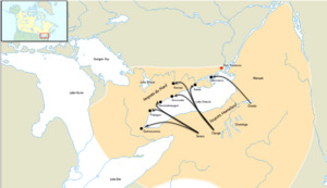
As the ice sheet moved south, it left behind hills and mounds of earth called drumlins, kames, and moraines. These landforms changed how water flowed in the whole region. When the ice sheet melted and moved north, it still blocked the St. Lawrence Valley. This caused the lake's water level to be much higher than it is now. This stage is known as Lake Iroquois. During that time, the lake drained through what is now Syracuse, New York, into the Mohawk River, and then into the Hudson River and the Atlantic Ocean. You can still see the old shorelines from Lake Iroquois today, as dry beaches and wave-cut hills about 10 to 25 miles (16 to 40 km) from the current shoreline.
When the ice finally moved out of the St. Lawrence valley, the lake's outlet was below sea level. For a short time, Lake Ontario became a bay of the Atlantic Ocean. Slowly, the land began to rise again. This is because the huge weight of the ice (about 6,500 feet or 2,000 meters thick) was gone. The land is still rising about 12 inches (30 cm) per century in the St. Lawrence area. Because of this, the lake bed is slowly tilting southward. This causes the south shore to be flooded more, turning river valleys into bays. Both the north and south shores experience erosion, but the tilting makes it worse on the south shore, causing problems for property owners.
Lake Ontario's Climate

Lake Ontario has a natural "seiche" rhythm, which is like a sloshing motion, that happens every eleven minutes. This sloshing is usually only about 3/4 inch (2 cm) but can become much larger due to strong winds or changes in air pressure.
Because the lake is very deep, it does not completely freeze over in winter. However, an ice sheet usually covers between 10% and 90% of the lake, depending on how cold the winter is. Ice usually forms along the shorelines and in calm bays where the water is not as deep. The lake has completely frozen over only five times in recorded history: in 1830, 1874, 1893, 1912, and 1934.
When cold winter winds blow over the warmer lake water, they pick up moisture. This moisture then falls as lake-effect snow on the land downwind. Since winter winds usually come from the northwest, the southern and southeastern shores of the lake are known as the "snowbelt." In some winters, areas like Oswego and Pulaski can get 20 feet (600 cm) or more of snow. The Tug Hill Plateau, about 20 miles (32 km) east of Lake Ontario, also gets a lot of lake-effect snow. It often receives more snow than any other region in the eastern United States. This makes Tug Hill a popular spot for winter sports like snowmobiling and cross-country skiing. Lake-effect snow often reaches Syracuse, which often has the most winter snowfall of any large city in the United States.
Fog is common, especially in the fall, due to temperature differences. This can make boating difficult. Lake breezes in spring help to delay fruit trees from blooming too early, protecting them from frost. In autumn, these breezes also delay the first frost. These local climate effects allow fruits like apples, cherries, pears, plums, and peaches to grow well in areas around Rochester and the Niagara Peninsula. This region is also known for its wine-making.
Lake Ontario's Ecosystem

The area around the Great Lakes has many different kinds of plants and animals. Lake Ontario is important for its wide variety of birds, fish, reptiles, amphibians, and plants. Many of these special species live near the shorelines, especially in sand dunes, lagoons, and wetlands.
People now understand how important wetlands are to the lake, and many larger wetlands are protected. However, these wetlands are changing because the natural ups and downs of water levels have been reduced. Many wetland plants need low water levels to reproduce. When water levels stay too stable, the size and variety of the marsh decrease. This can lead to the growth of cattails, which can take over and reduce the number of native plant species. Pollution can make this worse by providing extra nutrients that help fast-growing plants.
Most of the forests around the lake are deciduous forests, with trees like maple, oak, and beech. These forests have been greatly reduced by logging and farming. This has led to fewer forest birds, the loss of native salmon, and more dirt flowing into the lake. In some areas, over 90 percent of the forest has been cleared for agriculture. Efforts are being made to restore forest cover, especially along streams and wetlands.
By the 1960s and 1970s, increased pollution caused frequent algal blooms in the summer. These blooms killed many fish and left piles of rotting algae and dead fish along the shores.
Water Pollution in Lake Ontario
Lake Ontario is the last lake in the Great Lakes system, so pollution from all the other lakes flows into it. A study in 2015 found that Lake Ontario was the most environmentally stressed of the five Great Lakes. Some of the problems include too much fertilizer from farms running into the lake, overflow from old city sewage systems, harmful chemicals from industries along rivers that flow into the lake, and drainage from large cities like Toronto, Rochester, and Hamilton.
Randle Reef, in the western part of Lake Ontario, was one of the most polluted areas. However, a $150-million cleanup project started in 2016 and was completed by 2025.
Human History of Lake Ontario
The name Ontario comes from the Huron word Ontarí'io, meaning "great lake." The first signs of humans living in the Lake Ontario region date back about 11,000 years. These early people were hunters and gatherers who moved around based on where caribou migrated. They also used smaller animals and plants.
Before Europeans arrived, the lake was a border between the Huron people and the Iroquois Confederacy. In the 1600s, the Iroquois settled the northern shores of Lake Ontario. When the Iroquois left, the Anishinaabe people moved in from the north and kept the Iroquois name for the lake.
It is believed that the first European to see the lake was Étienne Brûlé in 1615. European settlement around Lake Ontario was slow because of the strong Native American nations like the Haudenosaunee, Wendat, and Ojibwe.
French explorers gave the lake other names. In 1632, Samuel de Champlain called it Lac de St. Louis. Later, in 1660, a Jesuit historian named Francis Creuxius called it Lacus Ontarius. A French map from 1712 called it "Lac Frontenac," after Louis de Buade, who was a Governor General of New France.
In the 1600s, there were stories of a creature called Gaasyendietha in the lake, similar to the Loch Ness Monster. It was described as large, with a long neck, green, and causing waves on the surface.
Both the British and French built trading posts around the lake, such as Fort Frontenac in 1673 and Fort Oswego in 1722. Kingston, Ontario, which was once the capital of Canada, dates back to the building of Fort Frontenac.

After the French and Indian War, the British controlled all the forts around the lake. During the American Revolution, the British kept control of Lake Ontario, largely keeping Americans off the lake. The United States gained control of the forts on their side of the lake after the Jay Treaty was signed in 1794. Permanent European settlement began with Loyalist settlers after the American Revolution.
After the War of 1812, Lake Ontario became a busy place for trade. Canals were built on both sides of the border, and many sailing ships and steamers used the lake. However, sailing trade on Lake Ontario became less important compared to the other Great Lakes after the mid-1800s. This was because farming, logging, and mining moved further west. After the Erie Canal opened, much of the travel and trade between the East Coast and the Great Lakes bypassed Lake Ontario.
Oswego, New York, remained an important port because the Oswego Canal connected to the Erie Canal, avoiding busy areas. Kingston, Clayton, and Oswego were major shipbuilding centers in the 1800s. Oil and coal were important goods shipped on Lake Ontario into the early 1900s.
The Frontenac was the first steamer (a ship powered by steam) on Lake Ontario and the Great Lakes. It was launched in September 1816. The Americans launched a smaller steamship, the Ontario, in March 1817. As more goods were shipped, propeller ships became more common than side-wheel steamers by about 1857. The Vandalia, launched in Oswego in 1841, was the first propeller ship on the Great Lakes.
Swimming Across Lake Ontario

As of 2012, almost 50 people have successfully swum across Lake Ontario. The first person to do this was a Canadian swimmer named Marilyn Bell in 1954. She was only 16 years old. Toronto's Marilyn Bell Park is named after her.
In 1974, Diana Nyad was the first person to swim across the lake against the current (from north to south). On August 28, 2007, 14-year-old Natalie Lambert from Kingston, Ontario, swam from Sackets Harbor, New York, to Kingston in less than 24 hours. On August 19, 2012, 14-year-old Annaleise Carr became the youngest person to swim across the lake. She completed the 32-mile (52-km) swim from Niagara-on-the-Lake to Marilyn Bell Park in just under 27 hours.
Cities and Towns Around Lake Ontario
A large group of cities and towns called the Golden Horseshoe is located on the western shores of the lake. This area includes the major cities of Toronto and Hamilton. Other ports on the Canadian side are St. Catharines, Oshawa, Cobourg, and Kingston. Nearly 9 million people, which is over a quarter of Canada's population, live in the area that drains into Lake Ontario.
The American shore is mostly rural, except for Rochester and smaller ports like Oswego and Sackets Harbor. The city of Syracuse is about 40 miles (64 km) inland but is connected to the lake by the New York State Canal System. Over 2 million people live in the American area that drains into Lake Ontario.
.jpg)
- Ontario, Canada
- Toronto
- Mississauga
- Hamilton
- Burlington
- Oshawa
- Kingston
- Whitby
- Stoney Creek
- Grimsby
- Oakville
- St. Catharines
- Port Hope
- Cobourg
- Brighton
- Pickering
- Ajax
- Bowmanville
- Belleville
- Trenton
- Niagara-on-the-Lake
- New York, United States

Islands in Lake Ontario

Lake Ontario has several islands. The largest is Wolfe Island. Most of the islands are on the eastern and northeastern shores, near Kingston. Some notable islands include:
- Amherst Island
- Association Island
- Big Island
- Galloo Island
- Garden Island
- Grenadier Island
- Little Galloo Island
- Nicholson Island
- Simcoe Island
- Toronto Islands (a group of 15 smaller islands)
- Waupoos Island
- Wolfe Island
Boating and Travel on Lake Ontario

The Great Lakes Waterway connects Lake Ontario to the Atlantic Ocean through the Saint Lawrence Seaway. It also connects upstream to the other Great Lakes via the Welland Canal. The Trent-Severn Waterway is for pleasure boats and links Lake Ontario (at the Bay of Quinte) to Georgian Bay (part of Lake Huron).
The Oswego Canal connects Lake Ontario at Oswego to the New York State Canal System. This system has routes to the Hudson River, Lake Erie, and Lake Champlain. The Rideau Canal, also for pleasure boats, connects Lake Ontario at Kingston to the Ottawa River in downtown Ottawa, Ontario.
Many lighthouses help guide boats on the lake. Some historic examples are:
- Braddock Point Light
- Charlotte-Genesee Lighthouse
- Gibraltar Point Lighthouse
- Oswego Harbor West Pierhead Light
- Presqu'ile Lighthouse
- Selkirk Lighthouse
- Sodus Point Light
- Stony Point Light
- Thirty Mile Point Light
There are also land-based trails that follow the lake's shoreline, like the Great Lakes Circle Tour and Seaway Trail. These scenic road systems connect all the Great Lakes and the St. Lawrence River.
Lake Ontario National Marine Sanctuary

The Lake Ontario National Marine Sanctuary was created on September 6, 2024. It covers about 1,722 square miles (4,460 km2) in U.S. waters in southeastern Lake Ontario. This special area protects historic shipwrecks and is very important to the culture and history of the Native American peoples of the Haudenosaunee Confederacy. The National Oceanic and Atmospheric Administration (NOAA) and the Government of New York work together to manage the sanctuary.
Economic Activities on Lake Ontario

Lake Ontario is home to several major commercial ports, including the Port of Toronto and the Port of Hamilton. Hamilton Harbour is a key location for steel production.
The government of Ontario does not allow wind power to be generated offshore in the Canadian part of the lake.
The Great Lakes once had a large fishing industry, with record catches in 1899. However, too much fishing later harmed the industry. Today, only recreational fishing activities take place.
See also
 In Spanish: Lago Ontario para niños
- Charity Shoal Crater
- Glacial Lake Admiralty
- Lake Ontario Waterkeeper
- List of lakes of Ontario
