St. Catharines facts for kids
Quick facts for kids
St. Catharines
|
|||||
|---|---|---|---|---|---|
| City of St. Catharines | |||||
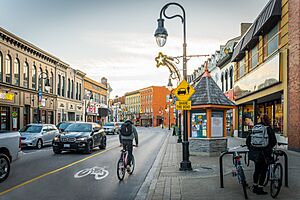
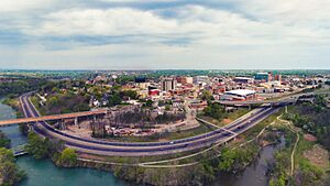
Downtown St. Catharines
|
|||||
|
|||||
| Nickname(s):
The Garden City, St. Kitts, St. Cats, The Kitts
|
|||||
| Motto(s):
Industry and Liberality
|
|||||
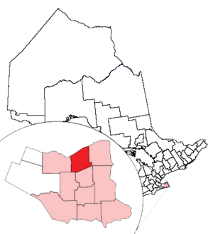
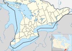
Location of St. Catharines and its census metropolitan area in Ontario
|
|||||
| Country | Canada | ||||
| Province | Ontario | ||||
| Region | Niagara | ||||
| Settled | 1779 | ||||
| Incorporated (town) | 1845 | ||||
| Incorporated (city) | 1876 | ||||
| Area | |||||
| • Land | 96.20 km2 (37.14 sq mi) | ||||
| Elevation | 97.80 m (320.87 ft) | ||||
| Population
(2021)
|
|||||
| • City (lower-tier) | 136,803 (42nd) | ||||
| • Metro | 433,604 (13th) | ||||
| Time zone | UTC−5 (Eastern (EST)) | ||||
| • Summer (DST) | UTC−4 (EDT) | ||||
| Forward Sortation Area |
L2M to L2W
|
||||
| Area code(s) | 905, 289, 365, and 742 | ||||
| Highways | |||||
| GDP (St. Catharines–Niagara CMA) | CA$17.4 billion (2020) | ||||
| GDP per capita (St. Catharines–Niagara CMA) | CA$37,505 (2016) | ||||
St. Catharines is a big city in Canada's Niagara Region. It is the eighth largest urban area in the province of Ontario. As of 2017, St. Catharines covers about 96 square kilometers and has over 140,000 people. It is located in Southern Ontario, about 51 kilometers south of Toronto across Lake Ontario. The city is also 19 kilometers inland from the U.S. border along the Niagara River. It is known as the northern entrance of the Welland Canal. People who live in St. Catharines are called St. Catharinites. The city's official nickname is "The Garden City" because it has over 1,000 acres of parks, gardens, and trails.
St. Catharines is located between the Greater Toronto and Hamilton Area (GTHA) and the Canada–U.S. border at Fort Erie. In the past, making things (manufacturing) was the city's main industry. This is shown by its motto, "Industry and Liberality." General Motors of Canada, Ltd. used to be the biggest employer. Now, the District School Board of Niagara employs the most people. Other companies like THK Rhythm Automotive also have factories here. In recent years, jobs have moved from heavy industry to service jobs.
St. Catharines is on a major internet connection route between Canada and the United States. Because of this, many call centers operate in the city. It is also a growing urban center, aiming to have more jobs and residents in the future.
Brock University is also located in St. Catharines.
Contents
- Exploring St. Catharines' Past
- Understanding St. Catharines' Environment
- People of St. Catharines
- St. Catharines' Economy
- Arts and Culture in St. Catharines
- Places to Visit in St. Catharines
- Sports in St. Catharines
- City Infrastructure
- Learning in St. Catharines
- Media in St. Catharines
- Sister City
- See also
Exploring St. Catharines' Past
Early Beginnings
Long ago, the Iroquoian-speaking Chonnonton people lived in this area. They were also called the "people of the deer." The Chonnonton grew vegetables like corn, beans, and squash. They lived in longhouses. In 1647, the Seneca took over Chonnonton villages east of the Niagara River. The Haudenosaunee then destroyed the villages in the 1650s. After these attacks and sicknesses, the Chonnontons disappeared. French explorers last saw them in 1671.
St. Catharines is in the original land of the Mississaugas. In 1782, the Mississaugas and the British government signed a treaty. This treaty gave a large piece of land, including the St. Catharines area, to the British for European settlers. Loyalists settled St. Catharines in the 1780s. The British government gave them land for their help and for what they lost in the United States. Early stories say that Loyalists Jacob Dittrick and John Hainer were among the first settlers in 1790. They got their land where Dick's Creek and 12 Mile Creek meet. This is now the center of St. Catharines. Some historians think Dick's Creek was named after Richard Pierpoint. He was a Black Loyalist and a former American slave. This idea comes from old stories and events from that time. Besides water routes, old Indigenous trails helped people travel. These trails led to the road patterns we see today. The land around was measured and divided into townships between 1787 and 1789.
After the Butler's Rangers group ended in 1784, its members settled in the area. Duncan Murray, who was a quartermaster in the 84th Regiment of Foot (Royal Highland Emigrants), was chosen by the British to give free government supplies to the Loyalists for two years. He did this from his mill, which was built on the 12 Mile Creek in Power Glen. After he died in 1786, his land went to Robert Hamilton, a merchant from Queenston. Hamilton tried to run Murray's supply center and mill for profit. Hamilton became very rich in land by taking land from Loyalist settlers who could not pay their debts. Murray's supply center, later Hamilton's warehouse, was a mystery for a long time. Hamilton made most of his money by moving supplies for the military from his business in Queenston. He was not very interested in helping the settlers. Hamilton sold his business to Jesse Thompson before the 1800s.

The Merritt family arrived later, after the American Revolution. They came from the Carolinas, New York State, and New Brunswick. In 1796, Thomas Merritt came to build on his connection with his old commander, John Graves Simcoe. Simcoe was now the Lieutenant Governor of Upper Canada. The first Welland Canal was built from 1824 to 1833. William Hamilton Merritt worked hard to make this big project happen. He raised money and got government help. The canal made St. Catharines a center for trade and industry in the Niagara Peninsula. Merritt also helped make St. Catharines a place where people fought against slavery. In 1855, the British Methodist Episcopal Church, Salem Chapel was built. It was on land given to the church by Merritt in the early 1840s. This area became known as a safe place for enslaved people escaping from the United States. It was one of the last stops in Canada on the Underground Railroad for African-American refugees. The famous abolitionist Harriet Tubman lived in St. Catharines during this time. By the mid-1850s, about 800 of the town's 6,000 people were of African descent. St. Catharines is still an important place in Black Canadian history.
At some point, an inn was built by Thomas Adams on the east side of what is now Ontario Street. It became a place for community meetings, elections, and mail delivery. Before that, a church and a log school house were finished before 1797. These were all on the east bank of the 12 Mile Creek, at the far west end of what was then called Main Street. This street was an extension of the old Iroquois Trail. Settlers later renamed it St. Paul Street by the mid-19th century. Later, many businesses grew, including mills, salt works, shops, a shipbuilding yard, and a distillery.
St. Catharines became a village in 1845. It had about 3,500 people in 1846. The main business was making flour. Other businesses included ship repairs, a brewery, distilleries, and factories for machines. There were also many skilled workers, three bank offices, and eight taverns. Stage coaches offered rides to other towns. There were already six churches, a post office that got mail every day, a school, and a weekly newspaper.
St. Catharines became a city in 1876. The city grew when it took over Grantham Township, Merritton, and Port Dalhousie. There was also some growth to the west, shared with Lincoln.
How St. Catharines Got Its Name
Before it was called St. Catharines, the settlement near Twelve Mile Creek had other names. These included Shipman's Corners and The Twelve. The name St. Catharines was first written down in 1796. It became a common name for the settlement by 1809. However, it was often spelled with "-er-" or with an apostrophe before the "-s." The name and its spelling were made official as St. Catharines when the town became a city in 1845. It is not clear which Catherine the city is named after. Some ideas include Saint Catherine of Alexandria, Catherine Butler (wife of Colonel John Butler), and Catherine Askin Hamilton (wife of Robert Hamilton). Catharine Rodman Prendergast Merritt, who was the wife of William Hamilton Merritt, might be why it is spelled with "-ar." Another idea for the spelling is that "Catharine" with "-ar" was a common way to spell the name for Palatine German settlers in the area.
Understanding St. Catharines' Environment
Weather and Climate
St. Catharines has a humid continental climate. This means it has warm summers and cold winters. It has a special local climate because of the nearby Lake Ontario and Lake Erie. The Niagara Escarpment to the south also helps protect it. This climate is great for growing grapes, which is why wineries do well here. The city has many frost-free days and often has warm spells in winter. However, it can get heavy lake-effect snow when the wind blows from certain directions. Sometimes, it gets cooler by the lake on spring afternoons. Summers are usually warm, sometimes hot and humid. The average high temperature in July is 27°C (81°F). Summer thunderstorms happen but are usually less strong than in other parts of southern Ontario. This is because of the lakes.
The hottest temperature ever recorded in St. Catharines was 40.0°C (104°F) on July 10, 1936. The coldest temperature ever recorded was -25.7°C (-14.3°F) on February 18, 1979.
| Climate data for St. Catharines Airport, 1981–2010 normals, extremes 1911–present | |||||||||||||
|---|---|---|---|---|---|---|---|---|---|---|---|---|---|
| Month | Jan | Feb | Mar | Apr | May | Jun | Jul | Aug | Sep | Oct | Nov | Dec | Year |
| Record high humidex | 20.8 | 20.2 | 29.3 | 34.5 | 43.5 | 44.5 | 46.1 | 49.4 | 42.0 | 39.0 | 27.1 | 25.0 | 49.4 |
| Record high °C (°F) | 20.0 (68.0) |
19.4 (66.9) |
26.7 (80.1) |
32.2 (90.0) |
35.0 (95.0) |
36.1 (97.0) |
40.0 (104.0) |
38.3 (100.9) |
36.7 (98.1) |
31.1 (88.0) |
26.8 (80.2) |
21.9 (71.4) |
40.0 (104.0) |
| Mean daily maximum °C (°F) | −0.3 (31.5) |
0.9 (33.6) |
5.5 (41.9) |
12.4 (54.3) |
19.5 (67.1) |
24.4 (75.9) |
27.1 (80.8) |
25.8 (78.4) |
21.6 (70.9) |
15.1 (59.2) |
8.4 (47.1) |
2.5 (36.5) |
13.6 (56.5) |
| Daily mean °C (°F) | −3.8 (25.2) |
−2.9 (26.8) |
1.1 (34.0) |
7.4 (45.3) |
13.7 (56.7) |
19.0 (66.2) |
21.9 (71.4) |
20.8 (69.4) |
16.6 (61.9) |
10.4 (50.7) |
4.6 (40.3) |
−0.9 (30.4) |
9.0 (48.2) |
| Mean daily minimum °C (°F) | −7.4 (18.7) |
−6.8 (19.8) |
−3.3 (26.1) |
2.2 (36.0) |
7.9 (46.2) |
13.4 (56.1) |
16.6 (61.9) |
15.7 (60.3) |
11.6 (52.9) |
5.6 (42.1) |
0.8 (33.4) |
−4.2 (24.4) |
4.4 (39.9) |
| Record low °C (°F) | −23.8 (−10.8) |
−25.7 (−14.3) |
−21.1 (−6.0) |
−15 (5) |
−4.4 (24.1) |
1.0 (33.8) |
6.1 (43.0) |
2.6 (36.7) |
0.0 (32.0) |
−7 (19) |
−13.9 (7.0) |
−24.4 (−11.9) |
−25.7 (−14.3) |
| Record low wind chill | −42.0 | −34.6 | −28.3 | −19.7 | −2.9 | 0.0 | 0.0 | 0.0 | 0.0 | −8.3 | −18.9 | −28.0 | −42.0 |
| Average precipitation mm (inches) | 65.2 (2.57) |
54.9 (2.16) |
61.7 (2.43) |
77.0 (3.03) |
76.8 (3.02) |
85.9 (3.38) |
77.8 (3.06) |
70.3 (2.77) |
90.6 (3.57) |
67.0 (2.64) |
81.6 (3.21) |
71.5 (2.81) |
880.1 (34.65) |
| Average rainfall mm (inches) | 30.8 (1.21) |
28.9 (1.14) |
39.3 (1.55) |
71.2 (2.80) |
76.3 (3.00) |
86.0 (3.39) |
77.8 (3.06) |
70.3 (2.77) |
90.6 (3.57) |
67.0 (2.64) |
72.1 (2.84) |
44.0 (1.73) |
754.2 (29.69) |
| Average snowfall cm (inches) | 38.6 (15.2) |
29.3 (11.5) |
23.2 (9.1) |
5.8 (2.3) |
0.4 (0.2) |
0.0 (0.0) |
0.0 (0.0) |
0.0 (0.0) |
0.0 (0.0) |
0.1 (0.0) |
9.6 (3.8) |
30.1 (11.9) |
137.1 (54.0) |
| Average precipitation days (≥ 0.2 mm) | 16.5 | 13.4 | 13.3 | 13.9 | 11.5 | 10.9 | 9.8 | 9.7 | 10.9 | 11.8 | 14.1 | 15.2 | 150.7 |
| Average rainy days (≥ 0.2 mm) | 5.8 | 5.8 | 8.4 | 12.4 | 11.5 | 10.9 | 9.8 | 9.7 | 10.9 | 11.8 | 12.1 | 8.1 | 117.0 |
| Average snowy days (≥ 0.2 cm) | 12.3 | 9.1 | 6.5 | 2.4 | 0.05 | 0.0 | 0.0 | 0.0 | 0.0 | 0.10 | 3.0 | 9.4 | 42.7 |
| Average relative humidity (%) | 73.0 | 67.7 | 62.9 | 57.6 | 55.9 | 58.1 | 57.5 | 59.0 | 60.5 | 64.5 | 69.1 | 71.9 | 63.1 |
| Mean monthly sunshine hours | 64.5 | 106.8 | 140.5 | 166.5 | 242.3 | 279.9 | 277.6 | 255.3 | 185.0 | 155.2 | 80.5 | 69.3 | 2,023.4 |
| Percent possible sunshine | 22.2 | 36.2 | 38.1 | 41.5 | 53.3 | 60.9 | 59.6 | 59.1 | 49.2 | 45.2 | 27.5 | 24.7 | 43.1 |
| Source: Environment Canada | |||||||||||||
The Niagara Peninsula has a long and interesting glacial history. This has created complex soil layers in St. Catharines. The city was once at the bottom of a glacial lake called Glacial Lake Iroquois. This lake left thick layers of clay between the Escarpment and Lake Ontario. Because of these factors, the city's soil is very good for growing fruit. It can produce grapes used to make wine. Three wineries operate in the west end of the city: Henry of Pelham Winery, Hernder Estates, and Harvest Estates.
Since the first Welland Canal opened in 1829, the city has had four different canal systems. These canals were either changed or newly built into the land. The fourth and current canal forms most of the city's eastern border. The first three canals have mostly been covered up. Parts of them are next to Highway 406 and near Lake Street and the QEW highway. Other parts of the old canals can still be seen in different places around the city. Many remains are hidden in wooded areas that are now city parks. Some people in the region want to bring back the original path of the Welland Canal through the city. They hope the restored waterway and locks would become a new tourist attraction.
St. Catharines was hit by the Blizzard of 1977. This storm brought over 150 cm (59 inches) of snow. Winds reached 110 km/h (68 mph), and the wind chill was about -45 degrees Celsius (-49°F). The Queen Elizabeth Way (QEW) was closed, and a state of emergency was declared. The Canadian Armed Forces helped with rescue efforts.
City Communities
St. Catharines has grown over time, creating many unique neighborhoods. The original St. Catharines was just the downtown area. The rest of the land was part of Louth Township to the west and Grantham Township to the east. St. Catharines grew steadily in the late 1800s and early 1900s. It eventually took over land to the southwest, which became Western Hill and Old Glenridge. It also grew to the east and north, which became the central part of St. Catharines. The towns of Merritton and Port Dalhousie were separate towns to the south and north. They slowly grew their own residential areas.
After World War II, St. Catharines grew very quickly, like the rest of Ontario. St. Catharines continued to take over Grantham Township as new buildings were put up. This included large areas to the north, now known as "The North End." St. Catharines also took in Merritton and Port Dalhousie in 1961, making them part of the city. During this time, St. Catharines almost tripled in population.
When the Regional Municipality of Niagara was formed in 1970, the part of Louth Township east of Fifteen Mile Creek became part of St. Catharines. This included the eastern part of Rockway and Power Glen. The few remaining parts of Grantham Township in the northeast, including Port Weller, also became part of the city. With the new Louth Township lands, St. Catharines started two new developments in the west end: Martindale Road in 1983 and Vansickle Road in 1987. These areas are almost fully developed. There was also a plan to expand further west in the late 1990s. However, this was stopped by the Ontario Greenbelt law.
Here are some of the different communities within St. Catharines:
- Carlton - Bunting
- Grantham
- Port Dalhousie
- Lakeshore
- Port Weller
- Facer
- Lancaster
- Michigan Beach
- The North End
- St. George's Point
- Kernahan
- Merritton
- Oakdale
- Secord Woods
- Queenston
- Fitzgerald
- Haig
- Orchard Park
- Downtown St. Catharines
- Barbican Heights
- Brockview
- Glenridge
- Marsdale
- Riverview
- Louth
- Martindale Heights
- Power Glen
- Vansickle
- Western Hill
Downtown St. Catharines
Many efforts have been made to make the downtown area better. When manufacturing jobs decreased, many shops also closed. In the early 2000s, the city, Brock University, and private companies started projects to bring downtown back to life. They focused on making it a place where people would want to visit all day and evening.
In 2006, the city council decided to change some one-way streets in the city center to two-way streets. This was to make it easier for people to drive around and explore the city. The city wanted downtown to be a place to visit, not just a place to pass through. The council also wanted downtown St. Catharines to be part of the Wine Route. This is a driving tour of Niagara wineries that helps bring more visitors to the region. The Wine Route was changed in 2012 to officially guide winery visitors through downtown. The first part of the two-way street change was finished in 2009. St. Paul and King streets were converted. This change cost $3.5 million, shared with Niagara Region. By 2012, most people agreed the change had worked. It even got attention from national news.
In 2009, $54 million was announced for a new performing arts center in the city's core. This money came from federal, provincial, and city governments. The center officially opened in September 2015 as the FirstOntario Performing Arts Centre. Next to the center, Brock University's Marilyn I. Walker School of Fine and Performing Arts opened. The university fixed up the old Canada Hair Cloth Building for the school. This old factory building is behind St. Paul Street and next to the arts center.
In late 2011, the city council approved building a new sports arena. It would replace the old Garden City Arena Complex, built in 1938. The council voted to build a U-shaped arena. This arena would be home to the Niagara IceDogs, an Ontario Hockey League team. It could also host other events like concerts. It would have room for 4,500 to 5,300 fans. The goal was to keep the cost at or below $50 million. It would be built on a parking lot behind St. Paul Street, next to Highway 406. The council's decision to build the arena led the IceDogs' owner, Bill Burke, to promise a 20-year lease with the city. He had threatened to move his team if the city did not build a new arena.
The city has also made other improvements to downtown. In January 2012, a new Carlisle Street Parking Garage opened. It was built to be environmentally friendly. It has a green roof, special parking for carpools and hybrid vehicles, and bike racks. It also collects rainwater and has permeable pavement. The building was planned to have shops on the street level to bring more activity. The project cost $27.9 million, shared by the federal, provincial, and city governments. Starting in 2019, some downtown streets in St. Catharines were closed to cars on weekends. These pedestrian zones grew over time. In 2021, $214,500 was set aside in the city's budget for these road closures. In 2023, this plan was stopped.
People of St. Catharines
| St. Catharines | ||
|---|---|---|
| Year | Pop. | ±% |
| 1841 | 3,500 | — |
| 1871 | 7,864 | +124.7% |
| 1881 | 9,631 | +22.5% |
| 1891 | 9,170 | −4.8% |
| 1901 | 9,946 | +8.5% |
| 1911 | 12,484 | +25.5% |
| 1921 | 19,881 | +59.3% |
| 1931 | 24,753 | +24.5% |
| 1941 | 30,025 | +21.3% |
| 1951 | 37,984 | +26.5% |
| 1961 | 84,472 | +122.4% |
| 1971 | 109,722 | +29.9% |
| 1981 | 124,018 | +13.0% |
| 1991 | 129,300 | +4.3% |
| 1996 | 130,926 | +1.3% |
| 2001 | 129,170 | −1.3% |
| 2006 | 131,989 | +2.2% |
| 2011 | 131,400 | −0.4% |
| 2016 | 133,113 | +1.3% |
| 2021 | 136,803 | +2.8% |
| Ethnic origin 2021
(>2000 population) |
Population | Percent |
|---|---|---|
| English | 31,030 | 23.1% |
| Scottish | 24,775 | 18.4% |
| Irish | 22,070 | 16.4% |
| Canadian | 19,025 | 14.2% |
| German | 16,000 | 11.9% |
| Italian | 12,515 | 9.3% |
| French | 11,345 | 8.4% |
| Dutch | 9,120 | 6.8% |
| Ukrainian | 6,955 | 5.2% |
| Polish | 6,930 | 5.2% |
| British Isles n.o.s. | 6,015 | 4.5% |
| Welsh | 2,600 | 1.9% |
| Russian | 2,440 | 1.8% |
| Chinese | 2,405 | 1.8% |
| Hungarian | 2,290 | 1.7% |
| Caucasian (White), n.o.s. | 2,215 | 1.6% |
| First Nations n.o.s.
+ North American Indigenous, n.o.s. |
2,185 | 1.6% |
| French Canadian | 2,130 | 1.6% |
| Indian (India) | 2,110 | 1.6% |
| Filipino | 2,020 | 1.5% |
In the 2021 Census, St. Catharines had a population of 136,803 people. They lived in 58,903 homes. This was a 2.8% increase from its 2016 population of 133,113. The city covers 96.2 square kilometers. This means there were about 1,422 people per square kilometer in 2021.
The larger St. Catharines - Niagara area, called a census metropolitan area (CMA), had 433,604 people in 2021. This was a 6.8% increase from 2016.
In 2015, about 23% of children in St. Catharines were estimated to be living in poverty. This was higher than Canada's average rate of child poverty. In 2022, the city government became the largest employer in Ontario to offer a living wage. This means they pay their workers enough to cover basic needs. This action was praised by the Niagara Poverty Reduction Network.
Different Backgrounds
As of the 2021 Census, 16.5% of people in St. Catharines were visible minorities. This means they belong to groups that are not White. Also, 2.5% of residents identified as Indigenous. The remaining 81.0% were White. The largest visible minority groups were Black (4.1%), South Asian (2.5%), Latin American (2.3%), Chinese (1.6%), Filipino (1.5%), and Arab (1.3%).
| Panethnic group |
2021 | 2016 | 2011 | 2006 | 2001 | |||||
|---|---|---|---|---|---|---|---|---|---|---|
| Pop. | % | Pop. | % | Pop. | % | Pop. | % | Pop. | % | |
| European | 108,815 | 81% | 109,770 | 84.54% | 113,650 | 88.26% | 115,060 | 88.5% | 117,020 | 92.23% |
| African | 5,540 | 4.12% | 3,715 | 2.86% | 2,675 | 2.08% | 2,615 | 2.01% | 1,910 | 1.51% |
| South Asian | 3,325 | 2.48% | 1,865 | 1.44% | 1,430 | 1.11% | 1,690 | 1.3% | 1,385 | 1.09% |
| Indigenous | 3,305 | 2.46% | 3,550 | 2.73% | 2,425 | 1.88% | 1,915 | 1.47% | 1,480 | 1.17% |
| Southeast Asian | 3,295 | 2.45% | 2,340 | 1.8% | 1,675 | 1.3% | 2,175 | 1.67% | 1,215 | 0.96% |
| East Asian | 3,090 | 2.3% | 3,475 | 2.68% | 2,565 | 1.99% | 2,100 | 1.62% | 1,710 | 1.35% |
| Latin American | 3,065 | 2.28% | 2,175 | 1.68% | 1,920 | 1.49% | 2,310 | 1.78% | 785 | 0.62% |
| Middle Eastern | 2,130 | 1.59% | 1,780 | 1.37% | 1,630 | 1.27% | 1,550 | 1.19% | 870 | 0.69% |
| Other | 1,770 | 1.32% | 1,175 | 0.9% | 780 | 0.61% | 595 | 0.46% | 500 | 0.39% |
| Total responses | 134,335 | 98.2% | 129,845 | 97.54% | 128,765 | 97.99% | 130,005 | 98.5% | 126,875 | 98.22% |
| Total population | 136,803 | 100% | 133,113 | 100% | 131,400 | 100% | 131,989 | 100% | 129,170 | 100% |
- Note: Totals greater than 100% due to multiple origin responses.
Religious Beliefs
In 2021, 58.3% of people in St. Catharines were Christians. This was down from 71.8% in 2011. About 25.8% were Catholic, and 17.8% were Protestant. Another 9.4% were Christians of an unknown type. About 1.3% were Christian Orthodox, and 3.9% followed other Christian traditions. A large part of the population, 35.9%, did not have a religion. This was up from 24.5% in 2011. All other religions made up 5.8% of the population. The biggest non-Christian religions were Islam (3.4%), Buddhism (0.6%), and Hinduism (0.6%).
St. Catharines' Economy
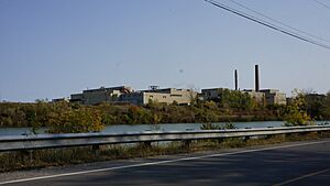
Tourism is an important part of St. Catharines' economy. The city is about 20 kilometers (12 miles) from the U.S.–Canada border. Its economy is also affected by the millions of tons of goods shipped through the Welland Canal. The locks of the canal are even a tourist attraction themselves. St. Catharines used to have a transmission plant for General Motors. The land where the factory once stood is now a brownfield, meaning it needs to be cleaned up.
Arts and Culture in St. Catharines
Local Theatre Scene
St. Catharines is home to several theatre groups. These include Garden City Productions, Carousel Players, Mirror Theatre, Essential Collectives Theatre, and the Empty Box Theatre Company. In 2015, the FirstOntario Performing Arts Centre opened. In 2016, the Film House started inside the center. It shows movies with special themes or genres.
Exciting Events
The Grape and Wine Festival Parade happens every September. Over 100,000 people were expected for the 2022 event.
The International Chicken Chucking Championships takes place every January in Port Dalhousie. Hundreds of people come to watch or take part. Chicken Chucking involves throwing or sliding frozen chickens along the ice of Martindale Pond. The event is hosted by the Kilt and Clover. Animal rights groups have protested the event. Money raised from the event is given to Community Care, a local food bank.
St. Catharines was one of the cities that hosted the 2022 Canada Summer Games. More than 5,000 athletes and coaches came for the games. They took place from August 6 to August 21, 2022. The opening ceremony was held at the Meridian Centre.
Places to Visit in St. Catharines
- Lakeside Park Carousel – A historic carousel in Port Dalhousie.
- Morningstar Mill – An old mill and heritage site.
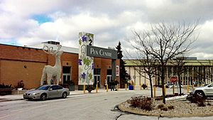
- Pen Centre – A large shopping mall for the region.
- The St. Catharines Armoury is a recognized historic building.
Beautiful Parks
- Montebello Park: This park was designed in 1887 by Frederick Law Olmsted. He also designed New York City's Central Park. It has a rose garden with over 1,300 rose bushes of 25 types. This is the city's largest rose collection. The park also has a fountain. The main features of the park are a band shell and pavilion built in 1888. The park is protected under the Ontario Heritage Act.
- Lakeside Park: This park is in the North end, along the shores of Lake Ontario in Port Dalhousie. It hosts fireworks shows every July 1st (Canada Day). It has picnic areas, a pavilion, a snack bar, and washrooms. There is also playground equipment, a boardwalk, the Lakeside Park Carousel, and docks for boats. The beach offers amazing sunset views over Lake Ontario. Lakeside Park inspired a song by the rock band Rush. The song describes the park and drummer Neil Peart's memories there.
- Burgoyne Woods: This is a 50-hectare (0.5 km²) wooded area and park near downtown. It also has a dog park. It hosts yearly cross-country races for local school boards.
- Happy Rolph's Bird Sanctuary: This 6-hectare (0.06 km²) park is on the shores of Lake Ontario in Port Weller. It is home to hundreds of local and migrating birds. It also has many beautiful rhododendron flowers. There is a petting farm on site with horses, pigs, sheep, goats, llamas, and a donkey named 'Hoti'. The city runs the farm from Victoria Day to Thanksgiving weekend. A trail through the park leads to a quiet memorial for Canadian victims of the 9/11 terrorist attacks.
- Ontario Jaycee Gardens: This is the city's largest garden park, overlooking the Henley Rowing Course. It has over 8 hectares (0.08 km²) of carefully designed gardens and flower displays. Among the displays is a memorial site for Kristen French. The park is on land that was once part of the Third Welland Canal. The old entrance to the canal can still be seen at the park's northwest end.
- Walker Arboretum: This garden is along the hillside of Rodman Hall and the Twelve Mile Creek below. The original owner was Thomas Rodman Merritt, son of William Hamilton Merritt. In the late 1800s, an English landscape designer named Samuel Richardson was hired to care for the grounds. Because of this, the arboretum is a large, winding garden with rare conifers. These trees grow well here because of the special local climate. It has one of the largest Chinese Empress trees in Canada.
- Woodgale Park: This park is located along Glendale Avenue. It has wide open spaces, fruit trees, and rare birds. It also has a soccer field and tennis courts. There is a memorial to the original farm building on the north end of the park. Locals call it Doug Hill Park, after a nearby resident who coached sports teams there.
City Trails for Exploration
The city has over 90 kilometers (55 miles) of paths. These trails are great for walking, jogging, cycling, hiking, and cross-country skiing.
- Bruce Trail: This is Canada's oldest and longest hiking trail. It follows the Niagara Escarpment (a UNESCO World Biosphere Reserve site) from Niagara-on-the-Lake to Tobermory. A 20-kilometer (12-mile) part of the trail goes through St. Catharines. It passes places like the Morningstar Mill.
- Merritt Trail: This is an 11 km (6.8 mi) trail made of different sections. It passes many old parts of the second Welland Canal and what is left of its locks.
- Laura Secord Legacy Trail – A trail created to remember Laura Secord's 32 km (20 mi) walk. She walked to warn of an upcoming American attack during the War of 1812.
- Terry Fox Trail: This is a 1.5 km (0.9 mi) trail along Carlon Street and Geneva Street. It has six exercise stations.
- Waterfront Trail: This trail follows the shore of Lake Ontario. It connects towns from Niagara-on-the-Lake to Brockville. The Port Dalhousie part of the trail is a major highlight.
- Welland Canals Parkway Trail: This trail is 45 km (28 mi) long. It stretches from St. Catharines to Port Colborne.
Sports in St. Catharines
Ice Hockey Teams
St. Catharines joined the Ontario Hockey Association Junior 'A' Hockey in 1943 as the St. Catharines Falcons. In 1947, they became the Teepees. They were connected with the American Hockey League's Buffalo Bisons. When the National Hockey League's (NHL) Chicago Blackhawks made the Bisons their main farm team, they also got the Teepees. In the 1960s, the Jr. 'A' team owed a lot of money to the Chicago Black Hawks. But they continued to be a successful team and were named the St. Catharines Black Hawks. The Hamilton Fincups moved to St. Catharines in 1976. They played here for one year before moving back to Hamilton. The AHL St. Catharines Saints played in St. Catharines between 1982 and 1986. They had to move to Newmarket because the NHL Buffalo Sabres protested. The St. Catharines Saints were the farm team for the Toronto Maple Leafs. Today, they are known as the Toronto Marlies.
In 2007, the OHL's Mississauga IceDogs moved to St. Catharines and became the Niagara IceDogs. The IceDogs played at the Jack Gatecliff Arena, which was later renamed the Gatorade Garden City Complex (now Garden City Arena Complex). In 2014, the IceDogs moved to the new Meridian Centre. Since starting, the team has won the Emms Trophy in 2010–2011 and 2018–2019. They also won the Bobby Orr Trophy in 2011–2012 and 2015–2016, reaching the OHL Finals. Both times, they lost to the London Knights. Many NHL players have come from this team, including Alex Pietrangelo, Dougie Hamilton, Vince Dunn, Ryan Strome, Akil Thomas, Jason Robertson, and Alex Nedeljkovic.
The current St. Catharines Falcons team plays in the Golden Horseshoe Division of the Greater Ontario Junior Hockey League. The team has played since 1968. They play all home games at the Jack Gatecliff Arena. The team was second place for the Sutherland Cup in 1979, 1990, 1994, 1997, 2000, and 2014. They won the cup in 2012.
Basketball Team
In 2015, the National Basketball League of Canada announced that Niagara would get a new team. The team, named the Niagara River Lions, started playing in the Meridian Centre in 2015. They reached the conference quarterfinals. The team joined the Canadian Elite Basketball League after the 2017–18 season. In 2021, the River Lions had one of their best seasons, finishing second. They made it to the finals but lost to the Edmonton Stingers. In 2024, the River Lions won their first CEBL Championship. They beat the Vancouver Bandits 97-95. The River Lions finished the season with a 14-6 record, including a perfect 11-0 at home.
Baseball Team History
The city was home to the New York–Penn League's St. Catharines Blue Jays. This was a minor league team for the Toronto Blue Jays. They played from 1986 to 1999. In 1996, the team was renamed the St. Catharines Stompers. It was later sold and moved to Queens, New York City, in late 1999. There, they became the Queens Kings.
Rugby and Soccer
The St. Catharines Tigers RFC rugby team was formed in 1978. In 2015, the Tigers joined the Niagara Wasps RFC. They now play at the Wasps' field in Thorold.
League1 Ontario's St. Catharines Wolves are one of Canada's most successful professional soccer teams. They play at Club Roma in the west end of the city.
Rowing Events
Martindale Pond in St. Catharines' Port Dalhousie is where the yearly Royal Canadian Henley Regatta takes place. This is a big event that brings over 3,000 athletes from many countries to the city. The pond also hosted the FISA World Rowing Championships in 1970 and 1999. More recently, the World Master's Rowing Championship was held at Martindale Pond in the summer of 2010. Improvements were made to the facility, including a weed harvester, new docks, and a new timing system. There are talks to bring the Canadian Rowing Hall of Fame to St. Catharines soon. The pond is also home to the St. Catharines rowing club, Brock University rowing club, and Ridley College rowing club. It also hosts the yearly CSSRA Championships, which brings hundreds of high school athletes from Canada, the U.S., and Mexico. Martindale Pond, or Henley, continues to be a world-famous rowing location. The rowing event in the Pan American Games was held in St. Catharines in 2015. Several Olympic medalists in rowing are from St. Catharines, including Melanie Kok, Buffy Williams, and Dave Boyes. St. Catharines hosted the 2024 World Rowing Championships.
Sailing Opportunities
There are marinas in Port Dalhousie and Port Weller. A club also sails from Municipal Beach. The St. Catharines Marina is in Port Weller. The Port Dalhousie Pier Marina and the Port Dalhousie Yacht Club are in Port Dalhousie.
City Infrastructure
Transportation Networks
The most important transportation feature of St. Catharines is the Welland Canal. This ship canal is 43.4 kilometers (27.0 miles) long and passes through the city. Four of its locks are within the city limits. The canal allows large ships to travel up or down the 99.5-meter (326.5-foot) difference in height between Lake Erie and Lake Ontario. The Garden City Skyway is a nearby bridge that helps cars get into the city.
The main ways to get into and out of St. Catharines are two major freeways. The Queen Elizabeth Way runs east to west. Highway 406 runs north to south. Before these freeways were built, St. Paul Street and Hartzel Road were the main routes.
Public transportation is provided by the St. Catharines Transit Commission. They operate bus routes throughout the city and the nearby town of Thorold. All major bus routes meet at the St. Catharines Bus Terminal. This terminal is downtown, inside the headquarters of the Ontario Ministry of Transportation. The central station also has service from Coach Canada, with buses to Toronto and Niagara Falls.
Even though train travel is becoming more popular, the St. Catharines train station is not used as much as it could be. Most people travel by car or bus. The train station is in its original building, outside the downtown area. This is because of issues with crossing the 12-Mile Creek. Via Rail and Amtrak trains serve the station daily. They connect St. Catharines to Toronto and New York City. The provincial and federal governments recently promised $385 million each to GO Transit. This money will help develop their 10-Year Capital Expansion Plan. This plan includes an expanded bus line serving the Niagara Region. Currently, regular GO Bus service goes to St. Catharines with a stop at Fairview Mall. This allows riders to travel west toward Burlington or east toward Niagara Falls. A train link with GO Transit runs during the summer months. There are plans for the city to have a permanent train link in the future.
St. Catharines/Niagara District Airport serves small planes and chartered jetliner flights. The airport has charter flights from FlyGTA Airlines. It offers flights to Billy Bishop Toronto City Airport, Muskoka, and Collingwood. It is near the city's east end in Niagara-on-the-Lake. Other airports near the city include Niagara Falls/Niagara South Airport and Niagara Central Dorothy Rungeling Airport. The closest airports for long-distance and international flights are John C. Munro Hamilton International Airport, Niagara Falls International Airport, and Toronto Pearson International Airport.
St. Catharines had one of the first electric streetcar routes. It ran between the city and Merritton. It was later extended to Port Dalhousie in the north and Thorold to the south. Like most streetcar routes around the world, it was stopped in the 1960s. The old tracks have since been turned into parks and trails.
Learning in St. Catharines
Secondary Schools
The District School Board of Niagara (DSBN) is the local public school board. It manages six high schools in St. Catharines: DSBN Academy, Laura Secord Secondary School, Sir Winston Churchill, Governor Simcoe, St. Catharines Collegiate, and Eden. The opening of DSBN Academy was called "Canada's most controversial teaching experiment in years." This is because the school was made specifically for students from low-income families. This caused worries about separating students in public education. Some feared it would make low-income students feel singled out. Supporters argued that the extra help offered to these students would increase their chances of going to college or university. Governor Simcoe and Winston Churchill offer French immersion programs. Eden Secondary School is a Christian school, but it is part of the DSBN and gets public school funding.
The Niagara Catholic District School Board (NCDSB) manages and runs three Catholic high schools in the city: Holy Cross, Denis Morris Catholic High School, and Saint Francis.
Ridley College is a private school near the city's downtown. It is for both boys and girls, and students can live there or attend during the day. It started as a boys' school in 1889 and became co-educational in 1973.
Colleges and Universities
St. Catharines is home to Brock University (started in 1964). It is a modern university located on the Niagara Escarpment. Concordia Lutheran Theological Seminary, a school for advanced studies in theology, also operates there. A partnership between the university and the Ontario Grape and Wine Industry has made the city a center for research on grapes and wine grown in cool climates.
The Michael G. DeGroote School of Medicine is a medical school run by McMaster University. It has a campus in downtown St. Catharines. Before 2004, it was known as the McMaster University School of Medicine.
Even though they are not in St. Catharines itself, there are nearby campuses for Niagara College in Niagara on the Lake and Welland. The college used to have a campus in St. Catharines on Niagara Street from the 1970s to the 1990s. It focused on horticulture (gardening and plant growing).
Media in St. Catharines
Newspapers
- St. Catharines Standard (daily newspaper)
- Niagara This Week (weekly community newspaper)
- The Brock Press (student newspaper for Brock University)
Radio Stations
- AM 610: CKTB, news /talk
- AM 1220: CFAJ, Oldies music
- FM 97.7: CHTZ (HTZ FM), active rock music
- FM 103.7: CFBU, Brock University campus radio
- FM 105.7: CHRE (Move), adult contemporary music
Television Access
The Niagara region does not have its own local television service. Stations from Toronto, Hamilton, and Buffalo can be watched in the region. There is also a local transmitter (CKVP-DT) that re-broadcasts the Barrie CTV 2 station CKVR-DT. A local news channel called Niagara News TV started in February 2011 but closed just three months later. In 2003, a local business group asked for a license to run TV Niagara, a community television station in St. Catharines. This request was denied in 2005. The reason was concerns about their business plan and how much they relied on getting viewers from the Toronto market.
Sister City
See also
 In Spanish: St. Catharines para niños
 | Ernest Everett Just |
 | Mary Jackson |
 | Emmett Chappelle |
 | Marie Maynard Daly |


