Welland Canal facts for kids
Quick facts for kids Welland Canal |
|
|---|---|
 |
|
| Specifications | |
| Length | 27 miles (43 km) |
| Maximum boat length | 740 ft 0 in (225.6 m) |
| Maximum boat beam | 78 ft 0 in (23.8 m) |
| Maximum boat draft | 26.5 ft (8.08 m) |
| Locks | 8 |
| Status | Open |
| Navigation authority | Saint Lawrence Seaway Management Corporation |
| History | |
| Original owner | Welland Canal Company |
| Principal engineer | Hiram Tibbetts |
| Construction began | 1824 |
| Date completed | November 30, 1829. |
| Date extended | 1833 |
| Date restored | August 6, 1932. |
| Geography | |
| Start point | Lake Ontario at Port Weller (St. Catharines) |
| End point | Lake Erie at Port Colborne |
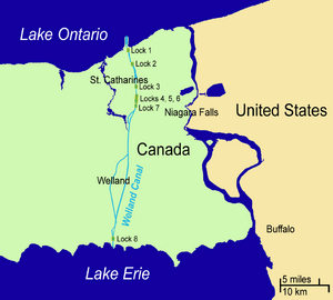
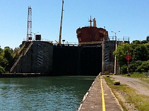
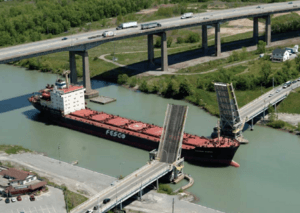
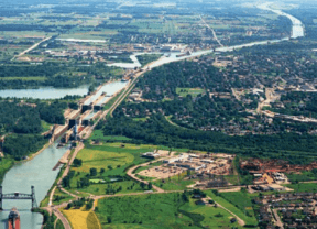
The Welland Canal is a very important ship canal in Ontario, Canada. It connects Lake Ontario and Lake Erie. This canal is a key part of the St. Lawrence Seaway and the Great Lakes Waterway. It runs across the Niagara Peninsula from Port Weller in St. Catharines to Port Colborne. The canal helps ships go up and down the Niagara Escarpment and get around Niagara Falls.
About 3,000 ships use the Welland Canal each year. They carry around 40,000,000 tons of goods. The canal played a big role in the growth of Toronto. It allowed goods from Great Lakes cities like Cleveland, Detroit, Milwaukee, and Chicago to reach the port of Montreal or Quebec City. From there, goods could be shipped all over the world. The Welland Canal became more important than other canals in the area, like the Erie Canal, because it offered a shorter path to Lake Erie.
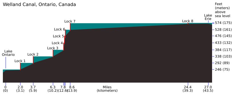
The end of the canal at Lake Erie is about 99.5 metres (326 feet) higher than the end at Lake Ontario. The canal has eight ship locks. Locks are like water elevators that raise or lower ships. Seven of these locks (Locks 1–7) are 233.5 m (766 ft) long. They lift or lower ships by about 13 and 15 m (43 and 49 ft) each. The last lock, Lock 8, is 349.9 m (1,148 ft) long. The Garden City Skyway bridge goes over the canal. It limits how tall a ship's mast can be to 35.5 m (116 ft).
Other roads and railways cross the canal using special bridges or tunnels. These bridges can move to let ships pass. The longest ship allowed in the canal is 225.5 metres (740 feet). It takes ships about eleven hours to travel the whole length of the Welland Canal.
Contents
How the Welland Canal Was Built
Before the Welland Canal was dug, ships moving between Lake Ontario and Lake Erie had to use a special road. This road was a "portage" route between Chippawa, Ontario and Queenston, Ontario, which are both on the Niagara River, above and below Niagara Falls.
The First Welland Canal (1829)
The Welland Canal Company was started in 1824. This happened after a group of people from the Niagara area asked for it. One of them was William Hamilton Merritt. He wanted to make sure his water-powered businesses along the Twelve Mile Creek had enough water. Building started on November 30, 1824. The first ship, the Anne & Jane, traveled through the canal on November 30, 1829.
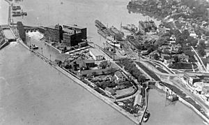
The first canal started at Port Dalhousie, Ontario on Lake Ontario. It went south along Twelve Mile Creek to St. Catharines. Then it wound its way up the Niagara Escarpment through Merritton, Ontario to Thorold. From there, it continued south to Port Robinson, Ontario on the Welland River. Ships would then go east on the Welland River to Chippawa, and then into the Niagara River towards Lake Erie.
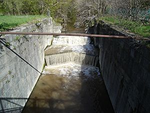
In 1833, the canal was extended south to Port Colborne on Lake Erie. This made the canal 44 km (27 mi) long. It had 40 wooden locks. The smallest lock was 33.5 by 6.7 m (110 by 22 ft), and the canal was at least 2.4 m (7.9 ft) deep. Because the wooden locks wore out and ships got bigger, people soon wanted a new, improved canal.
The Second Welland Canal (1846)
In 1839, the government bought shares in the canal company because it was having money problems. Work began to make the canal deeper and reduce the number of locks to 27. Each lock was 45.7 by 8.1 m (150 by 27 ft). By 1846, the canal was 2.7 m (9 ft) deep.
Even with improvements, many ships were still too big for the canal. So, smaller ships called "canallers" were used to carry goods. It became clear that the canal needed to be made even bigger.
The Third Welland Canal (1887)
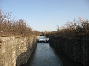
In 1887, a new, shorter path for the canal was finished between St. Catharines and Port Dalhousie. The third canal was at least 4.3 m (14 ft) deep. It had 26 stone locks, each 82.3 m (270 ft) long and 13.7 m (45 ft) wide. Still, the canal was not big enough for many ships.
The Fourth (Current) Welland Canal (1932)
Building the current canal started in 1913. Work stopped during World War I (1914–18) because there weren't enough workers. The canal was officially opened on August 6, 1932. The route was changed again north of St. Catharines, going straight north to Port Weller.
This canal has eight locks. Seven of them are on the Niagara Escarpment, and the eighth is a "guard lock" at Port Colborne. This guard lock helps control the water level from Lake Erie. The canal is now 7.6 m (25 ft) deep. The locks are 233.5 m (766 ft) long and 24.4 m (80 ft) wide. This canal is officially called the Welland Ship Canal.
The Welland By-Pass (1973)
In the 1950s, the St. Lawrence Seaway was built, and a standard depth of 8.2 m (27 ft) was set. The 13.4-kilometre (8.3 mi) long Welland By-Pass was built between 1967 and 1972. It opened for ships in 1973. This new section created a shorter path between Port Robinson and Port Colborne, going around downtown Welland. All three crossings over this new path, including one for the Welland River, were built as tunnels.
Plans for a Fifth Welland Canal
There were plans for a new canal called the Fifth Welland Canal. It would have gone around most of the current canal to the east. It was planned to cross the Niagara Escarpment with 4 large locks. Land was bought for this project, and early designs were made, but the project was never fully built and has been put on hold.
The current Welland Ship Canal was designed to last until 2030. However, improvements to the canal mean it might last much longer.
Sabotage Attempts
The Welland Canal has been the target of plots several times. Only two of these plots were actually carried out.
On September 9, 1841, an explosion damaged one of the lock gates at Lock No. 37 of the First Welland Canal. Luckily, a guard gate closed and stopped a big flood from happening. It was thought that a person named Benjamin Lett was responsible.
On April 21, 1900, a dynamite charge was set off near Lock No. 24 of the Third Welland Canal. It caused only minor damage. The people responsible, John Walsh, John Nolan, and "Dynamite" Luke Dillon, were caught and sent to prison. A 16-year-old girl named Euphemia Constable saw the bombers and helped the police.
During World War I, there were more plots against the canal. One famous plot was called "The Von Papen Plot." In 1916, a group of people, including Franz von Papen, were accused of planning to blow up the Welland Canal. However, Von Papen was already in Germany and the charges were dropped later.
Shipping Season
The Welland Canal is usually open from late March to December. It closes in the winter because of bad weather. On March 20, 2007, the canal opened earlier than ever before, and it opened that early again the next year.
Facts and Figures
Current Canal Details
- Maximum ship length: 225.5 m (740 ft)
- Maximum ship depth (draft): 8.08 m (26.5 ft)
- Maximum height above water: 35.5 m (116 ft)
- Total elevation change between Lake Ontario and Lake Erie: 99.5 m (326 ft)
- Average time to travel through the canal: 11 hours
- Length of canal: 43.5 km (27.0 mi)
How Lock Sizes Have Grown
| Canal | First (1829) | Second (1846) | Third (1887) | Fourth (1932) |
|---|---|---|---|---|
| Number of Locks | 40 | 27 | 26 | 8 |
| Width (metres) | 6.7 | 8.1 | 13.7 | 24.4 |
| Length (metres) | 33.5 | 45.7 | 82.3 | 261.8 |
| Depth (metres) | 2.4 | 2.7 | 4.3 | 8.2 |
Locks and Crossings Along the Canal
Locks and bridges are numbered from north to south.
| Municipality | Lock or bridge number † | Crossing | Remarks |
|---|---|---|---|
| St. Catharines | Lock 1 | 43°13′03″N 79°12′47″W / 43.217484°N 79.212992°W | |
| St. Catharines | Bridge 1 | Lakeshore Road (Regional Road 87) | Bascule bridge (a bridge that opens by lifting up) |
| St. Catharines | Lock 2 | 43°11′35″N 79°12′08″W / 43.193131°N 79.202178°W | |
| St. Catharines | Bridge 3A | Carlton Street (Regional Road 83) | Bascule bridge. This replaced an older Bridge 3. |
| St. Catharines | Bridge 4A | Garden City Skyway: Queen Elizabeth Way | |
| St. Catharines | Bridge 4 | Queenston Street (Regional Road 81) | Bascule bridge, also known as "Homer Lift Bridge" |
| St. Catharines | Lock 3 | 43°09′19″N 79°11′35″W / 43.155230°N 79.193058°W This is where the Welland Canal Information Centre is located. |
|
| St. Catharines | Bridge 5 | Glendale Avenue (Regional Road 89) | Vertical-lift bridge (a bridge that opens by lifting straight up) |
| St. Catharines | Bridge 6 | Canadian National Railway | Bascule bridge |
| St Catharines | Lock 4 | This is a "flight lock" where two locks are twinned together. | |
| Thorold | Locks 5–6 | 43°08′03″N 79°11′31″W / 43.134283°N 79.191899°W These are twinned "flight locks." |
|
| Thorold | Lock 7 | 43°07′24″N 79°11′38″W / 43.123446°N 79.193895°W This is the southernmost lift over the Niagara Escarpment. |
|
| Thorold | Thorold Tunnel, carries Highway 58 | ||
| Thorold | Bridge 11 | Canboro Road (Regional Road 20) | Vertical-lift bridge. In 2001, it was lowered too early onto a ship called the Windoc. |
| Welland | Main Street Tunnel: (Highway 7146) | ||
| Welland | Townline Tunnel: Highway 58A and Canadian National Railway/Penn Central | ||
| Port Colborne | Bridge 19 | Main Street (Regional Road 3) | Bascule bridge |
| Port Colborne | Lock 8 | 42°53′57″N 79°14′46″W / 42.899122°N 79.246166°W This is a "control lock" that helps manage water levels. |
|
| Port Colborne | Bridge 19A | Mellanby Avenue (Regional Road 3A) | Bascule bridge |
| Port Colborne | Bridge 21 | Clarence Street | Vertical-lift bridge |
† These numbers were given by the St. Lawrence Seaway Authority. The original bridges across the fourth canal were numbered in order. The numbering did not change when bridges were removed.
Canal Profile
This picture shows how the Welland Canal looks from the side. The horizontal line shows the length of the canal. The vertical line shows how high each part of the canal is above sea level.
Older Canal Path (before the Welland By-Pass)
| Municipality | Bridge Number † | Crossing | Remarks |
|---|---|---|---|
| The Welland Recreational Waterway splits off from the Welland By-Pass at Port Robinson. | |||
| Thorold | Canadian National Railway | Built when the canal path was changed. | |
| Thorold | Highway 406 | Built after the canal path was changed. | |
| Welland | Woodlawn Road (Regional Road 41) | Built after the canal path was changed. | |
| Welland | Bridge 13 | East Main Street/West Main Street (Regional Road 27) | This is a vertical lift bridge. Its counterweights (heavy parts that help it lift) have been removed. 42°59′30″N 79°15′05″W / 42.99167°N 79.25139°W |
| Welland | Division Street (Regional Road 527) | Built after the canal path was changed. | |
| Welland | Bridge 14 | Lincoln Street | Rebuilt as a fixed bridge (does not open) after the canal path was changed. 42°59′01″N 79°15′16″W / 42.98361°N 79.25444°W |
| Welland | Bridge 15 | Canada Southern Railway (Penn Central) | A rare type of swing bridge (a bridge that pivots open). 42°58′37″N 79°15′21″W / 42.97694°N 79.25583°W |
| Welland | Bridge 16 | Ontario Road/Broadway Avenue | Rebuilt as a fixed bridge after the canal path was changed. The new bridge is north of where the old Bridge 16 was. 42°58′25″N 79°15′21″W / 42.97361°N 79.25583°W |
| This section was cut by the western entrances to the Townline Tunnel (Highway 58A and Canadian National Railway/Penn Central). | |||
| Welland | Bridge 17 | Canadian National Railway | A vertical lift bridge, its counterweights are still there. 42°56′57″N 79°15′00″W / 42.94917°N 79.25000°W |
| Welland | Bridge 18 | Forks Road | The main part of this bridge has been removed. 42°56′50″N 79°14′58″W / 42.94722°N 79.24944°W |
| The Welland Recreational Waterway joins back with the Welland By-Pass at Ramey's Bend in Port Colborne. | |||
See also
 In Spanish: Canal Welland para niños
 | Frances Mary Albrier |
 | Whitney Young |
 | Muhammad Ali |


