Twelve Mile Creek (Ontario) facts for kids
Quick facts for kids Twelve Mile Creek |
|
|---|---|
|
Location of the mouth of the creek in Ontario
|
|
| Country | Canada |
| Province | Ontario |
| Region | Southern Ontario |
| Regional municipality | Niagara |
| Physical characteristics | |
| Main source | Unnamed pond Pelham 194 m (636 ft) 43°02′59″N 79°17′16″W / 43.04972°N 79.28778°W |
| River mouth | Martindale Pond St. Catharines 85 m (279 ft) 43°10′43″N 79°16′21″W / 43.17861°N 79.27250°W |
| Basin features | |
| River system | Great Lakes Basin |
| Basin size | 178 km2 (69 sq mi) |
Twelve Mile Creek is a waterway in the Niagara Peninsula region of Ontario, Canada. It starts in the town of Pelham. This area has some of the most natural and untouched parts of Niagara.
As the creek flows, it passes through the cities of Thorold and St. Catharines. In these urban areas, people have changed the creek a lot over the past 200 years.
Contents
What is Twelve Mile Creek?
Twelve Mile Creek gets its name because it flows into Lake Ontario about 12 miles (19 km) away from the Niagara River. The creek and all the smaller streams that flow into it cover an area of about 178 square kilometres (69 sq mi). This area is called its watershed.
The watershed is split into six smaller parts:
- Upper Twelve Mile Creek
- Lake Gibson System
- Richardson Creek
- Francis Creek
- Dicks Creek
- Lower Twelve Mile Creek
The Upper Creek: A Natural Gem
The Upper Twelve Mile Creek is the most natural part. It has many small streams that flow through Short Hills Provincial Park and St. John's Conservation Area. This area also includes farms and lightly developed lands.
The source of the creek is in a place called the Fonthill Kame Delta Complex. This area was formed about 12,000 years ago from rocks and dirt left by melting glaciers. It is the highest point in the region. It also has the only cold water streams found in Niagara. Many bird species live here, including the Acadian flycatcher and hooded warbler.
Lake Gibson: A Man-Made Lake
Lake Gibson is not a natural lake. It is a reservoir created by people. Old maps from the 1800s show a winding stream called Beaverdams Creek here. This stream used to flow over the Niagara Escarpment at Decew Falls.
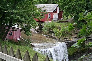
Morningstar Mill is still there today. It used the stream's power to operate. Later, a dam was built to create a reservoir. This reservoir provides water for hydroelectric power at the Decew Falls Generating Station. People also built channels and canals to improve water flow. Lake Gibson gets most of its water from Lake Erie through the Welland Canal. It also provides drinking water for the city of St. Catharines.
Other Creek Branches
Richardson Creek flows through farmland that is quickly becoming urbanized in western St. Catharines. It is about 10.5 km (6.5 mi) long. It joins with Francis Creek and flows into Martindale Pond. This pond is very close to where the Twelve Mile Creek empties into Lake Ontario. So, these two creeks do not add water to most of the main Twelve Mile Creek.

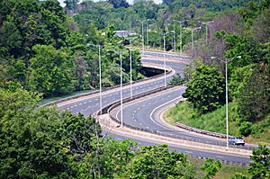
Dicks Creek starts near the escarpment in a residential area. Then it flows through industrial and commercial zones. It passes through the old stone locks of the second Welland Canal. After going through a tunnel, it joins the main Twelve Mile Creek. This meeting point is right next to Highway 406 and close to downtown St. Catharines.
The Lower Creek: A Busy Waterway
The lower part of Twelve Mile Creek used to be part of the second Welland Canal. Now, it is a fast-flowing river with rapids. Most of the water (98-99%) in this section comes from the Welland Canal. This water flows through the Decew Falls generating stations.
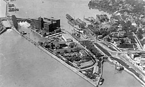
The creek flows into Martindale Pond. This is a small, man-made lake near Lake Ontario. It was created for the first Welland Canal to allow ships to pass. Martindale Pond was also used for the second and third canals. You can still see parts of the old locks there. Today, Martindale Pond is home to the Royal Canadian Henley Regatta course. The water then flows over a barrier into Port Dalhousie harbour and out into Lake Ontario.
The Welland Canal's History with the Creek
After the War of 1812, many mills used water power from creeks flowing over the Niagara Escarpment. William Hamilton Merritt owned a sawmill and a grist mill on Twelve Mile Creek. His mills often had low water, especially in late summer when grain needed to be ground.
Merritt had an idea to bring more water from the Welland River. Soon, this idea grew into building a navigable canal across the Niagara Peninsula. The first two Welland Canals used Twelve Mile Creek as their route. The third canal mostly bypassed the creek but still used its outlet to Lake Ontario.
Early maps show that the lower part of the creek had many curves. These curves were flooded by a dam at Port Dalhousie, Ontario to create Martindale Pond. For the second canal, most of the creek's bends were straightened. This is why the lower creek is now almost straight.
Enjoying and Protecting the Creek
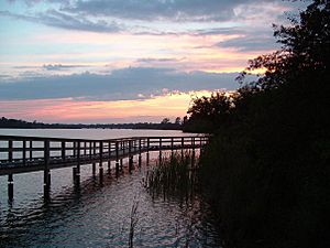
Many parts of Twelve Mile Creek are open for everyone to enjoy. There are walking and cycling trails along most of the lower creek. Short Hills Provincial Park and St. John's Conservation Area protect the upper creek and allow public access. Parks and trails are also found around Lake Gibson. The Bruce Trail crosses the upper part of the watershed. You can also visit historic places like Morningstar Mill and see parts of the old Welland Canals.
However, the creek faces challenges. More buildings and roads are being built, and pollution from farms, factories, and homes affects the water. The lower parts of the creek are very different from their natural state. They have been straightened, dug deeper, and now carry much more water. Dicks Creek flows through old stone locks and even tunnels in some places. Other smaller streams flow through channels built to control floods. The Lake Gibson system also looks very different from the Beaverdams Creek that once flowed there.
Twelve Mile Creek is a mix of natural beauty and human changes. Some areas are very wild, while others are among the most altered waterways in Niagara.
 | Jackie Robinson |
 | Jack Johnson |
 | Althea Gibson |
 | Arthur Ashe |
 | Muhammad Ali |


