Ottawa facts for kids
Quick facts for kids
Ottawa
Ville d'Ottawa (French)
|
|||||
|---|---|---|---|---|---|
|
Federal capital city
|
|||||
|
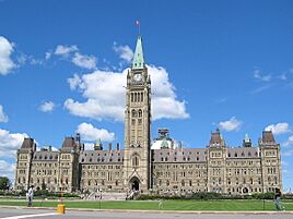
Centre Block on Parliament Hill
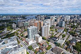
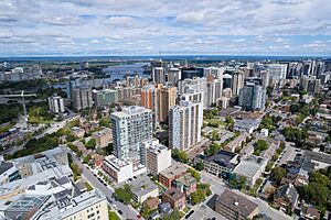
Downtown Ottawa
|
|||||
|
|||||
Nickname(s):
|
|||||
| Motto(s):
"Advance-Ottawa-En Avant"
Written in the two official languages. |
|||||
|
OpenStreetMap
|
|||||
 |
|||||
| Country | Canada | ||||
| Province | Ontario | ||||
| Established | 1826 as Bytown | ||||
| Incorporated | 1855 as City of Ottawa | ||||
| Amalgamated | 1 January 2001 | ||||
| Government | |||||
| • Type | Single-tier municipality with a Mayor-council system | ||||
| Area | |||||
| • Federal capital city | 2,790.31 km2 (1,077.34 sq mi) | ||||
| • Land | 2,788.20 km2 (1,076.53 sq mi) | ||||
| • Urban | 549.49 km2 (212.16 sq mi) | ||||
| • Metro | 8,046.99 km2 (3,106.96 sq mi) | ||||
| Elevation | 70 m (230 ft) | ||||
| Population
(2021)
|
|||||
| • Federal capital city | 1,017,449 (4th) | ||||
| • Density | 364.9/km2 (945/sq mi) | ||||
| • Urban | 1,068,821 | ||||
| • Urban density | 1,945.1/km2 (5,038/sq mi) | ||||
| • Metro | 1,488,307 (4th) | ||||
| • Metro density | 185.0/km2 (479/sq mi) | ||||
| • Demonym | Ottawan | ||||
| Time zone | UTC−05:00 (EST) | ||||
| • Summer (DST) | UTC−04:00 (EDT) | ||||
| Postal code span |
K0A-K4C
|
||||
| Area codes | 613, 343, 753 | ||||
| GDP (Ottawa–Gatineau CMA) | CA$89.9 billion (2020) | ||||
| GDP per capita (Ottawa–Gatineau CMA) | CA$60,414 (2020) | ||||
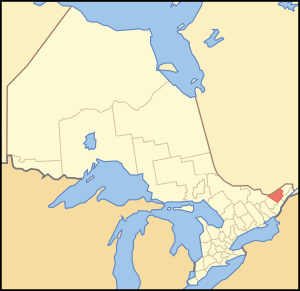
Ottawa is the capital city of Canada. It is located in the southern part of Ontario, where the Ottawa River and Rideau River meet. Ottawa is right next to Gatineau, Quebec, and together they form the National Capital Region.
As of 2021, Ottawa had a population of over 1 million people. This makes it the fourth-largest city and metropolitan area in Canada. Ottawa is the political heart of Canada. It is home to the Parliament of Canada, the Supreme Court, and many foreign embassies.
The city was founded in 1826 as Bytown and became the City of Ottawa in 1855. Its borders grew over time, and in 2001, it joined with nearby towns to form the larger city we know today. Ottawa's local government is led by an elected mayor and city council.
Ottawa has many highly educated residents. It is home to several universities and colleges, like the University of Ottawa and Carleton University. The city also has many museums, monuments, and historic sites. Over 11 million visitors come to Ottawa each year, making it one of Canada's most visited cities.
Contents
What's in a Name?
The name Ottawa was chosen in 1855. It comes from the Ottawa River, which was named after the Algonquin word adawe. This word means "to trade." In the modern Algonquin language, the city is called Odàwàg.
Ottawa's Story
Early Days
The Ottawa Valley became a place where people could live about 10,000 years ago. This was after the Champlain Sea naturally drained away. Scientists have found arrowheads, tools, and pottery that show Indigenous people lived here about 6,500 years ago. These Algonquin people hunted, fished, gathered food, and traded. Three major rivers meet in Ottawa, making it an important trading spot for thousands of years. This period changed when European settlers arrived in North America.
European Explorers and First Settlements
In 1610, Étienne Brûlé was the first European to travel on the Ottawa River. He passed by the area that would become Ottawa. A few years later, Samuel de Champlain wrote about the waterfalls and the Algonquin people he met there.
The first non-Indigenous settlement was started by Philemon Wright in 1800. He created a lumber town on the north side of the river, in what is now Hull. Wright also started a farming community called Wright's Town. He was a pioneer in the Ottawa River timber trade, sending wood down the river to Quebec City.
In 1826, a new community began on the south side of the Ottawa River. This happened because the British military was planning to build the Rideau Canal. The town was named Bytown in honor of Colonel John By, who was in charge of building the canal. The Rideau Canal was finished in 1832. It provided a safe route between Montreal and Kingston on Lake Ontario. This route avoided a dangerous part of the St. Lawrence River during the War of 1812.
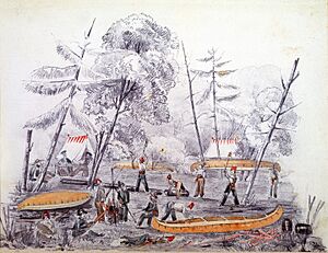
Colonel By set up military barracks where Parliament Hill is today. He also designed the streets and created two main areas: "Upper Town" (west of the canal) and "Lower Town" (east of the canal). Historically, Upper Town was mostly English-speaking and Protestant, while Lower Town was mainly French, Irish, and Catholic.
Bytown grew to 1,000 people by 1832. In 1855, Bytown was renamed Ottawa and officially became a city.
Becoming the Capital City
Choosing Ottawa as the capital was a big decision. Before Canada became a country, the government of the Province of Canada struggled to pick a permanent capital. They voted over 200 times!
Kingston was the capital in 1841, but other major cities like Toronto, Montreal, and Quebec City were not happy. The capital even moved between Quebec City and Toronto for a while. This was difficult because of all the moving.
Finally, the government asked Queen Victoria to decide. She listened to her governor general, Edmund Walker Head, who looked at proposals from different cities. Queen Victoria chose Ottawa as the capital, and this decision became official on December 31, 1857.
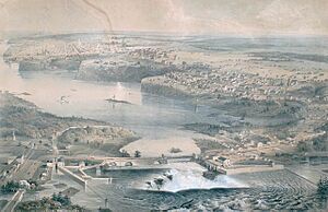
Ottawa was chosen for two main reasons:
- Safety: Ottawa was far from the Canada–US border and surrounded by thick forests. This made it easier to defend from attacks.
- Compromise: Ottawa was located right on the border between Canada West (mostly English-speaking) and Canada East (mostly French-speaking). This made it a good compromise for both sides.
Other reasons included access to water transportation and a railway by 1854. Also, Ottawa was smaller, so it was thought to be less likely to have political riots. The government already owned the land that became Parliament Hill, which was perfect for the Parliament buildings.
The original Parliament buildings were built between 1859 and 1866 in the Gothic Revival style. This was a huge construction project for its time. The Library of Parliament and the landscaping on Parliament Hill were finished in 1876.
After Canada Became a Country
In the 1850s, lumber businesses grew, and Ottawa became home to some of the world's largest sawmills. Railways connected Ottawa to other areas, including the transcontinental network by 1886. By 1885, Ottawa was the only city in Canada with downtown streetlights powered entirely by electricity. Public transportation started with horse-drawn streetcars in 1870, later replaced by electric streetcars until 1959.
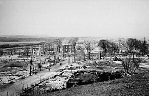
The 1900 Hull–Ottawa fire was a major disaster. It destroyed two-thirds of Hull and about one-fifth of Ottawa. The fire caused an estimated $300 million in damage (in 2020 Canadian dollars). About 14% of Ottawa's residents lost their homes.
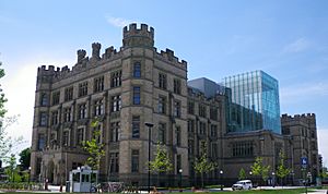
On February 3, 1916, the Centre Block of the Parliament buildings was destroyed by a fire. The government temporarily moved to the Victoria Memorial Museum (now the Canadian Museum of Nature). The new Centre Block was completed in 1922, with the Peace Tower as its main feature.
Confederation Square was redeveloped in 1938 as a ceremonial center. It became the site of the National War Memorial in 1939.
Modern Ottawa

After World War II, Ottawa's look changed a lot because of the 1950 Greber Plan. This plan aimed to make the city more beautiful and suitable for Canada's capital. It included creating the National Capital Greenbelt, a large area of protected land around the city. The plan also moved the main train station and removed the streetcar system.
In 1958, the National Capital Commission (NCC) was created. This group helps manage the development of the capital region. The NCC has a big role in shaping how Ottawa grows.
From the 1960s to the 1980s, Ottawa saw a lot of new construction. Then, in the 1990s and 2000s, the high-tech industry boomed. Ottawa became known as "Silicon Valley North" because of all the technology companies.
In 2001, Ottawa's city limits expanded significantly. Many smaller towns and communities joined to form the single large city we see today. The city also introduced a diesel-powered light rail transit (LRT) line, now known as O-Train Line 2. In 2012, the city approved the Confederation Line, a new light rail line that opened on September 14, 2019.
Ottawa's Geography
City Areas and Neighborhoods
Today's Ottawa includes the historic main city area, plus many other urban, suburban, and rural areas.
Old Ottawa
"Old Ottawa" refers to the city before the 2001 expansion. It includes the downtown core and older neighborhoods. These areas have busy commercial streets, cultural spots, and beautiful tree-lined streets. There are also historic working-class communities and ethnic enclaves like Chinatown and Little Italy.
Suburbs and Communities
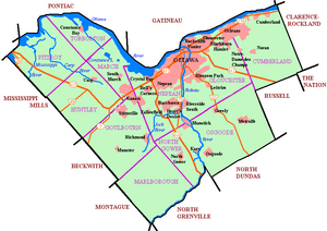
Modern Ottawa is made up of eleven historic townships. The main suburban areas stretch far to the east, west, and south of the city center. These include former cities like Cumberland, Gloucester (with Orleans), Kanata, and Nepean (with Barrhaven).
Many rural communities and villages are also part of the City of Ottawa. Some examples are Manotick, Richmond, and Osgoode. Several towns are part of the wider National Capital Region but are outside Ottawa's city limits.
Building Styles
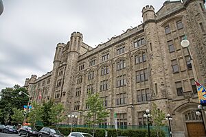
Ottawa's buildings are often formal and practical, especially government structures. However, you can also see romantic and picturesque styles, like the Gothic Revival architecture of the Parliament Buildings. Many homes in the city center are made of red brick.
Building heights in Ottawa have been controlled to keep Parliament Hill and the Peace Tower visible. The National Capital Commission (NCC) manages much of the undeveloped land. This gives the NCC a lot of power over how the city develops.
Ottawa's Climate
Ottawa has four distinct seasons. Summers are generally warm and humid, with temperatures sometimes going above 30°C. Winters are cold and snowy, with temperatures often dropping below -20°C. Spring and fall have changing temperatures and conditions.
Ottawa gets about 772 mm of rain and 184.5 cm of snow each year. The city experiences about 2,080 hours of sunshine annually. Winds usually come from the west, but northerly winds are common during cold winter periods.
Rivers and Canals
Ottawa is on the south bank of the Ottawa River, where the Rideau River and Rideau Canal join. The Rideau Canal, opened in 1832, is 202 km long. It connects the Saint Lawrence River to the Ottawa River.
In winter, the Ottawa section of the canal becomes the world's largest skating rink. It's a fun place to skate and a 7.8 km path to downtown. On June 29, 2007, the Rideau Canal was named a UNESCO World Heritage Site.
The older part of the city, called Lower Town, is between the canal and the rivers. Across the canal are Centretown and Downtown Ottawa. These areas have important government buildings, including the Parliament of Canada, the Office of the Prime Minister and Privy Council, and the Supreme Court of Canada.
Across the Ottawa River is Gatineau, Quebec. Ottawa and Gatineau, along with nearby towns, form the National Capital Region. The National Capital Commission (NCC) manages many historical and tourist sites in both cities. Around the main urban area is a large greenbelt, managed by the NCC for nature and recreation.
Who Lives in Ottawa?
| Historic Population | ||
|---|---|---|
| Year | Pop. | ±% |
| 1901 | 101,102 | — |
| 1911 | 123,417 | +22.1% |
| 1921 | 152,868 | +23.9% |
| 1931 | 174,056 | +13.9% |
| 1941 | 206,367 | +18.6% |
| 1951 | 246,298 | +19.3% |
| 1956 | 287,244 | +16.6% |
| 1961 | 358,410 | +24.8% |
| 1966 | 413,695 | +15.4% |
| 1971 | 471,931 | +14.1% |
| 1976 | 520,533 | +10.3% |
| 1981 | 546,849 | +5.1% |
| 1986 | 606,639 | +10.9% |
| 1991 | 678,147 | +11.8% |
| 1996 | 721,136 | +6.3% |
| 2001 | 774,072 | +7.3% |
| 2006 | 812,129 | +4.9% |
| 2011 | 883,391 | +8.8% |
| 2016 | 934,243 | +5.8% |
| 2021 | 1,017,449 | +8.9% |
| Note: Population figures are extrapolated for current municipal boundaries Sources: Chart format |
||
In 2021, Ottawa's population was 1,017,449 people. The larger Ottawa-Gatineau metropolitan area had 1,488,307 people. Ottawa's population grew by 8.9% between 2016 and 2021.
Ottawa is a relatively young city, with a median age of 40.1 years in 2016. About 16.7% of the population was under 15, and 15.4% was 65 or older.
Many people in Ottawa were born outside Canada. In 2021, immigrants made up 25.9% of the population. The top countries of origin for immigrants were China, India, and the United Kingdom.
Backgrounds and Beliefs
In 2021, about 64.9% of Ottawa's population was white or European. About 2.6% were Indigenous, and 32.5% were visible minorities.
Christianity is the largest religious group in Ottawa, with 52.8% of the population identifying as Christian in 2021. About 31.6% of people reported having no religious affiliation. Other religions like Islam (9.9%), Hinduism (2.0%), and Buddhism (1.1%) are also present.
Languages Spoken
Ottawa has an official policy of bilingualism for city business since 2002. This means both English and French are used. About 37.6% of the population can speak both languages.
English is the mother tongue for 62.4% of residents, while French is the mother tongue for 14.2%. Many people also speak other languages, such as Arabic, Chinese, and Spanish. The Ottawa–Gatineau area is one of the most bilingual regions in Canada.
Ottawa's Economy
Ottawa-Gatineau has one of the highest household incomes among Canadian cities. Ottawa's unemployment rate has been lower than the national average for many years. In 2019, Mercer ranked Ottawa as having the third-highest quality of living in Canada and 19th highest in the world. It was also rated the second cleanest city in Canada.
The main employers in Ottawa are the Canadian federal government and the high-tech industry. Tourism and healthcare are also growing parts of the economy. The federal government is the city's largest employer, with over 116,000 people working in the National Capital Region. Many government offices are located in Ottawa.
Tourism is very important to Ottawa's economy. The National Capital Region attracts about 22 million tourists each year. These visitors spend around $2.2 billion and support over 30,600 jobs.
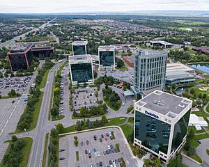
Ottawa is a major technology hub, sometimes called "Silicon Valley North." In 2015, about 1,800 tech companies employed 63,400 people. These companies often focus on telecommunications, software development, and environmental technology. Many large tech companies have their roots or offices in Ottawa, especially in the western part of the city (Kanata).
The health sector is another big employer, with over 18,000 people working in healthcare. Business, finance, and sales are also common jobs. Ottawa also has the largest rural economy among Canada's major cities, with agriculture contributing significantly.
Learning in Ottawa
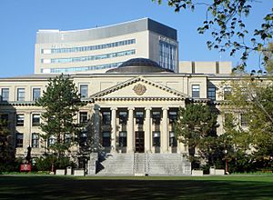
Ottawa is known as Canada's most educated city. More than half of its population has graduated from college or university. It has the highest number of engineers, scientists, and people with PhDs per person in Canada.
Schools for Kids
Ottawa has four main public school boards:
- The English-language Ottawa-Carleton District School Board (OCDSB) is the largest.
- The English-Catholic Ottawa Catholic School Board.
- The French-Catholic Conseil des écoles catholiques du Centre-Est.
- The French Conseil des écoles publiques de l'Est de l'Ontario.
Ottawa also has many private schools.
The Ottawa Public Library was founded in 1906. As of 2008, it had 2.3 million items across 34 branches.
Colleges and Universities
Ottawa has two main public universities and two main public colleges:
- Carleton University was founded in 1942. It is a highly ranked university located between Old Ottawa South and Dow's Lake.
- The University of Ottawa (originally "College of Bytown") was established in 1848. It is the largest English-French bilingual university in the world. Its main campus is in the Sandy Hill neighborhood.
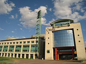
- Algonquin College is a college of applied arts and technology, founded in 1967. Its main campus is in the City View neighborhood.
- Collège La Cité is the largest French-language college in Ontario. It was founded in 1989.
Other colleges and universities are in nearby Gatineau, Quebec.
Health Care
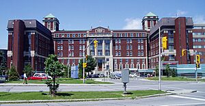
Ottawa has six general hospitals, including the Queensway Carleton Hospital and The Ottawa Hospital. There are also specialized hospitals like the University of Ottawa Heart Institute. The University of Ottawa Faculty of Medicine works with hospitals to train new doctors.
Many important medical organizations have their headquarters in Ottawa, such as the Canadian Red Cross and Health Canada.
Ottawa's Culture and Fun
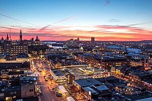
The ByWard Market, Parliament Hill, and the Golden Triangle are key cultural spots in Ottawa. Streets like Wellington Street and Elgin Street have many shops, museums, theaters, and restaurants.
As Canada's capital, Ottawa has hosted many important events. These include royal visits, like King George VI in 1939 and Queen Elizabeth II in 1982. The first raising of the new Canadian flag happened here in 1965.
Famous Places
Ottawa has one World Heritage Site, the Rideau Canal. It also has 25 National Historic Sites, including the Château Laurier and the Parliament of Canada. Many other buildings have been recognized for their cultural value.
Arts and Museums
The Ottawa Little Theatre is the city's oldest community theater company, started in 1913. The National Arts Centre, opened in 1969, is a major place for performing arts. It is home to the National Arts Centre Orchestra.
Ottawa is special because it has six of Canada's nine national museums:
- Canada Agriculture and Food Museum
- Canada Aviation and Space Museum
- Canada Science and Technology Museum
- Canadian Museum of Nature
- Canadian War Museum
- National Gallery of Canada
The Canadian War Museum moved to a larger building in 2005. The Canadian Museum of Nature was renovated and now features a large blue whale skeleton.
Food in Ottawa
Ottawa has its own special dishes. You can find poutine everywhere, a traditional French-Canadian food. Many people consider shawarma Ottawa's unofficial dish, as there are more shawarma restaurants here than anywhere else in Canada.
"Ottawa-style" pizza has a thicker crust and slightly spicy sauce. BeaverTails, a fried dough pastry, were first created in Ottawa in the 1970s. Le Cordon Bleu has a famous cooking school in Ottawa.
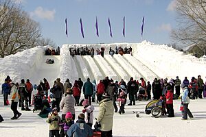
Festivals and Celebrations
Ottawa hosts many annual festivals:
- Winterlude: Canada's largest winter festival, with ice sculptures and skating.
- Canada Day: Big celebrations on Parliament Hill.
- Bluesfest: A major music festival.
- Canadian Tulip Festival: Celebrates the city's beautiful tulips.
- Ottawa Dragon Boat Festival
- Ottawa International Jazz Festival
- Fringe Festival
- Capital Pride
- CityFolk Festival
In 2010, Ottawa won an award as a "World Festival and Event City."
Sports in Ottawa
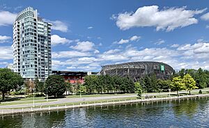
Ottawa has a long history of sports, dating back to the 1800s. The city is currently home to six professional sports teams.
Professional Teams
- The Ottawa Senators are a professional ice hockey team in the National Hockey League. The original Senators team won the Stanley Cup eleven times by 1927. They play at the Canadian Tire Centre.
- The Ottawa Charge joined the Professional Women's Hockey League (PWHL) in 2023. They play at TD Place Arena.
- The Ottawa Redblacks are a professional Canadian Football team in the Canadian Football League. They play at TD Place Stadium.
- Atlético Ottawa is a professional soccer club in the Canadian Premier League. They also play at TD Place Stadium.
- Ottawa Rapid FC of the Northern Super League also play at TD Place Stadium.
- The Ottawa Black Bears, founded in 2024, play in the National Lacrosse League at the Canadian Tire Centre.
- The Ottawa Blackjacks are a professional basketball team in the Canadian Elite Basketball League, playing at TD Place Arena.
- The Ottawa Titans play professional baseball in the Frontier League at Raymond Chabot Grant Thornton Park.
University Sports
The University of Ottawa Gee-Gees and Carleton University Ravens compete in U Sports. Carleton's men's basketball team is especially famous, having won 17 of the last 20 national championships.
Other Sports
Ottawa is also home to the Ottawa 67's junior ice hockey team. Many amateur sports are popular, including soccer, basketball, baseball, and curling. People also enjoy skating, cycling, tennis, hiking, and skiing.
How Ottawa is Governed
The City of Ottawa is a "single-tier municipality." This means it is its own government and provides all local services. Ottawa is governed by the 25-member Ottawa City Council. This includes 24 councillors, each representing a different area (ward), and the mayor, Mark Sutcliffe, who was elected in 2022.
Ottawa is politically diverse. Most of the city usually supports the Liberal Party in federal elections. Areas with many French speakers, like Vanier, are often Liberal. Central Ottawa tends to be more left-leaning, sometimes voting for the New Democratic Party. Suburban and rural areas, especially those further from the city center, tend to be more conservative.
Ottawa is home to 130 embassies from other countries.
Getting Around Ottawa
Public Transit
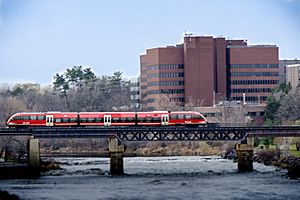
Ottawa's public transportation is managed by OC Transpo. They operate a system that includes:
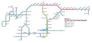
- The O-Train light rail system: This has four lines, with one currently being built.
- Line 1 runs east-west and goes under the downtown area.
- Line 2 runs north-south, connecting the south end of Ottawa to Line 1.
- Line 3 is a branch of Line 1, extending west.
- Line 4 is a 4 km link from Line 2 to the Ottawa Macdonald–Cartier International Airport.
- A large bus rapid transit (BRT) system called the Transitway. This uses special bus-only roads and connects suburbs to the city center.
- Over 190 local bus routes, including double-decker buses.
Both OC Transpo and Gatineau's transit system (STO) offer bus services between Ottawa and Gatineau.
Airports
The main airport is the Ottawa Macdonald–Cartier International Airport. There are also three smaller regional airports: Gatineau-Ottawa Executive Airport, Ottawa/Carp Airport, and Ottawa/Rockcliffe Airport.
Travel Between Cities
Ottawa station is the main train station for travel between cities, operated by Via Rail. It is located east of downtown. Another station, Fallowfield station, serves the southwestern suburbs.
Bus services between cities are provided by several companies at different stops around the city.
Roads and Highways
Ottawa has over 12,200 km of roads and several freeways. The main freeways are Highway 417 (the Queensway) and Highway 416. These connect to other major highways. There are also freeway connections to Gatineau, Quebec.
The city has beautiful parkways like the Kichi Zibi Mikan and Colonel By Drive. These roads are managed by the National Capital Commission and link important attractions.
Biking and Walking
Ottawa has many paved multi-use trails for biking and walking. These pathways run along the Ottawa River, Rideau River, and Rideau Canal. They are used for transportation, tourism, and fun. Cycling is a popular way to get around, even in winter, with over 900 km of cycling paths.
Sparks Street became a pedestrian mall in 1966. Some other streets and parkways are closed to cars on weekends and holidays for pedestrians and cyclists. In 2021, the city approved a plan to make the Byward Market area more pedestrian-friendly.
Famous People from Ottawa
- List of people from Ottawa
See also
 In Spanish: Ottawa para niños
- Outline of Ottawa
- List of francophone communities in Ontario
- World national capitals
- List of Ottawa buildings
- Geography of Ottawa
- Mark Sutcliffe, Current Mayor of Ottawa
 | Jewel Prestage |
 | Ella Baker |
 | Fannie Lou Hamer |


