Rideau River facts for kids
Quick facts for kids Rideau River |
|
|---|---|

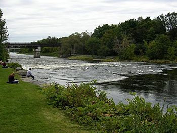
The Rideau River in Ottawa flowing between Carleton University and Vincent Massey Park
|
|
| Other name(s) | Rivière Rideau |
| Country | Canada |
| Province | Ontario |
| Region | Eastern Ontario |
| Physical characteristics | |
| Main source | Upper Rideau Lake United Counties of Leeds and Grenville, Ontario, Canada 44°40′55″N 76°20′10″W / 44.682°N 76.336°W |
| River mouth | Ottawa River City of Ottawa 45°26′29″N 75°41′46″W / 45.441405°N 75.69623°W |
| Length | 100 km (62 mi) |
| Basin features | |
| Progression | Ottawa River→ Saint Lawrence River→ Gulf of Saint Lawrence |
| River system | Ottawa River drainage basin |
| Basin size | 4,000 km2 (1,500 sq mi) |


The Rideau River is a river in Eastern Ontario, Canada. It flows north from Upper Rideau Lake and ends in the Ottawa River. This happens at the Rideau Falls in Ottawa, Ontario. The river is about 146 kilometres (91 mi) long.
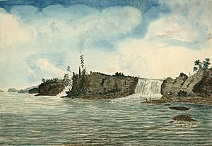
The name "Rideau" comes from a French word meaning "curtain." Samuel de Champlain gave it this name in 1613. He thought the Rideau Falls looked like a curtain. The Ojibwe name for the river is Pasapkedjinawong. This means "the river that passes between the rocks."
The Rideau Canal was built by connecting the Rideau River with the Cataraqui River. This canal lets boats travel from Ottawa to Kingston, Ontario. The Rideau River separates from the canal at Hog's Back Falls in Ottawa.
Every spring, city workers help prevent floods on the lower part of the river. They use special methods to break up the ice. This helps large sheets of ice move away. This practice has been done for over 100 years. The Rideau Valley Conservation Authority helps protect the Rideau River and its smaller streams.
Contents
Exploring the Rideau River's Geography
Smaller Rivers and Streams
Many smaller rivers and streams flow into the Rideau River. These are called tributaries. They add water to the main river.
- Adrians Creek
- Duck Creek
- Tay River
- Black Creek
- Otter Creek
- Rosedale Creek
- Irish Creek
- Babers Creek
- Atkinsons Creek
- Rideau Creek
- Dales Creek
- Brassils Creek
- Murphy Drain
- Kemptville Creek
- McDermott Drain
- Cranberry Creek
- Steven Creek
- Mud Creek
- Jock River
- Black Rapids Creek
- Nepean Creek
- Sawmill Creek
Towns and Cities Along the River
Several communities are located along the Rideau River. These include:
- Ottawa, Ontario
- Manotick, Ontario
- Kars, Ontario
- North Grenville, Ontario
- Merrickville, Ontario
- Smiths Falls, Ontario
History of the Rideau River
The Rideau River has an interesting history. It was important for travel and settlement.
Early Explorers and Names
Samuel de Champlain was one of the first Europeans to see the river. He named it rideau because the Rideau Falls looked like a curtain. This French word means "curtain."
Transportation and Settlement
In the past, the river was a key route for travel. It connected the Ottawa River and the Saint Lawrence River. The land along the Rideau River was very fertile. This attracted settlers, especially loyalists. They were looking for good farmland. This led to the growth of towns and farms in the area.
After the War of 1812, a special waterway was built. It was designed by John By. This waterway connected Kingston to Montreal through the Rideau River. It helped with transportation and defense.
See also
 In Spanish: Río Rideau para niños
 | Victor J. Glover |
 | Yvonne Cagle |
 | Jeanette Epps |
 | Bernard A. Harris Jr. |


