Kanata, Ontario facts for kids
Quick facts for kids
Kanata
|
|
|---|---|
|
Community
|
|

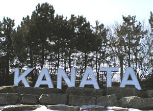
Three-metre-high sign at Kanata's eastern boundary
|
|
| Country | Canada |
| Province | Ontario |
| City | Ottawa |
| Incorporated | 1978 |
| Amalgamated | 2001 |
| Area | |
| • Land | 132.21 km2 (51.05 sq mi) |
| In 2001, at time of dissolution | |
| Population
(2021)
|
|
| • Community | 98,938 (Former city) |
| • Urban | 137,118 |
| Time zone | UTC−5 (Eastern (EST)) |
| • Summer (DST) | UTC−4 (EDT) |
| Postal code FSA |
K2L, K2M, K2K
|
| Area code(s) | 613, 343, 753 |
| Website | http://web.ncf.ca/aj624/kanata.html |
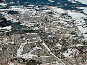
Kanata (pronounced kə-NAT-ə) is a large community and former city in Ottawa, Ontario, Canada. It is located about 22 kilometres (14 miles) west of downtown Ottawa. In 2021, the area that used to be the City of Kanata had about 98,938 people. If you include the nearby community of Stittsville, the total population was 137,118. Before it joined Ottawa in 2001, Kanata was one of the fastest-growing cities in Canada. It is just west of Ottawa's Greenbelt and is one of the biggest communities surrounding central Ottawa.
Contents
- Exploring Kanata's Past
- Kanata's Location and Surroundings
- Main Neighbourhoods of Kanata
- South March: Growing North
- Kanata North Business Park: Silicon Valley North
- Marchwood Lakeside (Kanata Lakes)
- Beaverbrook: Kanata's Oldest Neighbourhood
- Kanata Town Centre: Shopping and Homes
- Terry Fox Business Park: Sports and Big Stores
- Katimavik-Hazeldean
- Glen Cairn: An Older Community
- Kanata South Business Park: Developing Fast
- Bridlewood: A Growing Neighbourhood
- Kanata's Economy
- Important Buildings and Places
- Local Media
- Sports in Kanata
- Arts and Culture
- Schools in Kanata
- Kanata's Population Growth
- See also
Exploring Kanata's Past
Kanata was once part of March Township. European settlers first arrived here in the early 1800s. For a long time, the area was mostly farmland.
How Kanata Became a Modern Community
In the 1960s, a planner and developer named Bill Teron bought a lot of land in the area. He wanted to build a special "model community." Unlike typical suburbs, Kanata was planned to have different types of homes and businesses. It also had many open green spaces. The idea was to create a "garden city," where each part of the community would have its own shops and unique feel.
Some of these planned communities include:
- Beaverbrook
- Glen Cairn
- Bridlewood
- Katimavik
- Hazeldean
- Morgan's Grant
- Kanata Lakes
The very first street built was Tiffany Crescent in 1964.
The Rise of Kanata's Tech Industry
Bill Teron also set aside land for a technology park. He believed that Kanata could become a hub for high-tech companies. Many scientists and researchers were already in Ottawa because of government jobs. To attract the first tech companies, he offered them land for free, only asking them to pay for setting up services. This brought companies like Atomic Energy Canada, Northern Electric, and Mitel to Kanata.
The community grew quickly as more tech workers moved in. In 1978, the Province of Ontario officially made Kanata a city. The new city included parts of March, Goulbourn, and Nepean townships. Residents voted on the name "Kanata," choosing it over "Hazeldean," "March," and "Kairnwood."
Remembering Those Who Served
On September 20, 1998, Kanata dedicated a special monument called a cenotaph in Village Green Memorial Park. It honours people who served their country in times of war and peace.
Later, in December 2006, the Kanata Avenue–Castlefrank Road overpass was renamed Valour Bridge. This bridge honours all Canadians who have served in battles and campaigns since the 1900s.
Kanata Joins Ottawa
Kanata remained its own city until 2001. That year, the province created a new, larger City of Ottawa. Kanata, with a population of about 59,700 at the time, became part of this new city.
Kanata Today: A Tech Hub
Kanata has grown into an important high-tech centre. Many major tech companies have offices here, including Ericsson, Avaya, Juniper Networks, BlackBerry, Mitel, Nokia, Dell Canada, HP, and Cisco. These companies are mostly found in the Kanata North Business Park and Kanata Research Park, as well as the Kanata South Business Park.
Kanata's Location and Surroundings
Kanata is located in the Ottawa Valley, about 22 kilometres (14 miles) west of downtown Ottawa. It covers an area of about 139 square kilometres (54 square miles). The northern part of Kanata is close to the Ottawa River.
Green Spaces and Nearby Communities
To the east, Kanata is separated from the former City of Nepean by the National Capital Commission's Greenbelt. The community of Bells Corners is just inside this Greenbelt. Bells Corners is also a tech suburb that started around 1950.
The Carp River flows through the western part of Kanata. To the southwest are the communities of Stittsville and Richmond. Many people who work in Kanata's tech industry live in these nearby areas.
Main Neighbourhoods of Kanata
Kanata is made up of several distinct neighbourhoods. Here are some of the main ones, listed from north to south:
South March: Growing North
This area is north of the Kanata North Business Park. It is bounded by Terry Fox Drive to the south and the urban boundary to the north. Many new homes are being built here. The area west of March Road is often called Morgan's Grant. The area east of March Road includes Briarbrook, Briar Ridge, and Brookside.
Kanata North Business Park: Silicon Valley North
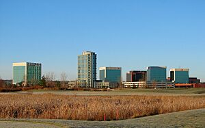
This area was known as "Silicon Valley North" in the late 1990s because of all the tech companies. It is home to companies like BlackBerry, Nokia, Dell, Mitel, and Cisco. The 18-story Brookstreet Hotel is located here, surrounded by the Marshes Golf Club. This golf course is open to the public.
Marchwood Lakeside (Kanata Lakes)
Often called Kanata Lakes, this neighbourhood has a main street called Kanata Avenue. It runs north-south and connects to Highway 417. This area has another 18-hole golf course, but it is not open to the public.
Beaverbrook: Kanata's Oldest Neighbourhood
Beaverbrook is the first and oldest neighbourhood in Kanata. It is known for its houses with hedges and its community facilities.
Kanata Town Centre: Shopping and Homes
This area is split by Highway 417. North of the highway, you'll find many townhomes and Kanata's main shopping area, the Kanata Entertainment Centrum. This centre has big stores, a movie theatre, and other shops. South of the highway, there's a mix of homes, schools, and businesses.
Terry Fox Business Park: Sports and Big Stores
This park is home to the Canadian Tire Centre, which is the arena for the Ottawa Senators hockey team. You'll also find many large stores here, like Home Depot, Staples, Canadian Tire, and Costco. The Bell Sensplex is also in this area, offering multiple ice rinks and an indoor soccer field.
Katimavik-Hazeldean
This is a well-established residential area with a mix of housing types.
Glen Cairn: An Older Community
Glen Cairn is one of Kanata's older neighbourhoods, along with Beaverbrook. It has a mix of housing and is bordered by the Trans Canada Trail.
Kanata South Business Park: Developing Fast
This area is still developing. Many smaller high-tech companies are located here. A large grocery store recently opened, and new homes and offices are being built in the southern part of this park.
Bridlewood: A Growing Neighbourhood
Bridlewood was originally part of the City of Nepean but became part of Kanata in 1978. It is still growing, with several new residential projects underway. Parts of southern Bridlewood are also known as Emerald Meadows or Monahan Landing.
Kanata's Economy
Kanata is a major economic centre, especially for technology. First Air, a Canadian airline, has its main office here.
The Kanata Research Park
The Kanata Research Park is Canada's largest technology park. It is a very important location for many high-tech companies. Some of the companies located here include Mitel, Ericsson, BlackBerry Canada, Nokia, Ciena, and Cisco.
Important Buildings and Places
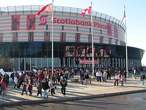
- Canadian Tire Centre: This is the home arena for the Ottawa Senators professional ice hockey team. It also hosts concerts and other big events. It has had several names over the years, including the Palladium, Corel Centre, and Scotiabank Place.
- The Kanata Recreation Complex: This complex has two skating rinks, a toboggan hill for winter fun, and a splash pad for summer.
- The Kanata Leisure Centre and Wave Pool: A great place for swimming and water activities.
- The Brookstreet Hotel: A luxury hotel located in the Kanata Research Park.
- The Kanata Centrum power centre: This is one of Ottawa's largest shopping centres, with many big stores and a movie theatre.
- The Royal Canadian Legion's national headquarters: This building is near the Kanata Leisure Centre. The bridge over Highway 417 nearby was named Valour Bridge in 2006 to honour Canada's Armed Forces.
- Ron Maslin Playhouse: A 350-seat theatre that opened in 1996. It was built by volunteers from a theatre company started in 1968.
- Bell Sensplex: This facility has four ice rinks (three NHL-sized and one Olympic-sized), an indoor soccer field, and a restaurant.
- Landmark Cinemas Kanata 24: The largest movie theatre in Ottawa, located in the Kanata Centrum.
- Jack Charron Arena (formerly The Glen Cairn Arena): Another ice rink for hockey and skating.
- Hazeldean Branch – Ottawa Public Library: A local library branch.
- Glen Cairn Tennis Courts: Four hard-courts for playing tennis.
- Hazeldean Mall: An indoor shopping mall.
- Tanger Outlet Mall: A large outdoor shopping complex that opened in 2014, located across from the Canadian Tire Centre.
Local Media
Kanata has its own community newspaper called The Kanata Community Voice. It is delivered every two weeks to homes and businesses in the area. This newspaper started in March 2018.
The Kanata Kourier-Standard was an older community newspaper. It was formed in 1989 by combining two older papers: the Kanata Kourier (started in 1983) and the Kanata Standard (started in 1965). This paper stopped publishing in January 2018.
Sports in Kanata
Kanata is famous for being home to the Ottawa Senators professional ice hockey team, who play at the Canadian Tire Centre. There's also a women's Ottawa Senators team that plays at the Bell Sensplex.
Youth Sports
- The Bell Capital Cup: A big youth ice hockey tournament held at the Sensplex during the Christmas holidays.
- The Kanata Lasers: A junior hockey team that plays at the Kanata Recreational Complex.
- The Kanata Soccer Club: This is the largest sports club in Kanata and the second largest in Ottawa, with almost 4,500 players.
- The Kanata Rhythmic Gymnastics Club: The biggest rhythmic gymnastics club in Ontario, started in 1975.
- Olympia Gymnastics: The first artistic gymnastics and recreational centre in the area, founded in 2005.
- The Kanata Knights football club: One of the 16 teams in the National Capital Amateur Football Association (NCAFA). They play at Robert Barr field.
Arts and Culture
Kanata has a lively arts scene. Some of the arts groups include:
- The Kanata Symphony
- Kanata Civic Art Gallery
- Kanata Theatre
Schools in Kanata
Kanata has many schools, including public and Catholic schools, offering education in English and French.
Elementary Schools
Kanata has several English public elementary schools, such as:
- Bridlewood Community Elementary School
- Castlefrank Elementary School
- Glen Cairn Public School
- Jack Donohue Public School
- John Young Elementary School
- Kanata Highlands Public School
- Katimavik Elementary School
- Roch Carrier Elementary School
- Roland Michener Public School
- South March Public School
- Stephen Leacock Public School
- W. Erskine Johnston Public School
- W. O. Mitchell Elementary School
There are also English Catholic elementary schools:
- Georges Vanier Catholic School
- St. Anne Catholic School
- St Gabriel Catholic School
- St Isidore Catholic School
- St James Catholic School
- St Martin de Porres Catholic School
For French-speaking students, there are French Catholic elementary schools:
- École élémentaire catholique Élisabeth-Bruyère
- École élémentaire catholique Roger-Saint-Denis
- École élémentaire catholique Saint-Remi
And French public elementary schools:
- Ecole Elementaire Publique Julie-Payette
- École élémentaire publique Maurice-Lapointe
Kanata also has Montessori schools:
- Becca's Home Montessori
- Kanata Montessori School
- March Montessori School and Childcare Centre Kanata (Ottawa)
High Schools
For older students, Kanata has public high schools:
- A.Y. Jackson Secondary School
- Earl of March Secondary School
And Catholic high schools:
- All Saints Catholic High School
- Holy Trinity Catholic High School
Kanata's Population Growth
Kanata has grown a lot over the years. Here's how its population has changed:
- Population (2011): 80,781
- Population (2006): 70,078
- Population (2001): 58,636
- Population (1996): 47,909
- Population (1991): 37,344
Population by Neighbourhood in 2021
| Neighbourhood | Population (2021) | Area (km2.) | Density (per km2.) |
|---|---|---|---|
| Beaverbrook | 5,094 | 2.592 | 1964.975 |
| Briarbrook / Brookside | 5,919 | 5.66 | 1045.797 |
| Bridlewood | 9,691 | 2.890 | 3353.287 |
| Emerald Meadows / Monahan Landing | 16,133 | 3.513 | 4592.371 |
| Glen Cairn / Trailwest | 15,963 | 6.397 | 2495.388 |
| Lakeside | 6,552 | 3.403 | 1925.36 |
| Kanata Town Centre / Village Green | 6,109 | 2.498 | 2445.752 |
| Katimavik-Hazeldean | 9,315 | 3.189 | 2920.978 |
| Marchwood / Arcadia | 10,990 | 11.33 | 969.991 |
| Morgan's Grant | 9,590 | 4.423 | 2,168.212 |
| Rural former March Township | 3,762 | 88.511 | 42.503 |
| Total | 99,118 | 134.406 | 737.452 |
See also
 In Spanish: Kanata para niños
 | Shirley Ann Jackson |
 | Garett Morgan |
 | J. Ernest Wilkins Jr. |
 | Elijah McCoy |


