Sodus Bay facts for kids
Quick facts for kids Sodus Bay |
|
|---|---|

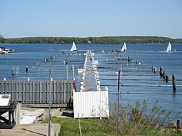
Flooded marina on the bay
|
|
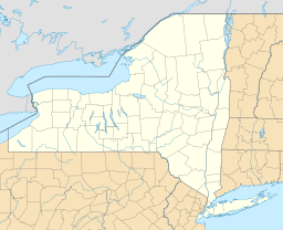
| Coordinates | 43°15′25″N 76°58′01″W / 43.257°N 76.967°W |
| Type | Bay |
| Native name | Assorodus Error {{native name checker}}: parameter value is malformed (help) |
| Etymology | Seneca for "silvery water" |
| Primary inflows | First Creek, Second Creek, Third Creek, Sodus Creek West, Sodus Creek East (Glenmark Creek), Clark Creek |
| Primary outflows | Lake Ontario |
| Managing agency | New York State Department of Environmental Conservation |
| Max. length | 3 miles (4.8 km) |
| Max. width | 2 miles (3.2 km) |
| Surface area | 3,357 acres (1,359 ha) |
| Average depth | 18 feet (5.5 m) |
| Max. depth | 48 feet (15 m) |
| Surface elevation | 247 feet (75 m) |
| Islands | Eagle, LeRoy, and Newark |
| Settlements | Huron, Sodus, Sodus Point |
Sodus Bay is a beautiful bay located on the southern shore of Lake Ontario. Lake Ontario is one of the five Great Lakes in North America. Sodus Bay is found in Wayne County, New York, USA. Most of the bay is in the Town of Huron. A smaller part is in the Town of Sodus.
Sometimes, Sodus Bay is called "Great Sodus Bay." This helps people tell it apart from "Little Sodus Bay." Little Sodus Bay is located to the east, in the Town of Sterling. Sodus Bay is about halfway between the cities of Rochester and Syracuse.
Sodus Bay is a large inlet of Lake Ontario. A long strip of land, about 7,500 feet (2,286 meters) long, separates it from the main lake. The bay itself is about 4.4 miles (7.1 km) long and 2.4 miles (3.9 km) wide. It's a popular spot for many activities. You can find 12 marinas, 13 waterfront restaurants, and a public beach here. There are also two public access points and a sailing school.
The land around Sodus Bay is called its watershed. This area includes different types of land. About 30% is used for farming. Forests cover 61% of the land. Wetlands make up 4%, and developed areas are 4%. Several creeks flow into the bay. These include First Creek, Second Creek, Third Creek, Sodus Creek West, Sodus Creek East (also called Glenmark Creek), and Clark Creek.
The towns of Huron, Sodus, Rose, Galen, Lyons, and the Village of Sodus Point are all in the Sodus Bay watershed. This watershed covers about 46 square miles (119 square kilometers).
Contents
Nature and Wildlife
The bays along Wayne County's shoreline are very important for nature. They have over 6,807 acres (2,755 hectares) of protected wetlands. These wetlands are home to many different plants and animals. Over 36 types of aquatic plants grow here. This includes three protected species, like the American Lotus. The protected softshell turtle also lives in these waters.
Chimney Bluffs State Park is a cool place to visit. It's located in the northeast part of the bay. This park is famous for its tall, clay cliffs.
A group called Sea Scout Ship 303 uses Sodus Bay. They are based in Webster, New York. They operate a large sailing ship called the schooner S.S.S. Lotus.
History of Sodus Bay
Early Days and Names
Long ago, before Europeans arrived, Native American people lived here. The Onondaga Nation called the bay "Assorodus." This name means "Silvery Waters." It describes how the bay looked in the sunlight. Around 1794, European settlers started to build a community. This community is now known as Sodus Point.
War of 1812 Impact
During the War of 1812, there was a battle here. British forces attacked the community. Most of the buildings were burned down. This was a tough time for the early settlers.
Shakers and Their Community
A group of people called the Shakers once lived near Sodus Bay. They had a special way of life. They left the area around 1836. They felt that the area was becoming too busy and "worldly" for their quiet lifestyle.
Lighthouses and Shipping
A lighthouse was built on the western side of the bay in 1870. This lighthouse helped guide ships safely. It replaced an older lighthouse that was built even earlier, in 1824. Sodus Bay was a very important port. A train line connected the bay to Pennsylvania. This allowed coal to be brought by train and then loaded onto ships on Lake Ontario.
Geography of the Bay
Sodus Bay has a few islands. These are Eagle Island, LeRoy Island, and Newark Island. These are the only islands found in the south-central part of Lake Ontario. They add to the unique look of the bay.
 | John T. Biggers |
 | Thomas Blackshear |
 | Mark Bradford |
 | Beverly Buchanan |


