Wilson (village), New York facts for kids
Quick facts for kids
Wilson
|
||
|---|---|---|
| Village of Wilson | ||
 |
||
|
||
| Motto(s):
Let Each Live in Harmony with Earth, Sea, and One Another
|
||
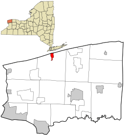
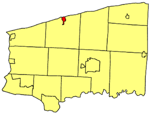
Location in Niagara County and the state of New York.
|
||
| Country | United States | |
| State | New York | |
| County | Niagara | |
| Named for | Luther Wilson | |
| Area | ||
| • Total | 1.00 sq mi (2.60 km2) | |
| • Land | 0.81 sq mi (2.11 km2) | |
| • Water | 0.19 sq mi (0.49 km2) | |
| Elevation | 344 ft (105 m) | |
| Population
(2020)
|
||
| • Total | 1,247 | |
| • Density | 1,533.83/sq mi (592.14/km2) | |
| Time zone | UTC-5 (Eastern (EST)) | |
| • Summer (DST) | UTC-4 (EDT) | |
| ZIP code |
14172
|
|
| Area code(s) | 716 | |
| FIPS code | 36-82359 | |
| GNIS feature ID | 971408 | |
| Website | www.wilsonnewyork.com | |
Wilson is a small village located in Niagara County, New York. In 2010, about 1,264 people lived here. The village is named after Luther Wilson. It is part of the larger Buffalo–Niagara Falls area.
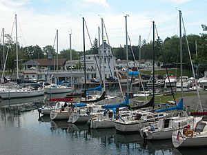
The Village of Wilson is found within the Town of Wilson, in the northern part of Niagara County. It became an official village on May 11, 1858. Wilson has a small boat harbor on Lake Ontario. This harbor is great for fishing, especially for bass, trout, and salmon.
Contents
Exploring Wilson's Past
The Village of Wilson became official in 1858. It was named after Luther Wilson, whose father, Reuben Wilson, founded the larger Town of Wilson. Luther Wilson was very clever, even as a teenager.
Luther Wilson's Clever Idea
During the War of 1812, when Luther was just 14, he showed his quick thinking. Settlers were warned that the British were coming. They quickly gathered their belongings and about 25 cattle. Luther was tasked with moving the cattle safely. To keep the British from hearing the cow bells, he stuffed dry leaves into them! He successfully moved the cattle about 5 miles (8 km) away. After the British left, Luther brought the cattle back to Wilson.
Developing the Village
As an adult, Luther Wilson became a successful businessman. He started many important projects in Wilson. In 1827, he began the hamlet of Wilson, New York. He planned out lots along Young Street. In 1829, a tavern was added to his father's store. This place was popular with early settlers and soldiers.
In 1834, Luther and his father built the "Ontario House." This cobblestone building was a well-known hotel until it burned down in 1894. Luther also helped start the first Methodist-Episcopal church in town in 1835. He later helped build a new church building. He also improved his father's grist mill by adding steam power. In 1844–45, Luther built his own cobblestone home, now known as the "Wilson House." During this time, he was also elected to the state assembly.
Building the Harbor and Industry
In 1846, Luther Wilson created the harbor. He got permission to build two 200-foot (61 m) piers into Lake Ontario. For 20 years, he paid to dredge the channel, making it deeper for boats. He also built a large storehouse for shipping grain and fruit. He even started a shipyard where he built a schooner (a type of sailing ship) named after his son, Reuben F. Wilson. This began a new industry in Wilson. About 20 schooners were built at the harbor until 1875. In 1848, Luther also helped make Wilson a Port of Entry, which meant ships could officially enter the country here.
Wilson's Official Start
The Village of Wilson officially became a village on May 11, 1858. It covered about 416 acres (1.7 km²) and had 715 people. Luther Wilson was chosen as the first president of the village board. When the R.W. & O. Railroad came through Wilson in 1875, it went through the old cemetery. Luther donated 8 acres (3.2 ha) of land for a new cemetery, called "Greenwood Cemetery." His remains were moved there. Luther was also interested in the military and served as a captain.
Luther Wilson supported many churches in Wilson. He gave land for the first Presbyterian and Baptist churches. He was loved and respected by everyone. He passed away in Wilson in 1890 at 92 years old and was buried in Greenwood Cemetery.
Wilson's Role in Wars
Many men from Wilson have served in the military. During the American Civil War, a Wilson native named Ira S. Pettit joined the Union Army. He sadly died in 1864. His diary was later published. Wilson lost many men in different wars: 50 in the Civil War, 6 in World War I, 28 in World War II, 3 in the Korean War, and 5 in the Vietnam War.
Geography and Nature
The village of Wilson covers about 1.0 square mile (2.6 km²). Most of this is land, but about 0.2 square miles (0.5 km²) is water.
Wilson is located where New York State Route 18 and New York State Route 425 meet. It is just east of the mouth of Twelve Mile Creek. Wilson-Tuscarora State Park is on the western side of the village. This park is a great place for picnics, canoeing, swimming, and hiking.
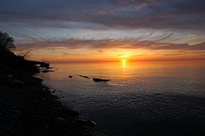
The village sits on the southern shore of Lake Ontario. On a clear day, you might even see the tall buildings of Toronto, Canada, across the lake. The CN Tower is just over 30 miles (48 km) away!
Sunset Island: A Unique Spot
Sunset Island forms the northern edge of Wilson Harbor. It is mostly used during certain seasons. You can usually reach the island by boat. The eastern part of the island has a large area for games and picnics. There's also a small store and library called the "Fire House." It holds fire equipment and a defibrillator. A large round building called "Colony Hall" is used for meetings and parties.
Sunset Island is actually two islands connected by a narrow strip of land. Sometimes, strong storms can wash away this strip, making them separate islands. The smaller western island is connected to the mainland through Tuscarora State Park by a path. However, most people still use boats to get there. In the past, there were hotels on the island, but they are now gone due to fires, storms, and time.
Population and People
| Historical population | |||
|---|---|---|---|
| Census | Pop. | %± | |
| 1870 | 661 | — | |
| 1880 | 662 | 0.2% | |
| 1890 | 683 | 3.2% | |
| 1900 | 612 | −10.4% | |
| 1910 | 655 | 7.0% | |
| 1920 | 631 | −3.7% | |
| 1930 | 660 | 4.6% | |
| 1940 | 849 | 28.6% | |
| 1950 | 962 | 13.3% | |
| 1960 | 1,320 | 37.2% | |
| 1970 | 1,284 | −2.7% | |
| 1980 | 1,259 | −1.9% | |
| 1990 | 1,307 | 3.8% | |
| 2000 | 1,213 | −7.2% | |
| 2010 | 1,264 | 4.2% | |
| 2020 | 1,247 | −1.3% | |
| U.S. Decennial Census | |||
In 2000, there were 1,213 people living in Wilson. These people lived in 505 households, with 348 of them being families. The village had a population density of about 1,474.5 people per square mile (569.3 per km²).
About 98.93% of the people were White. A small number were African American, Native American, Asian, Pacific Islander, or from other backgrounds. About 0.49% of the population was Hispanic or Latino.
In terms of age, about 24.1% of the population was under 18. About 17.3% were 65 or older. The average age in the village was 41 years old.
The average income for a household in Wilson was $36,534. For families, the average income was $42,656. About 4.6% of the people in Wilson lived below the poverty line.
Learning and Education
Wilson has a long history of education. In 1845, a special school called a Collegiate Institute was started. It opened in the fall of 1846 with 339 students! Many students came from other states and even Canada. The school had very high standards. Students had to go to church every Sunday and be in their rooms by 7:30 PM, except on Fridays for social activities.
Over time, as other schools were built, fewer students attended the Collegiate Institute. In 1869, it needed state help to keep going. There was a big debate about combining four school districts to form a "Wilson Union Free School." Many people were against it because they didn't want to pay taxes for a free school. Eventually, after a tie vote and some clever persuasion, the Union Free School was created.
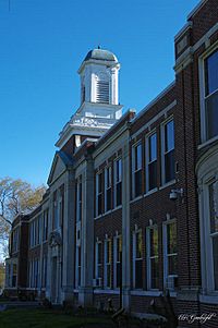
This Union Free School later became Wilson High School around 1900. Its use changed in 1935 when the current high school building was built across the street. The old school was used for some classes until 1956 and then burned down in 1957. Today, the Wilson Town Hall stands where the Union Free school once was.
Today, Wilson has a public school system with about 1,700 students. It includes Wilson Elementary, Wilson Central Middle School, and Wilson High School. The school district covers about 144 square miles (373 km²). It includes Wilson and parts of other towns like Ransomville, Youngstown, Newfane, Cambria, Lockport, and Porter.
Notable People from Wilson
- DeWitt Bristol Brace (1859–1905), a physicist, was born in Wilson.
- Earl Brydges, a former New York State Senator, lived in Wilson.
- Frank A. Cipolla, a Brigadier General, was born in Wilson.
- Virginia Dox (1851–1941), an educator and speaker, was born in Wilson.
- Rexford Guy Tugwell (1891–1979), who was part of President Franklin D. Roosevelt's "Brains Trust" and later Governor of Puerto Rico, grew up in Wilson.
See also
 In Spanish: Wilson (Nueva York) para niños
 | Leon Lynch |
 | Milton P. Webster |
 | Ferdinand Smith |


