Lockport (town), New York facts for kids
Quick facts for kids
Lockport
|
|||
|---|---|---|---|
| Town of Lockport | |||
|
|||

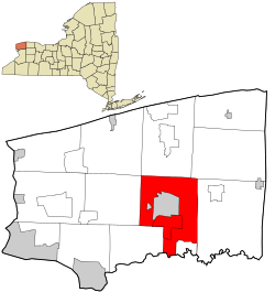
Location in Niagara County and the state of New York
|
|||
| Country | |||
| State | |||
| County | Niagara | ||
| Government | |||
| • Type | Town Council | ||
| Area | |||
| • Total | 44.90 sq mi (116.28 km2) | ||
| • Land | 44.84 sq mi (116.14 km2) | ||
| • Water | 0.05 sq mi (0.13 km2) | ||
| Elevation | 630 ft (192 m) | ||
| Population
(2010)
|
|||
| • Total | 20,529 | ||
| • Estimate
(2016)
|
20,094 | ||
| • Density | 448.10/sq mi (173.01/km2) | ||
| Time zone | UTC-5 (Eastern (EST)) | ||
| • Summer (DST) | UTC-4 (EDT) | ||
| ZIP codes |
14094-14095
|
||
| Area code(s) | 716 | ||
| FIPS code | 36-43093 | ||
| GNIS feature ID | 0979165 | ||
Lockport is a town in Niagara County, New York, United States. In 2010, about 20,529 people lived here. The town gets its name from the special "locks" on the Erie Canal. These locks help boats travel up and down hills of water. They lift boats from the lower lands near Lake Ontario over the Niagara Escarpment. The Town of Lockport is in the middle-south part of Niagara County. It completely surrounds the City of Lockport.
Contents
History of Lockport Town
Many of the first people to settle here were Quakers. They were important in making the area a strong supporter of anti-slavery. The Town of Lockport was officially created in 1824. It was formed from parts of Cambria and Royalton. This happened in the same year the Erie Canal was finished up to the City of Lockport.
Cold Springs Cemetery is a historic place in the town. It was added to the National Register of Historic Places in 2004.
Geography and Location
The Town of Lockport covers about 44.7 square miles (115.8 square kilometers). Most of this area, 44.6 square miles (115.6 square kilometers), is land. Only a small part, 0.1 square mile (0.2 square kilometers), is water.
The southern edge of the town is marked by Tonawanda Creek. The famous Erie Canal runs through the northern part of the town. It also goes through the City of Lockport. New York State Route 78 forms the western border of the town.
Neighboring Towns and Cities
The Town of Lockport shares its borders with several other towns and one city:
- Town of Cambria is to the west.
- Erie County and the Town of Clarence are to the south.
- Town of Pendleton is to the southwest.
- Town of Royalton is to the east.
- Town of Newfane is to the north.
- Town of Hartland is to the northeast.
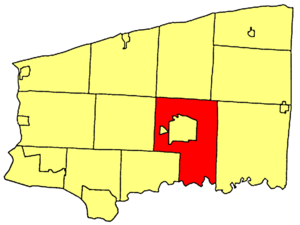
- The City of Lockport is completely surrounded by the Town of Lockport.
Main Roads in Lockport Town
Several important highways pass through the Town of Lockport:
 New York State Route 31 runs from east to west. It goes through the town and the City of Lockport.
 New York State Route 77 is a north-south road. It starts near the City of Lockport and goes into the Town of Royalton.
 New York State Route 78 travels north and south. It goes from the Amherst town line, through the City of Lockport, and up to the Newfane town line.
 New York State Route 93 is an east-west road. It passes south of the city and then turns north. Part of it runs together with NY 31.
Population and People
| Historical population | |||
|---|---|---|---|
| Census | Pop. | %± | |
| 1830 | 3,823 | — | |
| 1840 | 9,125 | 138.7% | |
| 1850 | 12,323 | 35.0% | |
| 1860 | 13,523 | 9.7% | |
| 1870 | 3,032 | −77.6% | |
| 1880 | 2,847 | −6.1% | |
| 1890 | 2,773 | −2.6% | |
| 1900 | 2,585 | −6.8% | |
| 1910 | 2,399 | −7.2% | |
| 1920 | 1,833 | −23.6% | |
| 1930 | 2,720 | 48.4% | |
| 1940 | 3,160 | 16.2% | |
| 1950 | 3,945 | 24.8% | |
| 1960 | 6,492 | 64.6% | |
| 1970 | 8,177 | 26.0% | |
| 1980 | 12,942 | 58.3% | |
| 1990 | 16,596 | 28.2% | |
| 2000 | 19,655 | 18.4% | |
| 2010 | 20,529 | 4.4% | |
| 2020 | 20,563 | 0.2% | |
| U.S. Decennial Census | |||
In 2010, the town had 20,529 people living in 8,293 homes. About 5,482 of these were families. The population was mostly White (91.1%). About 4.8% were Black or African American. Other groups included Native American (0.4%) and Asian (1.0%). About 2.6% of the population identified as Hispanic or Latino.
In 2000, about 33.3% of homes had children under 18. More than half (55.4%) were married couples. The average household had 2.52 people. The average family had 3.03 people.
The population was spread out by age. About 25.3% were under 18. About 30.4% were between 25 and 44 years old. The median age was 37 years. This means half the people were younger than 37 and half were older.
The average income for a household in the town was $45,977. For families, it was $55,414. About 7.7% of all people lived below the poverty line. This included 10.8% of those under 18.
Education in Lockport
Most students in the Town of Lockport attend schools in the Lockport City School District. However, smaller parts of the town are served by other school districts. These include Akron Central School District, Newfane Central School District, Royalton-Hartland Central School District, and Starpoint Central School District.
Communities and Places in Lockport Town
- Carlisle Gardens – A neighborhood next to the east side of Lockport. It has many homes built in the 1920s.
- County Fair Grounds – Located north of the City of Lockport.
- Highland Park – A place north of the City of Lockport, near the fair grounds.
- Nottingham Estates – Found east of the City of Lockport, north of Route 31.
- Rapids – A small village on the southern border of the town.
- Raymond – A location northwest of Rapids.
- Ridge Lea – A place north of the City of Lockport.
- Shooktown – A location east of the City of Lockport. This area was settled by the Shook family in the 1830s.
- South Lockport – A community next to the south side of the City of Lockport.
- Wrights Corners – A small village on the northern town line. It's where NY 78 and NY 104 meet. Part of it is in the Town of Newfane.
- City of Lockport – This city is located in the north-central part of the town. The town surrounds it.
- Lockport Mall – This used to be a shopping mall in South Lockport. It was mostly empty by 2007. Demolition started in 2011. Now, a new Walmart supercenter stands on part of the old mall's land.
See also
 | Roy Wilkins |
 | John Lewis |
 | Linda Carol Brown |


