Hartland, New York facts for kids
Quick facts for kids
Hartland
|
|
|---|---|
| Town of Hartland | |

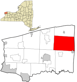
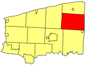
Location in Niagara County and the state of New York.
|
|
| Country | United States |
| State | New York |
| County | Niagara |
| Named for | Hartland, Vermont |
| Government | |
| • Type | Town Council |
| Area | |
| • Total | 52.41 sq mi (135.75 km2) |
| • Land | 52.38 sq mi (135.66 km2) |
| • Water | 0.04 sq mi (0.10 km2) |
| Elevation | 361 ft (110 m) |
| Population
(2010)
|
|
| • Total | 4,117 |
| • Estimate
(2016)
|
4,007 |
| • Density | 76.50/sq mi (29.54/km2) |
| Time zone | UTC-5 (Eastern (EST)) |
| • Summer (DST) | UTC-4 (EDT) |
| FIPS code | 36-32490 |
| GNIS feature ID | 0979054 |
Hartland is a small town in Niagara County, New York, United States. It's located on the eastern side of the county. In 2010, about 4,117 people lived here.
The town got its name from Hartland, Vermont. This is where some of the first people who settled in the area came from.
Contents
History of Hartland
Hartland was first settled in 1803 by Zebulon Barnum, Isaac Southwell, and John Morrison. The town itself was officially created in 1812. It was formed from a part of the Town of Cambria.
Over time, other towns were created from parts of Hartland. These included Somerset, Royalton, and Newfane. This happened by 1824.
When the Erie Canal was finished in 1824, Hartland's importance as a trading center changed. The city of Lockport, which was built around the canal, became the main business hub instead.
Several buildings in Hartland are very old and important. They are listed on the National Register of Historic Places. This means they are protected because of their history. These include the Constant Riley W. Bixby House, the Amzi Bradley Farmstead, the District#10 Schoolhouse, the Harrington Cobblestone Farmhouse and Barn Complex, and the Philo Newton Cobblestone House.
Where is Hartland?
Hartland covers an area of about 52.4 square miles (135.7 square kilometers). Most of this area is land, with a very small amount of water.
The eastern border of Hartland is also the border of Orleans County. Part of this border is marked by New York State Route 269. A main road called Ridge Road, also known as New York State Route 104, runs across the town.
Famous People from Hartland
Some notable people have come from Hartland:
- Henry H. Bickford – A soldier who fought in the American Civil War. He received the Medal of Honor, a very brave award.
- S. Wallace Dempsey – A former member of the U.S. Congress.
- Newton Edmunds – He was the second Governor of Dakota Territory.
Nearby Towns and Areas
Hartland is surrounded by several other towns:
- To the north is the Town of Somerset.
- To the south are the Town of Royalton and a small part of the Town of Lockport.
- To the west is the Town of Newfane.
- To the east is the Town of Ridgeway in Orleans County.
Here's a list of the towns next to Hartland:
- Orleans County, Town of Ridgeway - east
- Town of Royalton - south
- Town of Lockport - southwest
- Town of Newfane - west
- Town of Somerset - north
Main Roads in Hartland
Several important roads run through the Town of Hartland:
 New York State Route 104 (Ridge Rd.) – This road goes from east to west across the town. It connects from the Newfane town line to the border of Niagara and Orleans Counties.
 New York State Route 148 (Quaker Rd.) – This road goes from north to south through the middle of town. It starts at Ridge Road (NY 104) and goes north to the Town of Somerset.
 New York State Route 269 (County Line Rd.) – This road also goes north to south. It forms the eastern border of the town and the county line. It runs from Ridge Road (NY 104) north into the Town of Somerset.
 New York State Route 271 (Stone Rd., Main St. (Middleport)) – This road is in the southeastern part of town. It goes from Ridge Road (NY 104) south into Middleport.
Who Lives in Hartland?
| Historical population | |||
|---|---|---|---|
| Census | Pop. | %± | |
| 1820 | 1,448 | — | |
| 1830 | 1,584 | 9.4% | |
| 1840 | 2,350 | 48.4% | |
| 1850 | 3,028 | 28.9% | |
| 1860 | 3,256 | 7.5% | |
| 1870 | 3,226 | −0.9% | |
| 1880 | 3,340 | 3.5% | |
| 1890 | 2,843 | −14.9% | |
| 1900 | 2,728 | −4.0% | |
| 1910 | 2,638 | −3.3% | |
| 1920 | 1,987 | −24.7% | |
| 1930 | 2,500 | 25.8% | |
| 1940 | 2,527 | 1.1% | |
| 1950 | 2,849 | 12.7% | |
| 1960 | 3,577 | 25.6% | |
| 1970 | 4,223 | 18.1% | |
| 1980 | 4,105 | −2.8% | |
| 1990 | 3,911 | −4.7% | |
| 2000 | 4,165 | 6.5% | |
| 2010 | 4,117 | −1.2% | |
| 2016 (est.) | 4,007 | −2.7% | |
| U.S. Decennial Census | |||
Based on the 2000 census, there were 4,165 people living in Hartland. These people made up 1,526 households, with 1,167 of them being families. The town had about 79.6 people per square mile.
Most people in Hartland were White (97.79%). A small number were African American, Native American, Asian, Pacific Islander, or from other backgrounds. About 0.72% of the population was Hispanic or Latino.
About 35.5% of households had children under 18 living there. Most households (63.8%) were married couples. The average household had 2.73 people, and the average family had 3.10 people.
The population's age was spread out. About 26.6% were under 18 years old. The median age was 38 years. This means half the people were younger than 38 and half were older.
The average income for a household in Hartland was about $40,281 per year. For families, the average income was $43,218. About 9.3% of all people in the town lived below the poverty line. This included 10.4% of those under 18 and 12.5% of those 65 or older.
Places and Neighborhoods in Hartland
Hartland has several smaller communities and interesting spots:
- Eighteen Mile Creek (East Branch) – This is a stream that flows through the southern part of the town.
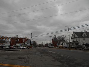
- Hartland – This is a small community, or hamlet, located in the southern part of the town on Ridge Road (Route 104). It's just north of the East Branch Eighteen Mile Creek.
- Hartland Swamp Wildlife Management Area – This is a special area in the northern part of Hartland. It's set aside to protect wildlife and nature.
- Jeddo – Another small community located near the eastern town line, also on Ridge Road (Route 104).
- Johnson Creek – This hamlet is east of the Hartland hamlet, along Ridge Road (Route 104).
- Middleport – A small part of the Village of Middleport extends into the southeastern corner of Hartland.
- North Hartland – A hamlet found in the northwest corner of the town, on Hosmer Road.
- North Ridgeway – A location near the eastern town line, along Route 269.
See also
 In Spanish: Hartland (Nueva York) para niños
 | Percy Lavon Julian |
 | Katherine Johnson |
 | George Washington Carver |
 | Annie Easley |


