kids encyclopedia robot

Vermont facts for kids

Kids Encyclopedia Facts
Quick facts for kids
Vermont
State of Vermont
Flag of Vermont Official seal of Vermont
Nickname(s): 
The Green Mountain State
Motto(s): 
Freedom and Unity and Stella quarta decima fulgeat (May the 14th star shine bright)
Anthem: These Green Mountains
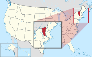
Map of the United States with Vermont highlighted
Country United States
Before statehood Vermont Republic
Admitted to the Union March 4, 1791 (14th)
Capital Montpelier
Largest city Burlington
Largest metro Greater Burlington
Legislature General Assembly
 • Upper house Senate
 • Lower house House of Representatives
Area
 • Total 9,616 sq mi (24,923 km2)
 • Land 9,250 sq mi (23,957.39 km2)
 • Water 382 sq mi (989 km2)  4.1%
Area rank 45th
Dimensions
 • Length 160 mi (260 km)
 • Width 80 mi (130 km)
Elevation
1,000 ft (300 m)
Highest elevation 4,395 ft (1,340 m)
Lowest elevation 95 to 100 ft (29 to 30 m)
Population
 (2020)
 • Total 643,503
 • Rank 49th
 • Density 67.7/sq mi (26.1/km2)
 • Density rank 30th
 • Median household income
$57,513
 • Income rank
26th
Demonym(s) Vermonter
Language
Time zone UTC−05:00 (Eastern)
 • Summer (DST) UTC−04:00 (EDT)
USPS abbreviation
VT
ISO 3166 code US-VT
Trad. abbreviation Vt.
Latitude 42°44′ N to 45°1′ N
Longitude 71°28′ W to 73°26′ W
Vermont state symbols
Flag of Vermont.svg
Seal of Vermont.svg
Coat of arms of Vermont.svg
The Coat of arms of Vermont
Living insignia
Amphibian Northern leopard frog
Rana pipiens
Bird Hermit thrush
Catharus guttatus
Fish Brook trout
Salvelinus fontinalis
Walleye
Sander vitreous vitreous
Flower Red clover
Trifolium pratense
Insect Western honey bee
Apis mellifera
Mammal Morgan horse
Reptile Painted turtle
Tree Sugar maple
Acer saccharum
Inanimate insignia
Beverage Milk
Food Apple pie
Fossil Woolly mammoth,
beluga whale
Gemstone Grossular garnet
Mineral Talc
Rock Granite, marble, slate
Soil Tunbridge
State route marker
Vermont state route marker
State quarter
Vermont quarter dollar coin
Released in 2001
Lists of United States state symbols

Vermont is a state in the New England region of the United States. It borders the states of Massachusetts to the south, New Hampshire to the east, and New York to the west, and the Canadian province of Quebec to the north. Vermont is the only state in New England that does not border the Atlantic Ocean. Vermont is the second-least-populated U.S. state after Wyoming and the sixth-smallest by area of the 50 U.S. states with a recorded population of 643,503 according to the 2020 U.S. census. The state capital is Montpelier, the least-populous state capital in the United States. The most-populous city, Burlington, is the least-populous city to be the most-populous city in a state.

For some 12,000 years, indigenous peoples have inhabited this area. The historically competitive tribes of the Algonquian-speaking Abenaki and Iroquoian-speaking Mohawk were active in the area at the time of European encounter. During the 17th century, French colonists claimed the territory as part of the Kingdom of France's colony of New France. After the Kingdom of Great Britain began to settle colonies to the south along the Atlantic coast, the two nations competed in North America in addition to Europe. After being defeated in 1763 in the Seven Years' War, France ceded its territory east of the Mississippi River to Great Britain.

Thereafter, the nearby British Thirteen Colonies, especially the provinces of New Hampshire and New York, disputed the extent of the area called the New Hampshire Grants to the west of the Connecticut River, encompassing present-day Vermont. The provincial government of New York sold land grants to settlers in the region, which conflicted with earlier grants from the government of New Hampshire. The Green Mountain Boys militia protected the interests of the established New Hampshire land grant settlers against the newly arrived settlers with land titles granted by New York. Ultimately, a group of settlers with New Hampshire land grant titles established the Vermont Republic in 1777 as an independent state during the American Revolutionary War. The Vermont Republic abolished slavery before any of the other states.

Vermont was admitted to the newly established United States as the fourteenth state in 1791. During the mid-19th century, Vermont was a strong source of abolitionist sentiment, although it was also tied to King Cotton through the development of textile mills in the region, which relied on southern cotton. It sent a significant contingent of soldiers to participate in the American Civil War.

The geography of the state is marked by the Green Mountains, which run north–south up the middle of the state, separating Lake Champlain and other valley terrain on the west from the Connecticut River valley that defines much of its eastern border. A majority of its terrain is forested with hardwoods and conifers, and a majority of its open land is devoted to agriculture. The state's climate is characterized by warm, humid summers and cold, snowy winters.

Vermont's economic activity of $34 billion in 2018 ranked last on the list of U.S. states and territories by GDP but 34th in GDP per capita. In 2000, the state legislature was the first to recognize civil unions for same-sex couples.

Geography

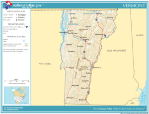
National-atlas-vermont
Map of Vermont, showing cities, roads, and rivers

Vermont is located in the New England region of the northeastern United States and comprises 9,614 square miles (24,900 km2), making it the 45th-largest state. It is the only state that does not have any buildings taller than 124 feet (38 m). Land comprises 9,250 square miles (24,000 km2) and water comprises 365 square miles (950 km2), making it the 43rd-largest in land area and the 47th in water area. In total area, it is larger than El Salvador and smaller than Haiti.

The west bank of the Connecticut River marks the state's eastern border with New Hampshire, though much of the river is within New Hampshire's territory. 41% of Vermont's land area is part of the Connecticut River's watershed.

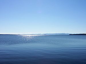
Lake Champlain, the major lake in Vermont, is the sixth-largest body of fresh water in the United States and separates Vermont from New York in the northwest portion of the state. From north to south, Vermont is 159 miles (256 km) long. Its greatest width, from east to west, is 89 miles (143 km) at the Canada–U.S. border; the narrowest width is 37 miles (60 km) at the Massachusetts line. The width averages 60.5 miles (97.4 km). The state's geographic center is approximately three miles (5 km) east of Roxbury, in Washington County. There are fifteen U.S. federal border crossings between Vermont and Canada.

The origin of the name "Vermont" is uncertain, but likely comes from the French les Verts Monts, meaning "the Green Mountains". Thomas Young introduced it in 1777. Some authorities say that the mountains were called green because they were more forested than the higher White Mountains of New Hampshire and Adirondacks of New York; others say that the predominance of mica-quartz-chlorite schist, a green-hued metamorphosed shale, is the reason. The Green Mountain range forms a north–south spine running most of the length of the state, slightly west of its center. In the southwest portion of the state are the Taconic Mountains; the Granitic Mountains are in the northeast. In the northwest, near Lake Champlain, is the fertile Champlain Valley. In the south of the valley is Lake Bomoseen.

Several mountains have timberlines with delicate year-round alpine ecosystems, including Mount Mansfield, the highest mountain in the state; Killington Peak, the second-highest; Camel's Hump, the state's third-highest; and Mount Abraham, the fifth-highest peak.

Areas in Vermont administered by the National Park Service include the Marsh-Billings-Rockefeller National Historical Park (in Woodstock) and the Appalachian National Scenic Trail.

Cities

City populations (2010 census)
City Population
Burlington
42,417
South Burlington
17,904
Rutland
16,495
Barre
9,052
Montpelier
7,855
Winooski
7,267
St. Albans
6,918
Newport
5,005
Vergennes
2,741

The most populous city in Vermont is Burlington, and its metropolitan area is also the most populous in the state with an estimate of 214,796 as of 2013.

Largest towns

Although these towns are large enough to be considered cities, they are not incorporated as such.

Large town populations (2010 census)
Town Population
Essex
19,587
Colchester
17,067
Bennington
15,764
Brattleboro
12,046
Milton
10,352
Hartford
9,952
Springfield
9,373
Williston
8,698
Middlebury
8,496
Barre
7,924
St. Johnsbury
7,603
Shelburne
7,144

Climate

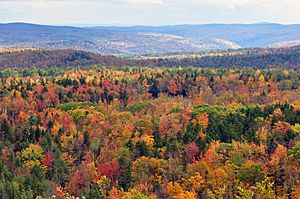
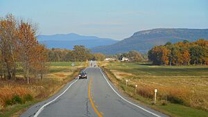
Vermont fall foliage hogback mountain
Fall foliage seen from Hogback Mountain, Wilmington

The annual mean temperature for the state is 43 °F (6 °C). Vermont has a humid continental climate, with muddy springs, in general a mild early summer, hot Augusts; it has colorful autumns: Vermont's hills reveal red, orange, and (on sugar maples) gold foliage as cold weather approaches. Winters are colder at higher elevations.

The rural northeastern section known as the "Northeast Kingdom" often averages 10 °F (5.6 °C) colder than the southern areas of the state during winter. The annual snowfall averages between 60 and 100 inches (1,500 and 2,500 mm) depending on elevation.

Vermont is the seventh coldest state in the country. In winter, until typical El Niño conditions, Vermont's winters are "too cold to snow"; the air is too cold to contain sufficient moisture to prompt precipitation.

Fauna

The state contains 41 species of reptiles and amphibians, 89 species of fish, of which 12 are non native; 193 species of breeding birds, 58 species of mammals, more than 15,000 insect species, and 2,000 higher plant species, plus fungi, algae, and 75 different types of natural communities.

Vermont contains one species of venomous snake, the eastern timber rattlesnake, which is confined to a few acres in western Rutland County.

Flora

Vermont is in the temperate broadleaf and mixed forests biome. Much of the state, in particular the Green Mountains, is covered by the conifers and northern hardwoods of the New England-Acadian forests. The western border with New York and the area around Lake Champlain lies within the Eastern Great Lakes lowland forests. The southwest corner of the state and parts of the Connecticut River are covered by Northeastern coastal forests of mixed oak.

History

Native American occupancy

Between 8500 and 7000 BCE, at the time of the Champlain Sea, Native Americans inhabited and hunted in present-day Vermont. During the Archaic period, from the 8th millennium BCE to 1000 BCE, Native Americans migrated year-round. During the Woodland period, from 1000 BCE to 1600 CE, villages and trade networks were established, and ceramic and bow and arrow technology was developed. In the western part of the state there lived a small population of Algonquian-speaking tribes, including the Mohican and Abenaki peoples. Sometime between 1500 and 1600 CE, the Iroquois, based in present-day New York, drove many of the smaller native tribes out of Vermont, later using the area as a hunting ground and warring with the remaining Abenaki. The population in 1500 CE was estimated to be around 10,000 people.

Colonial

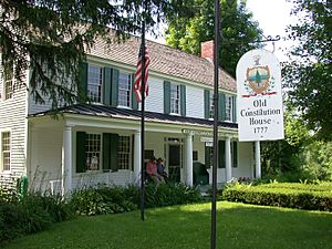
ConstitutionHouse WindsorVermont
The Old Constitution House at Windsor, where the Constitution of Vermont was adopted on July 8, 1777
GreenMtBoys
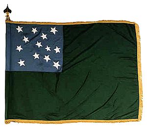
A c. 1775 flag used by the Green Mountain Boys

The first European to see Vermont is thought to have been Jacques Cartier in 1535. On July 30, 1609, French explorer Samuel de Champlain claimed Vermont as part of New France. In 1666, French settlers erected Fort Sainte Anne on Isle La Motte, the first European settlement in Vermont.

The "violent" 1638 New Hampshire earthquake was felt throughout New England, centered in the St. Lawrence Valley. This was the first seismic event noted in Vermont.

In 1690, a group of Dutch-British settlers from Albany established a settlement and trading post at Chimney Point 8 miles (13 km) west of present-day Addison.

During Dummer's War, the first permanent British settlement was established in 1724 with the construction of Fort Dummer. It was to protect the nearby settlements of Dummerston and Brattleboro.

From 1731 to 1734, the French constructed Fort St. Frédéric, which gave them control of the New France-Vermont frontier region in the Lake Champlain Valley. With the outbreak of the French and Indian War in 1754, the North American front of the Seven Years' War between the French and British, the French began construction of Fort Carillon at present-day Ticonderoga, New York in 1755. The British failed to take Fort St. Frédéric or Fort Carillon between 1755 and 1758. In 1759 a combined force of 12,000 British regular and provincial troops under Sir Jeffery Amherst captured Carillon, after which the French abandoned Fort St. Frédéric. Amherst constructed Fort Crown Point next to the remains of the Fort St. Frédéric, securing British control over the area.

Following France's loss in the French and Indian War, through the 1763 Treaty of Paris they ceded control of the land to the British. Colonial settlement was limited by the Crown to lands east of the Appalachians, in order to try to end encroachment on Native American lands. The territory of Vermont was divided nearly in half in a jagged line running from Fort William Henry in Lake George diagonally north-eastward to Lake Memphremagog.

On July 20, 1764, King George III established the boundary between New Hampshire and New York along the west bank of the Connecticut River, north of Massachusetts, and south of 45 degrees north latitude. New York refused to recognize the land titles known as the New Hampshire Grants (towns created by land grants sold by New Hampshire Governor Benning Wentworth) and dissatisfied New Hampshire settlers organized in opposition. In 1770 Ethan Allen, his brothers Ira and Levi, and the Allens' cousins Seth Warner and Remember Baker, recruited an informal militia known as the Green Mountain Boys to protect the interests of the original New Hampshire settlers against newcomers from New York.

In 1775, after the outbreak of the American Revolutionary War, the Green Mountain Boys assisted a force from Connecticut, led by Benedict Arnold, in capturing the British fort at Ticonderoga. Thereafter, the Continental Congress in Philadelphia directed the New York colony's revolutionary congress to fund and equip Allen's militia as a ranger regiment of the Continental Army, which it did. Seth Warner was chosen by the men of the regiment to lead, while Ethan Allen went on to serve as a colonel in Schuyler's Army of Northern New York.

Sovereignty

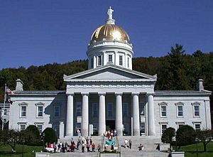
Vermont State House front
The gold leaf dome of the neoclassical Vermont State House (Capitol) in Montpelier

On January 15, 1777, representatives of the New Hampshire Grants declared the independence of Vermont. For the first six months of its existence, it was called the Republic of New Connecticut.

On June 2, 1777, a second convention of 72 delegates met and adopted the name "Vermont."

On July 4, they completed the drafting of the Constitution of Vermont at the Windsor Tavern, and adopted it on July 8. This was the first written constitution in North America to ban adult slavery, saying male slaves become free at the age of 21 and females at 18. Slavery was fully banned by state law on November 25, 1858, less than three years before the American Civil War.

Vermont played an important geographical role in the Underground Railroad, which helped American slaves escape to Canada.

Revolutionary War

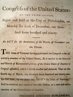
VTadmissionAct
1791 Act of Congress, admitting Vermont to the federal union.

The Battle of Bennington, fought on August 16, 1777, was a seminal event in the history of the state of Vermont and the United States. A combined American force, under General John Stark's command, attacked the Hessian column at Hoosick, New York, just across the border from Bennington. It killed or captured virtually the entire Hessian detachment. General Burgoyne never recovered from this loss and eventually surrendered the remainder of his 6,000-man force at Saratoga, New York, on October 17 that year.

The battles of Bennington and Saratoga together are recognized as the turning point in the Revolutionary War because they were the first major defeat of a British army. The anniversary of the battle is still celebrated in Vermont as a legal holiday.

The Battle of Hubbardton (July 7, 1777) was the only Revolutionary battle within the present boundaries of Vermont. Although the Continental forces were technically defeated, the British forces were damaged to the point that they did not pursue the Americans (retreating from Fort Ticonderoga) any further.

Admission to the Union

Vermont continued to govern itself as a sovereign entity based in the eastern town of Windsor for 14 years. The independent state of Vermont issued its own coinage from 1785 to 1788 and operated a statewide postal service. Thomas Chittenden was the Governor in 1778–89 and in 1790–91.

In January 1791, a convention in Vermont voted 105–4 to petition Congress to become a state in the federal union. Congress acted on February 18, 1791 to admit Vermont to the Union as the 14th state as of March 4, 1791. Vermont became the first to enter the Union after the original 13 states.

The Civil War

1827 Finley Map of Vermont - Geographicus - Vermont-finely-1827
Vermont in 1827. The county boundaries have since changed.

During the American Civil War, Vermont sent 33,288 men into United States service. 5,224 Vermonters, over 15%, were killed or mortally wounded in action or died of disease.

The northernmost land/battle action of the war, the St. Albans Raid, took place in Vermont. However, the raiders were forced to return the possessions after the Canadians captured them at their border.

Postbellum era to present

Demographic changes

Beginning in the mid-19th century, Vermont attracted numerous Irish, Scots-Irish and Italian immigrants, adding to its residents of mostly English and French-Canadian ancestry. Many migrated to Barre, where the men worked as stonecutters of granite, for which there was a national market. Vermont granite was used in major public buildings in many states. Many Italian and Scottish women operated boarding houses in the late 19th century to support their families. Such facilities helped absorb new residents, who peaked between 1890 and 1900. Typically immigrants boarded with people of their own language and ethnicity, but sometimes they boarded with others.

Natural disasters

The state has suffered some natural disasters in the 20th and 21st centuries related to hurricanes, extensive rain and flooding. Large-scale flooding occurred in early November 1927. During this incident, 84 people died, including the state's lieutenant governor.

The 1938 New England hurricane in the fall of that year blew down 15,000,000 acres (61,000 km2) of trees, one-third of the total forest at the time in New England. Three billion board feet were salvaged. Today many of the older trees in Vermont are about 75 years old, dating from after this storm.

Another flood occurred in 1973, causing the deaths of two people and millions of dollars in property damage.

The state suffered severe flooding in late August 2011 caused by Tropical Storm Irene. Heavy rains caused flooding in many towns built in narrow river valleys. The governor described it as one of the worst natural disasters of the 20th and 21st centuries, second only to the flood of 1927.

Political changes

Vermont approved women's suffrage decades before it became part of the national constitution. Women were first allowed to vote in the elections of December 18, 1880, when women were granted limited suffrage. They were first allowed to vote in town elections, and later in state legislative races.

Demographics

Historical population
Census Pop.
1790 85,425
1800 154,465 80.8%
1810 217,895 41.1%
1820 235,981 8.3%
1830 280,652 18.9%
1840 291,948 4.0%
1850 314,120 7.6%
1860 315,098 0.3%
1870 330,551 4.9%
1880 332,286 0.5%
1890 332,422 0.0%
1900 343,641 3.4%
1910 355,956 3.6%
1920 352,428 −1.0%
1930 359,611 2.0%
1940 359,231 −0.1%
1950 377,747 5.2%
1960 389,881 3.2%
1970 444,330 14.0%
1980 511,456 15.1%
1990 562,758 10.0%
2000 608,827 8.2%
2010 625,741 2.8%
2020 643,077 2.8%
Source: 1910–2020

Population

According to the United States Census Bureau, the state of Vermont had a population of 643,503 in the 2020 U.S. census. At the of July 1, 2019 Population Estimates Program, Vermont had an estimated population of 623,989. This included a natural increase of 3,178 (31,716 births minus 28,538 deaths) and a decrease due to net migration of 2,432 people out of the state. In 2006, it had the second lowest birthrate in the nation, 42/1000 women. The center of population of Vermont is located in Washington County, in the town of Warren.

As of 2014, 51.3% of Vermont's population was born in the state (compared with 58.7% for the United States). The changing demographics between those with multi-generational ties to the state and those who are newcomers, bringing different values with them, has resulted in a degree of tension between the two perspectives. This tension is expressed in the terms, "Woodchuck", being applied to those established in the state, and "Flatlander", applied to the newcomers. Vermont is the least populous New England state. As of 2012, Vermont was one of only two states in the U.S. with fewer people than the District of Columbia (Wyoming was the other).

From 2010 to 2013, 16 out of Vermont's 251 towns experienced an increase in population. All towns in Chittenden increased with the exception of Burlington. More than 180 towns experienced a decrease, which had not happened since the mid-19th century.

As of 2010, Vermont was the second most rural state in the country, following Maine, with 61% of the population living in rural areas.

Dialect

Linguists have identified speech patterns found among Vermonters as belonging to Western New England English, a dialect of New England English, which features full pronunciation of all r sounds, pronouncing horse and hoarse the same, and pronouncing vowels in father and bother the same, none of which are features traditionally shared in neighboring Eastern New England English. Some rural speakers realize the t as a glottal stop (mitten sounds like "mi'in" and Vermont like "Vermon' " ). A dwindling segment of the Vermont population, generally both rural and male, pronounces certain vowels in a distinctive manner (e.g. cows with a raised vowel as [kʰɛʊz] and ride with a backed, somewhat rounded vowel as [ɹɒɪd]).

Eastern New England English—also found in New Hampshire, Maine and eastern Massachusetts—was common in eastern Vermont in the mid-twentieth century and before, but has become rare. This accent drops the r sound in words ending in r (farmer sounds like "farm-uh") and adds an r sound to some words ending in a vowel (idea sounds like "idee-er") was common. Those characteristics in eastern Vermont appear to have been inherited from West Country and Scots-Irish ancestors.

Religion

Religion in Vermont (2014)
Religion Percent
Unaffiliated
  
37%
Protestant
  
30%
Catholic
  
22%
Eastern Orthodox
  
1%
Jewish
  
2%
Hindu
  
1%
Buddhist
  
1%
Other
  
3%
Don't know
  
2%

According to the Pew Research Center in 2014, 37% reported no religion, the highest rate of irreligion of all U.S. states. The Pew Research Center also determined the largest religion was Christianity; Catholics made 22% of the population and Protestants were 30%. In contrast with Southern U.S. trends, the majority of Protestants are Mainline Protestant dominated by Methodism. The United Methodist Church was the largest Mainline Protestant denomination in Vermont, followed by the American Baptist Churches USA and United Church of Christ. Evangelical Protestants were dominated by independent Baptist churches. Major non-Christian religions were Judaism, Islam, Buddhism, Hinduism, and other faiths. The largest non-Christian religious group outside of irreligion were Unitarians. An estimated 3.1% of the irreligious were atheist.

Economy

Vermont Product Exports (2020)
A proportional representation of Vermont exports, 2020

In 2016, Vermont had a total employment of 262,705, and the total employer establishments were 21,174. In 2019, VermontBiz reported a WalletHub ranking of Vermont 43rd as place to start a business, citing Vermont as 49th in average growth of small businesses and 50th in the availability of human capital. CNBC ranked Vermont 32nd as a place to do business in 2018, citing access to capital as the largest impediment. While U.S. News ranked Vermont 37th for "business environment", it ranked it 18th for employment in 2019.Forbes magazine as the 42nd best state in which to do business in 2015, 32nd in 2007, and 30th in 2006.

As of 2017, Vermont's gross regional domestic product (GDP) was $19.3 billion, making it the second smallest among the 50 states. Its per capita GDP was $51,600, ranking it 34th among the states.

Components of GSP were:

  • Government $3 billion (13.4%)
  • Real estate, rental, and leasing $2.6 billion (11.6%)
  • Durable goods manufacturing $2.2 billion (9.6%)
  • Health care and social assistance $2.1 billion (9.4%)
  • Retail trade $1.9 billion (8.4%)
  • Finance and insurance $1.3 billion (5.9%)
  • Construction $1.2 billion (5.5%)
  • Professional and technical services $1.2 billion (5.5%)
  • Wholesale trade $1.1 billion (5.1%)
  • Accommodations and food services $1 billion (4.5%)
  • Information $958 million (4.2%)
  • Non-durable goods manufacturing $711 million (3.1%)
  • Other services $563 million (2.4%)
  • Utilities $553 million (2.4%)
  • Educational services $478 million (2.1%)
  • Transportation and warehousing $484 million (2.1%)
  • Administrative and waste services $436 million (1.9%)
  • Agriculture, forestry, fishing, and hunting $375 million (1.6%)
  • Arts, entertainment, and recreation $194 million (.8%)
  • Mining $100 million (.4%)
  • Management of companies $35 million (.2%)

Canada was Vermont's largest foreign trade partner in 2007. The state's second-largest foreign trade partner was Taiwan. The state had $4 billion worth of commerce with Quebec. One measure of economic activity in Vermont is retail sales. The state had $5.2 billion in 2007. In 2008, 8,631 new businesses were registered in Vermont, a decline of 500 from 2007.

Personal income

In 2019, the state had a median household income of $61,973. Approximately 10.2% of the population lived at or below the poverty line. The median household income from 2002 to 2004 was $45,692. This was 15th nationally. The median wage in the state in 2008 was $15.31 hourly or $31,845 annually. In 2007, about 80% of the 68,000 Vermonters who qualify for food stamps received them. 40% of seniors 75 years or older live on annual incomes of $21,660 or less. In 2011, 15.2% of Vermonters received food stamps. This compares to 14.8% nationally.

In 2011, 91,000 seniors received an annual average of $14,000 from Social Security. This was 59% of the average senior's income. This contributed $1.7 billion to the state's economy.

Agriculture

Vermont fall foliage hogback mountain
Fall foliage seen from Hogback Mountain, Wilmington

Agriculture contributed 2.2% of the state's domestic product in 2000. In 2000, about 3% of the state's working population engaged in agriculture. As of 2014, the Pew Research Center estimated that farms in the state employed fewer than 5,000 illegal immigrants. In 2017, Vermont Governor Phil Scott announce that the state was "exploring a legal challenge" to the executive order signed by President Donald Trump for Vermont law enforcement authorities to cooperate with U.S. Immigration and Customs Enforcement and "perform the functions of immigration officers in relation to the investigation, apprehension, or detention of aliens".

Dairy farming

Dairy farming is the primary source of agricultural income. In the second half of the 20th century, developers had plans to build condos and houses on what was relatively inexpensive, open land. Vermont's government responded with a series of laws controlling development and with some pioneering initiatives to prevent the loss of Vermont's dairy industry. Still, the number of Vermont dairy farms has declined more than 85% from the 11,206 dairy farms operating in 1947. In 2003, there were fewer than 1,500 dairy farms in the state; in 2006 there were 1,138; in 2019 there were 658. The number of dairy farms has been diminishing by 10% annually. 80% of open land is controlled by dairy farms.

The number of cattle in Vermont had declined by 40%; however, milk production has doubled in the same period due to tripling the production per cow. While milk production rose, Vermont's market share declined. Within a group of states supplying the Boston and New York City markets (called "Federal order Class I"), Vermont was third in market share, with 10.6%; New York has 44.9% and Pennsylvania has 32.9%. In 2007, dairy farmers received a record $23.60 for 100 pounds (45 kg) (11.63 gallons at $2.03/gallon) of milk. This dropped in 2008 to $17 ($1.46/gallon). The average dairy farm produced 1.3 million pounds of milk annually in 2008.

The dairy barn remains an iconic image of Vermont, but the 87% decrease in active dairy farms between 1947 and 2003 means that preservation of the dairy barns has increasingly become dependent upon a commitment to maintaining a legacy rather than basic need in the agricultural economy. The Vermont Barn Census, organized by a collaboration of educational and nonprofit state and local historic preservation programs, has developed educational and administrative systems for recording the number, condition, and features of barns throughout Vermont.

In 2009, there were 543 organic farms. Twenty percent of the dairy farms were organic and 23% (128) vegetable farms were organic. Organic farming increased in 2006–07, but leveled off in 2008–09.

A significant amount of milk is shipped into the Boston market. Therefore the Commonwealth of Massachusetts certifies that Vermont farms meet Massachusetts sanitary standards. Without this certification, a farmer may not sell milk for distribution into the bulk market. In 2019, two-thirds of all milk in New England was produced by Vermont dairies.

Forestry

Forest products have always been a staple to the economy, comprising 1% of the total gross state output and 9% of total manufacturing as of 2013. In 2007, Windham County contained the largest concentration of kilns for drying lumber east of the Mississippi River. The decline of farms has resulted in a regrowth of Vermont's forests due to ecological succession. Today, most of Vermont's forests are secondary. The state and non-profit organizations are actively encouraging regrowth and careful forest management. Over 78% of the land area of the state is forested compared to only 37% in the 1880s, when sheep farming was at its peak and large amounts of acreage were cleared for grazing. Over 85% of that area is non-industrial, private forestland owned by individuals or families. In 2013, 73,054 million cubic feet (2,068.7 million cubic meters) of wood was harvested in Vermont. A large amount of Vermont forest products are exports with 21,504 million feet (6.554×10⁹ meters) being shipped overseas plus an additional 16,384 million cubic feet (463.9 million cubic meters) to Canada. Most of it was processed within the state. In this century the manufacture of wood products has fallen by almost half. The annual net growth has been estimated at 172,810 million cubic feet (4,893 million cubic meters). The USDA estimates that 8,584 billion cubic feet (243.1 billion cubic meters) remain in the state. Forest products also add to carbon sequestration since lumber and timber used in houses and furniture hold carbon for long periods of time while the trees that were removed are replaced overtime with new growing stock.

In 2017, the price of wood products had either plummeted or remained the same when compared to previous decades, which meant there was cause for concern with jobs in the industry. For example, in 1994, the price of a thousand board feet was $300, the same as it was in 2017. The price of wood chips has halved in the same time frame. In 1980, the price for a cord of wood was $50; in 2017, $25. For lack of demand, Vermont's forests are growing twice as fast as they are being cut.

Other

An important and growing part of Vermont's economy is the manufacture and sale of artisan foods, fancy foods, and novelty items trading in part upon the Vermont "brand," which the state manages and defends. Examples of these specialty exports include Cabot Cheese, the Vermont Teddy Bear Company, Fine Paints of Europe, Vermont Butter and Cheese Company, several microbreweries, ginseng growers, Burton Snowboards, King Arthur Flour, and Ben and Jerry's Ice Cream.

As of 2019, Vermont was the leading producer of maple syrup in the United States. There were about 2,000 maple products producers in 2010. Production rose to 920,000 US gallons (3,500,000 L; 770,000 imp gal) in 2009. The state's share of the nation's production rose to 42% in 2013. It had the second lowest price at $33.40/gallon.

The wine industry in Vermont started in 1985. As of 2007, there were 14 wineries.

Manufacturing

As of 2015, GlobalFoundries was the largest private employer in the state and provides jobs to 3,000 employees at its plant in the village of Essex Junction within Chittenden County.

A 2010 University of Connecticut study reported that Vermont, Rhode Island, and New Hampshire tied as the most costly states in the U.S. for manufacturers.

Energy

Vermont has no fossil-fuel reserves, however its forest products industry provides fuel for electricity generation and home heating. Electricity consumption per capita ranks it among the lowest 20% of states, and total electricity consumption was the lowest in the United States. Vermont consumed three times more electricity than it generated in-state in 2019, and imported its largest share of electricity from Canada. Vermont's 99.9% share of in-state electricity generation from renewable sources was the highest among all 50 states.

Labor

In 2009, the state attained a high of 361,290 workers.

As of 2006, there were 305,000 workers in Vermont. Eleven percent of these are unionized. Out of a workforce of 299,200 workers, 52,000 were government jobs, federal, state, and local.

A modern high unemployment rate of 9% was reached in June 1976. A modern low of 2.4% was measured in February 2000. As of October 2019, the unemployment rate was 2.2%.

Employment grew 7.5% from 2000 to 2006. From 1980 to 2000, employment grew by 3.4%; nationally it was up 4.6%. Real wages were $33,385 in 2006 constant dollars and remained there in 2010; the nation, $36,871.

Insurance

Captive insurance plays an increasingly large role in Vermont's economy. With this form of alternative insurance, large corporations or industry associations form standalone insurance companies to insure their own risks, thereby substantially reducing their insurance premiums and gaining a significant measure of control over types of risks to be covered. There are also significant tax advantages to be gained from the formation and operation of captive insurance companies. According to the Insurance Information Institute, Vermont in 2009 was the world's third-largest domicile for captive insurance companies, following Bermuda and the Cayman Islands.

In 2009, there were 560 such companies.

In 2010, the state had 900 such companies.

Recreation

Summer camps such as Camp Abenaki, Camp Billings, Camp Dudley, and Camp Hochelaga contribute to Vermont's tourist economy.

In 2005, visitors made an estimated 13.4 million trips to the state, spending $1.57 billion.

In 2012, fall accounted for $460 million of income, about one-quarter of all tourism.

In 2011, the state government earned $274 million in taxes and fees from tourism. 89% of the money came from out-of-state visitors. Tourism supported over 26,000 jobs, 7.2% of total employment.

According to the 2000 Census, almost 15% of all housing units in Vermont were vacant and classified "for seasonal, recreational, or occasional use". This was the second highest percentage nationwide, after Maine. In some Vermont cities, vacation homes owned by wealthy residents of New England and New York constitute the bulk of all housing stock. According to one estimate, as of 2009, 84% of all houses in Ludlow were owned by out-of-state residents. Other notable vacation-home resorts include Manchester and Stowe.

Hunting

1 vermont fall foliage panorama 2010
Autumn in Vermont

Hunting is controlled for black bear, wild turkeys, deer, and moose. There are 5,500 bears in the state. The goal is to keep the numbers between 4,500 and 6,000.

In 2010, there were about 141,000 deer in the state, which is in range of government goals. However, these are distributed unevenly and when in excess of 10–15 per square mile (4–6/km2), negatively impact timber growth.

In 2012, hunting of migratory birds was limited to October 13 to December 16. Waterfowl hunting is also controlled by federal law.

Skiing and snowmobiling

Stowe village Stevage
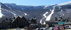
Stowe Resort Village

Some of the largest ski areas in New England are located in Vermont. Skiers and snowboarders visit Burke Mountain Ski Area, Bolton Valley, Smugglers' Notch, Killington Ski Resort, Mad River Glen, Stowe Mountain Resort, Cochrans Ski Area, Sugarbush, Stratton, Jay Peak, Okemo, Mount Snow, Bromley, and Magic Mountain Ski Area. Summer visitors tour resort towns like Stowe, Manchester, Quechee, Wilmington and Woodstock. The effects of global warming have been predicted to shorten the length of the ski season across Vermont, which would continue the contraction and consolidation of the ski industry in Vermont and threaten individual ski businesses and communities that rely on ski tourism.

In winter, Nordic and backcountry skiers visit to travel the length of the state on the Catamount Trail. Several horse shows are annual events. Vermont's state parks, historic sites, museums, golf courses, and new boutique hotels with spas were designed to attract tourists.

In 2000–01, there were 4,579,719 skier and snowboarder visits to the state. There were 4,125,082 visits in 2009–2010, a rise from recent years.

In 2008, there were 35,000 members of 138 snowmobiling clubs in Vermont. The combined association of clubs maintains 6,000 miles (9,700 km) of trail often over private lands. The industry is said to generate "hundreds of millions of dollars worth of business."

Quarrying

The towns of Rutland and Barre are the traditional centers of marble and granite quarrying and carving in the U.S. For many years Vermont was also the headquarters of the smallest union in the U.S., the Stonecutters Association, of about 500 members. The first marble quarry in America was on Mount Aeolus overlooking East Dorset. The granite industry attracted numerous skilled stonecutters in the late 19th century from Italy, Scotland, and Ireland. Barre is the location of the Rock of Ages quarry, the largest dimension stone granite quarry in the United States. Vermont is the largest producer of slate in the country. The highest quarrying revenues result from the production of dimension stone. The Rock of Ages quarry in Barre is one of the leading exporters of granite in the country. The work of the sculptors of this corporation can be seen 3 miles (4.8 km) down the road at the Hope Cemetery, where there are gravestones and mausoleums.

Non-profits and volunteerism

There were 2,682 non-profit organizations in Vermont in 2008, with $2.8 billion in revenue. The state ranked ninth in the country for volunteerism for the period 2005–08. 35.6% of the population volunteered during this period. The national average was 26.4%.

Transportation

Welcome to Vermont
Vermont welcome sign in Addison on Route 17 just over the New York border over the Champlain Bridge

Vermont's main mode of travel is by automobile. 5.7% of Vermont households did not own a car in 2008.

In 2012, there were 605,000 motor vehicles registered, nearly one car for every person in the state. This is similar to average car ownership nationwide.

In 2012, about half the carbon emissions in the state resulted from vehicles.

In 2007, Vermont was ranked the third safest state for highway fatalities. In northern Vermont particularly, moose are not uncommon, including in urban areas. They constitute a traffic threat since they are unaware of vehicles. There are several deaths each year from automobiles striking moose.

In 2009, 93% of Vermont motorists were insured, tying the state with Pennsylvania for the highest percentage. In 2008, Vermont was the fifth best state for fewest uninsured motorists—6%.

In 2010, Vermont owned 2,840 miles (4,570 km) of highway. This was the third smallest quantity among the 50 states. 2.5% of the highways were listed as "congested," the fifth lowest in the country. The highway fatality rate was one per 100,000,000 miles (160,000,000 km), tenth lowest in the nation. The highways cost $28,669 per mile ($17,814/km) to maintain, the 17th highest in the states. 34.4% of its bridges were rated deficient or obsolete, the eighth worst in the nation.

In 1968, Vermont outlawed the use of billboards for advertisement along its roads. It is one of four states in the U.S. to have done this, along with Hawaii, Maine, and Alaska.

Individual communities and counties have public transit, but their breadth of coverage is frequently limited. Greyhound Lines services a number of small towns. Two Amtrak trains serve Vermont, the Vermonter and the Ethan Allen Express.

In early 2011, Amtrak evaluated the track used by the Ethan Allen Express between Rutland and Whitehall as the worst in the nation, but subsequent improvements to the track later in 2011 vastly improved its performance going forward.

Trucks weighing less than 80,000 pounds (36,000 kg) can use Vermont's interstate highways. The limit for state roads is 99,000 pounds (45,000 kg). This means that vehicles too heavy for the interstates can legally use only secondary roads.

Major routes

The state has 2,843 miles (4,575 km) of highways under its control. Three Interstate highways and five U.S. highways enter Vermont, in addition to its own state highway network.

North–south routes

  • I-89.svg Interstate 89 runs a northwest–southeast path through Vermont, beginning in White River Junction and heading northwest to serve the cities of Montpelier, Burlington, and St. Albans en route to the Canada–U.S. border. I-89 intersects I-91 in White River Junction and has a short spur route, Interstate 189, just outside of Burlington.
  • I-91.svg Interstate 91 runs a north–south path from the Massachusetts state line to the Canada–U.S. border, connecting the towns of Brattleboro, White River Junction, St. Johnsbury, and the city of Newport. I-91 intersects I-89 in White River Junction, and I-93 in St. Johnsbury.
  • I-93.svg Interstate 93 runs a short, 11-mile (18 km) distance from the New Hampshire state line to its northern terminus in St. Johnsbury, where it intersects I-91. I-93 connects the Northeast Kingdom region of Vermont with the White Mountains region of New Hampshire, and points south.
  • US 5.svg U.S. Route 5 runs a north–south path in eastern Vermont from the Massachusetts state line to the Canada-U.S. border. U.S. Route 5 is a surface road that runs parallel to I-91 for its entire length in the state, and serves nearly all the same towns. The two routes also parallel the New Hampshire state line between Brattleboro and St. Johnsbury.
  • US 7.svg U.S. Route 7 runs a north–south path in western Vermont from the Massachusetts state line to the Canada-U.S. border. U.S. Route 7 connects the cities and towns of Bennington, Rutland, Middlebury, Burlington, and St. Albans. Between Bennington and Dorset, U.S. Route 7 runs as a Super 2 freeway. It also parallels I-89 between Burlington and the Canada–U.S. border.
  • Vermont 30.svg Vermont Route 30 is a 111.870-mile-long north–south road that runs from Brattleboro to Middlebury. Vermont Route 30 runs through the state's historic West River Valley, where it passes through the colonial towns of Newfane, Townshend, West Townshend, East Jamaica, Jamaica, Rawsonville and Bondville.
  • Vermont 100.svg Vermont Route 100 runs a north–south path directly through the center of the state, along the length of the Green Mountains. VT Route 100 generally parallels both U.S. Route 5 (which runs to its east) and U.S. Route 7 (which runs to its west). Many of the state's major ski areas are located either directly on, or very close to, VT Route 100. The largest town by population along VT Route 100 is Morristown.

East–west routes

  • US 2.svg U.S. Route 2 runs a generally east–west path across central and northern Vermont, from Alburgh (on the New York state line) to Guildhall (on the New Hampshire state line). U.S. Route 2 connects the Lake Champlain Islands and the Northeast Kingdom to the population centers of Burlington, Montpelier, and St. Johnsbury. U.S. Route 2 runs parallel to I-89 between Colchester and Montpelier. Although the portion of the road from Alburgh to Burlington follows a north–south orientation, U.S. Route 2 in Vermont is entirely signed as east–west.
  • US 4.svg U.S. Route 4 runs east–west across south-central Vermont from Fair Haven (on the New York state line) to White River Junction (on the New Hampshire state line). U.S. Route 4 also connects the city of Rutland and the towns of Killington and Woodstock. Between Fair Haven and Rutland, U.S. Route 4 runs as a four-lane freeway that is mostly up to Interstate design standards.
  • US 302.svg U.S. Route 302 runs an east–west path from its western terminus in Montpelier to the village of Wells River, where it intersects both I-91 and U.S. Route 5, and then crosses into New Hampshire. U.S. Route 302 is one of the main roads connecting Montpelier and Barre in central Vermont.
  • Vermont 9.svg Vermont Route 9 runs an east–west path across the southern part of the state. VT Route 9 connects the towns of Bennington, Wilmington, and Brattleboro.
  • Vermont 105.svg Vermont Route 105 runs a generally east–west path across the northernmost parts of Vermont (sometimes within a few miles of the Canada–U.S. border) from St. Albans to Bloomfield (on the New Hampshire state line). VT Route 105 ultimately connects the cities of St. Albans and Newport.

A 2005–06 study ranked Vermont 37th out of the states for "cost-effective road maintenance", a decline of thirteen places since 2004–05.

Federal data indicates that 16% of Vermont's 2,691 bridges had been rated structurally deficient by the state in 2006. In 2007, Vermont had the sixth worst percentage of structurally deficient bridges in the country.

Rail

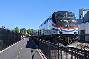
White River Junction VT
Amtrak station in White River Junction

The state is served by Amtrak's Vermonter and Ethan Allen Express, the New England Central Railroad, the Vermont Railway, and the Green Mountain Railroad.

The Ethan Allen Express serves Castleton and Rutland, while the Vermonter serves St. Albans, Essex Junction, Waterbury, Montpelier, Randolph, White River Junction, Windsor, Bellows Falls, and Brattleboro.

Intercity

Greyhound Lines stops at Bellows Falls, Brattleboro, Burlington, Montpelier, and White River Junction. Megabus, as of November 2014, stops in Burlington and Montpelier. Vermont Translines, an intercity bus company started by Premier Coach in 2013 partnering with Greyhound and starting service on June 9, 2014, serves Milton, Colchester, Burlington, Middlebury, Brandon, Rutland, Wallingford, Manchester and Bennington on its Burlington to Albany line, and Rutland, Killington, Bridgewater, Woodstock, Queechee and White River Junction along the U.S. Route 4 corridor. The town of Bennington also has the weekday-operating Albany-Bennington Shuttle, an intercity bus operated by Yankee Trails World Travel.

Local

Other transportation includes:

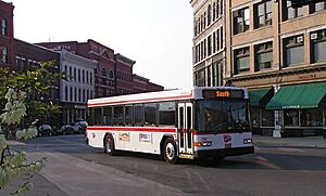
  • Addison County Transit Resources (ACTR) services Addison County, including the college town of Middlebury, Bristol, and Vergennes.
  • Bennington County has the Green Mountain Community Network (GMCN) out of Bennington.
  • Brattleboro in Windham County is served by the BeeLine (Brattleboro Town Bus), which is part of Connecticut River Transit ("the Current"). Southern Windham County and southern Bennington County is served, out of West Dover, by the MOOver (Southeast Vermont Transit or SEVT, formerly the Deerfield Valley Transit Association or DVTA).
  • Burlington has Chittenden County Transportation Authority (CCTA) and CATS (University of Vermont Campus Area Transportation System).
  • Colchester in Chittenden County is serviced by the SSTA (Special Services Transportation Agency).
  • Rutland County has "the Bus" (Marble Valley Regional Transit District, MVRTD) out of Rutland.
  • Windsor County:
    • Ludlow (in Windsor County) is served by the LMTS (Ludlow Municipal Transit System).
    • The Current (CRT) division of Southeast Vermont Transit (SEVT), out of Rockingham, serves parts of Windham and Windsor County.
    • In parts of Windsor County, including Norwich and Hartford, as well as in White River Junction and in parts of New Hampshire there is a free public transportation service called Advance Transit. It has routes and many different lines all throughout the Upper Valley region.
  • Stowe in Lamoille County is serviced by STS (Stowe Trolley System, Village Mountain Shuttle, Morrisville Shuttle).
  • Stagecoach Transportation Services (STS) out of Randolph in Orange County also serves parts of Windsor County.
  • In Washington County, the Green Mountain Transit Authority (GMTA) runs out of the capital city, Montpelier.
  • The Network (Northwest Vermont Public Transit Network, NVPT) running out of Saint Albans services Franklin and Grand Isle counties.
  • Rural Community Transportation (RCT) runs out of Saint Johnsbury and services Caledonia, Essex, Lamoille and Orleans Counties. There is a shuttle bus linking the various local networks.

Ferry

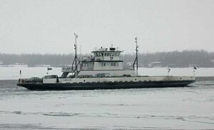
There is a year-round ferry service to and from New York State across Lake Champlain from Burlington, Charlotte, Grand Isle, and Shoreham. All but the Shoreham ferry are operated by the LCTC (Lake Champlain Transportation Company).

Airports

Culture

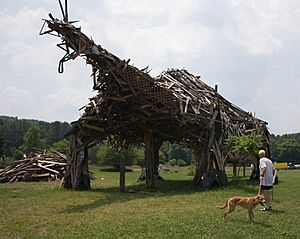
Vermontasaurus-2010-07-07
Vermontasaurus sculpture in Post Mills, Vermont in 2010

Vermont festivals include the Vermont Maple Festival, Festival on the Green, The Vermont Dairy Festival in Enosburg Falls, the Apple Festival (held each Columbus Day Weekend), the Marlboro Music Festival, and the Vermont Brewers Festival. The Vermont Symphony Orchestra is supported by the state and performs throughout the area.

Since 1973 the Sage City Symphony, formed by composer Louis Calabro, has performed in the Bennington area. In 1988 a number of Vermont-based composers including Gwyneth Walker formed the Vermont Composers Consortium, which was recognized by the governor proclaiming 2011 as The Year of the Composer.

The Brattleboro-based Vermont Theatre Company presents an annual summer Shakespeare festival. Brattleboro also hosts the summertime Strolling of the Heifers parade which celebrates Vermont's unique dairy culture. The annual Green Mountain Film Festival is held in Montpelier.

In the Northeast Kingdom, the Bread and Puppet Theatre holds weekly shows in Glover in a natural outdoor amphitheater.

Vermont's most recent best known musical talent was the group Phish, whose members met while attending school in Vermont and spent much of their early years playing at venues across the state.

The Vermont-based House of LeMay performs several shows a year, hosts the annual "Winter is a Drag Ball," and performs for fundraisers.

Examples of folk art found in Vermont include the Vermontasaurus in Post Mills, a community in Thetford.

The rate of volunteerism in Vermont was eighth in the nation with 37% in 2007. The state stood first in New England. In 2011 Vermont residents were ranked as the healthiest in the country. Also in 2011, Vermont was ranked as the fourth most peaceful state in the United States. In 2011 Vermont residents were ranked as the sixth most fit/leanest in the country. Vermonters were the second most active citizens of state with 55.9% meeting the Centers for Disease Control and Prevention's physical activity requirements. Vermont was ranked as the 12th happiest state in the country.

There are a number of museums in the state.

State symbols

Hermitthrush63
The hermit thrush is Vermont's state bird.

State symbols include:

Notable Vermonters

Coolidge at National Portrait Gallery IMG 4494
Vermont native Calvin Coolidge as he appears at the National Portrait Gallery in Washington, D.C.

Vermont is the birthplace of former U.S. Presidents Chester A. Arthur and Calvin Coolidge.

Residents

The following were either born in Vermont or resided there for a substantial period during their lives.

In fiction

  • Vermont was also the home of Dick Loudon, Bob Newhart's character on the 1980s sitcom Newhart. All action supposedly took place in Vermont.
  • Vermont was the home of Pollyanna and her Aunt Polly in the novel Pollyanna, later made into the 1960 Disney film starring Hayley Mills and Jane Wyman, respectively.
  • In the Marvel Comics shared universe, Vermont is home of the superhero team the Garrison.
  • In H. P. Lovecraft's The Whisperer in Darkness, Vermont is the home of folklorist Henry Akeley (and the uninhabited hills of Vermont serve as one of the earth bases of the extraterrestrial Mi-Go).

Sports

Winter sports

Winter sports are popular in New England, and Vermont's winter sports attractions are a big part of Vermont tourism. Some well known attractions include Burke Mountain ski area, Jay Peak Resort, Killington Ski Resort, Stowe Mountain Resort, the Quechee Club Ski Area, and Smugglers' Notch Resort.

Vermont natives in the snowboarding profession include Kevin Pearce, Ross Powers, Hannah Teter, and Kelly Clark. Others learned snowboarding in the state, such as Louie Vito and Ellery Hollingsworth.

Vermont Olympic gold medalists include Barbara Cochran, Hannah Kearney, Kelly Clark, Ross Powers, and Hannah Teter.

Baseball

The largest professional franchise is the Vermont Lake Monsters of the Futures Collegiate Baseball League, based in Burlington. They were named the Vermont Expos before 2006. Up until the 2011 season, they were the affiliate of the Washington Nationals (formerly the Montreal Expos). Up until 2020, they played in the New York-Penn League of Single-A and were the Single-A affiliate of the Oakland Athletics

Basketball

Currently the highest-ranked teams in basketball representing Vermont are the NCAA's Vermont Catamounts—male and female.

The Vermont Frost Heaves, the 2007 and 2008 American Basketball Association national champions, were a franchise of the Premier Basketball League, and were based in Barre and Burlington from the fall of 2006 through the winter of 2011.

Football

The Vermont Bucks, an indoor football team, were based in Burlington and began play in 2017 as the founding team in the Can-Am Indoor Football League. For 2018, the Bucks joined the American Arena League, but folded prior to playing in the new league.

Hockey

Vermont is home to the University of Vermont Men's and Women's hockey teams. Vermont's only professional hockey team was the Vermont Wild who played in the Federal Hockey League during the 2011–12 season, but the team folded before the season ended.

Soccer

The Vermont Voltage were a USL Premier Development League soccer club that played in St. Albans.

Vermont Green FC are a USL League 2 club that will play at University of Vermont's Virtue Field in Burlington.

Annually since 2002, high school statewide all stars compete against New Hampshire in ten sports during "Twin State" playoffs.

Motorsport

Vermont also has a few auto racing venues. The most popular of them is Thunder Road International Speedbowl in Barre, Vermont. It is well known for its tight racing and has become well known in short track stock car racing. Other racing circuits include the USC sanctioned Bear Ridge Speedway, and the NASCAR sanctioned Devil's Bowl Speedway. Some NASCAR Cup drivers have come to Vermont circuits to compete against local weekly drivers such as Tony Stewart, Clint Bowyer, Kyle Busch, Kenny Wallace, Ken Schrader, and Christopher Bell. Kevin Lepage from Shelburne, Vermont is one of a few professional drivers from Vermont. Racing series in Vermont include NASCAR Whelen All-American Series, American Canadian Tour, and Vermont's own Tiger Sportsman Series.

Education

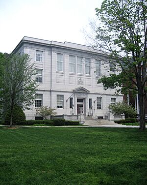
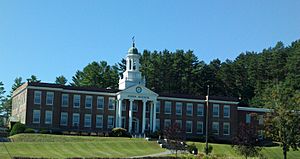
Lyndon Institute
The Lyndon Institute, a high school in Lyndon, Vermont

Vermont was named the nation's smartest state in 2005 and 2006. In 2006, there was a gap between state testing standards and national, which is biased in favor of the state standards by 30%, on average. This puts Vermont 11th-best in the nation. Most states have a higher bias. However, when allowance for race is considered, a 2007 U.S. Government list of test scores shows Vermont white fourth graders performed 25th in the nation for reading (229) and 26th for math (247). White eighth graders scored 18th for math (292) and 12th for reading (273). The first three scores were not considered statistically different from average. White eighth graders scored significantly above average in reading. Statistics for black students were not reliable because of their small representation in the testing.

In 2017, spending $1.6 billion on education for 76,000 public school children, represents more than $21,000 per student.

Education Week ranked the state second in high school graduation rates for 2007.

In 2011, 91% of the population had graduated from high school compared with 85% nationally. Almost 34% have at least an undergraduate degree compared with 28% nationally.

In 2013, the ratio of pupils to teachers was the lowest in the country.

Higher education

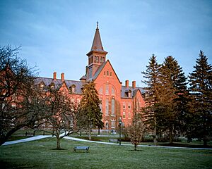
UVM Old Mill building 20040101
The University of Vermont
Old Mill, the oldest building of the university

Experimentation at the University of Vermont by George Perkins Marsh, and later the influence of Vermont-born philosopher and educator John Dewey brought about the concepts of electives and learning by doing.

Vermont has five colleges within the Vermont State Colleges system, University of Vermont (UVM), and thirteen other private, degree-granting colleges, including Bennington College, Champlain College, Goddard College, Marlboro College, Middlebury College, Saint Michael's College, the Vermont Law School, and Norwich University.

Images for kids

See also

Kids robot.svg In Spanish: Vermont para niños

kids search engine
Vermont Facts for Kids. Kiddle Encyclopedia.