Chittenden County, Vermont facts for kids
Quick facts for kids
Chittenden County
|
|
|---|---|
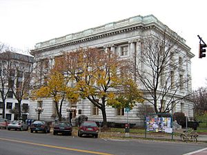
Chittenden County Superior Court in Burlington
|
|
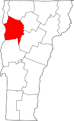
Location within the U.S. state of Vermont
|
|
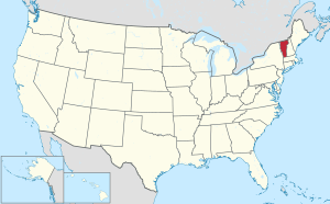 Vermont's location within the U.S. |
|
| Country | |
| State | |
| Founded | October 22, 1787 |
| Named for | Thomas Chittenden |
| Shire Town | Burlington |
| Largest city | Burlington |
| Area | |
| • Total | 619 sq mi (1,600 km2) |
| • Land | 537 sq mi (1,390 km2) |
| • Water | 83 sq mi (210 km2) 13%% |
| Population
(2020)
|
|
| • Total | 168,323 |
| • Estimate
(2022)
|
169,301 |
| • Density | 271.93/sq mi (104.99/km2) |
| Time zone | UTC−5 (Eastern) |
| • Summer (DST) | UTC−4 (EDT) |
| Congressional district | At-large |
Chittenden County is the county with the most people in the U.S. state of Vermont. In 2020, about 168,323 people lived here. The main city and county seat is Burlington, which is also Vermont's biggest city.
This county has more than a quarter of Vermont's total population. It has more than twice as many people as Rutland, the second-largest county. Chittenden County is named after Thomas Chittenden. He was Vermont's first governor and helped write its constitution.
Chittenden County is home to many of Vermont's fastest-growing towns. It is part of the Burlington metropolitan area. This area also includes Franklin and Grand Isle counties.
The University of Vermont, the state's largest university, is located here. Its hospital, the UVM Medical Center, is also in the county. Together, they are the biggest employer in Vermont. The largest private employer, GlobalFoundries, is in Essex Junction. Vermont's biggest airport, Patrick Leahy Burlington International Airport, is in South Burlington.
The Vermont Army National Guard is based at Camp Johnson in Colchester. The Vermont Air National Guard is at the Burlington Air National Guard Base. This base is located at the international airport.
Contents
Exploring Chittenden County's Geography
Chittenden County covers about 619 square miles. About 83 square miles (13%) of this area is water. It is the third-smallest county in Vermont by land area.
Long ago, Chittenden County was much larger. It included parts of other counties we know today. These were Franklin, Grand Isle, Lamoille, Orleans, Washington, and Addison counties.
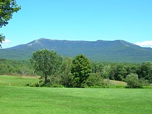
The town of Underhill in Chittenden County is special. It is home to Mount Mansfield, Vermont's highest mountain. Its peak is about 4,393 feet (1,339 meters) above sea level.
Neighboring Counties
Chittenden County shares borders with these other counties:
- Addison County – to the south
- Clinton County, New York – to the northwest
- Essex County, New York – to the west
- Franklin County – to the north
- Grand Isle County – to the northwest
- Lamoille County – to the northeast
- Washington County – to the southeast
Major Roads and Highways
Many important roads run through Chittenden County. These help people travel and connect communities.
 I-89
I-89 I-189
I-189 US 2
US 2 US 7
US 7
 US 7 Alt.
 VT 2A
VT 2A- VT F-5
 VT 15
VT 15 VT 17
VT 17 VT 116
 VT 117
 VT 127
 VT 128
 VT 289
People and Population (Demographics)
| Historical population | |||
|---|---|---|---|
| Census | Pop. | %± | |
| 1790 | 7,287 | — | |
| 1800 | 12,778 | 75.4% | |
| 1810 | 18,120 | 41.8% | |
| 1820 | 16,955 | −6.4% | |
| 1830 | 21,765 | 28.4% | |
| 1840 | 22,977 | 5.6% | |
| 1850 | 29,036 | 26.4% | |
| 1860 | 28,171 | −3.0% | |
| 1870 | 36,480 | 29.5% | |
| 1880 | 32,792 | −10.1% | |
| 1890 | 35,389 | 7.9% | |
| 1900 | 39,600 | 11.9% | |
| 1910 | 42,447 | 7.2% | |
| 1920 | 43,708 | 3.0% | |
| 1930 | 47,471 | 8.6% | |
| 1940 | 52,098 | 9.7% | |
| 1950 | 62,570 | 20.1% | |
| 1960 | 74,425 | 18.9% | |
| 1970 | 99,131 | 33.2% | |
| 1980 | 115,534 | 16.5% | |
| 1990 | 131,761 | 14.0% | |
| 2000 | 146,571 | 11.2% | |
| 2010 | 156,545 | 6.8% | |
| 2020 | 168,323 | 7.5% | |
| 2022 (est.) | 169,301 | 8.1% | |
| U.S. Decennial Census 1790–1960 1900–1990 1990–2000 2010–2020 |
|||
In 2018, Chittenden County had about 164,572 people. Many households (36.23%) had children under 18 living in them. Most households (52.9%) were married couples.
The population is mostly White (91.7%). Other groups include Black or African American (2.4%), Asian (3.5%), and people of two or more races (2.1%). About 2.2% of the population is Hispanic or Latino.
The county has a younger average age compared to other parts of Vermont. In 2007, the average age was 37.5 years. About 8% of residents speak a language other than English at home.
Economy and Jobs
The economy in Chittenden County is strong. In 2007 and 2011, the average household income was about $62,260. The income per person was about $32,533.
Major Industries and Companies
Essex Junction is home to GlobalFoundries. This company makes computer chips and is the largest private employer in Vermont. It has about 3,000 employees.
Burton Snowboards, a famous company that makes snowboards, is based in Burlington. They employ 500 people.
Shopping and Retail
Chittenden County is a big shopping area for Vermont. In 2007, it had 29% of all retail sales in the state. This was about $1.52 billion. Several cities in the county are top shopping spots. These include Williston, South Burlington, Colchester, and Burlington.
Learning and Education
Chittenden County has many schools for students from kindergarten to high school. Teachers' salaries in 2007–2008 ranged from about $33,000 to $79,000 per year.
School Districts
Here are some of the school districts in the county:
- Burlington School District
- Champlain Valley Unified School District
- Chittenden East Supervisory Union
- Colchester School District
- Essex-Westford Educational Community Unified School District
- Milton School District
- South Burlington School District
- Winooski Incorporated School District
Colleges and Universities
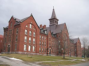
Chittenden County is home to several colleges and universities:
- University of Vermont (in Burlington)
- Champlain College (in Burlington)
- Saint Michael's College (in Colchester)
- Vermont Center of Southern New Hampshire University (in Colchester)
- A branch campus of Albany College of Pharmacy and Health Sciences (in Colchester)
- A branch of the Community College of Vermont (in Winooski)
- A satellite campus of Vermont Technical College (in Williston)
County Infrastructure
Vermont counties, including Chittenden, have less formal county government than in some other states. Few agencies work county-wide. One example is the Chittenden County Solid Waste District, which manages trash and recycling.
Roads and Transportation
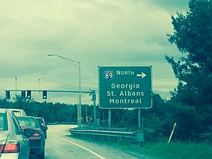
Interstate 89 is a major highway that crosses Chittenden County. It runs from the southeast to the northwest, following the Lake Champlain shoreline. This interstate has several exits that connect to other important roads like U.S. Route 2 and U.S. Route 7.
The Chittenden County Metropolitan Planning Organization helps manage traffic. They also check road conditions and decide how to use money for roads.
Communities in Chittenden County
Chittenden County has several cities, towns, and other communities.
Cities
- Burlington (This is the county seat)
- Essex Junction
- South Burlington
- Winooski
Towns
Villages
Census-Designated Places (CDPs)
These are areas that the U.S. Census Bureau identifies for statistics.
- Bolton
- Bolton Valley
- East Charlotte
- Hanksville
- Hinesburg
- Huntington
- Huntington Center
- Milton
- Richmond
- Shelburne
- St. George
- Underhill Center
- Underhill Flats
- West Charlotte
- Westford
Unincorporated Communities
These are small areas that are not officially part of any town.
- Buels Gore
- Jonesville
- Stevensville
See also
 In Spanish: Condado de Chittenden para niños
 | Frances Mary Albrier |
 | Whitney Young |
 | Muhammad Ali |


