Chittenden, Vermont facts for kids
Quick facts for kids
Chittenden, Vermont
|
||
|---|---|---|
|
||

Chittenden, Vermont
|
||
| Country | United States | |
| State | Vermont | |
| County | Rutland | |
| Communities |
|
|
| Area | ||
| • Total | 74.2 sq mi (192.2 km2) | |
| • Land | 73.0 sq mi (189.1 km2) | |
| • Water | 1.2 sq mi (3.1 km2) | |
| Elevation | 1,496 ft (456 m) | |
| Population
(2020)
|
||
| • Total | 1,237 | |
| • Density | 16.671/sq mi (6.436/km2) | |
| Time zone | UTC-5 (Eastern (EST)) | |
| • Summer (DST) | UTC-4 (EDT) | |
| ZIP Codes |
05737 (Chittenden)
05763 (North Chittenden) 05701 (South Chittenden) |
|
| Area code(s) | 802 | |
| FIPS code | 50-14350 | |
| GNIS feature ID | 1462071 | |
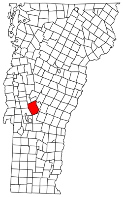
Chittenden is a town in Rutland County, Vermont, United States. In 2020, about 1,237 people lived there.
Contents
History of Chittenden
Chittenden is the largest town in Vermont by land area. It was named after Thomas Chittenden. He was a famous leader of the Green Mountain Boys. This was a group of soldiers who helped Vermont become independent. Thomas Chittenden later became the first governor of the Vermont Republic and then the state of Vermont. He and his son Noah were among the first people to be granted land in the town. However, the governor might never have visited the area himself.
The Chittenden Reservoir is a popular spot in the area. People enjoy swimming and boating there.
Geography of Chittenden
Chittenden covers a total area of about 74.2 square miles (192.2 square kilometers). Most of this area, about 73.0 square miles (189.1 square kilometers), is land. The rest, about 1.2 square miles (3.1 square kilometers), is water. This makes Chittenden the biggest town in Vermont by area. It is a little larger than the town of Stowe.
A ridge of the Green Mountains divides the town into two parts. Only the western half of Chittenden has people living in it. The small community of Chittenden is located in the southwest part of the town. A large part of the town is still covered by untouched forest.
Population and People in Chittenden
| Historical population | |||
|---|---|---|---|
| Census | Pop. | %± | |
| 1790 | 159 | — | |
| 1800 | 327 | 105.7% | |
| 1810 | 446 | 36.4% | |
| 1820 | 528 | 18.4% | |
| 1830 | 610 | 15.5% | |
| 1840 | 644 | 5.6% | |
| 1850 | 675 | 4.8% | |
| 1860 | 763 | 13.0% | |
| 1870 | 802 | 5.1% | |
| 1880 | 1,092 | 36.2% | |
| 1890 | 730 | −33.2% | |
| 1900 | 621 | −14.9% | |
| 1910 | 563 | −9.3% | |
| 1920 | 472 | −16.2% | |
| 1930 | 341 | −27.8% | |
| 1940 | 379 | 11.1% | |
| 1950 | 424 | 11.9% | |
| 1960 | 460 | 8.5% | |
| 1970 | 646 | 40.4% | |
| 1980 | 927 | 43.5% | |
| 1990 | 1,102 | 18.9% | |
| 2000 | 1,182 | 7.3% | |
| 2010 | 1,258 | 6.4% | |
| 2020 | 1,237 | −1.7% | |
| U.S. Decennial Census | |||
In 2000, there were 1,182 people living in Chittenden. There were 451 households, and 345 of these were families. The town had about 16 people per square mile. Most of the people living in Chittenden were White (98.48%).
About 37.3% of households had children under 18 living with them. The average household had 2.62 people. The average family had 2.97 people.
About 26.3% of the people were under 18 years old. About 8.4% were 65 years or older. The average age in the town was 40 years.
Famous People from Chittenden
- Horatio Eddy, who was known for his psychic abilities in a traveling show.
- William Eddy, Horatio's brother, also known for his psychic abilities in a traveling show.
Climate in Chittenden
Chittenden has a type of climate called a humid continental climate. This means the town experiences big changes in temperature throughout the year. Summers are usually warm to hot, and they can often be humid. Winters are cold, and sometimes they can be very cold.
See also
 In Spanish: Chittenden para niños
 | Audre Lorde |
 | John Berry Meachum |
 | Ferdinand Lee Barnett |


