
Winooski, Vermont facts for kids
Quick facts for kids
Winooski, Vermont
|
||
|---|---|---|

The Winooski Block (1867) in downtown Winooski
|
||
|
||
| Nickname(s):
Onion City
|
||

Location in Chittenden County and the state of Vermont
|
||

Winooski, Vermont
Location in the United States
|
||
| Country | United States | |
| State | Vermont | |
| County | Chittenden | |
| Area | ||
| • Total | 1.51 sq mi (3.92 km2) | |
| • Land | 1.43 sq mi (3.71 km2) | |
| • Water | 0.08 sq mi (0.21 km2) | |
| Elevation | 177 ft (54 m) | |
| Population
(2020)
|
||
| • Total | 7,997 | |
| • Density | 5,592.31/sq mi (2,155.52/km2) | |
| Time zone | UTC−5 (Eastern (EST)) | |
| • Summer (DST) | UTC−4 (EDT) | |
| ZIP code |
05404
|
|
| Area code(s) | 802 | |
| FIPS code | 50-85150 | |
| GNIS feature ID | 1460302 | |
| Website | Winooski, VT Official City Website: https://www.winooskivt.gov/ | |

Winooski is a small city in Chittenden County, Vermont, United States. It sits right on the Winooski River. In 2020, about 7,997 people lived there.
Winooski is the most densely populated city in northern New England. This area includes the states of Maine, New Hampshire, and Vermont. It is also the smallest city in Vermont by land area. However, the city of Vergennes has fewer people. Winooski is part of the larger Burlington, Vermont metropolitan area. It is bordered by Burlington, Colchester, and South Burlington.
Contents
Exploring Winooski's Location
Winooski is a small city, covering about 1.5 square miles (3.9 square kilometers). A small part of this area, about 0.1 square miles (0.2 square kilometers), is covered by water.
The Meaning Behind the Name
The name "Winooski" comes from the Abenaki tribe. Around 750 CE, they lived along a waterfall in a rich river valley. They called this place Winoskitegw, which means "land of the wild onion." The Winooski River, which forms the city's southern border, is also known as the Onion River.
A Look at Winooski's Past
Ancient Times
About 5,000 years ago, a family of early Native Americans, called paleolithic people, visited this area. Their ancient camping spot is a very important archaeological site in Vermont. Other native people also came to Winooski in the years that followed.
Colonial Era and Early Growth
Winooski was likely a rest stop for travelers because it was on a main road. It also had waterfalls, which were perfect for powering industries. This helped it become a center for processing wool.
In the early 1770s, a man named Ira Allen built a blockhouse on the Winooski River. This building was like a small fort. It also served as a general store and office for his land company. The fort was never used for fighting. However, it made the land more valuable and encouraged people to settle there.
After the Revolutionary War
After the American Revolutionary War, Ira Allen built a dam across the river. He added sawmills on each side of the dam. These mills used the river's power.
In the late 1830s, the Burlington Mill Company used the river's power to make yarns and cloth. In 1846, James and Lucinda Stone, who were from Winooski, moved to Sheboygan County in the Wisconsin Territory. They named their new home Winooski, Wisconsin.
Modern History and Changes

In 1901, the American Woolen Company bought the struggling Burlington Mills. This helped the area's economy grow again. Because of this success, Winooski officially became a city in 1922. It separated from the town of Colchester.
The mills closed in 1954. This caused economic problems for the city for about 20 years. In the 1980s, two old mills were turned into new spaces for businesses, offices, and apartments. This helped to bring new life to the area.
In 1979, the city looked into building a giant dome over Winooski. The idea was to save on heating costs during the winter. The dome would have been 200 feet tall in the middle. Cars that used gasoline would have been banned inside. The dome was never built. However, in 2009, the city's planner said it was a great idea. He even said, "You could have had year-round fly-fishing."
Who Lives in Winooski?
| Historical population | |||
|---|---|---|---|
| Census | Pop. | %± | |
| 1880 | 2,833 | — | |
| 1890 | 3,659 | 29.2% | |
| 1900 | 3,659 | 0.0% | |
| 1910 | 4,520 | 23.5% | |
| 1920 | 4,932 | 9.1% | |
| 1930 | 5,308 | 7.6% | |
| 1940 | 6,036 | 13.7% | |
| 1950 | 6,734 | 11.6% | |
| 1960 | 7,420 | 10.2% | |
| 1970 | 7,309 | −1.5% | |
| 1980 | 6,318 | −13.6% | |
| 1990 | 6,649 | 5.2% | |
| 2000 | 6,561 | −1.3% | |
| 2010 | 7,267 | 10.8% | |
| 2020 | 7,997 | 10.0% | |
| U.S. Decennial Census | |||
In 2010, about 7,267 people lived in Winooski. The city had about 5,191 people per square mile. Most people (82.5%) were White. There were also people of African American (6.9%), Asian (6.2%), and other backgrounds. About 2.2% of the population was Hispanic or Latino.
Many people in Winooski have French or French-Canadian family roots (about 36%). Other common backgrounds include Irish (13%), English (8%), Italian (5%), and German (5%). About 14.4% of the people in Winooski were born outside of the United States.
The average age in the city was 33 years old. About 21.5% of the population was under 18. About 13.5% of the population was 65 or older.

Getting Around Winooski
Bus service in Winooski is provided by Green Mountain Transit. The city is also served by major roads. These include Interstate 89, and US Routes 2 and 7.

Famous People from Winooski
- Jan Backus, who used to be a state senator in Vermont, lives in Winooski.
- Peter Clavelle, who was once the mayor of Burlington, was born in Winooski.
Images for kids
-
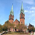
St. Francis Xavier Church on St. Peter Street


See also
 In Spanish: Winooski para niños
