
Interstate 89 facts for kids
Quick facts for kids
|
|
|---|---|
| Lua error in Module:Infobox_road/map at line 15: attempt to index field 'wikibase' (a nil value). | |
| Route information | |
| Length | 191.12 mi (307.58 km) |
| Major junctions | |
| South end | |
| North end | |
| Highway system | |
| Main route of the Interstate Highway System Main • Auxiliary • Business |
|

Interstate 89 is an important road in the United States. It is part of the Interstate Highway System, which connects many cities across the country. This highway starts in Concord, New Hampshire and travels north. It ends at the Canada border near Highgate Springs, Vermont. The entire route is about 191 miles (307 kilometers) long.

What is Interstate 89?
Interstate 89, often called I-89, is a major highway. It helps people travel between New Hampshire and Vermont. It's a key road for both everyday drivers and tourists. The highway makes it easier to visit different towns and cities. It also helps transport goods across these states.
Where Does I-89 Go?
I-89 begins in Concord, New Hampshire. This is near where it connects with Interstate 93. From there, it heads northwest through New Hampshire. It passes through beautiful forested areas.
The highway then crosses into Vermont. It goes through the heart of the state. You'll see many scenic views along the way. I-89 connects with Interstate 91 in White River Junction, Vermont. This is another important meeting point for travelers.
As it continues north, I-89 passes near Vermont's capital, Montpelier. It also goes through larger cities like Burlington. Finally, it reaches the Canadian border. Here, it connects with Quebec Route 133. This allows travelers to continue into Canada.
Fun Facts About I-89
I-89 is known for its pretty scenery. Especially in Vermont, you can see mountains and forests. It's a popular route for people visiting ski resorts in winter. In the fall, the leaves turn bright colors. This makes for a very beautiful drive.
One famous landmark along I-89 is "The Whale Tails" sculpture. You can see it in South Burlington. It's a fun and unique piece of art right by the highway. Many drivers enjoy spotting it as they pass by. This highway helps connect many communities. It also provides a direct path to Canada.
Images for kids
-
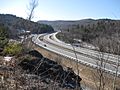
New Hampshire Exit 15 (Montcalm), looking south
-
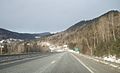
Interstate 89 northbound in Vermont, approaching Exit 2 in Sharon
-
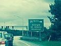
I-89 Exit 17 in Colchester (June 5, 2015), Chittenden County
-
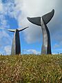
The Whale Tails along I-89 northbound in South Burlington, just west of Exit 12


.jpg)
