Sharon, Vermont facts for kids
Quick facts for kids
Sharon, Vermont
|
|
|---|---|
|
Town
|
|

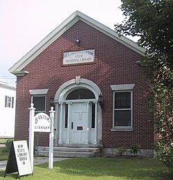
Baxter Memorial Library
|
|

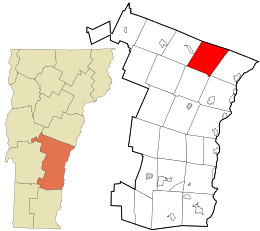
Location in Windsor County and the state of Vermont.
|
|

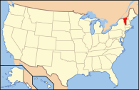
Location of Vermont in the United States
|
|
| Country | United States |
| State | Vermont |
| County | Windsor |
| Chartered | 1761 |
| Area | |
| • Total | 40.1 sq mi (103.8 km2) |
| • Land | 39.6 sq mi (102.6 km2) |
| • Water | 0.5 sq mi (1.2 km2) |
| Elevation | 500 ft (449 m) |
| Population
(2020)
|
|
| • Total | 1,560 |
| • Density | 38.90/sq mi (15.03/km2) |
| Time zone | UTC-5 (EST) |
| • Summer (DST) | UTC-4 (EDT) |
| ZIP Codes |
05065 (Sharon)
05068 (South Royalton) |
| Area code(s) | 802 |
| FIPS code | 50-63775 |
| GNIS feature ID | 1462204 |
Sharon is a small town in Windsor County, Vermont, United States. In 2020, about 1,560 people lived there.
Sharon is famous as the birthplace of Joseph Smith. He was the founder of the Latter Day Saint movement. This makes Sharon an important historical place for people who follow that faith. The town is also home to The Sharon Academy, which is a special middle and high school.
Contents
History of Sharon
Sharon was created on August 17, 1761. This happened when King George III of the United Kingdom gave a special paper called a royal charter. It was part of the "New Hampshire grants," which were lands given out by the governor. John Taylor and 61 other people received the land. Many of them came from a town called Sharon, Connecticut.
The first people to settle in Sharon were Robert Havens and his family around 1765. During the American Revolution in 1780, the town was attacked. A group of British soldiers and Mohawk people burned parts of the village. This event is known as the Royalton Raid.
Even though the land in Sharon is hilly, the flat areas near rivers have good soil. Because of this, farming became a very important job. On June 26, 1848, a new train line opened. The Vermont Central Railroad went through Sharon, helping the town grow faster.
The White River and its smaller streams provided water power. This power was used for mills. By 1859, Sharon had 12 sawmills, a gristmill (for grinding grain), and a factory that made bobbins (parts for spinning machines). Many old homes in Sharon are still found along the White River. For a long time in the mid-1900s, cutting and selling lumber was the main job in Sharon.
Geography and Nature
Sharon is located in Vermont. The town covers about 40.1 square miles (103.9 square kilometers). Most of this area, about 39.6 square miles (102.6 square kilometers), is land. The rest, about 0.5 square miles (1.2 square kilometers), is water.
The White River flows through Sharon. Many smaller streams also flow into it. These rivers and streams help drain the land.
Major roads like Interstate 89 and Vermont Route 14 pass through Sharon. Vermont Route 132 also crosses the town.
Population Information
| Historical population | |||
|---|---|---|---|
| Census | Pop. | %± | |
| 1790 | 569 | — | |
| 1800 | 1,158 | 103.5% | |
| 1810 | 1,363 | 17.7% | |
| 1820 | 1,431 | 5.0% | |
| 1830 | 1,459 | 2.0% | |
| 1840 | 1,371 | −6.0% | |
| 1850 | 1,240 | −9.6% | |
| 1860 | 1,111 | −10.4% | |
| 1870 | 1,013 | −8.8% | |
| 1880 | 1,012 | −0.1% | |
| 1890 | 737 | −27.2% | |
| 1900 | 709 | −3.8% | |
| 1910 | 585 | −17.5% | |
| 1920 | 545 | −6.8% | |
| 1930 | 569 | 4.4% | |
| 1940 | 530 | −6.9% | |
| 1950 | 470 | −11.3% | |
| 1960 | 485 | 3.2% | |
| 1970 | 541 | 11.5% | |
| 1980 | 828 | 53.0% | |
| 1990 | 1,211 | 46.3% | |
| 2000 | 1,411 | 16.5% | |
| 2010 | 1,502 | 6.4% | |
| 2020 | 1,560 | 3.9% | |
| U.S. Decennial Census | |||
In 2000, there were 1,411 people living in Sharon. There were 553 households, which are groups of people living together. About 36.5% of these households had children under 18. The average age of people in Sharon was 38 years old.
By 2010, the population had grown to 1,502 people. The average age was 44 years old. Most of the people living in Sharon were white (95.5%).
Places to Visit
- Joseph Smith Birthplace Memorial: This is a historical site where Joseph Smith was born.
- Sharon Historical Society & Museum: Here you can learn about the history of Sharon.
- Baxter Memorial Library: A local library for the community.
Famous People From Sharon
- Jason Downer: He was a judge on the Wisconsin Supreme Court.
- Robby Mook: A political strategist who managed campaigns.
- Joseph Olshan: An American writer and book publisher.
- Charley Parkhurst: A well-known stagecoach driver.
- John Spaulding: He served as the Vermont State Treasurer.
See also
 In Spanish: Sharon (Vermont) para niños
 | Selma Burke |
 | Pauline Powell Burns |
 | Frederick J. Brown |
 | Robert Blackburn |


