Sharon, Connecticut facts for kids
Quick facts for kids
Sharon, Connecticut
|
|
|---|---|
| Town of Sharon | |

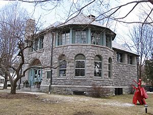
Hotchkiss Memorial Library
|
|
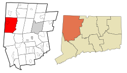
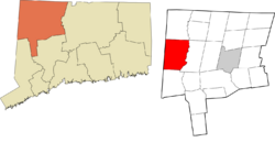
 Litchfield County and Connecticut Litchfield County and Connecticut Northwest Hills Planning Region and Connecticut Northwest Hills Planning Region and Connecticut |
|
| Country | |
| U.S. state | |
| County | Litchfield |
| Region | Northwest Hills |
| Incorporated | 1739 |
| Named for | Sharon plain |
| Government | |
| • Type | Selectman–town meeting |
| Area | |
| • Total | 59.6 sq mi (154.3 km2) |
| • Land | 58.8 sq mi (152.2 km2) |
| • Water | 0.8 sq mi (2.1 km2) |
| Elevation | 1,135 ft (346 m) |
| Population
(2020)
|
|
| • Total | 2,680 |
| • Density | 44.98/sq mi (17.37/km2) |
| Time zone | UTC−5 (Eastern) |
| • Summer (DST) | UTC−4 (Eastern) |
| ZIP Code |
06069
|
| Area code(s) | 860/959 |
| FIPS code | 09-005-67960 |
| GNIS feature ID | 213503 |
Sharon is a charming town located in Litchfield County, Connecticut. It sits in the northwest corner of the state. In 2020, about 2,680 people lived here. Sharon is part of the Northwest Hills Planning Region. The town's main area is known as the Sharon census-designated place.
Contents
Discovering Sharon's Past
Early Inhabitants and Founding
The first people to live in this area were the Mattabesec Native Americans. They called their home Poconnuck. These groups were part of the larger Wappinger confederacy. This confederacy was also connected to the even bigger Algonquian group.
Sharon officially became a town in 1739. It was named after the Plain of Sharon, a famous place mentioned in the Bible.
Exploring Historic Sites
Sharon is home to six important places. These sites are listed on the U.S. National Register of Historic Places. This means they are special and protected for their history.
- Ebenezer Gay House, 18 Main St., Sharon
- George King House, 12 N. Main St., Sharon
- Gov. Smith Homestead, South Main St., Sharon
- James Pardee House, 129 N. Main St., Sharon
- Sharon Historic District, a large area around Main Street
- Sharon Valley Historic District
Sharon's Location and Landscape
Where is Sharon?
Sharon is bordered by several other towns. To the north is Salisbury. To the east, across the Housatonic River, is Cornwall. Kent is to the south, and Dutchess County, New York is to the west.
Sharon is about 42 miles north of Danbury. It's also 52 miles west of Hartford. And it's 30 miles northeast of Poughkeepsie, New York.
Natural Beauty and Size
The town covers a total area of about 154.3 square kilometers. Most of this (152.2 sq km) is land. About 2.1 sq km, or 1.33%, is water. Sharon is actually the third largest town in Connecticut by land area.
Sharon is part of the Northwest Highlands of Connecticut. This region includes the area around the Housatonic River. The famous Appalachian Trail also runs through the eastern side of Sharon for a few miles. This is near West Cornwall and U.S. Route 7. You can also find Housatonic Meadows State Park in the eastern part of town, right next to the Housatonic River.
Main Areas in Sharon
Sharon has several smaller communities within its borders:
- Amenia Union
- Ellsworth
- Sharon center
- Sharon Valley
- Main Street & Green
- Calkinstown
- West Woods
People of Sharon
Population Over Time
| Historical population | |||
|---|---|---|---|
| Census | Pop. | %± | |
| 1820 | 2,573 | — | |
| 1850 | 2,507 | — | |
| 1860 | 2,556 | 2.0% | |
| 1870 | 2,441 | −4.5% | |
| 1880 | 2,580 | 5.7% | |
| 1890 | 2,149 | −16.7% | |
| 1900 | 1,982 | −7.8% | |
| 1910 | 1,880 | −5.1% | |
| 1920 | 1,585 | −15.7% | |
| 1930 | 1,710 | 7.9% | |
| 1940 | 1,611 | −5.8% | |
| 1950 | 1,889 | 17.3% | |
| 1960 | 2,141 | 13.3% | |
| 1970 | 2,491 | 16.3% | |
| 1980 | 2,623 | 5.3% | |
| 1990 | 2,928 | 11.6% | |
| 2000 | 2,968 | 1.4% | |
| 2010 | 2,782 | −6.3% | |
| 2020 | 2,680 | −3.7% | |
| U.S. Decennial Census | |||
In 2000, there were 2,968 people living in Sharon. These people made up 1,246 households and 775 families. The town had about 50.6 people per square mile. Most residents (96.87%) were White. A small percentage were African American (0.94%) or Asian (0.57%). About 1.95% of the population was Hispanic or Latino.
Household Information
About 25.8% of households had children under 18. Many households (51.9%) were married couples living together. About 31.1% of all households were single individuals. The average household had 2.26 people. The average family had 2.87 people.
The median age in Sharon was 45 years old. About 21.3% of the population was under 18. And 21.0% were 65 years or older.
The median income for a household was $53,000. For families, it was $71,458. The average income per person in the town was $45,418. A small number of families (3.9%) and people (7.2%) lived below the poverty line.
Education in Sharon
Sharon is part of Regional School District 01. This district also includes the towns of Canaan, Cornwall, Kent, North Canaan, and Salisbury.
Younger students (Kindergarten to 8th grade) attend Sharon Center School. For high school (grades 9-12), students go to Housatonic Valley Regional High School. Some students might also choose to attend Oliver Wolcott Regional Vocational Technical School.
Getting Around Sharon
Sharon is served by several state highways. These include Route 4, Route 41, Route 343, and Route 361.
Route 4 starts in Sharon and goes southeast for 8 miles to Cornwall Bridge. It eventually reaches West Hartford, which is 47 miles east. Route 41 goes 8 miles north to Salisbury and 4 miles southwest to the New York state line. Route 343 heads west and becomes New York State Route 343, leading 5 miles to Amenia, New York. Route 361 goes towards Millerton, New York, which is 6 miles north of Sharon.
Famous People from Sharon
Many well-known people have lived in or have connections to Sharon:
- Kevin Bacon (born 1958), and his wife Kyra Sedgwick (born 1965), actors
- William F. Buckley Jr. (1925–2008), a famous writer and founder of National Review magazine
- Yancy Butler (born 1970), actress
- William Coley (1862–1936), a New York surgeon who developed an early cancer treatment
- Jane Curtin (born 1947), actress and comedian
- Michael J. Fox (born 1961) and his wife Tracy Pollan (born 1960), actors
- Frank R. Fratellenico (1951–1970), a Medal of Honor recipient from the Vietnam War
- Arthur Getz (1913–1996), illustrator for The New Yorker magazine
- Jasper Johns (born 1930), a famous artist
- Sam Posey (born 1944), a retired race car driver and sports broadcaster
- Campbell Scott (born 1961), actor
- Bradley Whitford (born 1959) and his wife Jane Kaczmarek (born 1955), actors
Born in Sharon Hospital
Some notable people were born at Sharon Hospital, even if they grew up elsewhere:
- Philip Amelio, a child actor from the 1980s, born in Sharon in 1977. He grew up in nearby Pine Plains, New York.
- Samuel Berger, who was a U.S. National Security Advisor for President Bill Clinton. He was born in Sharon in 1945 and grew up in Millerton, New York.
- Michael Cole (born Michael Shawn Coulthard), a well-known announcer for WWE Raw. He was born in Sharon in 1968 and grew up in Amenia, New York.
- Alfred Korzybski, who started the nearby Institute of General Semantics, passed away at Sharon Hospital in 1950.
See also
 In Spanish: Sharon (Connecticut) para niños
 | Claudette Colvin |
 | Myrlie Evers-Williams |
 | Alberta Odell Jones |

