
Canaan, Connecticut facts for kids
Quick facts for kids
Canaan, Connecticut
|
||
|---|---|---|

South Canaan Congregational Church
|
||
|
||
 Litchfield County and Connecticut Litchfield County and Connecticut Northwest Hills Planning Region and Connecticut Northwest Hills Planning Region and Connecticut |
||
| Country | ||
| U.S. state | ||
| County | Litchfield | |
| Region | Northwest Hills | |
| Incorporated | 1739 | |
| Government | ||
| • Type | Selectman-town meeting | |
| Area | ||
| • Total | 33.24 sq mi (86.08 km2) | |
| • Land | 32.91 sq mi (85.24 km2) | |
| • Water | 0.32 sq mi (0.84 km2) | |
| Elevation | 656 ft (200 m) | |
| Population
(2020)
|
||
| • Total | 1,080 | |
| • Density | 32.50/sq mi (12.55/km2) | |
| Time zone | UTC−5 (EST) | |
| • Summer (DST) | UTC−4 (EDT) | |
| ZIP code |
06031
|
|
| Area code(s) | 860/959 | |
| FIPS code | 09-10940 | |
| GNIS feature ID | 0213402 | |

Canaan is a small town in Litchfield County, Connecticut, USA. It is part of the Northwest Hills Planning Region. In 2020, about 1,080 people lived there.
Many people in the area call the town by the name of its main village, Falls Village.
Contents
Where is Canaan Located?
Canaan is in the northwestern part of Litchfield County. It shares borders with several other towns. To the north is North Canaan. To the east, you'll find Norfolk. Cornwall is to the south. To the west, across the Housatonic River, is Salisbury.
The town is about 17 miles (27 km) northwest of Torrington. It is also about 46 miles (74 km) north of Danbury. Canaan is 17 miles (27 km) south of Great Barrington, Massachusetts.
Land and Water
Canaan covers a total area of about 33.2 square miles (86.1 square kilometers). Most of this area, about 32.9 square miles (85.2 square kilometers), is land. The rest, about 0.3 square miles (0.8 square kilometers), is water.
Main Communities in Canaan
Canaan has a few important communities:
- Falls Village (This is the main town center)
- Huntsville
- Lower City
- South Canaan
A Look at Canaan's History
Canaan became an official town in 1739. The name "Canaan" comes from an ancient name for a region in the Middle East. This town was founded eight years after another town called New Canaan was settled in a different part of Connecticut.
How Many People Live in Canaan?
The number of people living in Canaan has changed over the years. Here's a quick look at the population counts from different years:
| Historical population | |||
|---|---|---|---|
| Census | Pop. | %± | |
| 1820 | 2,332 | — | |
| 1850 | 2,627 | — | |
| 1860 | 1,408 | −46.4% | |
| 1870 | 1,257 | −10.7% | |
| 1880 | 1,157 | −8.0% | |
| 1890 | 970 | −16.2% | |
| 1900 | 820 | −15.5% | |
| 1910 | 702 | −14.4% | |
| 1920 | 561 | −20.1% | |
| 1930 | 565 | 0.7% | |
| 1940 | 555 | −1.8% | |
| 1950 | 708 | 27.6% | |
| 1960 | 790 | 11.6% | |
| 1970 | 931 | 17.8% | |
| 1980 | 1,002 | 7.6% | |
| 1990 | 1,057 | 5.5% | |
| 2000 | 1,081 | 2.3% | |
| 2010 | 1,234 | 14.2% | |
| 2020 | 1,080 | −12.5% | |
| U.S. Decennial Census | |||
In 2000, there were 1,081 people living in Canaan. There were 445 households, which are groups of people living together. About 30% of these households had children under 18. The average age of people in Canaan was 42 years old.
Education in Canaan
Canaan is part of Regional School District 1. This school district also includes the towns of Cornwall, Kent, North Canaan, Salisbury, and Sharon.
Younger students, from kindergarten to 8th grade, go to Lee H. Kellogg School. For high school, students in grades 9-12 attend Housatonic Valley Regional High School.
Famous People from Canaan
Many interesting people have connections to Canaan:
- Philo Belden – A politician from Wisconsin.
- Steve Blass – A former baseball pitcher and current sports broadcaster.
- Major Felten – An artist and illustrator.
- James Mars – An author who wrote about his experiences as a slave.
- Judson Philips – An author known for his mystery novels.
- Cyrus Prindle – A leader in the movement to end slavery and a founder of the Wesleyan Church.
- Lemuel Roberts – A soldier and historian from the American Revolutionary War. He was born in Canaan in 1755.
- Catherine Roraback – A lawyer who worked for civil rights.
- Bates Turner – A politician and judge from Vermont.
- Elizur Wright – Often called the "father of life insurance."
How to Get Around Canaan
Several important roads pass through Canaan. These include U.S. Route 7, Route 63, and Route 126.
U.S. Route 7 goes north into Massachusetts and south to Danbury. Route 63 heads southeast towards Litchfield. Route 126 is a local road that goes through the center of Falls Village and runs north along the Housatonic River.
Images for kids
-
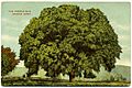
"The Famous Elm", c. 1910
-
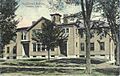
High school, 1910


See also
 In Spanish: Canaan (Connecticut) para niños
