
Norfolk, Connecticut facts for kids
Quick facts for kids
Norfolk, Connecticut
|
||
|---|---|---|
| Town of Norfolk | ||

Shops in Downtown Norfolk
|
||
|
||
 Litchfield County and Connecticut Litchfield County and Connecticut Northwest Hills Planning Region and Connecticut Northwest Hills Planning Region and Connecticut |
||
| Country | ||
| U.S. state | ||
| County | Litchfield | |
| Region | Northwest Hills | |
| Incorporated | 1758 | |
| Government | ||
| • Type | Selectman-town meeting | |
| Area | ||
| • Total | 46.4 sq mi (120.2 km2) | |
| • Land | 45.3 sq mi (117.4 km2) | |
| • Water | 1.1 sq mi (2.9 km2) | |
| Elevation | 1,230 ft (375 m) | |
| Population
(2020)
|
||
| • Total | 1,588 | |
| • Density | 35/sq mi (13.5/km2) | |
| Time zone | UTC-5 (Eastern) | |
| • Summer (DST) | UTC-4 (Eastern) | |
| ZIP code |
06058
|
|
| Area code(s) | 860/959 | |
| FIPS code | 09-53470 | |
| GNIS feature ID | 0213476 | |

Norfolk (pronounced NOR-foke) is a small town in Litchfield County, Connecticut, United States. In 2020, about 1,588 people lived there. It's part of the Northwest Hills Planning Region. The main part of town, called the Norfolk census-designated place, had 553 residents in 2010.
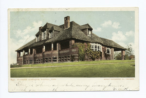
Norfolk is famous for the Yale Summer School of Music—Norfolk Chamber Music Festival. This festival holds concerts every year in "the Music Shed," a special building on the Ellen Battell Stoeckel estate. The town also has cool old buildings. These include the Village Hall (now Infinity Hall), the Norfolk Library, and over thirty buildings designed by Alfredo S. G. Taylor.
Contents
History of Norfolk

Norfolk officially became a town in 1758. It was named after Norfolk in England. The Norfolk Historic District is the old center of the village.
Geography and Nature
Norfolk covers about 120.2 square kilometers (46.4 square miles). Most of this is land, with about 2.9 square kilometers (1.1 square miles) of water. The town is in the Litchfield Hills, which are part of the Appalachian mountain range.
Norfolk is about 375 meters (1,230 feet) above sea level. It's sometimes called "the Icebox of Connecticut" because its winters are very cold and its summers are cool.
Norfolk shares borders with several other towns:
- To the west: Canaan and North Canaan, Connecticut
- To the north: New Marlborough and Sandisfield, Massachusetts
- To the east: Colebrook and Winchester, Connecticut
- To the south: Goshen, Connecticut
Town Areas
Norfolk has a few main areas:
- Norfolk Center
- North Norfolk
- South Norfolk
- West Norfolk
State Parks to Explore
Norfolk is home to three state parks, great for outdoor adventures:
- Dennis Hill State Park: This park has the remains of a fancy summer house designed by Alfredo Taylor.
- Haystack Mountain State Park: You can find a stone tower at the top of this mountain.
- Campbell Falls State Park Reserve: This park has a natural waterfall that is about 30 meters (100 feet) tall.
Climate and Weather
Norfolk has a humid continental climate. This means it has big changes in temperature throughout the year. Summers are warm to hot and often humid, while winters are cold, sometimes very cold.
On February 16, 1943, the temperature dropped to −38 °C (−37 °F). This is the lowest temperature ever recorded in Connecticut.
| Climate data for Norfolk, Connecticut, 1991–2020 normals, extremes 1942–present | |||||||||||||
|---|---|---|---|---|---|---|---|---|---|---|---|---|---|
| Month | Jan | Feb | Mar | Apr | May | Jun | Jul | Aug | Sep | Oct | Nov | Dec | Year |
| Record high °F (°C) | 62 (17) |
70 (21) |
81 (27) |
89 (32) |
89 (32) |
92 (33) |
93 (34) |
98 (37) |
93 (34) |
81 (27) |
76 (24) |
67 (19) |
98 (37) |
| Mean maximum °F (°C) | 52.6 (11.4) |
52.0 (11.1) |
61.9 (16.6) |
77.7 (25.4) |
84.0 (28.9) |
86.6 (30.3) |
88.3 (31.3) |
86.6 (30.3) |
82.6 (28.1) |
72.9 (22.7) |
64.7 (18.2) |
55.2 (12.9) |
90.0 (32.2) |
| Mean daily maximum °F (°C) | 29.8 (−1.2) |
32.3 (0.2) |
40.4 (4.7) |
54.0 (12.2) |
65.3 (18.5) |
73.4 (23.0) |
78.4 (25.8) |
76.4 (24.7) |
69.0 (20.6) |
56.5 (13.6) |
44.8 (7.1) |
34.6 (1.4) |
54.6 (12.5) |
| Daily mean °F (°C) | 21.9 (−5.6) |
23.9 (−4.5) |
31.6 (−0.2) |
44.0 (6.7) |
55.3 (12.9) |
64.0 (17.8) |
69.0 (20.6) |
67.3 (19.6) |
60.0 (15.6) |
48.1 (8.9) |
37.5 (3.1) |
27.9 (−2.3) |
45.9 (7.7) |
| Mean daily minimum °F (°C) | 14.1 (−9.9) |
15.4 (−9.2) |
22.8 (−5.1) |
34.0 (1.1) |
45.4 (7.4) |
54.5 (12.5) |
59.5 (15.3) |
58.1 (14.5) |
50.9 (10.5) |
39.7 (4.3) |
30.2 (−1.0) |
21.1 (−6.1) |
37.1 (2.9) |
| Mean minimum °F (°C) | −5.7 (−20.9) |
−2.0 (−18.9) |
4.7 (−15.2) |
22.0 (−5.6) |
31.6 (−0.2) |
41.5 (5.3) |
49.8 (9.9) |
47.1 (8.4) |
36.8 (2.7) |
26.6 (−3.0) |
15.1 (−9.4) |
4.5 (−15.3) |
−8.0 (−22.2) |
| Record low °F (°C) | −22 (−30) |
−37 (−38) |
−11 (−24) |
6 (−14) |
25 (−4) |
32 (0) |
41 (5) |
35 (2) |
26 (−3) |
17 (−8) |
3 (−16) |
−23 (−31) |
−37 (−38) |
| Average precipitation inches (mm) | 3.97 (101) |
3.33 (85) |
4.21 (107) |
3.93 (100) |
4.13 (105) |
4.96 (126) |
4.77 (121) |
4.67 (119) |
4.90 (124) |
5.14 (131) |
4.07 (103) |
4.86 (123) |
52.94 (1,345) |
| Average snowfall inches (cm) | 17.8 (45) |
17.5 (44) |
14.9 (38) |
3.9 (9.9) |
0.0 (0.0) |
0.0 (0.0) |
0.0 (0.0) |
0.0 (0.0) |
0.0 (0.0) |
1.4 (3.6) |
4.4 (11) |
15.0 (38) |
74.9 (189.5) |
| Average precipitation days (≥ 0.01 in) | 13.1 | 11.6 | 12.4 | 12.7 | 14.1 | 13.0 | 11.8 | 11.4 | 10.4 | 12.2 | 11.4 | 13.8 | 147.9 |
| Average snowy days (≥ 0.1 in) | 9.5 | 8.8 | 6.8 | 2.2 | 0.1 | 0.0 | 0.0 | 0.0 | 0.0 | 0.3 | 2.8 | 7.7 | 38.2 |
| Source 1: NOAA | |||||||||||||
| Source 2: National Weather Service | |||||||||||||
Population Over Time
| Historical population | |||
|---|---|---|---|
| Census | Pop. | %± | |
| 1820 | 1,422 | — | |
| 1850 | 1,643 | — | |
| 1860 | 1,803 | 9.7% | |
| 1870 | 1,641 | −9.0% | |
| 1880 | 1,418 | −13.6% | |
| 1890 | 1,546 | 9.0% | |
| 1900 | 1,614 | 4.4% | |
| 1910 | 1,541 | −4.5% | |
| 1920 | 1,229 | −20.2% | |
| 1930 | 1,298 | 5.6% | |
| 1940 | 1,333 | 2.7% | |
| 1950 | 1,572 | 17.9% | |
| 1960 | 1,827 | 16.2% | |
| 1970 | 2,073 | 13.5% | |
| 1980 | 2,156 | 4.0% | |
| 1990 | 2,060 | −4.5% | |
| 2000 | 1,660 | −19.4% | |
| 2010 | 1,709 | 3.0% | |
| 2020 | 1,588 | −7.1% | |
| U.S. Decennial Census | |||
In 2000, there were 1,660 people living in Norfolk. There were 676 households, and 461 families. The average household had about 2.44 people. The average family had about 2.92 people.
About 23.7% of the people were under 18 years old. The median age was 41 years.
Education in Norfolk
Norfolk is part of Regional School District 7. This district also includes the towns of Barkhamsted, Colebrook, and New Hartford.
Students in Norfolk go to these public schools:
- Botelle Elementary School for grades K–6
- Northwestern Middle School for grades 7–8
- Northwestern Regional High School for grades 9–12
Transportation Around Town
The main roads in Norfolk are U.S. Route 44 and Connecticut Route 272.
- U.S. Route 44 goes east and west. It's also known as Greenwoods Road. It leads west about 7 miles (11 km) to North Canaan. It goes southeast about 10 miles (16 km) to Winsted.
- Connecticut Route 272 goes north and south. Route 272N is called North Street, and 272S is called Litchfield Road. It goes south about 15 miles (24 km) to Torrington.
Cool Places to See

Norfolk has many interesting places, some of which are listed on the National Register of Historic Places:
- Blackberry River Inn: Built in 1763, it's a very old and historic building.
- Gould House
- Haystack Mountain Tower: Built in 1929, this tower offers great views.
- Hillside
- Infinity Hall: An old opera house from 1883, now a concert hall.
- Low House
- Norfolk Library: Built in 1888–89, it's a beautiful shingle-style building.
- Rectory and Church of the Immaculate Conception: Built in 1924.
- Rockwell House
- Tom Thumb House
- World War I Memorial
Famous People from Norfolk
,_a_Victorian_Tudor_mansion_in_Norfolk,_Connecticut.jpg)
Many notable people have lived in Norfolk, including:
- Hayden Carruth (1921–2008): A poet who wrote a book called "Norfolk Poems."
- Joseph Emerson (1821-1900): A minister and thinker.
- Anne Garrels (1951-2022): A foreign correspondent for NPR.
- Brendan Gill (1914–1997): A critic and writer for The New Yorker magazine.
- James Laughlin (1914–1997): A famous publisher.
- Marie Hartig Kendall (1854–1943): A photographer.
- Barbara Spofford Morgan (1887–1971): An educator and writer.
- Michael I. Pupin (1858–1935): An inventor.
- Laura M. Hawley Thurston (1812–1842): A poet and teacher.
- William Henry Welch (1850–1934): A founding dean of the Johns Hopkins University School of Medicine.
- William Windom (1827–1891): A U.S. senator and Secretary of the Treasury.
Nearby Attractions
- Haystack Mountain State Park: A public park with hiking trails and a tall mountain with an observation tower.
- Campbell Falls State Park: A natural area with a beautiful waterfall.
- Infinity Hall: A place where you can watch concerts and shows.
- Husky Meadows Farm: An organic farm where you can get fresh produce.
- Norfolk Chamber Music Festival: One of the oldest summer music festivals in North America, run by Yale University.
See also
 In Spanish: Norfolk (Connecticut) para niños
