
Barkhamsted, Connecticut facts for kids
Quick facts for kids
Barkhamsted, Connecticut
|
||
|---|---|---|

View of the Barkhamsted Reservoir
|
||
|
||
 Litchfield County and Connecticut Litchfield County and Connecticut Northwest Hills Planning Region and Connecticut Northwest Hills Planning Region and Connecticut |
||
| Country | ||
| U.S. state | ||
| County | Litchfield | |
| Region | Northwest Hills | |
| Incorporated | 1779 | |
| Government | ||
| • Type | Selectman-town meeting | |
| Area | ||
| • Total | 38.8 sq mi (100.6 km2) | |
| • Land | 36.3 sq mi (93.9 km2) | |
| • Water | 2.6 sq mi (6.7 km2) | |
| Elevation | 607 ft (185 m) | |
| Population
(2020)
|
||
| • Total | 3,647 | |
| • Density | 100/sq mi (38.8/km2) | |
| Time zone | UTC−5 (Eastern) | |
| • Summer (DST) | UTC−4 (Eastern) | |
| ZIP code |
06063, 06065
|
|
| Area codes | 860/959 | |
| FIPS code | 09-02760 | |
| GNIS feature ID | 0213386 | |

Barkhamsted is a small town located in Litchfield County, Connecticut, United States. It's a quiet place with a population of 3,647 people, based on the 2020 census. The town is made up of seven smaller areas called villages: West Hill, Mallory, Barkhamsted Center, Center Hill, Washington Hill, Pleasant Valley, and Riverton. Barkhamsted became an official town in 1779. It was named after a town in England called Berkhamsted, which is in Hertfordshire.
Contents
Where is Barkhamsted Located?
Barkhamsted is in the northeastern part of Litchfield County. It shares its northern and eastern borders with Hartford County. The town covers a total area of about 38.8 square miles (100.6 square kilometers). Most of this area, about 36.2 square miles (93.9 square kilometers), is land. The rest, about 2.6 square miles (6.7 square kilometers), is water.
Water Bodies and Natural Areas
Important water areas in Barkhamsted include the Barkhamsted Reservoir. This large reservoir is the main source of drinking water for the city of Hartford. Another notable lake is Lake McDonough. The Farmington River also flows through the town. A small part of West Hill Lake is found at Barkhamsted's southern edge.
A lot of land in Barkhamsted is protected. The state of Connecticut owns large parts as state forests, such as Peoples State Forest, American Legion State Forest, Tunxis State Forest, and Enders State Forest. The Metropolitan District Commission (MDC) also owns land here for water supply.
Main Villages in Barkhamsted
Barkhamsted has several communities:
- Barkhamsted Center
- Barkhamsted Hollow (This was a historical area that is now covered by the Barkhamsted Reservoir.)
- Center Hill
- Pleasant Valley
- Riverton
- West Hill
Who Lives in Barkhamsted?
| Historical population | |||
|---|---|---|---|
| Census | Pop. | %± | |
| 1820 | 1,592 | — | |
| 1850 | 1,524 | — | |
| 1860 | 1,272 | −16.5% | |
| 1870 | 1,439 | 13.1% | |
| 1880 | 1,297 | −9.9% | |
| 1890 | 1,130 | −12.9% | |
| 1900 | 864 | −23.5% | |
| 1910 | 865 | 0.1% | |
| 1920 | 719 | −16.9% | |
| 1930 | 697 | −3.1% | |
| 1940 | 724 | 3.9% | |
| 1950 | 946 | 30.7% | |
| 1960 | 1,370 | 44.8% | |
| 1970 | 2,066 | 50.8% | |
| 1980 | 2,935 | 42.1% | |
| 1990 | 3,369 | 14.8% | |
| 2000 | 3,494 | 3.7% | |
| 2010 | 3,799 | 8.7% | |
| 2020 | 3,647 | −4.0% | |
| U.S. Decennial Census | |||
In 2010, Barkhamsted had 3,799 people. Most residents, about 97.5%, were white. A small number were Black or African American (0.3%), Asian (0.6%), or from other races. About 1.5% of the population was Hispanic or Latino.
The average age of people in Barkhamsted in 2000 was 40 years old. About 25% of the population was under 18 years old. The median income for a family in the town was about $73,218 per year. This means half of the families earned more than this amount, and half earned less.
What Services Does Barkhamsted Offer?
Barkhamsted has one elementary school, which is located in the village of Pleasant Valley. For middle school and high school, students from Barkhamsted attend Northwestern Regional Middle School and Northwestern Regional High School. These schools are part of the Northwestern Regional School District No. 7, located in nearby Winsted. Students from New Hartford, Norfolk, and Colebrook also attend these regional schools.
The town is protected by three volunteer fire departments: Pleasant Valley, Riverton, and Barkhamsted East. There is also one paid firefighter who helps during the day. Emergency medical care is provided by volunteer ambulance services from Winsted and New Hartford, along with a paramedic from Campion.
How Do People Get Around in Barkhamsted?
There is no public transportation in Barkhamsted, so most people use cars to get around. The main roads that go through the town include Route 44, Route 20, Route 219, Route 318, and Route 181. The village of Riverton is on Route 20, and Pleasant Valley is near Route 44. If you need to fly, Bradley International Airport is about 15 miles to the east.
What Are Some Cool Places to Visit in Barkhamsted?

Barkhamsted is home to the historic Saville Dam, which creates the Barkhamsted Reservoir. You can also visit Peoples State Forest, where the Stone Museum is located.
Underneath the Barkhamsted Reservoir are the remains of Barkhamsted Hollow. This was once the center of town. It was bought by the Metropolitan District Commission of Connecticut in the early 1900s to create the reservoir for Hartford. The area was flooded after the Saville Dam was built, and it took eight years for the reservoir to fill up.
Just south of the Barkhamsted Reservoir is Lake McDonough. This lake is also owned by the MDC and is used for fun activities like swimming, boating, and fishing.
The village of Pleasant Valley has a general store, the Barkhamsted Elementary School, the Pleasant Valley Drive-In movie theater, and the town hall.
The village of Riverton has its own post office, the Riverton General Store, the Riverton Inn, and the Royal Coachman Tavern. It also has the Riverton Congregational Church and fair grounds. The annual Riverton Fair takes place here every October. It's the last fair of the year in Connecticut.
The West Branch of the Farmington River is a special place. It's known as a Wild and Scenic River. This means it's protected for its natural beauty. It flows through Riverton and Pleasant Valley. Many people come here to fish year-round. There's even a fishing tournament held in Riverton each year on the opening day of fishing season.
Historic Places on the National Register
Several places in Barkhamsted are listed on the National Register of Historic Places. This means they are important historical sites.
- American Legion Forest CCC Shelter – a shelter in American Legion State Forest (added in 1986)
- Barkhamsted Center Historic District – a historic area with old buildings (added in 1999)
- Beaver Meadow Complex Prehistoric Archeological District – an area with ancient history (added in 1988)
- Lighthouse Archeological Site (5-37) – another important archaeological site (added in 1991)
- William Moore Jr. House – a historic house (added in 1999)
- Old Riverton Inn – a historic inn (added in 1992)
- Peoples Forest Museum – a museum in Peoples State Forest (added in 1986)
- Riverton Historic District – a historic area in Riverton (added in 2007)
- Union Church/St. Paul's Church – a historic church (added in 1985)
Images for kids
-
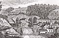
"West view of Hitchcocksville, Barkhamsted" by John Warner Barber, 1830s

See also
 In Spanish: Barkhamsted para niños
