New Marlborough, Massachusetts facts for kids
Quick facts for kids
New Marlborough, Massachusetts
|
||
|---|---|---|

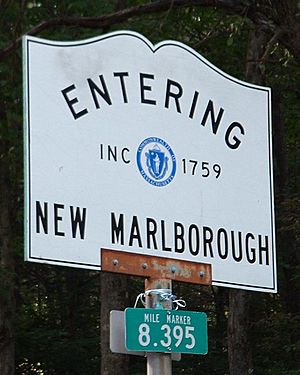
Entering New Marlborough – Inc. 1759
|
||
|
||

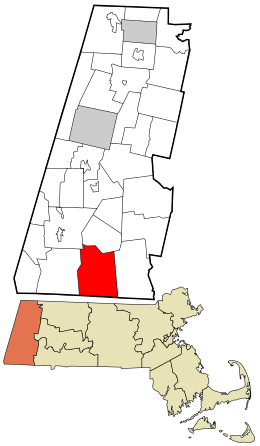
Location in Berkshire County and the state of Massachusetts.
|
||
| Country | United States | |
| State | Massachusetts | |
| County | Berkshire | |
| Settled | 1738 | |
| Incorporated | 1759 | |
| Government | ||
| • Type | Open town meeting | |
| Area | ||
| • Total | 47.9 sq mi (124.1 km2) | |
| • Land | 46.9 sq mi (121.4 km2) | |
| • Water | 1.0 sq mi (2.6 km2) | |
| Elevation | 1,351 ft (412 m) | |
| Population
(2020)
|
||
| • Total | 1,528 | |
| • Density | 31.890/sq mi (12.313/km2) | |
| Time zone | UTC-5 (Eastern) | |
| • Summer (DST) | UTC-4 (Eastern) | |
| ZIP code |
01244
|
|
| Area code(s) | 413 | |
| FIPS code | 25-45420 | |
| GNIS feature ID | 0618272 | |
New Marlborough is a small town located in Berkshire County, Massachusetts, United States. It's known for its beautiful rural setting. In 2020, about 1,528 people lived here. The town is made up of five smaller areas, often called villages: Clayton, Hartsville, Mill River, New Marlborough Village, and Southfield.
Contents
History of New Marlborough
New Marlborough was one of four new towns created along a road connecting Sheffield and Westfield. In 1736, 72 people from Marlborough, Massachusetts and nearby areas bought the land from the local Native Americans, who were a group of Mohican Indians.
Settlers started arriving in 1739, and the area quickly grew in the 1740s. The town officially became a town in 1775. It was named after the original owners' hometown. New Marlborough grew with farms around its center and mills along its rivers. Today, it is mostly a quiet, rural area with very little industry.
Geography and Nature
New Marlborough covers about 124.1 square kilometers (47.9 square miles). Most of this area, 121.4 square kilometers (46.9 square miles), is land. The rest, about 2.6 square kilometers (1 square mile), is water.
Neighboring Towns and States
New Marlborough shares its borders with several other towns. To the north is Monterey. To the east is Sandisfield. To the south, it borders two towns in Connecticut: Norfolk and North Canaan, Connecticut. To the west, you'll find Sheffield, and to the northwest is Great Barrington.
Location in Massachusetts
The town is located about 26 miles (42 km) south of Pittsfield. It's also about 42 miles (68 km) west of Springfield. If you travel west-southwest, you'll reach Boston, which is about 128 miles (206 km) away.
Rivers, Swamps, and Forests
New Marlborough is in the lower part of the Berkshires, a mountain range with several peaks. Many rivers flow through the town, including the Konkapot River, Umpachene River, and Whiting River. All these rivers eventually flow into the larger Housatonic River.
The town also has several swamps and ponds. Lake Buel is partly in New Marlborough and partly in Monterey. The Thousand Acre Swamp is in the southeast corner of the town. This swamp is near Campbells Falls State Park, which is named after the beautiful falls on the Whiting River. Parts of Sandisfield State Forest are also located within New Marlborough.
Roads and Transportation
Massachusetts Route 183 runs through New Marlborough. This road connects Lenox and Great Barrington to Sandisfield and the Connecticut border. For part of its journey, Route 183 joins with Route 57. Route 57 then splits off near the center of town, heading east towards Sandisfield and eventually ending in Agawam.
The closest major highway, Interstate 90 (also known as the Massachusetts Turnpike), is several miles north of the town. The nearest exit for this highway is Exit 2 in Lee, which is about 15 miles (24 km) away. For public transport, the nearest bus service is in Great Barrington. If you need to travel by train, the closest Amtrak station is in Pittsfield.
For air travel, there's a small airport in Great Barrington. For larger flights, the nearest national airport is Bradley International Airport in Windsor Locks, Connecticut.
Population and People
| Historical population | ||
|---|---|---|
| Year | Pop. | ±% |
| 1850 | 1,847 | — |
| 1860 | 1,782 | −3.5% |
| 1870 | 1,855 | +4.1% |
| 1880 | 1,876 | +1.1% |
| 1890 | 1,305 | −30.4% |
| 1900 | 1,282 | −1.8% |
| 1910 | 1,124 | −12.3% |
| 1920 | 1,010 | −10.1% |
| 1930 | 864 | −14.5% |
| 1940 | 956 | +10.6% |
| 1950 | 989 | +3.5% |
| 1960 | 1,083 | +9.5% |
| 1970 | 1,031 | −4.8% |
| 1980 | 1,160 | +12.5% |
| 1990 | 1,240 | +6.9% |
| 2000 | 1,494 | +20.5% |
| 2010 | 1,509 | +1.0% |
| 2020 | 1,528 | +1.3% |
| 2022* | 1,510 | −1.2% |
| * = population estimate. Source: United States Census records and Population Estimates Program data. |
||
In 2000, there were 1,494 people living in New Marlborough. The town ranks 17th in population among the 32 cities and towns in Berkshire County. It is also 307th out of 351 cities and towns in all of Massachusetts.
The average number of people living in each household was about 2.42. For families, the average size was about 2.88 people. About 28.5% of households had children under 18 living with them.
The population's age was spread out. About 24.7% of the people were under 18 years old. About 14.5% were 65 years or older. The average age in the town was 41 years.
Climate and Weather
New Marlborough, Massachusetts, experiences a varied climate throughout the year. Typically, temperatures drop below 50 degrees Fahrenheit (10 degrees Celsius) for about 205 days each year.
The town receives a good amount of rain and snow. The average yearly rainfall is about 46.9 inches (119 cm), which is quite high for the United States. Snow usually covers the ground for about 69 days each year. This means snow is on the ground for nearly 19% of the year. The humidity is usually below 60% for about 18.4 days each year.
Education and Schools
New Marlborough is part of the Mount Everett Regional School District. This district also includes students from Alford, Egremont, Monterey, Mount Washington, and Sheffield.
Younger students in New Marlborough attend the New Marlborough Central School for kindergarten and first grade. Students in second through sixth grades go to the Undermountain Elementary School in Sheffield. For grades 7 through 12, students attend Mount Everett Regional High School, also located in Sheffield.
There are also private schools available in nearby towns like Sheffield, Great Barrington, and Salisbury, Connecticut.
For higher education, the closest community college is the South County Center of Berkshire Community College in Great Barrington. The nearest state university is Westfield State University. If you're looking for a private college, Bard College at Simon's Rock is located in Great Barrington.
See also
 In Spanish: New Marlborough (Massachusetts) para niños
 | John T. Biggers |
 | Thomas Blackshear |
 | Mark Bradford |
 | Beverly Buchanan |


