Monterey, Massachusetts facts for kids
Quick facts for kids
Monterey, Massachusetts
|
||
|---|---|---|
|
||
|
||
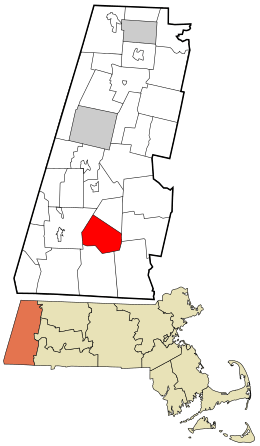
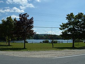
Location in Berkshire County and the state of Massachusetts.
|
||
| Country | United States | |
| State | Massachusetts | |
| County | Berkshire | |
| Settled | 1739 | |
| Incorporated | 1847 | |
| Government | ||
| • Type | Open town meeting | |
| Area | ||
| • Total | 27.4 sq mi (71.0 km2) | |
| • Land | 26.4 sq mi (68.5 km2) | |
| • Water | 1.0 sq mi (2.5 km2) | |
| Elevation | 1,244 ft (379 m) | |
| Population
(2020)
|
||
| • Total | 1,095 | |
| • Density | 39.94/sq mi (15.423/km2) | |
| Time zone | UTC-5 (Eastern) | |
| • Summer (DST) | UTC-4 (Eastern) | |
| ZIP code |
01245
|
|
| Area code(s) | 413 | |
| FIPS code | 25-42460 | |
| GNIS feature ID | 0618270 | |
Monterey is a small town located in Berkshire County, Massachusetts, in the United States. It is part of the larger Pittsfield area. In 2020, about 1,095 people lived there.
Contents
History of Monterey
Before European settlers arrived, the area of Monterey was home to the Mahican people, a local Native American tribe. The first European settlers came to Monterey in 1739. At that time, it was part of a larger area called Housatonic Township Number One.
The township had two main villages. One was along Hop Brook to the north, which is now the town of Tyringham. The other was along the Konkapot River in the south, which is now Monterey.
Becoming a Town
The whole township was officially named Tyringham in 1767. In 1776, during the American Revolution, General Henry Knox traveled through the town. He was moving cannons from Fort Ticonderoga in New York to help end the Siege of Boston. Today, the path he took is called the Henry Knox Trail.
Because the two villages were far apart, they decided to split. In 1847, the southern part became its own town. It was previously known as Green Woods or South Tyringham. The local people voted to name their new town Monterey. This name was chosen to remember the Battle of Monterey, which happened just a year earlier during the Mexican–American War.
In the past, Monterey was mostly known for its sawmills. Today, it is a quiet, rural community. People often visit for fun activities in the state forests and around Lake Garfield.
Geography of Monterey
Monterey covers a total area of about 71 square kilometers (27.4 square miles). Most of this area, about 68.5 square kilometers (26.4 square miles), is land. The rest, about 2.5 square kilometers (1 square mile), is water.
Monterey is surrounded by several other towns:
- To the north: Tyringham
- To the east: Otis
- To the southeast: Sandisfield
- To the south: New Marlborough
- To the west: Great Barrington
Monterey is about 21 miles (34 km) south-southeast of Pittsfield. It is also about 124 miles (200 km) west of Boston.
Natural Features
Monterey is located in the southern part of the Berkshires, a beautiful mountain range. The Konkapot River starts here, flowing from Lake Garfield. Lake Garfield is surrounded by several hills. Another lake, Lake Buel, is partly in Monterey and partly in New Marlborough.
A large part of the northwest side of town is covered by Mount Wilcox and the lower section of Beartown State Forest. The famous Appalachian Trail, a long hiking path, goes through this state forest. It crosses from Great Barrington, goes below Mount Wilcox, and then continues to Sky Hill in Tyringham.
Transportation
The main road through Monterey is Massachusetts Route 23, which runs east and west. Near the border with Great Barrington, Route 57 begins and heads east. It passes Lake Buel before going into New Marlborough. Route 183 also joins Route 23 for a short distance before heading south towards Connecticut.
Most people in Monterey live near Route 23, especially around Lake Garfield. The closest major highway, Interstate 90 (also known as the Massachusetts Turnpike), is in nearby Otis.
For longer trips, you can find train service in Pittsfield. There is also a small airport in Great Barrington for private planes. The closest major airport is Bradley International Airport in Windsor Locks, Connecticut.
Population Facts
| Historical population | ||
|---|---|---|
| Year | Pop. | ±% |
| 1850 | 761 | — |
| 1860 | 758 | −0.4% |
| 1870 | 653 | −13.9% |
| 1880 | 635 | −2.8% |
| 1890 | 495 | −22.0% |
| 1900 | 455 | −8.1% |
| 1910 | 388 | −14.7% |
| 1920 | 282 | −27.3% |
| 1930 | 321 | +13.8% |
| 1940 | 320 | −0.3% |
| 1950 | 367 | +14.7% |
| 1960 | 480 | +30.8% |
| 1970 | 600 | +25.0% |
| 1980 | 818 | +36.3% |
| 1990 | 805 | −1.6% |
| 2000 | 934 | +16.0% |
| 2010 | 961 | +2.9% |
| 2020 | 1,095 | +13.9% |
| 2022* | 1,085 | −0.9% |
| * = population estimate. Source: United States Census records and Population Estimates Program data. |
||
According to the census of 2000, there were 934 people living in Monterey. The town ranks 21st in population out of the 32 towns in Berkshire County.
About 23.8% of households had children under 18 living with them. The average household had about 2.21 people. The average family had about 2.74 people.
The population was spread out by age:
- 17.2% were under 18 years old.
- 8.6% were from 18 to 24 years old.
- 24.6% were from 25 to 44 years old.
- 33.1% were from 45 to 64 years old.
- 16.5% were 65 years or older.
The average age in Monterey was 44 years.
Education in Monterey
Monterey is part of the Mount Everett Regional School District. This district also includes students from Alford, Egremont, Mount Washington, New Marlborough, and Sheffield.
Students in Monterey attend the Monterey School for kindergarten and first grade. For grades two through six, they go to Undermountain Elementary School in Sheffield. Older students, from grades 7 to 12, attend Mount Everett Regional High School also in Sheffield. There are also private schools in nearby towns like Great Barrington.
For higher education, the closest community college is the South County Center of Berkshire Community College in Great Barrington.
Notable People
Some well-known people have lived in Monterey:
- Karen Allen, an actress
- Edwin N. Chapin (1823–1896), a postmaster and newspaper publisher
Places to Visit
See also
 In Spanish: Monterey (Massachusetts) para niños
 | Isaac Myers |
 | D. Hamilton Jackson |
 | A. Philip Randolph |


