
Alford, Massachusetts facts for kids
Quick facts for kids
Alford, Massachusetts
|
||
|---|---|---|

The state line at Route 71, with a Knox Trail marker beside the road sign
|
||
|
||

Location in Berkshire County and the state of Massachusetts.
|
||
| Country | United States | |
| State | Massachusetts | |
| County | Berkshire | |
| Settled | 1740 | |
| Incorporated | 1773 | |
| Government | ||
| • Type | Open town meeting | |
| Area | ||
| • Total | 11.5 sq mi (29.9 km2) | |
| • Land | 11.5 sq mi (29.8 km2) | |
| • Water | 0.04 sq mi (0.1 km2) | |
| Elevation | 839 ft (256 m) | |
| Population
(2020)
|
||
| • Total | 486 | |
| • Density | 42.10/sq mi (16.25/km2) | |
| Time zone | UTC−5 (Eastern) | |
| • Summer (DST) | UTC−4 (Eastern) | |
| ZIP Code |
01230
|
|
| Area code(s) | 413 | |
| FIPS code | 25-00975 | |
| GNIS feature ID | 0618263 | |

Alford is a small town located in Berkshire County, Massachusetts, in the United States. It is part of the larger Pittsfield area. In 2020, the town had a population of 486 people.
Contents
History of Alford
Alford was first settled in 1756. This happened when a group led by Timothy Woodbridge bought land from the Shauanum Stockbridge Mahican tribe. The town was originally part of Great Barrington. It officially became its own town in 1773.
The town was named after Colonel John Alford. He was known for teaching Christianity to Native Americans. He also helped fund a special teaching position at Harvard College's Divinity School.
For most of its history, Alford was a farming community. However, in 1799, people found large amounts of marble on the western side of Tom Ball Mountain. For about 90 years, Alford became a busy mining town. This ended when a railroad was built in a nearby valley. The quarries in Alford could no longer compete.
Around New Year's Day in 1776, General Henry Knox traveled through Alford. He was bringing cannons from Fort Ticonderoga to help end the Siege of Boston. Today, this path is known as the Knox Trail. You can find a marker for it at the state line.
-
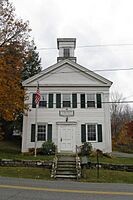
Susan Smith Andersen Library
-
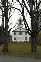
Alford Village Church


Geography of Alford
Alford is located along the western edge of Berkshire County and Massachusetts. It sits east of Columbia County, New York. The town is shaped a bit like an arrowhead. It shares borders with West Stockbridge to the northeast and Great Barrington to the southeast. To the south is Egremont, and to the west are Hillsdale and Austerlitz, New York.
Alford is about 19 miles (31 km) south-southwest of Pittsfield. It is also about 138 miles (222 km) west of Boston.
Natural Features
The town is surrounded by hills and mountains that are part of the Taconic Range. The Green River flows through the southwest part of town. Alford Brook flows through the middle of town. Both of these eventually join the Housatonic River. Tom Ball Mountain is just northeast of town.
Transportation
Massachusetts Route 71 starts in Alford. This road is a short continuation of New York State Route 71. The Knox Trail follows this route into Massachusetts. Route 71 then goes southeast into Egremont and ends in Great Barrington. There are not many other main roads in Alford.
The closest major highway is Interstate 90, also known as the Massachusetts Turnpike. It passes through nearby West Stockbridge. The nearest train station is in Pittsfield. You can catch Amtrak trains there. For bus service, you can go to Pittsfield or Great Barrington. The closest airport for commercial flights is Albany International Airport in New York.
Population Information
| Historical population | ||
|---|---|---|
| Year | Pop. | ±% |
| 1850 | 502 | — |
| 1860 | 542 | +8.0% |
| 1870 | 430 | −20.7% |
| 1880 | 348 | −19.1% |
| 1890 | 297 | −14.7% |
| 1900 | 272 | −8.4% |
| 1910 | 275 | +1.1% |
| 1920 | 248 | −9.8% |
| 1930 | 200 | −19.4% |
| 1940 | 201 | +0.5% |
| 1950 | 212 | +5.5% |
| 1960 | 256 | +20.8% |
| 1970 | 302 | +18.0% |
| 1980 | 394 | +30.5% |
| 1990 | 418 | +6.1% |
| 2000 | 399 | −4.5% |
| 2010 | 494 | +23.8% |
| 2020 | 486 | −1.6% |
| 2022* | 483 | −0.6% |
| * = population estimate. Source: United States Census records and Population Estimates Program data. |
||
According to the 2000 census, 399 people lived in Alford. This makes Alford one of the smaller towns in Berkshire County and in Massachusetts.
Education in Alford
Alford is part of the Mount Everett Regional School District. This district also includes students from Egremont, Monterey, Mount Washington, New Marlborough, and Sheffield.
Younger students in Alford attend the Appalachian School for kindergarten and first grade. Students in second through sixth grades go to Undermountain Elementary School in Sheffield. For grades 7–12, students attend Mount Everett Regional High School in Sheffield. There are also private schools in nearby towns like Great Barrington.
For higher education, the closest community college is Berkshire Community College in Great Barrington.
Notable People
- Carolyn Gold Heilbrun: A mystery writer who once had a summer home in Alford.
- John W. Hulbert (1770–1831): Born in Alford, he became a lawyer and a congressman for Massachusetts.
See also
 In Spanish: Alford (Massachusetts) para niños
