West Stockbridge, Massachusetts facts for kids
Quick facts for kids
West Stockbridge, Massachusetts
|
||
|---|---|---|

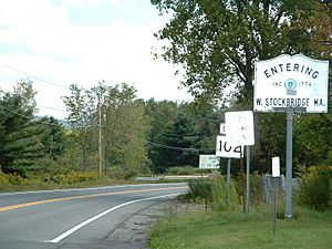
The Massachusetts state line along Route 102
|
||
|
||
| Nickname(s):
Queensborough
(former official name) |
||

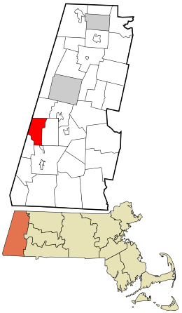
Location in Berkshire County and the state of Massachusetts.
|
||
| Country | United States | |
| State | Massachusetts | |
| County | Berkshire | |
| Settled | 1766 | |
| Incorporated | 1775 | |
| Government | ||
| • Type | Open town meeting | |
| Area | ||
| • Total | 18.7 sq mi (48.4 km2) | |
| • Land | 18.5 sq mi (47.8 km2) | |
| • Water | 0.2 sq mi (0.6 km2) | |
| Elevation | 901 ft (275 m) | |
| Population
(2020)
|
||
| • Total | 1,343 | |
| • Density | 71.87/sq mi (27.75/km2) | |
| Time zone | UTC-5 (Eastern) | |
| • Summer (DST) | UTC-4 (Eastern) | |
| ZIP code |
01266
|
|
| Area code(s) | 413 | |
| FIPS code | 25-77990 | |
| GNIS feature ID | 0618276 | |
West Stockbridge is a small town located in Berkshire County, Massachusetts, United States. In 2020, about 1,343 people lived there. It is part of the larger Pittsfield area.
Contents
History of West Stockbridge
West Stockbridge was first settled by people in 1766. It officially became a town in 1774. Before that, it was part of a larger area called Stockbridge, which was once known as Indiantown.
The town was first named Queensborough. Its location was once part of a disagreement about the border between Massachusetts and New York. Eventually, the border was set, and West Stockbridge stayed in Massachusetts.
The town grew from five smaller villages: West Center, West Stockbridge, Freedleyville, Rockdale, and Williamsville. The village of West Stockbridge became the largest because of the railroad. The railroad helped move important materials like iron ore and marble.
There was an ironworks factory in Williamsville, started by Colonel Elijah Williams. Today, only the smokestack from the furnace remains.
Geography of West Stockbridge
West Stockbridge covers about 48.4 square kilometers (about 18.7 square miles). Most of this area is land, with a small part being water.
Location and Borders
West Stockbridge is surrounded by several other towns and even another state.
- To the north is Richmond.
- To the east is Stockbridge.
- To the south is Great Barrington.
- To the southwest is Alford.
- To the west are Austerlitz and Canaan in New York.
The town is about 11 miles (18 km) southwest of Pittsfield. It's also about 132 miles (212 km) west of Boston, the capital of Massachusetts.
Rivers and Mountains
The Williams River flows through West Stockbridge. This river is a bit marshy and connects to the Housatonic River.
You can find several mountains around the town:
- West Stockbridge Mountain is to the northeast, near the Stockbridge border.
- Tom Ball Mountain is to the southwest, near Alford.
- Harvey Mountain is on the state border with New York.
- Maple Hill is in the middle of town and has a special area for wildlife.
Transportation
Interstate 90, also known as the Massachusetts Turnpike, enters Massachusetts in West Stockbridge. There's an exit (Exit 1) near the town center. This exit connects to Route 41 and Route 102. Route 102 starts right at the state border in a village called State Line.
An old railroad line goes through the town. It connects to an active line in State Line and heads south towards Great Barrington. For bigger trips, you can find bus, Amtrak train, and air services in Pittsfield. The closest major airport is Albany International Airport in New York.
Population of West Stockbridge
| Historical population | ||
|---|---|---|
| Year | Pop. | ±% |
| 1850 | 1,713 | — |
| 1860 | 1,589 | −7.2% |
| 1870 | 1,924 | +21.1% |
| 1880 | 1,923 | −0.1% |
| 1890 | 1,492 | −22.4% |
| 1900 | 1,158 | −22.4% |
| 1910 | 1,271 | +9.8% |
| 1920 | 1,058 | −16.8% |
| 1930 | 1,124 | +6.2% |
| 1940 | 1,062 | −5.5% |
| 1950 | 1,165 | +9.7% |
| 1960 | 1,244 | +6.8% |
| 1970 | 1,354 | +8.8% |
| 1980 | 1,280 | −5.5% |
| 1990 | 1,483 | +15.9% |
| 2000 | 1,416 | −4.5% |
| 2010 | 1,306 | −7.8% |
| 2020 | 1,343 | +2.8% |
| 2022* | 1,329 | −1.0% |
| * = population estimate. Source: United States Census records and Population Estimates Program data. |
||
In 2020, the town of West Stockbridge had a population of 1,343 people. This makes it one of the smaller towns in Berkshire County.
Most of the people living in West Stockbridge are White. A very small number of people are African American, Native American, or Asian. Some people also identify as Hispanic or Latino.
The average age of people in West Stockbridge in 2000 was 44 years old. About 21.8% of the population was under 18 years old.
Education in West Stockbridge
West Stockbridge is part of the Berkshire Hills Regional School District. This district also includes the towns of Stockbridge and Great Barrington. All the schools for the district are located in these towns.
Younger students, from pre-kindergarten to fourth grade, go to the Muddy Brook Regional School. Middle school students attend Monument Valley Regional Middle School. High school students go to Monument Mountain Regional High School. Before this district was formed, high school students from West Stockbridge went to Williams High School in Stockbridge.
There are also private schools in nearby towns like Great Barrington and Lenox.
For higher education, the closest community college is Berkshire Community College in Great Barrington. The nearest state college is Massachusetts College of Liberal Arts in North Adams. The closest state university is the University of Massachusetts Amherst. There's also a private college called Bard College at Simon's Rock in Great Barrington.
Culture
One interesting place in West Stockbridge is the Turn Park Art Space. This is an art museum, a sculpture park, and a place for performances. It opened in May 2017 on the site of an old limestone and marble quarry.
See also
 In Spanish: West Stockbridge (Massachusetts) para niños
 | Sharif Bey |
 | Hale Woodruff |
 | Richmond Barthé |
 | Purvis Young |


