Richmond, Massachusetts facts for kids
Quick facts for kids
Richmond, Massachusetts
|
||
|---|---|---|

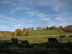
View of a farm in Richmond
|
||
|
||

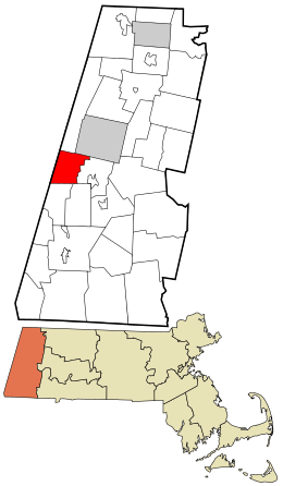
Location in Berkshire County and the state of Massachusetts.
|
||
| Country | United States | |
| State | Massachusetts | |
| County | Berkshire | |
| Settled | 1760 | |
| Incorporated | 1765 | |
| Government | ||
| • Type | Open town meeting | |
| Area | ||
| • Total | 19.0 sq mi (49.2 km2) | |
| • Land | 18.7 sq mi (48.4 km2) | |
| • Water | 0.3 sq mi (0.8 km2) | |
| Elevation | 1,057 ft (322 m) | |
| Population
(2020)
|
||
| • Total | 1,407 | |
| • Density | 74.07/sq mi (28.60/km2) | |
| Time zone | UTC-5 (Eastern) | |
| • Summer (DST) | UTC-4 (Eastern) | |
| ZIP code |
01254
|
|
| Area code(s) | 413 | |
| FIPS code | 25-56795 | |
| GNIS feature ID | 0619425 | |
Richmond is a small town located in Berkshire County, Massachusetts, in the United States. It's part of the larger Pittsfield area. In 2020, about 1,407 people lived in Richmond.
Contents
History of Richmond
Richmond was first settled in 1759 by two people: Micah Mudge and Ichabod Wood. Micah Mudge traveled from Connecticut using the Housatonic River. Ichabod Wood came from Rehoboth, a town on the eastern coast.
It's believed that Mudge and Wood didn't meet until after their first winter. Their first homes were about three miles apart in thick wilderness.
Becoming a Town
By 1762, more settlers were moving to the area. The Massachusetts government wanted to organize all unmarked land into official townships. In 1762, the land that is now Richmond and Lenox, Massachusetts was bought from two Native American leaders, Yokun and Ephraim.
Two separate villages started to form. Yokuntown was to the east, and Mt. Ephraim was to the west. A six-mile mountain ridge, now called Yokun Ridge, separated them.
On June 21, 1765, these two villages officially became one town named Richmont. However, the mountain made it hard for people in the two villages to communicate.
Separation from Lenox
Because of the communication problems, the eastern part of Richmont separated on February 26, 1767. This new area became a district called Lenox, with its own meeting house. It took several years for the new border to be fully decided, and there were arguments about it.
In 1785, Richmont officially changed its name to Richmond. By 1787, when the County Court moved to Lenox, it was clear that Richmond and Lenox were working well as separate towns.
How Richmond Got Its Name
The names of Richmond and Lenox are a bit of a mystery. It's likely that Francis Bernard, who was the leader of the Province of Massachusetts Bay, named them. Some people think he named them after Charles Lennox, the Duke of Richmond.
The Duke of Richmond was an important figure who supported the American Colonies before the American Revolution. However, he didn't become well-known until after 1770. His most famous speech was in 1778. This makes some people wonder if the towns were originally named after him.
Even so, when Richmont asked to change its name from "Richmont" to "Richmond," it was definitely done to honor Charles, Duke of Richmond.
Early Economy
For a long time, Richmond was mainly a farming town. But in 1829, iron ore was discovered there. This led to the creation of an iron works, which operated in the town for many years, even into the 1900s.
Geography of Richmond
Richmond covers a total area of about 49.2 square kilometers (19.0 square miles). Most of this, 48.4 square kilometers (18.7 square miles), is land. The rest, 0.8 square kilometers (0.3 square miles), is water.
Neighboring Towns and States
Richmond shares its borders with several other towns and a state:
- To the north: Hancock and Pittsfield
- To the east: Lenox
- To the south: Stockbridge and West Stockbridge
- To the west: Canaan in Columbia County, New York
Transportation in Richmond
Massachusetts Route 41 runs through Richmond from north to south. Another road, Route 295, connects to the same route in New York.
The closest major highway is Interstate 90, also known as the Massachusetts Turnpike. There's an exit for it nearby, but it only allows cars to leave going west or enter going east.
The closest airport for local flights is Pittsfield Municipal Airport, which is about 5.5 miles away. For national flights, the nearest airport is Albany International Airport, about 45 miles northwest of Richmond.
There is no public bus service in Richmond itself. The closest bus station is in Pittsfield. A CSX freight train line also passes through the town.
Richmond's Population and People
| Historical population | ||
|---|---|---|
| Year | Pop. | ±% |
| 1850 | 907 | — |
| 1860 | 914 | +0.8% |
| 1870 | 1,091 | +19.4% |
| 1880 | 1,124 | +3.0% |
| 1890 | 796 | −29.2% |
| 1900 | 679 | −14.7% |
| 1910 | 650 | −4.3% |
| 1920 | 561 | −13.7% |
| 1930 | 583 | +3.9% |
| 1940 | 624 | +7.0% |
| 1950 | 737 | +18.1% |
| 1960 | 890 | +20.8% |
| 1970 | 1,461 | +64.2% |
| 1980 | 1,659 | +13.6% |
| 1990 | 1,677 | +1.1% |
| 2000 | 1,604 | −4.4% |
| 2010 | 1,475 | −8.0% |
| 2020 | 1,407 | −4.6% |
| 2022* | 1,402 | −0.4% |
| * = population estimate. Source: United States Census records and Population Estimates Program data. |
||
According to the 2000 census, Richmond had 1,604 people living there. There were 643 households, with 480 of them being families. Richmond is the 16th largest town in Berkshire County by population.
The town had about 84.6 people per square mile. Most of the people in Richmond (97.63%) were White. A small percentage were African American (1.00%), Native American (0.50%), or Asian (0.44%).
Households and Families
About 27.7% of households in Richmond had children under 18 living with them. Most households (64.4%) were married couples living together. About 20.8% of all households were single individuals.
The average household had 2.49 people, and the average family had 2.89 people.
Age and Income
The population of Richmond is spread out in terms of age. About 21.5% of residents were under 18 years old. The median age, meaning the middle age of all residents, was 45 years.
In 2000, the median income for a household in Richmond was $60,917 per year. For a family, the median income was $72,500. The average income per person in the town was $35,568.
About 3.1% of all people in Richmond lived below the poverty line. This included 0.9% of those under 18 and 3.2% of those 65 or older.
Education in Richmond
Richmond has one school called Richmond Consolidated School. This school teaches students from preschool all the way up to 8th grade.
After 8th grade, high school students from Richmond can choose to attend several different high schools. These include Lenox Memorial Middle/High School, Monument Mountain Regional High School, Pittsfield High School, Taconic High School, or Lee High School.
Higher Education Options
For students interested in college, there are several options nearby:
- The closest community college is Berkshire Community College in Pittsfield.
- The nearest state college is Massachusetts College of Liberal Arts.
- The closest big university is the University of Massachusetts Amherst.
- A nearby private college is Williams College in Williamstown.
Notable People from Richmond
Many interesting people have connections to Richmond. Here are a few:
- Samuel Betts: A politician and judge from New York.
- Augustine Clarke: A leader of the Anti-Masonic Party and a state treasurer for Vermont.
- Deval Patrick: An American politician, civil rights lawyer, author, and businessman.
- Edward Aylesworth Perry: A general for the Confederate side during the Civil War, who later became the Governor of Florida.
- Neal Pilson: A former president of CBS Sports and a town leader (selectman) in Richmond.
- Rix Robinson: An early pioneer in Michigan, a fur merchant, and a politician.
See also
 In Spanish: Richmond (Massachusetts) para niños
 | Claudette Colvin |
 | Myrlie Evers-Williams |
 | Alberta Odell Jones |


