Housatonic River facts for kids
Quick facts for kids Housatonic River |
|
|---|---|
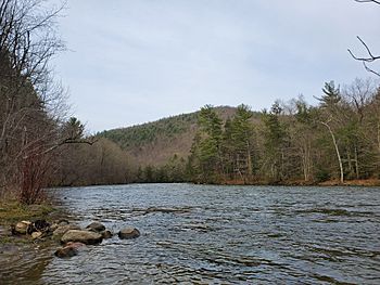
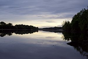
The Housatonic River in Cornwall
|
|
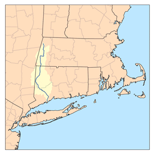
Housatonic River watershed
|
|
| Country | United States |
| State | Connecticut, Massachusetts |
| Counties | Fairfield, CT, Litchfield, CT, New Haven, CT, Berkshire, MA |
| City | Pittsfield, MA |
| Physical characteristics | |
| Main source | Confluence of West and East Branches Housatonic River Washington, Berkshire County, Massachusetts, United States 959 ft (292 m) 42°26′01″N 073°15′03″W / 42.43361°N 73.25083°W |
| River mouth | Long Island Sound Milford, New Haven County, Connecticut, United States 0 ft (0 m) 41°10′09″N 073°06′30″W / 41.16917°N 73.10833°W |
| Length | 149 mi (240 km) |
| Discharge (location 2) |
|
| Basin features | |
| Basin size | 1,948 sq mi (5,050 km2) |
| Tributaries |
|
The Housatonic River ( HOOS-ə-TON-ik) is a river about 149 miles (240 km) long. It flows through western Massachusetts and western Connecticut in the United States. The river flows south and southeast, emptying into Long Island Sound. Its watershed, which is the area of land that drains into the river, covers about 1,950 square miles (5,050 km²). This watershed is located just west of the lower Connecticut River's watershed.
Contents
River History
Native American History
Native American people began using the Housatonic River area for fishing and hunting at least 6,000 years ago. By the year 1600, most of the people living here were Mohicans. There may have been as many as 30,000 Mohicans living in the area.
The river's name comes from a Mohican phrase, "usi-a-di-en-uk". This means "beyond the mountain place" or "river of the mountain place." Early settlers sometimes called it "Ousetonack" or "Oweantinock." Before the 1700s, it was also known as the Pootatuck River. Some say Pootatuck means "river of the falls." Others believe it was named after a tribe that lived along the river near Newtown, Connecticut. Today, "Pootatuck River" refers to a smaller stream that flows into the Housatonic River.
The river flows through lands once lived on by Algonquian tribes. These tribes typically lived in villages with 200 to 300 families. They lived in homes called wigwams, made from animal hides. These native people used to burn the forests along the Housatonic Valley each autumn. This helped to keep the underbrush from growing too thick. This practice was common across Connecticut before Europeans settled there.
One important native leader was Chief Squantz of the Schaghticoke tribe. This tribe still owns part of their original land on the west side of the Housatonic River, in what is now Kent, Connecticut.
English settlers began to arrive in the northern Housatonic Valley around 1725 in Sheffield, Massachusetts. By 1734, Mohicans created the Indian Town of Stockbridge. This town grew for about 15 years, but then faced challenges as more land was taken by settlers.
Industrial Growth
The Housatonic River has been a key source of power for many industries. These include paper mills, ironworks, textile factories, and electricity plants. In Great Barrington, Massachusetts, a mill built in 1739 by David Ingersoll used the river's power to grind grain. The paper industry also grew, using the river's energy starting around 1800.
As industries grew, many dams were built on the river. In 1900, there were 30 dams just in Pittsfield. Many of these have been removed over time. However, some still remain, like the Woods Pond dam in Lenox and the Rising Pond dam in Great Barrington, Massachusetts.
Later History
The American composer Charles Ives was inspired by the river during his honeymoon. In the 1910s, he wrote a piece called "The Housatonic at Stockbridge." This music was part of his larger work, Three Places in New England. He used words from a poem by Robert Underwood Johnson with the same name. The town of Stockbridge is in southwestern Massachusetts. The river flows into Stockbridge on the east side before turning south towards Connecticut.
The United States Navy named a ship after the Housatonic River. The USS Housatonic was the first ship in history to be sunk by a submarine. It was sunk by the Confederate submarine CSS H.L. Hunley.
Covered Wooden Bridges
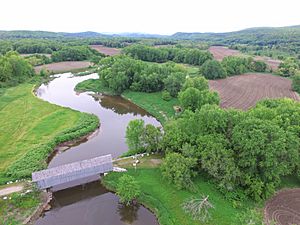
Three wooden covered bridges cross the Housatonic River. Two of them are in Connecticut. One is called Bull's Bridge, and it crosses the river between Gaylordsville and Kent. The other is in Cornwall and is known as the West Cornwall Covered Bridge. Both of these bridges have been strengthened with modern materials. They still carry regular vehicle traffic, but only one direction at a time.
The third bridge, the Old Covered Bridge in Sheffield, Massachusetts, was destroyed by fire. It was rebuilt in 1998 and is now only open for people walking.
UFO Sighting and Monument
In 1969, a nine-year-old boy named Thom Reed and his family said they saw a bright light rise from the Housatonic River. They then found themselves inside what seemed like an airplane hanger. There, they claimed to see creatures that looked like large insects.
People who believed the family's story put up a monument to this event near the Old Covered Bridge in Sheffield, Massachusetts in 2015. This monument weighed 5,000 pounds. However, the town removed the monument in 2019. This incident was featured in a 2020 episode of the TV show Unsolved Mysteries on Netflix.
River Environment and Wildlife
Historically, the Housatonic River was home to Atlantic salmon (Salmo salar). These salmon would swim up the river to lay their eggs. This was the southernmost place where Atlantic salmon were found. The Salmon Creek tributary might have been named for these large fish, which can weigh up to 30 pounds (14 kg).
River Pollution
PCBs
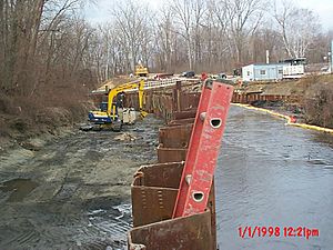
From about 1932 until 1977, the river was polluted with chemicals called PCBs. These PCBs came from the General Electric (GE) plant in Pittsfield, Massachusetts. The U.S. Environmental Protection Agency (EPA) declared the plant and parts of the river a Superfund site in 1997. This meant it was a very polluted area that needed to be cleaned up. The EPA ordered GE to clean the site.
Cleanup efforts began in 1999. Most of the PCBs used in the U.S. during this time were made by a company called Monsanto. Even though the water quality has gotten better, and some cleanup has happened, the river still has PCBs.
As of 2020, GE has finished cleaning up the plant areas in Pittsfield. They are now checking and maintaining these areas. More cleanup is planned for the polluted parts of the river downstream. The highest amounts of PCBs are found in Woods Pond in Lenox, Massachusetts. They have been measured at very high levels in the mud there. About half of all the PCBs in the river are thought to be trapped behind the Woods Pond dam. This is estimated to be about 11,000 pounds (5,000 kg) of PCBs. Old river bends that were filled in are also polluted.
Birds like ducks and fish that live in the river have high levels of PCBs. Eating them can be a health risk.
- Cleanup Agreement
For many years, there were talks about how to clean up the polluted areas south of Pittsfield. GE, the EPA, local governments, and community groups were all involved. In February 2020, the EPA announced an agreement. This plan involves removing polluted mud from the river. Very polluted soil will be sent to special facilities outside the state. Less polluted soil will be put into a new, specially designed landfill in Berkshire County.
Mercury
The Connecticut part of the river is also polluted with mercury. This pollution starts where the Still River flows into the Housatonic. The hat-making industry in Danbury, Connecticut, which operated from the 1800s to the mid-1900s, caused most of this mercury pollution. They used mercury nitrate in the hat-making process.
Today, the mercury remains in the river's mud. It flows downstream, especially during storms. High levels of mercury are found in the mud where the Housatonic River flows into Long Island Sound.
River Course and Watershed
The Housatonic River watershed covers 1,948 square miles (5,045 km²) in western Connecticut, Massachusetts, and eastern New York. The Housatonic River begins from four different sources in western Massachusetts. These sources are in the Berkshire Mountains near Pittsfield.
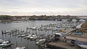
The river flows south through the Berkshires and into western Connecticut. It then empties into the Long Island Sound between the cities of Stratford and Milford. This part of the river forms a border between Fairfield County and New Haven County in Connecticut.
The river drops a total of 1,430 feet (436 m) from its source to Long Island Sound. Its main smaller rivers (tributaries) in Massachusetts include the Williams River, Green River, and Konkapot River.
As it crosses into Connecticut, the Housatonic's main tributaries are the Blackberry River, Salmon Creek, Ten Mile River, Still River, Shepaug River, Pomperaug River, and Naugatuck River. The Naugatuck River is the largest tributary, with its own watershed covering 312 square miles (808 km²).
Five dams hold back the river in Connecticut to create hydroelectricity. These are the Falls Village, Bulls Bridge, Shepaug, Stevenson, and Derby dams. The last three dams create a chain of lakes: Lake Lillinonah, Lake Zoar, and Lake Housatonic. These lakes stretch from New Milford south to Shelton.
Recreational Activities
The Housatonic River is a popular place for whitewater paddling. This activity starts at Falls Village, Connecticut and goes down to Gaylordsville. Most of the river has calm, fast-moving water or easy whitewater (Class I). There are also longer sections with more challenging whitewater (Class II-III). There is a very dangerous section of rapids at Great Falls in Canaan that is usually not safe to paddle. The most difficult section that can be paddled is near Bulls Bridge, with Class V whitewater.
Several dams along the river create lakes. Two notable lakes in Connecticut are Lake Zoar and Lake Lillinonah. Lake Zoar borders Monroe, Newtown, Oxford, and Southbury. Both lakes are popular for water sports.
Two of the lakes formed by the dams are used for rowing. Rowing clubs and schools use them, and they host regattas (rowing races). Lake Lillinonah is used by the GMS Rowing Center and hosts the GMS Regatta. Lake Housatonic is used by the Yale University Crew Team and the New Haven Rowing Club. It hosts the Derby Sweeps & Sculls and the Head of the Housatonic races.
The Housatonic River is also a popular place for fly fishing. Many people say that fly fishing on the Housatonic River is among the best for trout in the eastern United States. The most popular area for fly fishing is in Litchfield County, Connecticut. This section is between the dam at Falls Village and the Cornwall Bridge.
The Appalachian Trail follows the river along this section. It goes from the Bulls Bridge covered wooden bridge near Kent to Falls Village.
Major River Crossings
U.S. Route 7 runs along the Housatonic River Valley between Pittsfield and New Milford. Because of this, it crosses the Housatonic River several times.
| State | County | Carrying |
|---|---|---|
| MA | Berkshire | |
| CT | Litchfield | |
(West Cornwall Covered Bridge) |
||
| Bulls Bridge Road in South Kent (Bull's Bridge) |
||
| Litchfield/ Fairfield Line |
||
| Fairfield/ New Haven Line |
||
(Lake Zoar Dam) |
||
 | Kyle Baker |
 | Joseph Yoakum |
 | Laura Wheeler Waring |
 | Henry Ossawa Tanner |


