
Connecticut River facts for kids
Quick facts for kids Connecticut River |
|
|---|---|

The Connecticut River seen from behind Gillette Castle in Lyme, Connecticut
|
|

River map, with major tributaries
|
|
| Native name | Kwenitegok (Abenaki) |
| Country | United States |
| Region | New England |
| State | Connecticut, Massachusetts, Vermont, New Hampshire |
| Cities | Springfield, Massachusetts, Hartford, Connecticut |
| Physical characteristics | |
| Main source | Fourth Connecticut Lake Coos County, New Hampshire, United States 2,660 ft (810 m) 45°14′53″N 71°12′51″W / 45.24806°N 71.21417°W |
| River mouth | Long Island Sound Old Saybrook and Old Lyme, Connecticut 41°16′20″N 72°20′03″W / 41.27222°N 72.33417°W |
| Length | 410 mi (660 km) |
| Discharge (location 2) |
|
| Basin features | |
| Basin size | 11,260 sq mi (29,200 km2) |
| Tributaries |
|
| Protection status | |
| Official name: Connecticut River Estuary and Tidal River Wetlands Complex | |
| Designated: | October 14, 1994 |
| Reference #: | 710 |
The Connecticut River is a very important river in the New England part of the United States. It is the longest river in this region, flowing about 406 miles (653 km) south through four states. The river starts near the border with Quebec, Canada, and ends in Long Island Sound between Old Saybrook and Old Lyme, Connecticut. Its watershed, which is the area of land that drains into the river, covers about 11,260 square miles (29,160 km²). This area includes parts of five U.S. states and one Canadian province. Many smaller streams and rivers, called tributaries, flow into the Connecticut River. It provides 70% of the fresh water for Long Island Sound.
The valley around the Connecticut River has some of the best farmland in the northeastern U.S. It is also home to a busy area called the Hartford–Springfield Knowledge Corridor, where about two million people live around the cities of Springfield, Massachusetts, and Hartford, Connecticut.
Contents
A Look Back at the Connecticut River's Past
The name "Connecticut" comes from Native American words like quinetucket and kwinitekw. These words mean "beside the long, tidal river." Europeans started using this name in the early 1600s. They also sometimes called it "The Great River" or the "Fresh River."
Native American Life Along the River
Archaeological discoveries show that people have lived in the Connecticut River Valley for about 6,000 years. Many different Native American tribes lived here before Europeans arrived in 1614. We know about their lives mostly from writings by English settlers in the 1630s.
The Pequot tribe lived in the southern part of the valley. They lived from the river's mouth up to Middletown, Connecticut. They sometimes had conflicts with other tribes like the Western Niantics and the Mohegans.
The Mattabesset tribe lived near the "Big Bend" of the river at Middletown. They were located between the Pequots to the south and the Mohegans to the north.
The Mohegans lived in the region where Hartford is today. They became allies with the European colonists during a conflict called the Pequot War in 1637. The Mohegans and Pequots had similar cultures but were rivals.
The Pocomtuc tribe were farmers. They lived in villages along the river near Springfield, Massachusetts. The Pocomtuc people at a village called Agawam helped Puritan explorers settle the area. They remained friendly with the settlers for many years. Other tribes like the Nipmuc also had farming settlements further north. Sometimes, tribes from New York, such as the Mohawk and Iroquois, would visit these villages.
The Pennacook tribe helped settle disagreements between colonists and other tribes. Their land stretched from the Massachusetts border up to the White Mountains. The Western Abenaki tribe lived in the Green Mountains region of Vermont. They sometimes moved south for winter.


Early European Explorers and Settlers
In 1614, a Dutch explorer named Adriaen Block was the first European to map the Connecticut River. He sailed up to Enfield Rapids and called it the "Fresh River." He claimed this land for the Netherlands. In 1623, Dutch traders built a fort and trading post in what is now Hartford, Connecticut. They called it Fort Huys de Hoop, meaning "Fort House of Hope."
Soon, groups of Puritans also began to settle in the fertile Connecticut River Valley. They founded important cities like Hartford (in 1635) and Springfield (in 1636). One group from the Plymouth Colony founded Windsor, Connecticut, in 1632. Another group from Watertown started Wethersfield, Connecticut, in 1633. They wanted a place where they could practice their religion more freely.
.jpg)
In 1635, Reverend Thomas Hooker led settlers from Cambridge, Massachusetts, to the Dutch fort's area. There, he founded a new town called Newtowne. Later, Newtowne joined with Windsor.
Another English settlement was started in 1635 by William Pynchon. He wanted to find the best spot for trade and farming. His scouts found the Pocomtuc village of Agawam. This spot was perfect because trade routes crossed the Connecticut River there. It was also near two major tributaries, the Chicopee River and the Westfield River. Pynchon believed traders would have to stop and change boats at his settlement, giving it a business advantage. This settlement became Springfield. At first, Springfield was allied with the Connecticut settlements. But in 1641, Springfield joined the Massachusetts Bay Colony.
Hartford and Springfield quickly became powerful towns. By 1654, the Dutch found it hard to keep their trading post. A treaty moved the border between the colonies. The Dutch kept their fort until the British took over New Netherland in 1664.
Settling Borders and New States
The Connecticut River Valley was a desirable place because of its location, rich soil, and natural resources. This led to many disagreements over borders for centuries. One of the first was when Springfield joined the Massachusetts Bay Colony in 1641.

Hartford had a fort at the river's mouth in Old Saybrook. This fort protected them from various Native American tribes and the Dutch. After Springfield joined Massachusetts, Connecticut settlements asked Springfield's ships to pay a tax to pass the fort. Springfield refused to pay without having a say in how the fort was run. In response, Massachusetts put a tax on Connecticut ships entering Boston Harbor. Connecticut needed trade with Boston, so it stopped its tax on Springfield. This event helped draw the first state border across the Connecticut River.
The Fort at Number 4 in Charlestown, New Hampshire, was the northernmost British settlement on the river. This was true until the end of the French and Indian War in 1763. After this war, more colonists began to settle north of Brattleboro, Vermont. The population in the Upper Connecticut River Valley grew quickly, reaching 36,000 by 1790.
Both New Hampshire and New York claimed Vermont. New Hampshire Governor Benning Wentworth gave out land grants starting in the 1740s. New York disagreed with these grants. In 1764, it was decided that the border between the provinces would be the western bank of the Connecticut River. People like Ethan Allen and the Green Mountain Boys resisted New York's control. This led to the creation of the independent Vermont Republic in 1777. Vermont later joined the United States in 1791 as the fourteenth state. Border disputes between Vermont and New Hampshire continued for almost 150 years. They were finally settled in 1933 by the U.S. Supreme Court.
The River in the 1800s: Trade and Industry
The Treaty of Paris (1783) ended the American Revolutionary War. It created a new international border between New Hampshire and Canada. This border was set at the "northwesternmost headwaters of the Connecticut." This led to a border disagreement that created the short-lived Indian Stream Republic from 1832 to 1835.
The wide, fertile Connecticut River Valley attracted many farmers and traders. The river's strong flow and many waterfalls were perfect for powering mills. This led to the growth of industries along its banks during the Industrial Revolution. Cities like Springfield and Hartford became centers for new ideas and wealth.

The Enfield Falls Canal opened in 1829. It helped boats get around the shallow areas at Enfield Falls. The locks built for this canal gave their name to the town of Windsor Locks, Connecticut. The Connecticut River Valley was a hub for new inventions into the 20th century. This attracted many railroad lines. The growth of railroads in Springfield and Hartford made the river less important for trade. From the late 1800s, the river became more important for wildlife and recreation.
Log Drives and the Great Flood
Around 1865, the river was used for huge logging drives. Logs were floated from Third Connecticut Lake down to sawmills near Enfield Falls. Trees cut near smaller streams were flushed into the main river. Teams of men guided the logs through difficult parts of the river. The White River and the Ammonoosuc River also brought more logs into the Connecticut. These spring log drives stopped after 1915 because boat owners complained about the danger. A final large drive happened in 1918 to help with wood demand during World War I.

In March 1936, a lot of winter snow, an early spring thaw, and heavy rains caused the Connecticut River to flood. This flood destroyed many bridges and left hundreds of people stranded.
The dam at Vernon, Vermont, was covered by 19 feet (5.8 m) of water. The National Guard and volunteers worked hard to protect the dam's power station. In Northampton, Massachusetts, over 3,000 people had to leave their homes. They found shelter at Amherst College and the Massachusetts State Agricultural College.
Large ice jams made the flood worse. They blocked the river and caused water levels to rise even higher. When a jam broke at Hadley, Massachusetts, the water rushed over the dam at Holyoke. The village of South Hadley Falls was badly damaged.

In Springfield, Massachusetts, 5 square miles (13 km²) and 18 miles (29 km) of streets were flooded. About 20,000 people lost their homes. The city lost power. Eight hundred National Guard troops helped keep order. Boats rescued people trapped in buildings. They were taken to lodges, schools, and churches for help. The American Red Cross and government groups helped with the recovery. The flood left behind thick mud. The cleanup in Springfield took about ten years.
Overall, the flood caused 171 deaths and about $500 million in damages. Across the northeast, over 430,000 people lost their homes or became very poor because of the flooding that year. To help prevent future serious floods, the Connecticut River Flood Control Compact was created in 1953.
Water Supply and Conservation Efforts
In the 1930s, the Quabbin Reservoir was built. This changed the flow of the Swift River, which feeds into the Chicopee River, a tributary of the Connecticut.
By 1969, the demand for drinking water in eastern Massachusetts was more than the existing system could provide. Diverting water from the Connecticut River was considered. However, in 1986, the Massachusetts Water Resources Authority started a program to save water. This helped reduce demand to safe levels by 1989.
The Journey of the Connecticut River
The Connecticut River is the largest river system in New England. Its watershed covers parts of Connecticut, Massachusetts, New Hampshire, Vermont, a small part of Maine, and the Canadian province of Quebec.
The Upper Connecticut River: New Hampshire and Vermont

The Connecticut River begins at Fourth Connecticut Lake. This small pond is about 300 yards (270 m) south of the Canada–United States border in Pittsburg, New Hampshire. It starts at an elevation of about 2,670 feet (814 m) above sea level. The river flows through the other Connecticut Lakes and Lake Francis for about 14 miles (23 km). Then, it widens and forms about 255 miles (410 km) of the border between New Hampshire and Vermont. The river drops more than 2,480 feet (756 m) in elevation as it flows south to Massachusetts.
The area around the river upstream and downstream from Lebanon, New Hampshire, and White River Junction, Vermont, is called the "Upper Valley." In 2001, the Trust for Public Land bought a large area of land in New Hampshire. This helped protect the land around the Connecticut Lakes. A special agreement ensures that the land cannot be developed. It also allows public access and sustainable forest management.

_at_high_flow_2-26-2016.JPG)
The Middle Connecticut River: Massachusetts and Central Connecticut
After the last ice age, the Middle Connecticut River Valley was covered by Lake Hitchcock. Its rich, almost rockless soil comes from the ancient lake's deposits. In this region, the river reaches its deepest point, 130 feet (40 m), near the French King Bridge in Gill, Massachusetts. It reaches its widest point, 2,100 feet (640 m), at Longmeadow. The Connecticut's largest falls, South Hadley Falls, has a vertical drop of 58 feet (18 m).
This middle part of the river has lush green forests and farms. It is also known for its many college towns, like Northampton, South Hadley, and Amherst. Springfield, the river's most populated city, sits on bluffs where the Connecticut meets the Chicopee River and Westfield River. This area is known as the Pioneer Valley. While the southern part of the valley in Massachusetts is urban, the northern section is mostly rural.
The tides affect the Connecticut River as far north as Enfield Rapids in Windsor Locks, Connecticut. This is about 58 miles (93 km) north of the river's mouth. Two million people live in the busy Hartford-Springfield region. Hartford is the second-largest city on the river and the only state capital along its banks.
The Lower Connecticut River: Southern Connecticut to Long Island Sound
About 15 miles (24 km) south of Hartford, at Middletown, the Lower Connecticut River begins. The river narrows and then turns sharply southeast. Through southern Connecticut, the river flows through a hilly, wooded region with fewer people. It then widens again and flows into Long Island Sound between Old Saybrook and Old Lyme. This area has flat coastal marshlands. Because of large, shifting sandbars at its mouth, the Connecticut is the only major river in the Northeastern United States without a port at its mouth.
River Mouth and Tidelands

The Connecticut River carries a lot of silt, especially during spring snowmelt. This creates a large sandbar near the river's mouth. This sandbar makes it hard for large ships to navigate. That is why major cities like Hartford and Springfield are located further upriver.
The Nature Conservancy has called the Connecticut River's tidelands one of the Western Hemisphere's "40 Last Great Places." The Ramsar Convention on Wetlands has also recognized its estuary and tidal wetlands as very important internationally. In 1997, the Connecticut River was named one of only 14 American Heritage Rivers. This recognized its special natural, economic, historic, and recreational qualities. In May 2012, the Connecticut River became America's first National Blueway. This honored the efforts to restore and preserve the river.
Dams Along the River
The flow of the Connecticut River is slowed by many dams. These dams create a series of slow-moving basins from Lake Francis Dam in New Hampshire to the Holyoke Dam in Massachusetts. The Connecticut is one of the most dammed rivers in the United States. Scientists are working to coordinate the dams to balance human needs with the river's natural flow. The Cabot and Turners Falls hydroelectric stations produce up to 68 megawatts of power. The Holyoke Canal System and Hadley Falls Station at Holyoke Dam produce a combined 48 megawatts.
River Tributaries
The Connecticut River watershed covers 11,260 square miles (29,160 km²). It connects 148 tributaries, including 38 major rivers and many lakes and ponds. Some major tributaries (from north to south) include the Passumpsic, Ammonoosuc, White, Black, West, Ashuelot, Millers, Deerfield, Chicopee, Westfield, and Farmington rivers. The Swift River, which flows into the Chicopee, has been dammed. It now largely forms the Quabbin Reservoir, which provides water to eastern Massachusetts, including Boston.
River Life: Plants and Animals

Along its southern parts, the Connecticut River has created a wide, fertile valley. This valley is known for its rich soils, which are great for farming. Many types of trees grow along the riverbanks, including sycamores, cottonwood, basswood, and willows. The river and its many smaller streams are home to many New England freshwater animals. These include dace, crawfish, hellgramites, freshwater mussels, frogs, snapping turtles, brook trout, freshwater sturgeon, catfish, and carp. Rainbow trout have also been introduced.
The river is an important path for many anadromous fish. These fish, like American shad, lamprey, and Atlantic salmon, live in the ocean but swim upriver to lay their eggs. American eels are also present. Predators like striped bass also follow these migratory fish. Shad swim as far north as Holyoke, Massachusetts. There, a fish elevator helps them get over the Holyoke Dam. This station keeps track of how many fish pass each year. Harbor seals have been seen traveling upriver as far as Holyoke, looking for migratory fish. In the southernmost parts of Connecticut, near Long Island Sound, dolphins are sometimes spotted.
There are 12 species of freshwater mussels in the river. Most of them live in the main part of the Connecticut River. Eight of these species are listed as endangered or of special concern in one or more of the states.
Many colonial animal species live in the Connecticut River's waters. Deeper areas are home to different colonial organisms, including bryozoa. Freshwater sponges the size of dinner plates have been found by divers. These were found at depths of over 130 feet (40 m) near the French King Bridge in Erving, Massachusetts. Mussels, eels, and northern pike were also seen there.
Fish Life Cycle and Species

The river has several species of fish that migrate between fresh and saltwater. These include brook trout, winter flounder, blueback herring, alewife, rainbow trout, large brown trout, American shad (Alosa sapidissima), hickory shad, smallmouth bass, Atlantic sturgeon, striped bass (Morone saxatilis), American eel, sea lamprey, and endangered shortnose sturgeon and dwarf wedgemussels. The United States Fish and Wildlife Service has also brought back Atlantic salmon to the river. These salmon had been gone for over 200 years because of dams. Several fish ladders and fish elevators now help fish swim upriver to their spawning grounds each spring.
Fish that live in the fresh and brackish waters of the river and its tributaries include common carp, white catfish, brown bullhead, fallfish, yellow perch, smallmouth bass, largemouth bass, northern pike, chain pickerel, bluegill, pumpkinseed sunfish, golden shiner, and rock bass.
The Connecticut Lakes, at the beginning of the river, have lake trout and landlocked salmon. The river has special rules for fly-fishing in a 5-mile (8 km) section. Most of the river south of Lake Francis is open to both lures and bait. Two dams release cold water downstream, making for good summer fishing.
After the first major dam was built near Turners Falls, Massachusetts, thirteen more dams were added. These dams stopped the large migrations of fish in the Connecticut River. Efforts to restore salmon began in 1967. Fish ladders and an elevator at Hadley Falls have since helped migrating fish return to some of their old spawning areas. From 1978 to 1992, warm water was released into the river from the Vermont Yankee Nuclear Power Plant. This warm water reached up to 105°F (41°C) and traveled 55 miles (89 km) downstream. This warm water seemed to be linked to an 80% drop in American shad numbers from 1992 to 2005. The nuclear plant closed at the end of 2014, and since then, the shad population has increased.
The River's Role in the Economy
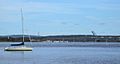
Boating and Recreation
The part of the river from its mouth up to Essex is one of the busiest waterways in Connecticut. Local police and environmental police patrol the area regularly. Many towns have boats ready if needed. In Massachusetts, the most active part of the Connecticut River is around the Oxbow. This is about 14 miles (23 km) north of Springfield in Northampton.
Camping is available along much of the river for non-motorized boats. This is part of the Connecticut River Paddlers' Trail. The Paddlers' Trail currently includes campsites along over 300 miles (480 km) of the river.
Pollution Control and Cleanup Efforts
The Water Quality Act of 1965 greatly helped control water pollution in the Connecticut River.
Since then, the river has improved from Class D to Class B. This means it is now safe for fishing and swimming. Many towns along the Lower Connecticut River have limited new building along the banks. A website now provides water quality reports twice a week. These reports tell people if different parts of the river are safe for swimming, boating, and fishing.
Lists
Populated Places Along the River
River Tributaries
Listed from south to north by location of mouth:
- Black Hall River (Old Lyme, CT)
- Falls River (Essex, CT)
- Eightmile River (Hamburg, CT)
- Deep River (Deep River, CT)
- Salmon River (Moodus, CT)
- Mattabesset River (Middletown, CT)
- Hockanum River (East Hartford and Hartford, CT)
- Park River (Hartford, CT)
- Farmington River (Windsor, CT)
- Scantic River (South Windsor, CT)
- Westfield River (West Springfield and Springfield, MA)
- Mill River (Springfield, MA)
- Chicopee River (Chicopee and Springfield, MA)
- Manhan River (The Oxbow of Northampton, MA)
- Mill River (Northampton, MA)
- Fort River (Hadley, MA)
- Mill River (Hatfield, MA)
- Mill River (Amherst, MA)
- Sawmill River (Montague, MA)
- Deerfield River (Deerfield and Greenfield, MA)
- Fall River (Greenfield and Gill, MA)
- Millers River (Millers Falls, MA)
- Ashuelot River (Hinsdale, NH)
- Whetstone Brook (Brattleboro, VT)
- West River (Brattleboro, VT)
- Partridge Brook (Westmoreland, NH)
- Cold River (Walpole, NH)
- Saxtons River (Westminster, VT)
- Williams River (Rockingham, VT)
- Black River (Springfield, VT)
- Little Sugar River (Charlestown, NH)
- Sugar River (Claremont, NH)
- Blow-me-down Brook (Cornish, NH)
- Ottauquechee River (Hartland, VT)
- Mascoma River (West Lebanon, NH)
- White River (White River Junction, VT)
- Mink Brook (Hanover, NH)
- Ompompanoosuc River (Norwich, VT)
- Waits River (Bradford, VT)
- Oliverian Brook (Haverhill, NH)
- Wells River (Wells River, VT)
- Ammonoosuc River (Woodsville, NH)
- Stevens River (Barnet, VT)
- Passumpsic River (Barnet, VT)
- Johns River (Dalton, NH)
- Israel River (Lancaster, NH)
- Upper Ammonoosuc River (Northumberland, NH)
- Paul Stream (Brunswick, VT)
- Nulhegan River (Bloomfield, VT)
- Simms Stream (Columbia, NH)
- Mohawk River (Colebrook, NH)
- Halls Stream (Beecher Falls, VT)
- Indian Stream (Pittsburg, NH)
- Perry Stream (Pittsburg, NH)
River Crossings
The Connecticut River can be a barrier for travel between western and eastern New England. Several major roads and train lines cross the river. These include Amtrak's Northeast Corridor, Interstate 95, Interstate 90 (Massachusetts Turnpike), Interstate 89, Interstate 93, and Interstate 84. Also, Interstate 91, which mostly follows the river, crosses it twice.
The River in Literature
Lydia Sigourney wrote a poem called "Connecticut River." It was first published in her 1834 poetry collection. She also wrote "Passage up the Connecticut" in 1845, which described a journey along the river.
Wallace Stevens, a famous American poet, lived in Hartford, Connecticut. He wrote many of his poems, including "The River of Rivers in Connecticut," during his daily walks.
Images for kids
-
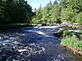
Near First Connecticut Lake
-
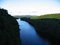
Looking north from the French King Bridge at the Erving-Gill town line in western Massachusetts
-
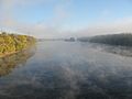
Mist upstream of the Bissell Bridge between Windsor and South Windsor, CT
-
View of Connecticut River downstream from Hartford as seen from East Hartford
-
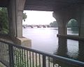
Founders Bridge in Hartford, with a view of the Bulkeley Bridge upstream
-
The river near its mouth


.JPG)


See also
 In Spanish: Río Connecticut para niños
- Equivalent Lands
- The Great Attack, the burning of American ships on the Connecticut River at Essex in 1814
- History of Connecticut
- Lake Connecticut, post-glacial predecessor to Lake Hitchcock
- Lake Hitchcock, post-glacial predecessor to the Connecticut River
- List of rivers of Connecticut
- List of rivers of Massachusetts
- List of rivers of New Hampshire
- List of rivers of Vermont
