Oliverian Brook facts for kids
Quick facts for kids Oliverian Brook |
|
|---|---|

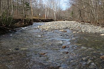
Oliverian Brook at the Appalachian Trail crossing near Glencliff, New Hampshire
|
|
| Country | United States |
| State | New Hampshire |
| County | Grafton |
| Towns | Benton, Warren, Haverhill |
| Physical characteristics | |
| Main source | Confluence of Slide Brook and Still Brook Glencliff 1,290 ft (390 m) 43°59′46″N 71°53′15″W / 43.99611°N 71.88750°W |
| River mouth | Connecticut River Haverhill 390 ft (120 m) 44°2′50″N 72°3′50″W / 44.04722°N 72.06389°W |
| Length | 13.1 mi (21.1 km) |
| Basin features | |
| Tributaries |
|
Oliverian Brook is a cool river in western New Hampshire, United States. It's about 13.1 miles (21.1 km) long. This brook flows into the Connecticut River, which eventually reaches Long Island Sound.
Contents
The Journey of Oliverian Brook
Where Oliverian Brook Starts
Oliverian Brook begins in the town of Benton, New Hampshire. It starts on the western side of Mount Moosilauke. Two smaller streams, Slide Brook and Still Brook, join together to form it. This starting point is near the village of Glencliff.
Flowing Through Mountains
The brook first flows south, passing close to the center of Glencliff. Then, it makes a sharp turn and heads northwest. It travels through a special area called Oliverian Notch. This notch is one of the main passes through the White Mountains.
Reaching the Connecticut River
As it continues its journey, Oliverian Brook flows through a reservoir called Oliverian Pond. A reservoir is like a big, artificial lake that holds water. After the pond, the brook enters the town of Haverhill.
It then passes through the small villages of East Haverhill and Pike. Finally, Oliverian Brook meets the much larger Connecticut River near Haverhill village. A road called New Hampshire Route 25 follows the brook closely for much of its path.
 | James Van Der Zee |
 | Alma Thomas |
 | Ellis Wilson |
 | Margaret Taylor-Burroughs |


