Equivalent Lands facts for kids
The Equivalent Lands were special areas of land given to settlers from the Connecticut Colony by the Province of Massachusetts Bay. This happened after April 1716. Massachusetts gave these lands as a way to make up for an equal amount of land that actually belonged to Connecticut. People from Massachusetts had accidentally settled on that land. This mix-up happened because of mistakes and unclear land surveys done much earlier in the 1600s. We don't have any maps of the Equivalent Lands today.

Contents
Why Were the Equivalent Lands Needed?
Settlers in Springfield, Massachusetts and Hartford, Connecticut had some disagreements in the late 1630s. At that time, the Connecticut Colony was just starting. The Springfield settlers decided to join the Massachusetts Bay Colony instead of Connecticut.
Because of this, Massachusetts Bay surveyed the border between Massachusetts and Connecticut in 1642. They took control of land as far south as Warehouse Point. This point was at Windsor Locks, Connecticut, the northernmost spot on the Connecticut River affected by tides.
Discovering the Survey Mistakes
In the 1690s, officials from the Connecticut Colony did their own survey. They found mistakes in the 1642 survey done by Massachusetts. But it wasn't until 1713 that the two colonies worked together to survey the correct borders.
During this new survey, they found that Massachusetts Bay had given land to Springfield settlers that actually belonged to Connecticut. This was a huge area, about 105,793 acres (42,813 hectares). These settlers had built their homes in and around towns like Springfield, Westfield, and Suffield. They thought they were living in Massachusetts.
Most people living in these areas did not want to switch from Massachusetts to Connecticut. So, they agreed that Massachusetts would keep control over these settled lands. In return, Connecticut would get property rights for an equal amount of land. This new land was called "Equivalent Lands."
Connecticut started selling these "Equivalent Lands" in 1716. They mostly used the money to help start Yale College.
How Were the Equivalent Lands Developed?
The surveys for these new land areas finished on November 10, 1715. One area was near Pelham and Hadley. Another was in the area of Putney, Brattleboro, and Dummerston. A third area was along the east side of the Connecticut River.
Important leaders helped find these lands. They included Massachusetts Governor Joseph Dudley and Connecticut Governor Gurdon Saltonstall. These Equivalent Lands were then put up for sale in Hartford on April 24–25, 1716. The money from these sales went to help establish Yale College.
These lands were sold in at least three known parts. However, since no maps of the Equivalent Lands exist today, there might have been other areas that were not sold at that time.
Who Bought the Lands?
A group of people who bought land hoping its value would increase, called land speculators, bought a large section of 44,000 acres (17,806 hectares). This group included William Brattle, Jr.. The town of Brattleboro, Vermont, was named after him. Other early buyers of the lands included Paul Dudley, Thomas Fitch III, and Jonathan Belcher.
Founding of Brattleboro
On December 27, 1723, the Massachusetts government decided to build a strong blockhouse and stockade. This was to be built north of its Northfield settlement. The goal was to protect the Province of Massachusetts Bay from Chief Gray Lock and others during a conflict known as Dummer's War.
Lieutenant-governor William Dummer approved the plan. Construction of Fort Dummer began on February 3, 1724. It was finished before summer. On October 11, about 70 Native Americans from the French-allied Abenaki tribe attacked the fort. They killed three or four defenders. The settlement around the fort was named "Brattleborough."
The fort was changed into a trading post in 1728. This was for trading with friendly Native American tribes. Soldiers were stationed at the fort again during King George's War from 1744 to 1748. A small group of troops stayed at the fort until 1750. After that, it was no longer considered necessary. Brattleborough itself had very few people living there until after the 1763 Treaty of Paris. This was when France stopped trying to colonize North America.
Other Settlements and New Borders
The towns of Upper Ashuelot and Arlington in the Ashuelot Valley were started before 1740. Several families lived in each of these settlements. Richard Hazzen was sent to survey the area in the winter of 1740–41. He tried to figure out the exact border between New Hampshire and Massachusetts Bay Colony.
Some settlements in the Equivalent Lands were left empty for a while in the mid- to late-1740s. This was because of new fights with the French and their allied tribes. At that time, these areas around Fort Dummer were thought to be in the New Hampshire colony. However, Massachusetts Bay paid for the upkeep and protection of these settlements.
So, another survey team was sent out in 1749. Their job was to make the provincial lines clear again. This led to the New Hampshire Grants and later arguments with the New York Colony. They disagreed about who had control over parts of the area and its people.
In 1752, a large part of the area came under the control of the Province of New Hampshire. But eventually, it became part of Vermont.
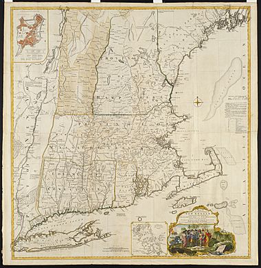
The Equivalent Lands include parts of what are now Vermont, New Hampshire, Connecticut, and Massachusetts.
 | Jessica Watkins |
 | Robert Henry Lawrence Jr. |
 | Mae Jemison |
 | Sian Proctor |
 | Guion Bluford |

