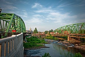
Westfield, Massachusetts facts for kids
Quick facts for kids
Westfield, Massachusetts
|
|||
|---|---|---|---|
|
City
|
|||
| Seal of Westfield | |||
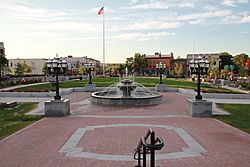
Downtown Westfield and Park Square
|
|||
|
|||
| Nickname(s):
The Whip City
|
|||
| Motto(s):
"Community Driven"
|
|||
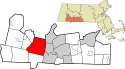
Location in Hampden County in Massachusetts
|
|||
| Country | United States | ||
| State | Massachusetts | ||
| County | Hampden | ||
| Settled | 1660 | ||
| Incorporated (town) | May 19, 1669 | ||
| Incorporated (city) | November 2, 1920 | ||
| Government | |||
| • Type | Mayor-council city | ||
| Area | |||
| • Total | 47.32 sq mi (122.54 km2) | ||
| • Land | 46.26 sq mi (119.81 km2) | ||
| • Water | 1.05 sq mi (2.73 km2) 2.24% | ||
| Elevation | 148 ft (45 m) | ||
| Population
(2020)
|
|||
| • Total | 40,834 | ||
| • Density | 882.69/sq mi (340.81/km2) | ||
| Time zone | UTC−5 (Eastern) | ||
| • Summer (DST) | UTC−4 (Eastern) | ||
| ZIP Codes |
01085–01086
|
||
| Area codes | 413 | ||
| FIPS code | 25-76030 | ||
| GNIS feature ID | 0608962 | ||
Westfield is a city in Hampden County, Massachusetts. It is located in the Pioneer Valley of western Massachusetts, United States. Westfield was first settled by Europeans in 1660. It is part of the Springfield, Massachusetts Metropolitan Statistical Area. In 2020, about 40,834 people lived there.
Contents
History of Westfield
The area where Westfield is now was first home to the Pocomtuc people. They called it Woronoco, which means "the winding land." European settlers from the Connecticut Colony built trading posts here around 1639-1640.
Massachusetts then took control of the area. In 1647, Woronoco became part of Springfield. English settlers started buying land from the Native Americans in 1658. People began to live there permanently in the 1660s.
In 1669, "Westfield" became its own town. It was named Westfield because it was the most westerly settlement at that time. Another name considered was "Streamfield." This was because it was settled between two rivers, the Westfield River and the Little River. These rivers flow through the downtown area.
From its start until 1725, Westfield was the westernmost town in the Massachusetts Colony. Town meetings were held in a church until 1839. That year, a Town Hall was built. This building also served as City Hall from 1920 to 1958. For about 150 years, people in Westfield mostly focused on farming. This was because the land was very fertile.
Westfield's Industrial Growth
In the early 1800s, making bricks, whips, and cigars became important. At one point, Westfield was famous for making buggy whips. This is why the city is still called the "Whip City." Other factories made bicycles, paper, pipe organs, and tools.
Westfield changed from a farming town to a busy industrial city in the 1800s. But in the late 1900s, many factories closed. This happened because other places offered cheaper wages.
Today, the north side of Westfield has many warehouses. Companies like C & S Wholesale, Home Depot, and Lowes have large storage buildings there. South of the river, Westfield State University has grown. This has changed the city's feel. Students make up about 15% of Westfield's population. The old downtown area now serves students more. Mainstream shopping has moved to East Main Street, which is part of U.S. Route 20.
Most buildings in Westfield are not very tall. Only four buildings are taller than four stories. This is partly because of a big fire in 1952. After the fire, new rules were made. These rules stopped most new buildings from being taller than three stories. This was because fire truck ladders were not tall enough.
In the early 1900s, Westfield was important for the Pure Food movement. This movement wanted stricter rules for making food. Louis B. Allyn, a pure foods expert, lived in Westfield. In 1906, Congress passed the Pure Food and Drug Act of 1906. This law helped make food safer.
In 1939, Westfield made history. It was the first city in Massachusetts to elect a female Mayor. Her name was Alice Burke.
Geography of Westfield
Westfield is located at 42°7′46″N 72°44′46″W / 42.12944°N 72.74611°W. It is surrounded by several towns. To the north is Southampton. To the east are Holyoke and West Springfield. To the south are Agawam and Southwick. To the west are Granville, Russell, and Montgomery.
The Westfield River divides the city into the "South Side" and the "North Side." The northwestern part of town is called Wyben.
The city covers about 47.3 square miles (122.7 square kilometers). About 46.3 square miles (120.0 square kilometers) are land. The rest, about 1.1 square miles (2.8 square kilometers), is water.
Westfield is on the western edge of the Connecticut River Valley. The Westfield River flows through the city. It comes from the Berkshire Hills and goes to the Connecticut River. The river has caused big floods many times. Even with dams and dikes, Westfield is still in a floodplain zone. This means it can still flood.
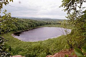
Westfield is bordered on the east by cliffs called East Mountain and Provin Mountain. These are part of the Metacomet Ridge. This ridge is a long line of mountains that goes from Long Island Sound to near the Vermont border. The 114-mile (183 km) Metacomet-Monadnock Trail crosses both mountains. It also crosses the Westfield River.
Westfield is close to the Northeast megalopolis. This is a very populated area of the United States. Westfield has grown with many homes and businesses. But to the west, there are hilltowns. These areas have very few people. Forests are growing back there. Wild animals like turkeys, bears, and moose are returning. This change from city life to wild nature happens over just a few miles.
Westfield is about 10 miles west of Springfield. It is 95 miles west of Boston. It is also 30 miles north of Hartford, Connecticut.
Climate in Westfield
| Climate data for Westfield-Barnes Regional Airport, Massachusetts (1981–2010 normals, extremes 1926–present) | |||||||||||||
|---|---|---|---|---|---|---|---|---|---|---|---|---|---|
| Month | Jan | Feb | Mar | Apr | May | Jun | Jul | Aug | Sep | Oct | Nov | Dec | Year |
| Record high °F (°C) | 71 (22) |
79 (26) |
83 (28) |
95 (35) |
98 (37) |
102 (39) |
103 (39) |
101 (38) |
97 (36) |
87 (31) |
76 (24) |
73 (23) |
103 (39) |
| Mean daily maximum °F (°C) | 32.9 (0.5) |
37.0 (2.8) |
45.9 (7.7) |
59.1 (15.1) |
70.5 (21.4) |
78.0 (25.6) |
82.8 (28.2) |
81.5 (27.5) |
74.0 (23.3) |
61.6 (16.4) |
49.4 (9.7) |
38.2 (3.4) |
59.3 (15.2) |
| Mean daily minimum °F (°C) | 12.9 (−10.6) |
17.4 (−8.1) |
25.1 (−3.8) |
35.4 (1.9) |
45.5 (7.5) |
54.7 (12.6) |
59.0 (15.0) |
58.5 (14.7) |
49.8 (9.9) |
38.2 (3.4) |
30.0 (−1.1) |
21.0 (−6.1) |
37.4 (3.0) |
| Record low °F (°C) | −14 (−26) |
−20 (−29) |
−14 (−26) |
17 (−8) |
25 (−4) |
34 (1) |
40 (4) |
41 (5) |
28 (−2) |
18 (−8) |
2 (−17) |
−14 (−26) |
−20 (−29) |
| Average precipitation inches (mm) | 3.26 (83) |
2.83 (72) |
4.10 (104) |
4.37 (111) |
4.44 (113) |
4.35 (110) |
4.09 (104) |
4.16 (106) |
4.49 (114) |
4.75 (121) |
4.12 (105) |
3.43 (87) |
48.39 (1,229) |
| Source: NOAA | |||||||||||||
People in Westfield
| Historical population | ||
|---|---|---|
| Year | Pop. | ±% |
| 1790 | 2,204 | — |
| 1800 | 2,185 | −0.9% |
| 1810 | 2,130 | −2.5% |
| 1820 | 2,668 | +25.3% |
| 1830 | 2,940 | +10.2% |
| 1840 | 3,526 | +19.9% |
| 1850 | 4,180 | +18.5% |
| 1860 | 5,055 | +20.9% |
| 1870 | 6,519 | +29.0% |
| 1880 | 7,587 | +16.4% |
| 1890 | 9,805 | +29.2% |
| 1900 | 12,310 | +25.5% |
| 1910 | 16,044 | +30.3% |
| 1920 | 18,604 | +16.0% |
| 1930 | 19,775 | +6.3% |
| 1940 | 18,793 | −5.0% |
| 1950 | 20,962 | +11.5% |
| 1960 | 26,302 | +25.5% |
| 1970 | 31,433 | +19.5% |
| 1980 | 36,465 | +16.0% |
| 1990 | 38,372 | +5.2% |
| 2000 | 40,072 | +4.4% |
| 2010 | 41,094 | +2.6% |
| 2020 | 40,834 | −0.6% |
| 2022 | 40,535 | −0.7% |
Source: United States Census records and Population Estimates Program data. Source: |
||
In 2010, there were 41,094 people living in Westfield. There were 15,335 households and 10,041 families. The city had about 860 people per square mile.
Most people in the city were White (92.8%). About 1.6% were African American, and 1.3% were Asian. About 7.5% of the people were Hispanic or Latino.
About 31.5% of households had children under 18. The average household had 2.54 people. The average family had 3.07 people.
The median age in Westfield was 36 years old. About 23.8% of people were under 18. About 12.6% were between 18 and 24. About 13.7% were 65 or older.
The median income for a household was $45,240. The median income for a family was $55,327. About 11.3% of the population lived below the poverty line. This included 16.2% of children under 18.
Fun Things to Do in Westfield
Westfield has many interesting places to visit:
- Amelia Park Ice Rink and Memorial Garden
- Stanley Park of Westfield
- The Metacomet-Monadnock Trail
- East Mountain
- United States Whip Company Complex
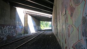
- Columbia Greenway Rail Trail
Education in Westfield
Westfield has a public school system. It includes schools for young children, elementary schools, and high schools.
Preschools
- Fort Meadow Early Childhood Center
Elementary Schools
- Abner Gibbs Elementary School
- Franklin Avenue Elementary School
- Highland Elementary School
- Munger Hill Elementary School
- Paper Mill Elementary School
- Southampton Road Elementary School
- Westfield River Elementary School
Middle Schools
- Westfield Intermediate School (used to be North Middle School)
- Westfield Middle School (used to be South Middle School)
High Schools
- Westfield High School
- Westfield Technical Academy
Private Schools
- St. Mary Preschool and Pre-K
- St. Mary Elementary School
- St. Mary Middle School
- St. Mary High School
- The White Oak School
Higher Education
The city is also home to Westfield State University.
Westfield Athenaeum Library
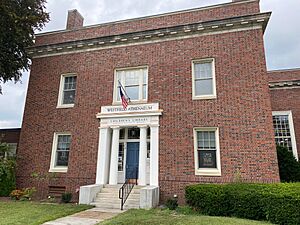
The Westfield Athenaeum is a free library for everyone. It is part of a group of libraries called CW MARS. The library started in 1864.
The Athenaeum first opened on January 1, 1868. At first, you had to pay $2 a year to be a member. But in 1895, it became free for all Westfield residents. In 1899, the library moved to a new building at 6 Elm Street. This building used to be the home of James Fowler.
The Athenaeum is a non-profit group. Its goal is to "enrich the community of Westfield." It does this by offering books, programs, and information for learning and fun.
Media in Westfield
- The Westfield News Group LLC. This company publishes The Westfield News, PennySaver, The Longmeadow News, and The Enfield Press.
Getting Around Westfield
Major Roads
The Massachusetts Turnpike (I-90) goes through Westfield. This highway goes east to Boston and west to Albany. It also connects across the United States. About 3 miles east of Westfield, the turnpike meets Interstate 91. I-91 goes south to Hartford and New Haven. It goes north toward Canada.
Westfield's main north-south road is U.S. 202/Route 10. This road includes many local streets. U.S. 20 is the main east-west road. It also includes several local streets.
Great River Bridge Project
The Great River Bridge is a key point for north-south travel. It is also called the "Green Bridge." It crosses the Westfield River. This bridge used to have three lanes. In 2007, a project started to build a second bridge next to it.
The new bridge opened in 2009. Then, the old bridge was fixed up. Now, each bridge carries traffic in one direction. This helps traffic flow better. A church, Blessed Sacrament Church, was moved for this project. It was rebuilt in a new location.
Train Service
Westfield is where two old train lines met. One went east-west, and one went north-south. Passenger trains stopped running through Westfield in the 1950s.
However, freight trains still use the tracks. The Pioneer Valley Railroad and CSX provide freight service. You can still catch passenger trains like the Lake Shore Limited and Vermonter in Springfield, Massachusetts, which is nearby.
There are plans for a new East-West Passenger Rail service. This would connect Boston and Pittsfield. It would run through Westfield. Local leaders are interested in having a train station in Westfield again.
Bus Service
The city has bus routes provided by the Pioneer Valley Transit Authority (PVTA).
- R10: Westfield / Westfield State University / West Springfield via Route 20. This bus goes between Westfield and Springfield. In Springfield, you can connect to other buses and trains.
- B23: Holyoke / Westfield via Holyoke Community College. This bus goes between Westfield Center and Holyoke.
- WSU Shuttle: This bus runs between Westfield Center and Westfield State University when school is in session.
Air Travel
Westfield-Barnes Regional Airport in Westfield offers charter flights. For regular flights, Bradley International Airport is about 18 miles south in Windsor Locks, Connecticut. Most airlines fly from there.
Famous People from Westfield
Many notable people have connections to Westfield:
- Edward Bancroft (1744–1821), a doctor and spy during the American Revolution.
- Lou Barlow (born 1966), a musician.
- Kacey Bellamy (born 1987), an Olympian who won a silver medal in ice hockey.
- Joseph Buell Ely (1881–1956), a former Governor of Massachusetts.
- Frederick H. Gillett (1851–1935), a U.S. Congressman and Speaker of the U.S. House of Representatives.
- Ferdinand Vandeveer Hayden (1829–1887), a pioneering geologist.
- William Allen Johnson, a famous organ builder.
- Jackie French Koller, an author and painter.
- Walt Kowalczyk (born 1935), a professional football player.
- Jesse Leach, a rock singer.
- Jim Matheos (born 1962), a guitarist for the band Fates Warning.
- Gilbert Clifford Noble (1860–1936), who helped found Barnes and Noble Book Stores.
- Don Pardo, a longtime announcer for Saturday Night Live.
- Frederic Rzewski, a composer.
- William Shepard, a general in the Revolutionary War.
- Rick Sullivan, a former Mayor of Westfield.
- Edward Taylor (c. 1642–1729), a poet and pastor.
Bands from Westfield
Several bands started in Westfield:
- Killswitch Engage, a metalcore band.
- Outpatients, a hardcore/metal band.
- Sebadoh, an indie rock band.
- Within the Ruins, a deathcore band.
- Deep Wound, a hardcore punk band.
- The Prozacs, a pop punk band.
See also
 In Spanish: Westfield (Massachusetts) para niños
 | Bayard Rustin |
 | Jeannette Carter |
 | Jeremiah A. Brown |


