Western Massachusetts facts for kids
Western Massachusetts, often called "western Mass," is a cool area in Massachusetts. This state is one of the six U.S. states in the New England part of the United States. Western Massachusetts has many different types of land, from mountains to valleys. It's home to 22 colleges and universities, including UMass in Amherst, MA, with about 100,000 students! You can also find famous places like Tanglewood, the Springfield Armory, and Jacob's Pillow here.
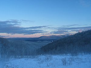
The western part of this region has the Berkshire Mountains, which are popular for vacations. The eastern part includes the Connecticut River Valley. This valley has many university towns, the big city of Springfield, and lots of farming villages. The Quabbin area in the east is a great spot for outdoor fun.
Contents
A Look at Its Past
Early Native American Life
Scientists have found signs of people living in the Connecticut River Valley at least 9,000 years ago. The Pocomtuc people have stories about a giant beaver creating Lake Hitchcock in Deerfield. This story might be about a glacier that melted away over 12,000 years ago.
Western Massachusetts was first home to Native American groups like the Pocomtuc, Nonotuck Mohawk, Nipmuck, and Mahican. Many old sites show that these groups fished, farmed, hunted beavers, and buried their dead here for thousands of years. In 1990, a law called the Native American Graves Protection and Repatriation Act was passed. It said that museums across the country, including those in western Massachusetts, must return these ancient remains to Native peoples. This process is still happening today.
Several Native American groups who spoke Algonkian languages lived in this region. They were connected by culture but had different names for their communities based on their locations. For example, the Agawam people lived in what is now the Springfield area. The Agawam and other groups are part of the larger Algonkian Indian family.
Around 1634, a serious illness, probably smallpox, greatly reduced the Native American population in the Connecticut River Valley. Governor Bradford of Massachusetts wrote that in Windsor, where European diseases often spread, "of 1,000 of [the Native Americans] 150 of them died." With so many people gone, English colonists felt more confident about settling in the area.
Colonial Times and the First Years of the U.S.
The first European explorers to arrive in western Massachusetts were English Puritans. In 1635, at the request of William Pynchon, they settled in what is now Agawam. They chose this spot because it was good for farming and trading. In 1636, a group of English colonists came to Springfield, drawn by the promise of a "great river" and fertile farmland. They started a permanent colony there.
This settlement was first called Agawam Plantation and was managed by the Connecticut Colony. Springfield is only 4 miles north of Connecticut. However, Agawam included land as far south as Windsor Locks and as far north as Holyoke. In 1640, Springfield decided to leave the Connecticut Colony and join the Massachusetts Bay Colony on the coast. This decision helped shape the region's political borders. From 1636 to 1654, the Massachusetts Bay Colony settled the best farmland in the Connecticut River Valley, from Windsor, Connecticut, to Northampton, Massachusetts.
For many years, Native people had a complicated relationship with the European settlers. The fur trade was very important for their economy. White settlers traded things like wampum, cloth, and metal for furs and farm products. Because Native people provided goods at certain times of the year, while colonial goods were always available, a credit system developed. Land was used as a promise for future payments. However, the fur trade became so profitable that beavers were hunted too much. The amount of furs traded dropped a lot, from 3723 furs in 1654 to only 191 ten years later. With each promise of land, Native people lost more of their territory.
Native people started building and gathering in walled "forts," which they didn't need before. In the 1800s and 1900s, scientists dug up these sites and took cultural items and human remains. These items were displayed in museums for many years. When the Native American Graves Protection and Repatriation Act (NAGPRA) was passed in 1990, a long process of returning these items began.
Problems between the colonists and Native American tribes grew worse before King Philip's War started. Colonists took more and more Native land, and many Native Americans got sick and died from European diseases. This made Native people angry and hostile towards the colonists. Some Native Americans joined colonial society, working in white households. However, laws were passed that stopped Native Americans from marrying settlers or staying in colonial settlements after dark. Colonists were also not allowed to live among Native Americans.
In 1662, Wamsutta, a leader of the Wampanoag tribe in eastern Massachusetts, died shortly after being questioned by Plymouth colonists. Wamsutta's brother, Chief Metacomet (also known as "Philip"), started a war against colonial expansion in New England. As the war began, colonists in western Massachusetts worried about keeping the loyalty of "their Indians." The Agawams helped the colonists, even giving them important information.
In August 1675, colonists in Hadley demanded that a group of Nonotuck Indians give up their weapons. The Nonotucks refused and left on the night of August 25. A hundred colonists chased them and caught up at the base of Sugarloaf Hill, a sacred Nonotuck place called the Great Beaver. The colonists attacked, but the Nonotucks fought back and kept moving. This attack on sacred land made Native peoples in western Massachusetts join the war.
After the war, most of the Native American population left western Massachusetts. Many who fled the war joined the Wabanaki in the north, where their families still live today. Native American culture still influences western Massachusetts, from tobacco farming to the names of cities and rivers.
In 1777, George Washington and Henry Knox chose Springfield as the location for the new United States' National Armory. They thought Springfield was perfect because it was on a high hill overlooking a great river and near major roads. For the next 200 years, the Springfield Armory brought wealth and new ideas to Springfield and its nearby towns.
After the American Revolution, a rebellion led by Daniel Shays ended with a battle at the National Armory in Springfield.
Exploring the Geography
The Berkshire Mountains
The Berkshires have long been a favorite place for artists. Famous writers like Herman Melville (who wrote Moby-Dick in Pittsfield) and Edith Wharton (who wrote The House of Mirth and Ethan Frome in Lenox) lived here. Artist Norman Rockwell based many of his paintings on scenes he saw in Stockbridge.
Today, you can visit cultural spots like Tanglewood in Lenox, Jacob's Pillow in Becket, and the Norman Rockwell Museum in Stockbridge. There's also the Clark Art Institute in Williamstown. The biggest city in the Berkshires is Pittsfield.
The Connecticut River Valley
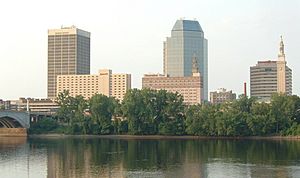
The Connecticut, New England's largest river, flows through the middle of its farming valley. This area is split by the Holyoke Range and the Mount Tom Range. It has many college towns, cities, and small farming villages. The part of this valley in Massachusetts is also called the Pioneer Valley.
Near its southern end, the Springfield-Hartford area has 29 colleges and universities with over 160,000 students. This is the second-highest number of colleges in the U.S., after the Boston metropolitan area.
Many cool inventions came from this valley! These include the sports of basketball (invented by James Naismith in 1895) and volleyball (invented by William Morgan in 1895). The first American car (Duryea, 1893), the first motorcycle company (Indian, 1901), and the first use of interchangeable parts in factories (Thomas Blanchard, 1825) also started here. The first commercial radio station, (WBZ, 1920), broadcast from Springfield's Kimball Hotel.
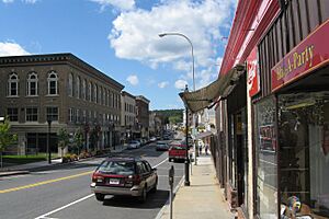
Important towns and cities in this "Knowledge Corridor" include Northampton, Amherst, Easthampton, Holyoke, Chicopee, West Springfield, East Longmeadow, Longmeadow, Ludlow, Agawam, and Westfield.
The Hilltowns
The Hilltowns are areas in Berkshire, Franklin, Hampshire, and Hampden counties. They are west of and higher than the valley where the Connecticut River flows. The land here rises from about 200 feet to at least 1000 feet. Higher up, the land slowly rises even more to the west. Williamsburg in Hampshire County and Becket in Berkshire County are well-known hilltowns.
Generally, the hilltowns west of the Connecticut River Valley were not as good for farming. This meant people settled there later than in the fertile Connecticut River Valley. Most farming here was for families to feed themselves.
The 1,000-foot height difference between the uplands and the Connecticut River Valley created fast-flowing streams and rivers. These rivers, like the Westfield and Deerfield rivers, flow through steep valleys. Mills were built to use the power of the falling water, and mill towns grew around them. Some were even company towns, where everything from production to homes was together.
Later, steam engines were invented, so factories didn't need to rely on water power. This led to the Second Industrial Revolution. Railroads were built along the rivers because the land was flatter there, making it easier to cross the Appalachians. So, as farming towns on hilltops became less important, industrial towns in the river valleys grew in size.
The Quabbin and Quaboag Regions
In northern Massachusetts, the higher area east of the Connecticut River Valley is called the North Quabbin region. These towns include Warwick, Orange, Petersham, Phillipston, Wendell, New Salem, and Athol, which is near the New Hampshire border.
The South Quabbin region (once called the Swift River Valley) includes towns like Barre, Belchertown, Pelham, Ware, Hardwick, Leverett, and Shutesbury. This area used to have four "Lost Towns"—Enfield, Dana, Greenwich, and Prescott—which were removed to create the Quabbin Reservoir.
Further south, the area called the Quaboag Hills includes Hampden, Monson, Wales, Warren, Holland, and Wilbraham near the Connecticut border. Many other towns stretching east towards Worcester are sometimes considered part of the Quaboag Valley region.
The land here is similar to the Hilltown-Berkshire uplands, with strong rocks and thin, rocky soil. The river valleys are not as deep, but the rivers still flow quickly. The Quaboag Hills and Valley, the Quabbin Regions, and towns stretching east towards Worcester are all known as "Hill Towns."
How the Land Was Formed
The mountains in Berkshire County in western Massachusetts are called the "Berkshires." But geologically, they are a continuation of the uplands west of the Connecticut River and a southern part of Vermont's Green Mountains.
The Hilltown-Berkshire upland ends at the valley of the Housatonic River, which flows south to Long Island Sound. In the far northwest of Massachusetts, it ends at the Hoosic River, which flows into the Hudson. From these valleys, the uplands to the east look like rounded mountains, rising about 1,600 feet, but they are actually a flat, high area called a plateau. West of the Housatonic-Hoosic valley system is the narrower Taconic Range along the New York border. Massachusetts' highest peak, Mount Greylock (3,491 feet), is separated from both ranges by smaller rivers, but its geology connects it to the Taconics.
Most of this region is a rolling upland made of strong metamorphic rocks like schist and gneiss, with some pegmatite and granite. Giant glaciers scraped the land during the Ice Age, leaving thin, rocky soil. This soil was only good for small-scale farming before the Industrial Revolution. Not many people rushed to settle this difficult land, but farmers slowly moved into the uplands throughout the 1700s and organized into townships. Then, in the early 1800s, better land became available in Western New York and the Northwest Territory. The farming population in the hilltowns slowly decreased, and fields started to turn back into forests.
The Connecticut River Valley is an ancient rift valley that formed during the Mesozoic Era. This happened when the supercontinent Pangaea began to split apart, separating North America from Europe and South America from Africa. Smaller cracks branched off the main one, and the Connecticut River eventually flowed through one of these. The Metacomet Ridge is a series of narrow traprock ridges where lava pushed through this rift zone. It starts near Greenfield and goes south through Massachusetts and Connecticut to Long Island Sound. Dinosaur footprints found in Holyoke show the life that existed here during the Mesozoic Era.
As continental glaciers melted near the end of the last glacial period, a moraine (a pile of rocks and dirt left by a glacier) at Rocky Hill, Connecticut, blocked the river. This created Lake Hitchcock, which stretched north for about 200 miles, covering places like Springfield, Agawam, and West Springfield. Some higher areas, like parts of Holyoke, stayed above the water.
Fine dirt and sand built up during the time of Lake Hitchcock. This is why the region has incredibly rich farming soil, which attracted settlers as early as 1635. Even though the Connecticut River Valley has the best soil in New England, many of its fields are now covered by cities and towns. Still, the valley remains New England's most productive farmland. Farmers here still grow tobacco, tomatoes, sweet corn, and other vegetables for sale.
People and Population
In 2020, Berkshire, Franklin, Hampshire, and Hampden counties together had 828,188 residents. This is more people than any of the six smallest U.S. states. This population was about 12.84% of Massachusetts' total population in 2000. The average number of people per square mile is about 293.07, which is less than the rest of Massachusetts (about 1,093.87 per square mile).
Most of western Massachusetts' population lives in the cities and suburbs along the Connecticut River. This urban area around Springfield connects with greater Hartford, Connecticut (known as the Knowledge Corridor). Another group of people lives in the Housatonic-Hoosic valley because of the old factories in Pittsfield and North Adams, and the growth of tourism. This far-western area is more connected to New York City and Albany, New York, than to the rest of Massachusetts. However, both populated areas are part of the larger Northeast megalopolis. The rest of western Massachusetts has fewer people, especially the Hilltowns, where there are often fewer than 50 people per square mile.
The largest communities, from biggest to smallest, are: Springfield, Chicopee, Pittsfield, Westfield, Holyoke, Northampton, Agawam, West Springfield, Amherst Center, Easthampton, Longmeadow, East Longmeadow, North Adams, and Greenfield.
Economy and Jobs
Western Massachusetts has been compared to a smaller version of the rest of the United States. Springfield, the third-largest city in Massachusetts, is in this region. It faced financial challenges in the early 2000s. The unemployment rate in western Massachusetts is higher than in eastern Massachusetts. Officials have been working to attract more long-term businesses to the area to use the many talented students graduating from local colleges and universities.
To help with higher internet and phone costs, the state government invested $45.4 million in building a broadband network. This project, called 'Massachusetts Technology Park - MassBroadband 123,' also received $45 million from the federal government. The 1,200-mile project was finished in early 2014. It connected public buildings across central and western Massachusetts and provided a fiber-optic backbone for future growth. Building on this, the state launched a 'Last Mile' program for 54 communities that didn't have good internet service. This program has invested in local fiber-to-the-home networks, private projects, and advanced wireless projects to connect homes and businesses. Now, small, rural towns like Mount Washington, Mass., have internet speeds of 500 megabits per second.
In recent years, there has been a push to add high-speed train service from western Massachusetts to eastern Massachusetts. People in western Massachusetts enjoy and support the local arts, tourism, and culture.
Education Opportunities
After World War II, manufacturing jobs decreased in the region, especially after the closing of the Springfield Armory. However, the growth of colleges, universities, and healthcare helped balance this.
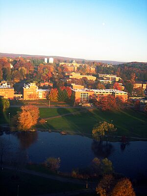
This growth created new jobs and changed the look and feel of many college towns. State and community-funded schools, like University of Massachusetts Amherst and Westfield State University, grew a lot. The region's highly respected liberal arts colleges also grew. These include Williams (founded 1793), Amherst (founded 1821), Mount Holyoke (founded 1837), Smith (founded 1871), and American International (founded 1885).
Even with the gains in higher education, the region has worked to get a fair share of the state's education money for local elementary and high schools. Several communities in western Massachusetts have pushed for changes in how the state gives money to cities and towns for schools.
Colleges and Universities
- Amherst College
- American International College
- Bard College at Simon's Rock
- Bay Path University
- Berkshire Community College
- Cambridge College
- Conway School of Landscape Design
- Elms College
- Five Colleges Association
- Greenfield Community College
- Hampshire College
- Holyoke Community College
- Massachusetts College of Liberal Arts
- Mount Holyoke College
- Smith College
- Springfield College
- Springfield Technical Community College
- University of Massachusetts Amherst
- Westfield State University
- Western New England University
- Williams College
Getting Around
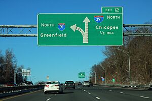
Major Highways
U.S. Routes
 US 5
US 5 US 7
US 7 US 20
US 20 US 202
State Roads
 Route 2
 Route 2A
 Route 5A
 Route 7A
 Route 8
 Route 8A
 Route 9
 Route 10
 Route 19
 Route 20A
 Route 21
 Route 23
 Route 30
 Route 32
 Route 33
 Route 38
 Route 41
 Route 43
 Route 47
 Route 57
 Route 62
 Route 63
 Route 66
 Route 67
 Route 71
 Route 75
 Route 78
 Route 83
 Route 97
 Route 102
 Route 106
 Route 112
 Route 116
 Route 122
 Route 141
 Route 142
 Route 143
 Route 147
 Route 159
 Route 168
 Route 181
 Route 183
 Route 186
 Route 187
 Route 189
 Route 192
 Route 225
 Route 295
Tunnels and Bridges
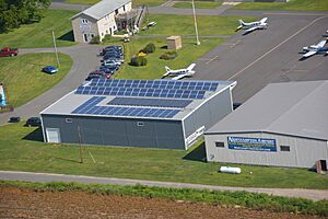
Airports
- Great Barrington Airport
- North Adams Airport
- Northampton Airport
- Orange Municipal Airport
- Pittsfield Municipal Airport
- Turners Falls Airport
- Westfield-Barnes Regional Airport
- Westover Airport
Nearby Airports
- Logan International Airport in Boston, about 3 miles northeast of downtown Boston. This is New England's biggest travel hub.
- Worcester Regional Airport in Worcester, Massachusetts
- Manchester-Boston Regional Airport in Manchester, New Hampshire
- Albany International Airport, west of the Berkshires in upstate New York
- Bradley International Airport, south of Springfield in Connecticut
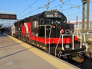
Trains and Buses
- Amtrak runs three train lines through western Massachusetts. All three stop at Springfield Union Station.
- Lake Shore Limited Line: This train goes from Chicago, Illinois, to Boston. It stops at Springfield-Union, Joseph Scelsi Intermodal Transportation Center (Pittsfield, MA), and then continues to upstate New York towards Buffalo via Albany.
- Northeast Regional Line: This train travels from Springfield to Washington, D.C./Virginia. It connects in New Haven, CT, with the main line from Boston.
- Vermonter Line: This train goes from Washington, D.C., to Vermont. It has four stops in western Massachusetts: Union-Springfield, Holyoke station, Union-Northampton, and John W. Olver Transit Center (Greenfield, MA).
- CTRail's Hartford Line started running to Union Station-Springfield as its northern end. Trains run from New Haven, CT, with several stops in Connecticut. The New Haven–Springfield Line was improved when the Hartford Line service began. This project got money from Massachusetts, the U.S. Government, and Connecticut. Amtrak trains on the route between New Haven and Springfield can reach speeds of 110 mph.
- Central Corridor Rail Line: A new train line is being planned from New London, CT. This line would also have stations in western Massachusetts at: Union-Palmer (Palmer, MA); Amherst station; and Millers Falls before reaching Vermont.
These regional bus systems operate in western Massachusetts:
- Berkshire Regional Transit Authority
- Franklin Regional Transit Authority
- Pioneer Valley Transit Authority (connects with Connecticut Transit Hartford trains)
Fun Things to Do and Historic Places
- Susan B. Anthony Birthplace Museum
- Arrowhead (Herman Melville)
- Basketball Hall of Fame
- The Big E (a big fair!)
- Clark Art Institute
- The Five Colleges: Amherst College, Hampshire College, Mount Holyoke College, Smith College, and UMass Amherst
- Forest Park in Springfield – one of the biggest city parks in the U.S., with a zoo and Bright Nights during the holidays
- Eric Carle Museum of Picture Book Art
- Historic Deerfield
- Emily Dickinson Museum: The Homestead and The Evergreens
- Jacob's Pillow
- MassMoCA
- National Yiddish Book Center
- The Quadrangle
- The Mount
- Norman Rockwell Museum
- Tanglewood
- Six Flags New England
- J. A. Skinner State Park
- The Springfield Armory National Park
- Springfield, Massachusetts' Club Quarter
- Yankee Candle
- Shelburne Falls Bridge of Flowers
- Shelburne Falls Trolley Museum
- Wistariahurst
Outdoor Adventures
- Appalachian Trail (great for hiking!)
- Ashuwillticook Rail Trail
- Bash Bish Falls State Park
- Berkshire East Ski Area
- The Berkshires
- Blandford Ski Area
- Bousquet Ski Area
- Connecticut River
- Deerfield River
- Farmington River
- Jiminy Peak
- Lake Buel
- Lake Onota
- Mount Everett State Reservation
- Mount Greylock
- Mount Holyoke
- Mount Tom
- Otis Reservoir
- Pittsfield State Forest
- Quabbin Reservoir
- Ski Butternut—Great Barrington
- Westfield River
 | Janet Taylor Pickett |
 | Synthia Saint James |
 | Howardena Pindell |
 | Faith Ringgold |


