
Williamstown, Massachusetts facts for kids
Quick facts for kids
Williamstown, Massachusetts
|
||
|---|---|---|

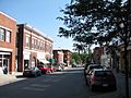
Main Street, Williamstown, Massachusetts (April 2008)
|
||
|
||
| Motto(s):
"The Village Beautiful"
|
||

Location in Berkshire County and the state of Massachusetts
|
||
| Country | United States | |
| State | Massachusetts | |
| County | Berkshire | |
| Settled | 1749 | |
| Incorporated | 1765 | |
| Government | ||
| • Type | Open town meeting | |
| Area | ||
| • Total | 46.9 sq mi (121.4 km2) | |
| • Land | 46.8 sq mi (121.1 km2) | |
| • Water | 0.1 sq mi (0.3 km2) | |
| Elevation | 638 ft (194 m) | |
| Population
(2020)
|
||
| • Total | 7,513 | |
| • Density | 160.28/sq mi (61.886/km2) | |
| Time zone | UTC−5 (Eastern) | |
| • Summer (DST) | UTC−4 (Eastern) | |
| ZIP Code |
01267
|
|
| Area code | 413 | |
| FIPS code | 25-79985 | |
| GNIS feature ID | 0619430 | |

Williamstown is a town in Berkshire County, Massachusetts, United States. It borders Vermont to the north and New York to the west. Williamstown is known as a college town because it is home to Williams College. It also has the Clark Art Institute and the Williamstown Theatre Festival, which has won Tony Awards. In 2020, about 7,513 people lived here.
Contents
History of Williamstown
Williamstown was first settled in 1749 and was called West Hoosac. Before that, the area was a hunting ground for the Mohican people. Its location near Dutch colonies in New York made it important. A fort, Fort West Hoosac, was built in 1756 to protect Massachusetts.
How Williamstown Got Its Name
The town was officially named Williamstown in 1765. This happened because of the will of Colonel Ephraim Williams. He was a soldier who died in the French and Indian War. He left a lot of money to the town. His will said the town should be named after him. It also said a free school should be started there.
From Free School to College
The school opened in 1791. It was a free school for a short time. In 1793, it became Williams College. Today, Williams College is the biggest employer in Williamstown.
Early Industries and Growth
In the past, farming was the main industry. People raised dairy cows and sheep for wool. There were also sawmills and gristmills that used water power from streams. Later, bigger mills were built, like the Walley Mill. These mills made textiles. The A. Loop & Company made twine.
When the railroad arrived, tourists started visiting Williamstown. Many inns and hotels opened, such as the Idlewild Hotel. In the 1930s and 1940s, a large experimental farm called Mount Hope Farm was created. It is now part of Williams College.
Geography of Williamstown

Williamstown is located in the the Berkshires region of Massachusetts. The Hoosic River flows through the town. The town covers about 121.4 square kilometers (46.9 square miles). Most of this area is land.
Where is Williamstown Located?
Williamstown is the northwesternmost town in Massachusetts.
- To the north, it borders Pownal, Vermont.
- To the east, it borders Clarksburg, North Adams, and Adams.
- To the south, it borders New Ashford and Hancock.
- To the west, it borders Berlin and Petersburgh, New York in New York State.
Mountains and Trails
The Taconic Range is to the west, along the New York border. Brodie Mountain is south of town. The Mount Greylock State Reservation is in the southwestern part of town. Mount Greylock, the highest point in Massachusetts, is just outside Williamstown. The Appalachian Trail, a famous hiking path, also passes near the town.
Major Roads
Several important roads go through Williamstown:
- U.S. Route 7 runs north to south.
- Massachusetts Route 2 starts in Williamstown. It is known as the Taconic Trail here. East of North Adams, it becomes the Mohawk Trail.
- Route 43 also starts here and goes south.
Population and People
Williamstown is the fourth-largest town in Berkshire County. In 2000, there were 8,424 people living in Williamstown. By 2020, the population was 7,513.
Who Lives in Williamstown?
In 2017, about 81.6% of the people in Williamstown were white. About 5.1% were black, and 6.3% were Asian. About 7.5% of the population were Hispanic or Latino. Many people in Williamstown have Irish, English, or German backgrounds. About 11.6% of the people living in Williamstown are immigrants. They come from countries like China, South Korea, and Cambodia.
Households and Families
In 2000, there were 2,753 households in Williamstown. About 24.7% of these households had children under 18. Most households (51.3%) were married couples living together. The average household had 2.21 people.
Age and Income
The median age in Williamstown in 2000 was 36 years old. This means half the people were younger than 36 and half were older. The median income for a household was $51,875. This is the middle income for all households. About 5.5% of the population lived below the poverty line.
Education in Williamstown
Williamstown has several schools for different age groups.
Local Schools
- Williamstown Elementary School teaches students from pre-kindergarten to sixth grade.
- Mount Greylock Regional School is the high school. It also serves students from nearby towns like New Ashford and Lanesborough. Their sports teams are called the Mounties.
- Pine Cobble School is a private school for students from pre-kindergarten to ninth grade.
- Buxton School is a private boarding school for high school students.
Colleges and Universities
- Williams College is a well-known private college in Williamstown.
- The nearest community college is Berkshire Community College in Pittsfield.
- The nearest public college is Massachusetts College of Liberal Arts in North Adams.
- The nearest large public university is the University of Massachusetts Amherst.
Places to Visit
Williamstown has many interesting places to explore.
- Williamstown Historical Museum: This museum was founded in 1941. It tells the story of Williamstown, from its early days as a stop on the Mohawk Trail to today. It has permanent exhibits like "From Wilderness to Williamstown" and "The College: A Defining Presence."
- The 1753 House: This house was built in 1953 to celebrate the town's 200th anniversary. Volunteers built it using old tools and materials. It shows what a typical home might have looked like in 1753.
- Clark Art Institute: A famous art museum.
- Williams College Museum of Art: Another art museum located at Williams College.
- Field Farm: A beautiful farm with walking trails.
Notable People from Williamstown
Many famous people have lived in or are connected to Williamstown.
- W. J. Abrams, Wisconsin state senator
- Herbert A. Allen, Jr., businessman
- Florence Bascom, geologist
- John Bascom, educator and former president of University of Wisconsin
- Ali Benjamin, author
- James MacGregor Burns, historian and writer
- Albert Cummings, blues guitarist
- Daniel Dewey, congressman
- Dick Farley, football player and coach
- Ali Fedotowsky, entertainment journalist
- Darra Goldstein, cookbook author
- Stephen Hannock, painter
- Mark Hopkins, educator and former president of Williams College
- Peter H. Hunt, producer and director
- Alex Kershaw, author
- Elizabeth Kolbert, journalist and author
- Joe McGinniss, author
- Farah Pahlavi, former empress of Iran
- John Bennett Perry, actor
- Matthew Perry, actor
- Cole Porter, songwriter
- Roger Rees, actor
- Christopher Reeve, actor
- John Edward Sawyer, historian and former president of Williams College
- Morton O. Schapiro, professor and former president of Williams College
- Jane Swift, former Lieutenant Governor and acting Governor of Massachusetts
- George Steinbrenner, former owner of the New York Yankees baseball team
- William Henry Vanderbilt III, statesman
- Fay Vincent, former baseball commissioner
- Bill Wootters, physicist
Transportation
Williamstown has several ways to get around.
Roads and Buses
- Major roads like U.S. Route 7, MA Route 2 (Mohawk Trail), and MA Route 43 cross through the town.
- The Berkshire Regional Transit Authority (BRTA) provides bus service to North Adams and Pittsfield.
- The Green Mountain Express offers a weekday bus route north to Bennington, Vermont.
- Peter Pan Lines provides daily bus service to and from New York City.
Trains and Airports
- A freight rail line passes through Williamstown.
- The closest Amtrak train station is in Pittsfield. It is on the Boston-Chicago Lake Shore Limited line.
- The nearest small airport is Harriman-and-West Airport in North Adams.
- For commercial flights, the closest airport is Albany International Airport.
Images for kids
-
Main Street in 1907
-

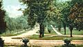
The road to South Williamstown in 1907
-
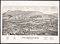
Print of Williamstown from the 1880s
-
Spring Street in 2010
-
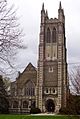
Thompson Memorial Chapel, part of Williams College, in 2012


.jpg)


See also
 In Spanish: Williamstown (Massachusetts) para niños
