North Adams, Massachusetts facts for kids
Quick facts for kids
North Adams
|
||
|---|---|---|
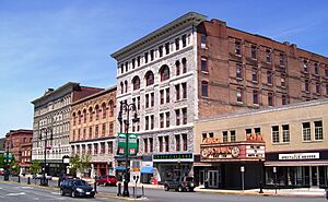
Main Street
|
||
|
||
| Nicknames:
Tunnel City and Steeple City
|
||
| Motto(s):
"We Hold the Western Gateway"
|
||
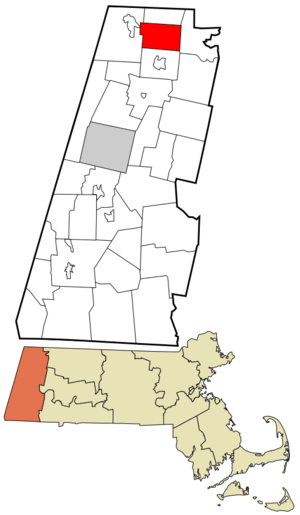
Location in Berkshire County and the state of Massachusetts.
|
||
| Country | United States | |
| Commonwealth | Massachusetts | |
| County | Berkshire | |
| Settled | 1745 | |
| Incorporated | 1878 (Town) | |
| Incorporated | 1895 (City) | |
| Government | ||
| • Type | Mayor-council city | |
| Area | ||
| • Total | 20.61 sq mi (53.39 km2) | |
| • Land | 20.35 sq mi (52.70 km2) | |
| • Water | 0.27 sq mi (0.69 km2) | |
| Elevation | 707 ft (215 m) | |
| Population
(2020)
|
||
| • Total | 12,961 | |
| • Density | 637.00/sq mi (245.95/km2) | |
| Time zone | UTC-5 (Eastern) | |
| • Summer (DST) | UTC-4 (Eastern) | |
| ZIP code |
01247
|
|
| Area code(s) | 413 | |
| FIPS code | 25-46225 | |
| GNIS feature ID | 0607610 | |
North Adams is a city in Berkshire County, Massachusetts, United States. It is known for being home to the Massachusetts Museum of Contemporary Art (MASS MoCA). This museum is the largest contemporary art museum in the United States.
In recent years, North Adams has become a popular spot for tourism, culture, and outdoor activities. Its population was 12,961 in 2020.
Contents
History of North Adams
Early Beginnings
North Adams was first settled in 1745. This was during a time called King George's War. A fort was built along the Hoosic River to defend the area. Massachusetts soldiers and their families lived there.
During the war, forces from Canada and Native American groups attacked Fort Massachusetts. Some prisoners were taken to Quebec. In 1747, the fort was rebuilt with stronger defenses. It was never attacked again.
After the war, many soldiers became farmers. They chose to receive land instead of back-pay. This land was in a nearby area called West Hoosac, now known as Williamstown.
Fort Massachusetts Memorial
In 1895, the North Adams Women's Club started raising money. They wanted to rebuild the fort as a memorial. It was officially opened in 1933. The site was a historical tourist spot until the 1960s.
Today, a replica chimney from the 1933 fort is behind a supermarket. The historic site was given to the City of North Adams in 2017.
Becoming a City
North Adams became a separate town from Adams in 1878. It became a city in 1895. The city is named after Samuel Adams. He was an important leader in the American Revolution. He also signed the Declaration of Independence.
Mill Town Era
For a long time, North Adams was a "mill town." This means it had many factories. Manufacturing started even before the American Revolutionary War. The Hoosic River provided water power for these early industries.
By the late 1700s and early 1800s, businesses grew. They included shoe factories, brick yards, saw mills, and machine shops. There were also places that made cabinets, hats, and wagons. An ironworks in North Adams even made armor plating for the Civil War ship, the Monitor.
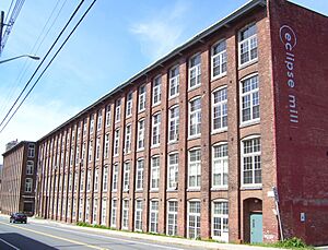
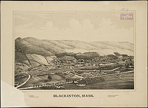
Three mill villages were built to use the river's power. These were Blackinton (1821), Greylock (1846), and Braytonville (1832). By 1850, more factory workers lived in the town than farmers. This showed that industry was now more important than farming.
In 1870, workers from China helped during a shoe factory strike. This event was important in the history of Chinese workers moving to the East Coast.
North Adams was also the main location for building the Hoosac Tunnel. This project started in 1851 and finished in 1874. The tunnel connected the city by rail to Boston and Albany. Before this, travel was mostly by stagecoach.
Arnold Print Works was a major company in North Adams. It started in 1860 and printed cloth. They had large government contracts during the Civil War. By 1905, it was the largest employer with 3,200 workers. However, the company closed its main operation in 1942 due to falling prices and the Great Depression.
Sprague Electric Company
Later in 1942, the Sprague Electric Company bought the former print works site. During World War II, Sprague helped the U.S. government. They designed and made important parts for advanced technologies, including those used in space missions.
Sprague was a big research center. They studied electricity and semi-conducting materials. After the war, their products were used in NASA's Gemini missions. By 1966, Sprague had 4,137 workers. But competition from other countries led to lower sales. In 1985, the company closed its operations. This closure greatly affected the local economy. Many people lost their jobs, and the population decreased.
MASS MoCA's Arrival
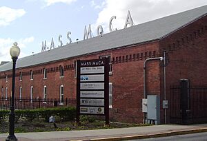
After Sprague closed, leaders in North Adams looked for new uses for the large factory complex. Thomas Krens, who directed the Williams College Museum of Art, needed space for big contemporary art pieces. These artworks were too large for regular museums.
The mayor, John Barrett III, suggested the Marshall Street complex. This idea led to the plan for a contemporary arts center in North Adams. The state government supported the project in 1988. Even with economic problems, the community and private businesses helped raise over $8 million. This made sure the project moved forward.
The plan used the large factory spaces to connect the building's past with its new life. It became the country's largest center for contemporary visual and performing arts. This new center is called the Massachusetts Museum of Contemporary Art (MASS MoCA).
Since it opened, MASS MoCA has helped change the region's economy. It has brought more cultural, recreational, and educational activities. North Adams now has new restaurants, art galleries, and cultural groups. Old factories and mills have also been turned into homes and studios for artists.
Geography

North Adams covers about 20.6 square miles (53.4 square kilometers). Most of this area is land, with a small part being water. The city is surrounded by other towns: Clarksburg to the north, Florida to the east, Adams to the south, and Williamstown to the west.
North Adams is in a valley formed by the Hoosic River. Parts of the river have concrete walls to prevent floods. The city is home to Natural Bridge State Park. This park has the only natural white marble bridge in North America. This arch was formed by melting glaciers about 11,000 years ago. It has attracted hikers for a long time.
To the east, the city is next to the Hoosac Range. From its West Summit, you can see views of the surrounding three states. To the southwest, you'll find the northern part of Mount Greylock State Reservation. This area includes Mount Williams, which is the highest point in the city at 2,951 feet (899 meters) above sea level. The Appalachian Trail also passes through the western part of the city.
Climate
North Adams has a humid continental climate. This means it has cold winters and warm summers. In winter, temperatures can drop to 0°F (-18°C) or colder about nine times a year. Summers are usually warm and pleasant, with temperatures reaching 90°F (32°C) or higher about four times a year.
The highest temperature ever recorded was 96°F (36°C) on July 8, 1988. The lowest was -20°F (-29°C), recorded on January 24, 2011, and February 6, 2015. On average, North Adams has measurable rain or snow about 153 days each year.
| Climate data for North Adams, MA (1991–2020 normals, extremes 1987–present) | |||||||||||||
|---|---|---|---|---|---|---|---|---|---|---|---|---|---|
| Month | Jan | Feb | Mar | Apr | May | Jun | Jul | Aug | Sep | Oct | Nov | Dec | Year |
| Record high °F (°C) | 68 (20) |
76 (24) |
87 (31) |
90 (32) |
92 (33) |
93 (34) |
96 (36) |
94 (34) |
92 (33) |
84 (29) |
77 (25) |
70 (21) |
96 (36) |
| Mean daily maximum °F (°C) | 32.4 (0.2) |
35.3 (1.8) |
43.6 (6.4) |
56.9 (13.8) |
68.6 (20.3) |
76.4 (24.7) |
80.9 (27.2) |
79.0 (26.1) |
72.1 (22.3) |
60.0 (15.6) |
48.4 (9.1) |
37.6 (3.1) |
57.6 (14.2) |
| Daily mean °F (°C) | 23.3 (−4.8) |
25.4 (−3.7) |
33.5 (0.8) |
45.2 (7.3) |
56.2 (13.4) |
64.7 (18.2) |
69.3 (20.7) |
67.5 (19.7) |
60.5 (15.8) |
49.2 (9.6) |
39.1 (3.9) |
29.5 (−1.4) |
46.9 (8.3) |
| Mean daily minimum °F (°C) | 14.3 (−9.8) |
15.5 (−9.2) |
23.5 (−4.7) |
33.5 (0.8) |
43.9 (6.6) |
53.0 (11.7) |
57.7 (14.3) |
56.1 (13.4) |
48.8 (9.3) |
38.4 (3.6) |
29.7 (−1.3) |
21.5 (−5.8) |
36.3 (2.4) |
| Record low °F (°C) | −20 (−29) |
−20 (−29) |
−14 (−26) |
0 (−18) |
23 (−5) |
33 (1) |
43 (6) |
38 (3) |
28 (−2) |
18 (−8) |
1 (−17) |
−12 (−24) |
−20 (−29) |
| Average precipitation inches (mm) | 2.52 (64) |
1.97 (50) |
3.08 (78) |
3.12 (79) |
3.73 (95) |
4.41 (112) |
4.13 (105) |
4.47 (114) |
4.22 (107) |
4.28 (109) |
3.25 (83) |
3.12 (79) |
42.30 (1,074) |
| Average precipitation days (≥ 0.01 in) | 11 | 10 | 12 | 13 | 14 | 15 | 14 | 14 | 12 | 13 | 12 | 13 | 153 |
| Source: NOAA | |||||||||||||
Population of North Adams
| Historical population | ||
|---|---|---|
| Year | Pop. | ±% |
| 1880 | 10,191 | — |
| 1890 | 16,074 | +57.7% |
| 1900 | 24,200 | +50.6% |
| 1910 | 22,019 | −9.0% |
| 1920 | 22,282 | +1.2% |
| 1930 | 21,621 | −3.0% |
| 1940 | 22,213 | +2.7% |
| 1950 | 21,567 | −2.9% |
| 1960 | 19,905 | −7.7% |
| 1970 | 19,195 | −3.6% |
| 1980 | 18,063 | −5.9% |
| 1990 | 16,797 | −7.0% |
| 2000 | 14,681 | −12.6% |
| 2010 | 13,708 | −6.6% |
| 2020 | 12,961 | −5.4% |
| 2022* | 12,777 | −1.4% |
| * = population estimate. Source: United States Census records and Population Estimates Program data. Source: |
||
In 2010, North Adams had 13,708 people living in 5,652 households. About 23.6% of these households had children under 18. The city is the smallest in Massachusetts by area. However, it ranks second in population among cities and towns in Berkshire County.
The population density was about 665 people per square mile. Most of the people (93.0%) were White. Other groups included African American (1.8%), Asian (1.1%), and Native American (0.4%). About 2.4% of the population was Hispanic or Latino.
The average age in the city was 38 years old. About 21.74% of the population was under 18. About 16.4% were 65 years or older.
Arts and Culture


Art Scene
North Adams is home to MASS MoCA, a very large contemporary art museum. Because of this, there are many art galleries around the city. Some old mills have even been turned into lofts where artists can live and work. There are also plans for a new Frank Gehry-designed museum called the Extreme Model Railroad and Contemporary Architecture Museum.
Places to Visit and Events
North Adams offers many interesting places and events:
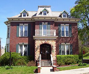
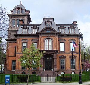
- Houghton Mansion
- Massachusetts College of Liberal Arts (MCLA)
- Massachusetts Museum of Contemporary Art (MASS MoCA)
- Natural Bridge State Park
- North Adams Museum of History and Science—North Adams Historical Society
- Western Gateway Heritage State Park
- Fall Foliage Festival
- Solid Sound Festival
Historic Places
Many places in North Adams are listed on the National Register of Historic Places. This means they are important for their history or architecture.
- Armstrong House
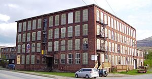
- Beaver Mill
- Blackinton Historic District
- The Boardman
- Charles Browne House
- Church Street-Caddy Hill Historic District
- H. W. Clark Biscuit Company
- Crowley House
- Freeman's Grove Historic District
- Freight Yard Historic District
- Hathaway Tenement
- Hillside Cemetery
- Hoosac Tunnel
- Johnson Manufacturing Company
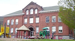
- Johnson School
- Monument Square-Eagle Street Historic District
- Norad Mill
- Wells House
- Windsor Print Works
Sports
The city has a baseball team called the North Adams SteepleCats. They play in the New England Collegiate Baseball League (NECBL) at Joe Wolfe Field. The SteepleCats hold the record for the most fans at a single game in the NECBL. This happened on July 4, 2006, with 6,714 fans.
North Adams also had a professional hockey team, the Berkshire Battalion. They played one season in 2014–2015 before moving to Dayton, Ohio.
The city has many sports fields and complexes. These include the Noel Field Athletic Complex and the Alcombright Athletic Complex.
Education
North Adams has its own public school system. It includes three elementary schools: Brayton, Greylock, and Colegrove Park. Students then go to Drury High School, which also serves nearby towns. The city is also home to Charles H. McCann Technical High School. There are also several private schools.
Former Schools
- Johnson School (Closed 1994)
- Silvio O. Conte Middle School (Closed June 2009)
- Sullivan Elementary School (Closed December 2015)
- St. Joseph's School (North Adams, Massachusetts) (Closed in 1970s)
- Notre Dame school (Closed 1975)
Higher Education
Massachusetts College of Liberal Arts (MCLA) is located in North Adams. About 1,980 students attend MCLA. It was founded in 1894 as North Adams Normal School. Over the years, its name changed several times. In 1997, it became Massachusetts College of Liberal Arts. This name reflects its focus on liberal arts studies.
Transportation and Roads
North Adams is the western end of the Mohawk Trail. This is a scenic road that goes up to the West Summit. The trail is part of Massachusetts Route 2, which continues west into Williamstown and towards New York. Route 8 also goes through the city, connecting it to Adams and Clarksburg.
The closest major highway is Interstate 91, which is about an hour away to the east.
Public Transport
The city is the northern end for several bus lines of the Berkshire Regional Transit Authority (BRTA). You can also find intercity bus service in nearby Williamstown. These buses connect to New York City and other towns.
North Adams has a small airport called Harriman-and-West Airport. For national flights, the nearest airport is Albany International Airport. A freight train line runs through the city and through the Hoosac Tunnel.
There are plans to bring passenger train service back to North Adams. This would connect the city to Boston. The last passenger train service ended in the 1950s.
Notable People
- Amanda L. Aikens (1833–1892), Editor, philanthropist
- Caleb Atwater (1778–1867), Archeologist, politician
- Paul Babeau (born 1969), Sheriff, politician
- Andrea Barrett (born 1954), Novelist
- Jonah Bayliss (born 1980), MLB relief pitcher
- Daniel E. Bosley (born 1953), State representative
- Harry C. Browne (1878–1954), Banjo player and actor
- Gailanne Cariddi (1953–2017), State representatives
- Arthur P. Carpenter, US Marshal for Vermont
- Jack Chesbro (1874–1931), Hall of Fame pitcher
- Martha Coakley (born 1953), Massachusetts attorney general
- Jeremiah Colegrove (1758–1836), Early leading citizen
- John M. Darby (1804–1877), Botanist, chemist
- Will Durant (1885–1981), Philosopher, historian
- Paul Farmer (1959–2022), Physician, anthropologist
- Joseph F. Finnegan (1904–1964), Labor mediator
- Van Hansis (born 1981), Actor
- John Henry Haynes (1849–1910), Archaeologist and photographer
- Peter Laird (born 1954), Comic book artist
- Amy Lee, Saxophonist
- Frank J. Matrango (1926–1996), Massachusetts state legislator
- Martin Melcher (1915–1968), Film producer and husband of Doris Day
- Francis Millard (1914–1958), U.S. Olympic Silver Medalist Wrestler
- Thomas Ward Osborn (1833–1898), U.S. Senator, Col. in Civil War
- Harrison Potter (1891–1984), Classical pianist
- Fritz Redl (1902–1988), Child psychoanalyst and educator
- Robert Rheinlander (1880–1961), Architect and civil engineer
- John Henry Schwarz, Theoretical physicist
- Hiram Sibley (1807–1888), Industrialist, philanthropist
- Frank J. Sprague (1857–1934), Electrical engineer, inventor
- John St. Cyr (1936–2022), Massachusetts state legislator and judge
- Jane Swift (born 1965), Massachusetts Lt. governor
- Oswald Tower (1883–1968), Basketball official
- Frank Vincent (1939–2017), Actor
- Ashley B. Wright (1841–1897), U.S. representative
Sister City
Images for kids
See also
 In Spanish: North Adams (Massachusetts) para niños
 | Kyle Baker |
 | Joseph Yoakum |
 | Laura Wheeler Waring |
 | Henry Ossawa Tanner |


