Mount Greylock facts for kids
Quick facts for kids Mount Greylock |
|
|---|---|
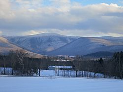
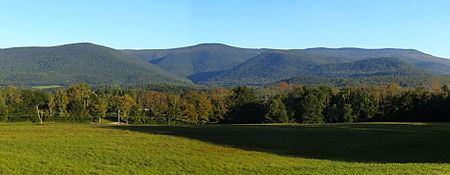
Mt. Greylock seen from the West
|
|
| Highest point | |
| Elevation | 3,489 ft (1,063 m) NAVD 88 |
| Prominence | 2,463 ft (751 m) |
| Listing | U.S. state high point 31st New England Fifty Finest 17th |
| Geography | |
| Parent range | Taconic Mountains |
| Geology | |
| Age of rock | Ordovician, Taconic orogeny |
| Mountain type | thrust fault |
| Climbing | |
| Easiest route | Cheshire Harbor Trail |
|
Mount Greylock Summit Historic District
|
|
| Location | Jct. of Notch, Rockwell, and Summit Rds., Adams, Massachusetts |
|---|---|
| Area | 1,200 acres (490 ha) |
| Built | 1830 |
| Architect | Maginnis and Walsh; Vance, Joseph MacArthur, et al. |
| Architectural style | Bungalow/Craftsman, Classical Revival |
| NRHP reference No. | 98000349 |
| Added to NRHP | April 20, 1998 |
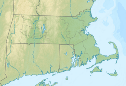
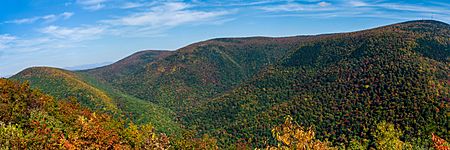
Mount Greylock is a tall mountain in the northwest corner of Massachusetts. Standing at 3,489 feet (1,063 m), it is the highest point in the entire state! Its top is located in the town of Adams in Berkshire County.
Even though it's part of the Taconic Mountains geologically, Mount Greylock is often thought of as part of the nearby Berkshires. The mountain is famous for its amazing views. From the top, you can see five different states! It also has a special type of forest called a taiga-boreal forest, which is rare in Massachusetts.
You can drive to the summit on a road that is open from late May to November 1. At the very top, there's a 93-foot-high (28 m) tower called the Massachusetts Veterans War Memorial Tower. Many hiking trails crisscross the mountain, including a part of the famous Appalachian Trail. Mount Greylock became a State Reservation in 1898. It was the first public land in Massachusetts set aside to protect its forests.
Contents
Exploring Mount Greylock's Location
Mount Greylock is part of a mountain range that stretches about 11-mile-long (18 km) and 4.5-mile-wide (7.2 km). This range runs north to south. It sits between other mountain ranges like the Hoosac Range and the Green Mountains. All these ranges are part of the larger Appalachian Mountains.
The very top of Mount Greylock is in Adams, Massachusetts. But the mountain itself reaches into several other towns. These include Cheshire, Lanesborough, New Ashford, North Adams, and Williamstown. Other peaks in this range, like Saddle Ball Mountain and Mount Fitch, are not as high as Greylock.
Mount Greylock rises about 2,000 ft (610 m) above the nearby river valleys. It's also about 1,000 ft (300 m) higher than the surrounding Berkshire and Taconic Mountains. On a clear day, you can see up to 72 mi (116 km) from the summit. You might even spot parts of Massachusetts, New York, Connecticut, Vermont, and New Hampshire.
The water from the northwest side of Mount Greylock flows into the Green River. This river eventually joins the Hoosic River, then the Hudson River, and finally reaches New York Harbor. Water from the south side goes into Town Brook, then the Housatonic River, and ends up in Long Island Sound. All other water from the mountain also flows into the Hoosic River.
How Mount Greylock Was Formed
Mount Greylock and the nearby Taconic Mountains are mostly made of a type of rock called Ordovician phyllite. This is a metamorphic rock, which means it changed from another type of rock due to heat and pressure. It sits on top of younger layers of changed sedimentary rock, especially marble.
Mount Greylock was created by something called a thrust fault. This is a powerful process where older rock layers are pushed up and over younger rock layers. This happens during times when mountains are actively forming. The younger marble rock found below the mountain has been quarried in the towns of Adams and North Adams, Massachusetts.
Mount Greylock's Ice Age Past
About 18,000 years ago, during the Pleistocene Ice Age, a huge ice sheet covered Mount Greylock. This ice sheet, called the Laurentide Ice Sheet, was up to 1-kilometer (0.62 mi) thick! As the glaciers moved, they smoothed and shaped the mountain. They carved out U-shaped valleys and left behind large rocks called glacial erratics. One example is the Balanced Rock in Lanesborough.
The Hopper, a bowl-shaped valley, is on the west side of Mount Greylock. It's the southernmost glacial feature of its kind in New England.
Forests and Wildlife
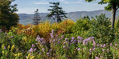
In the 1800s, much of Mount Greylock's trees were cut down. Fires and grazing animals also damaged the land. But since then, the forests have grown back. Different types of forests grow on Mount Greylock. The lower slopes have northern hardwood forests. The higher parts of the mountain are covered by balsam fir and red spruce trees.
The ridgeline of Greylock, between Mount Fitch and Saddle Ball, is the only place in Massachusetts where a taiga-boreal or sub-alpine forest grows. This type of forest is usually found in colder, northern regions. Researchers have found 555 acres (2.25 km2) of old growth forest on the mountain. These are very old forests that have not been disturbed much by humans. The steep western slopes, including The Hopper, have northern hardwood trees that are up to 350 years old. One red spruce tree there is 120-foot-tall (37 m)! Because of its many old red spruce trees, The Hopper is a National Natural Landmark.
Mount Greylock is also an important bird area. Many bird species that usually breed in colder, northern forests make their homes here. These include the blackpoll warbler and Bicknell's thrush. Over 132 different bird species have been recorded on Mount Greylock. It's harder to study birds on the mountain in winter because it's more difficult to reach.
Mount Greylock's Past
Early History and Names
Before Europeans arrived, the Mahican people lived in this region. An old trade route connecting tribes, now known as the Mohawk Trail, passes near the northern side of Mount Greylock.
In the 1700s, English settlers called the mountain Grand Hoosuc(k). Later, in the early 1800s, it was known as Saddleback Mountain because its shape looked like a saddle. The peak to the south is still called Saddle Ball, reflecting this old name.
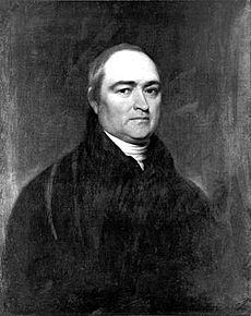
No one is completely sure how Mount Greylock got its current name. It first appeared in writing around 1819 and became popular by the 1830s. Many believe it honors a legendary Native American chief named Gray Lock. Chief Gray Lock (born around 1670) was a leader of the Western Abenaki people. He was known for leading raids in Vermont and western Massachusetts.
In 1799, Timothy Dwight IV, who was the President of Yale University, climbed Greylock. He was joined by Ebenezer Fitch, the President of Williams College. Dwight wrote about his climb in his book Travels in New England and New York. He said the trees at the top were so thick that he and Fitch had to climb a balsam fir tree to get a better view! He described the mountain as:
(Saddle Back) is the highest land in the state ... During a great part of the year, it is either embosomed or capped by clouds, and indicates to the surrounding inhabitants the changes of weather with not a little exactness.
The 1800s: A Popular Spot
Williams College, founded in 1793 in nearby Williamstown, has always had a strong connection to Greylock. Students and professors often studied its nature. In 1830, students led by college President Edward Dorr Griffin improved a trail to the summit. This trail is now called the Hopper Trail. Students still hike it once a year on "Mountain Day."
In 1831, students built the first wooden weather observatory on the summit. It was called "Griffin's Tower." Nine years later, a taller, 60-foot wooden tower replaced it. From this tower, a comet was even photographed in 1858. In 1863, Professor Albert Hopkins started the Alpine Club. This was the first organized hiking and nature study club in the United States. The club often camped on the mountain.
By the mid-1800s, it was easier to travel to the region, and many visitors came to Greylock. Famous writers and artists were inspired by the mountain. These included Nathaniel Hawthorne, William Cullen Bryant, Oliver Wendell Holmes, Herman Melville, and Henry David Thoreau.
Nathaniel Hawthorne visited North Adams in 1838 and climbed Mount Greylock many times. His experiences there, especially seeing a burning lime kiln at midnight, inspired his story "Ethan Brand".
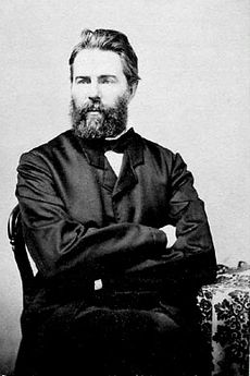
Herman Melville is said to have been inspired by the view of Mount Greylock from his home. Its snow-covered shape reminded him of a great white sperm whale's back. Melville even dedicated his novel Pierre to "Greylock's Most Excellent Majesty." In 1851, Melville and friends camped on the summit. Henry David Thoreau also climbed and spent a night on Greylock in 1844. His experience there helped him feel more confident in exploring nature on his own.
By the late 1800s, too many trees were being cut down on the mountain for local businesses. This led to bad forest fires and landslides. After a fire on the summit, a group of local business people formed the Greylock Park Association (GPA) in 1885. They bought 400 acres (1.6 km2) of land at the summit. The GPA also fixed the Notch Road so carriages could reach the top. They charged a small fee to use the road and climb their iron observation tower.
By 1897, the GPA was in debt. People who cared about nature wanted to protect the mountain. They worked to transfer the GPA's land to the state of Massachusetts to create a state reservation. One main reason was to protect the Hoosic and Housatonic River watersheds from erosion caused by all the tree cutting. Another reason was to keep the mountain open for everyone to enjoy, not just private owners. On June 20, 1898, the Mount Greylock State Reservation was created. This was the first public land in Massachusetts set aside to protect forests.
The 1900s: Growth and Protection
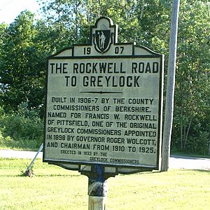
In 1906, Berkshire County started building another road to the summit from the south. It opened in 1907 and offered great views of the Berkshire hills. By 1913, there were 17 hiking trails on the mountain.
The Appalachian Trail route up Mount Greylock was first cut in 1929. Most of the Massachusetts section was finished by 1931.
The biggest period of development on Mount Greylock happened in the 1930s. The Massachusetts (Veterans) War Memorial Tower was built on the summit from 1931 to 1932. The Civilian Conservation Corps (CCC), a group of young men who worked on public lands, made many improvements from 1933 to 1941. They worked on roads, trails, scenic viewpoints, and recreation areas.
Some important CCC projects included improving the gravel roads for cars. They also built shelters and the Thunderbolt Ski Shelter. They finished Bascom Lodge, too. Because winter sports like downhill skiing became popular, the Mount Greylock Ski Club created a challenging ski run. The CCC built the Thunderbolt Ski Trail in 1934. It was named for its speed, like a roller coaster. This trail was used for many ski races until 1959.
In 1966, after years of discussions about how the mountain was being managed, a group called the Mount Greylock Protective Association helped transfer the mountain's management from Berkshire County to the state park system. This ensured the mountain would be protected for conservation.
Mount Greylock State Reservation Today
Today, the 12,500-acre (5,100 ha) Mount Greylock State Reservation is managed by the Massachusetts Department of Conservation and Recreation.
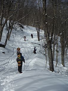
Mount Greylock has over 70 miles of trails for many activities. You can go hiking, mountain biking, back-country skiing, snowshoeing, and snowmobiling. An 11.5 miles (18.5 km) section of the Appalachian National Scenic Trail runs through the reservation.
If you like camping, you can find primitive camping at the Mount Greylock Campground. There are also 5 remote shelters for backpackers. The campground and shelters can only be reached by foot.
The visitors center in Lanesborough is open all year. It's a great place to get maps, brochures, and learn about the mountain.
The Greylock Glen is a 1,063-acre (4.30 km2) park next to the State Reservation in Adams. It was bought by the state in 1985.
Buildings on the Mountain Top
Important buildings on the summit include the Massachusetts Veterans War Memorial Tower, Bascom Lodge, the Thunderbolt Ski Shelter, and a television and radio tower. These buildings are historically important. The Mount Greylock Summit Historic District was added to the National Register of Historic Places in 1998.
Veterans War Memorial Tower
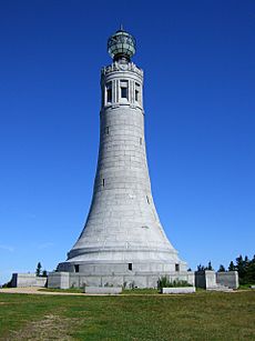
The Veterans War Memorial Tower was approved by the state legislature in 1930. It was designed by architects Maginnis & Walsh and built in 1931-1932. It cost $200,000. This tower was built to honor Massachusetts soldiers who died in World War I and later wars.
The tower is 93-foot (28 m) tall and has a light at the top. This light was once the strongest in Massachusetts. It could be seen up to 70 mi (110 km) away at night! The tower's design is simple and strong. It has some Art Deco details, like a decorative eagle. Inside, there's a special room meant to hold items from wartime units.
The stone for the tower came from Quincy Granite. One inscription inside says, "they were faithful even unto death." Another line is from a poem by George Eliot: "Of those immortal dead who live again in the minds made better by their presence."
The Veterans War Memorial Tower was closed in 2013 because water was getting inside. This caused damage to the granite stone. When water freezes in cracks, it expands and makes the damage worse. A $2.6 million project began in 2015 to fix the tower. It reopened to the public on July 26, 2017.
Bascom Lodge
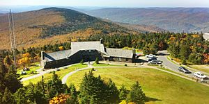
Bascom Lodge was built between 1932 and 1938. It uses natural materials from Greylock, like schist stone and red spruce wood. The design fits in with the natural park setting. The Greylock Commission wanted a better shelter for visitors after the old summit house burned down in 1929.
The first part of the lodge was built in 1932. The main and east parts were finished later, from 1935 to 1938, by the Civilian Conservation Corps. The lodge is named after John Bascom. He was a Greylock Reservation Commissioner and a professor at Williams College who loved the mountain.
Today, Bascom Lodge is managed by the Bascom Lodge Group. They work with the Massachusetts Department of Conservation and Recreation.
Thunderbolt Ski Shelter and Ski Race
The Thunderbolt Ski Shelter was also designed by Joseph McArthur Vance. It was built in 1940 by the Civilian Conservation Corps. Its main purpose was to be a warming hut for skiers using the Thunderbolt Trail. It's built from stone and wood beams. Inside, there are wooden benches around a large fireplace.
There's been a new interest in skiing the Thunderbolt Trail. In February 2010, a race was held to celebrate the 75th anniversary of the first downhill race on Mount Greylock. The Thunderbolt Ski Runners group continues to hold an annual backcountry ski race each winter, if conditions allow. Because of this, more and more backcountry skiers are using the trail in winter.
Broadcast Tower
One radio station and one television station broadcast from a tower below the summit on the west side. These are WAMC (90.3 Albany, New York) and W38DL (38 Adams, Massachusetts), which repeats WNYT-TV. A NOAA Weather Radio station (WWF-48, 162.525 MHz) also broadcasts from a different tower on the mountain. The Northern Berkshire Amateur Radio Club also runs several amateur radio repeaters on the mountain.
Images for kids
 | Misty Copeland |
 | Raven Wilkinson |
 | Debra Austin |
 | Aesha Ash |


