Brodie Mountain facts for kids
Quick facts for kids Brodie Mountain |
|
|---|---|

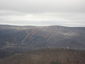
Ski slopes on Brodie Mountain
|
|
| Highest point | |
| Elevation | 2,621 ft (799 m) |
| Geography | |
| Location | Berkshire County, Massachusetts |
| Parent range | Taconic Mountains |
| Geology | |
| Age of rock | Ordovician |
| Mountain type | Thrust fault; metamorphic rock and sedimentary rock |
| Climbing | |
| Easiest route | former Taconic Skyline Trail |
Brodie Mountain is a long mountain ridge in western Massachusetts. It is part of the Taconic Mountains and is about 5.5 miles (8.9 km) long. The mountain is 2,621 feet (800 meters) tall. It was once home to the Brodie Mountain ski area, which closed in 2002.
The ridge has several peaks. Three of these peaks have names. Sheep's Heaven Mountain is 2,530 feet (770 meters) tall and is at the southern end of the ridge. Beoadic Mountain is the highest point on the ridge. East Mountain is 2,613 feet (796 meters) tall. This is where the old ski area was located. Older maps sometimes called a northern peak "Brodie Mountain."
Exploring Brodie Mountain
The Taconic Skyline Trail used to cross Brodie Mountain. It went north over Sheep's Heaven Mountain to the East Mountain peak. While the official trail is gone, some old paths are still used by ATVs. Even older paths once went along the whole ridge, but they are now hard to find.
The old ski area was bought in 2004. Parts of it are now being developed for homes. Brodie Mountain is located in several towns. These include Hancock, Lanesborough, New Ashford, and Williamstown, Massachusetts.
The mountain is surrounded by other natural areas. To the northeast is Mount Greylock. To the south is Potter Mountain. To the west is Misery Mountain. Water from Brodie Mountain flows into different rivers. These rivers eventually reach the Hudson River or the Housatonic River and then Long Island Sound. The mountain is covered in hardwood trees. Its rocks were formed during the Ordovician period.
Wind Power on Brodie Mountain
The Berkshire Wind Power Project is located on the southern part of Brodie Mountain. It is the largest working wind farm in Massachusetts. It started making electricity in 2011.
This wind farm has ten large wind turbines. These turbines can produce a total of fifteen megawatts of electricity. This is enough power for many homes. The wind farm is owned by the Berkshire Wind Power Cooperative Corporation. This is a non-profit group that provides public power.
 | Roy Wilkins |
 | John Lewis |
 | Linda Carol Brown |

